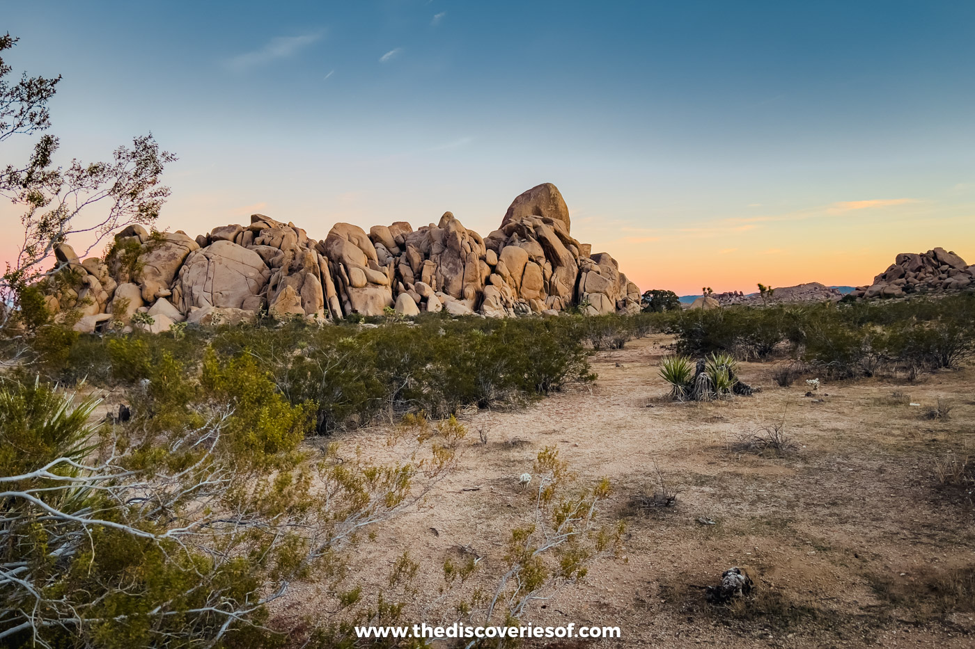

Planning an Arizona road trip and don’t know where to start? This 9-day Arizona road trip itinerary loops from Phoenix to Sedona’s red rocks, the Grand Canyon’s South Rim, Antelope Canyon, Horseshoe Bend and Monument Valley, with the drives, the stays and what to book ahead.
You’ve already made the hardest decision: choosing one of the best road trip playgrounds in the world. Arizona, the Grand Canyon State, packs in red rock country, slot canyons, ancient cliff dwellings and some of the most famous views in the American West. The catch is that it’s vast. The highlights are hours apart, the rules change from park to park (and from time zone to time zone), and it’s easy to spend the whole trip behind the wheel.
I’ve explored Arizona on two trips: one in early summer, walking the Grand Canyon’s Rim Trail, flying over the canyon by helicopter, weaving through Upper Antelope Canyon and driving out to Monument Valley from Page; and one in February, hiking among the giant cacti of Saguaro National Park, seeing Sedona’s red rocks under snow and taking it easy in Phoenix. This itinerary is my recommended route for a first visit, built around the places I’d go back to in a heartbeat and grouped so each drive is a manageable one.
While most people come for the hikes in the Grand Canyon or the scenery of Sedona, there’s so much more to Arizona. The state has six national forests, small historic towns, cliff dwellings and a growing wine scene, and this itinerary gives you a taste of all of them.
It assumes you’re hiring a car in Phoenix and driving a loop, with two nights in each base so you’re not packing up every morning. If you’re flying into Las Vegas instead, my 10-day Southwest road trip itinerary follows my early summer route through the Grand Canyon, Page, Monument Valley, Zion and Bryce.
Before you go: at the end of August 2026, a flash flood damaged the Grand Canyon South Rim’s water pipeline, and the hotels inside the park have been closed to overnight guests since. The Xanterra-run lodges are taking guests again from 20 November 2026; Yavapai Lodge hasn’t given a date. Restaurants and viewpoints are open, and hotels in Tusayan, just outside the South Entrance, are unaffected. Check the National Park Service’s alerts before you travel.
Your 9-day Arizona road trip at a glance
- Days 1 and 2: Phoenix: sunrise in South Mountain Park, Roosevelt Row, the Heard Museum and a night out downtown
- Days 3 and 4: Sedona: red rock hikes, Verde Valley wine, a spa session and Out of Africa Wildlife Park
- Days 5 and 6: the Grand Canyon: the Rim Trail, a helicopter flight, a hike below the rim and sunset on Desert View Drive
- Days 7 and 8: Page: Antelope Canyon, sunset at Horseshoe Bend, Glen Canyon Dam and a day trip to Monument Valley
- Day 9: back to Phoenix for the Desert Botanical Garden and a farewell dinner
Days 1 and 2: Phoenix, the Valley of the Sun

As the state capital and the gateway for most international flights, Phoenix is the natural place to start your road trip. It’s the fifth-largest city in the US, sprawling across a desert basin ringed by mountains that locals call the Valley of the Sun.
When I visited in February, I found Phoenix a chilled-out city. It isn’t packed with must-see sights, but there’s plenty to keep you busy, and the best way to enjoy it is to do so at your leisure: a sunrise hike, an afternoon in a museum, a long dinner. Two days gives you time to recover from the flight and stock up before you head north.
Catch the sunrise from Dobbins Lookout in South Mountain Park

Start as you mean to go on, with a hike. South Mountain Park and Preserve is one of the largest city parks in the US, covering more than 16,000 acres across three mountain ranges (the Ma Ha Tauk, Gila and Guadalupe) with over 100 miles of trails for hiking, mountain biking and horse riding.
Time it so you catch the sunrise from Dobbins Lookout, the highest point in the park open to the public at 2,330 feet, with views over the whole of Phoenix. You can hike up or drive Summit Road; the park opens at 5am. On Sundays, Summit Road is closed to cars for “Silent Sundays” (until 10am on most Sundays and all day on the fourth Sunday of the month), so plan to walk or cycle that morning. If you’d rather ride, Ponderosa Stables, just outside the Central Avenue entrance, runs horseback rides into the park.

If you’d prefer something gentler closer to town, head to Papago Park instead. It’s a pretty park with lots of nice hiking trails among red sandstone buttes, including the short walk up to Hole-in-the-Rock.
Wander the murals and galleries of Roosevelt Row

Once a run-down corner of downtown, Roosevelt Row (RoRo to locals) has been transformed into Phoenix’s arts district, with independent galleries, studios, boutiques and restaurants in converted bungalows and warehouses.
It’s very walkable, so wander the streets around Roosevelt Street and Fifth Street to see the murals that cover the walls, pop into the galleries and browse the shops. If you’re in town on the first Friday of the month, the district’s First Friday art walk brings out the galleries, street food and live music in the evening.
Spend an afternoon in the city’s museums

If you only have time to visit one museum in Phoenix, make it the Heard Museum, which showcases American Indian art. Plan to spend at least a couple of hours here: it’s not massive, but it’s packed with eye-catching pieces along with in-depth information, and a visit is as much a learning experience as it is a visual one. The boarding school exhibition, Away From Home: American Indian Boarding School Stories, is a no-punches-pulled look at the US’s terrible historic boarding school system for Native Americans. The Heard is open from 10am to 4pm, and adult tickets cost around $26. My Heard Museum guide covers what to see and how to plan your visit.
The Phoenix Art Museum, a mile down Central Avenue, is the largest art museum in the Southwest, with more than 20,000 works in its collection, from Old Master paintings and American and Western art to fashion and photography. It’s closed on Mondays and Tuesdays and stays open until 8pm on Wednesdays and Fridays, and admission is pay-what-you-wish on Wednesdays from 3pm.
Looking for something more unusual? The Hall of Flame Fire Museum, near Papago Park, is a tribute to firefighting through the decades, with hand- and horse-drawn engines, motorised fire apparatus, helmets and memorabilia. It’s open from Tuesday to Saturday, 10am to 6pm, and adult tickets cost $19.
Read Next
Eat, drink and dance into the night

Phoenix’s nightlife has come a long way, and what is a good night out without great food to start it?
Valentine, a short drive north of downtown in Melrose, was hands-down my favourite restaurant in Phoenix: an atmospheric spot with a small plates concept and excellent food. The smoked Two Wash Ranch chicken was cooked to perfection, and the eclectic menu features unusual dishes such as a bison tartare tostada and grilled lamb hearts. Wash it all down with a glass of natural wine or one of the unique cocktails (Dirty Cactus Martini, anyone?). It’s open from Wednesday to Sunday.
Closer to downtown, Farish House serves French-leaning European comfort food in a historic house on Third Street, and Ghost Donkey, a few blocks away on Roosevelt Row, pours agave cocktails alongside Mexican bites. For something different, Platform 18 is a quirky bar styled like a historic train carriage: hop aboard for well-executed cocktails and a touch of immersive drama. It’s a bit kitsch, but cool with it.
Then head to The Van Buren, The Rhythm Room or Copper Blues at CityScape for live music and a drink or two.
Getting to Phoenix
Phoenix Sky Harbor International Airport is the main gateway to Arizona, a few miles east of downtown. British Airways flies direct from London Heathrow, there are seasonal direct flights from Frankfurt with Condor, and American Airlines has a hub here with connections across the US. Most car hire companies are based at the airport’s Rental Car Center, a short shuttle ride from the terminals.
Suggested stay
Hyatt Regency Phoenix is a four-star hotel in the heart of downtown, a short walk from CityScape, the convention centre and the light rail. Its central location makes it an easy base for your first two nights. See my guide to where to stay in Phoenix for more options.
Alternatively, check all accommodation in Phoenix
Days 3 and 4: Sedona’s red rocks and the Verde Valley
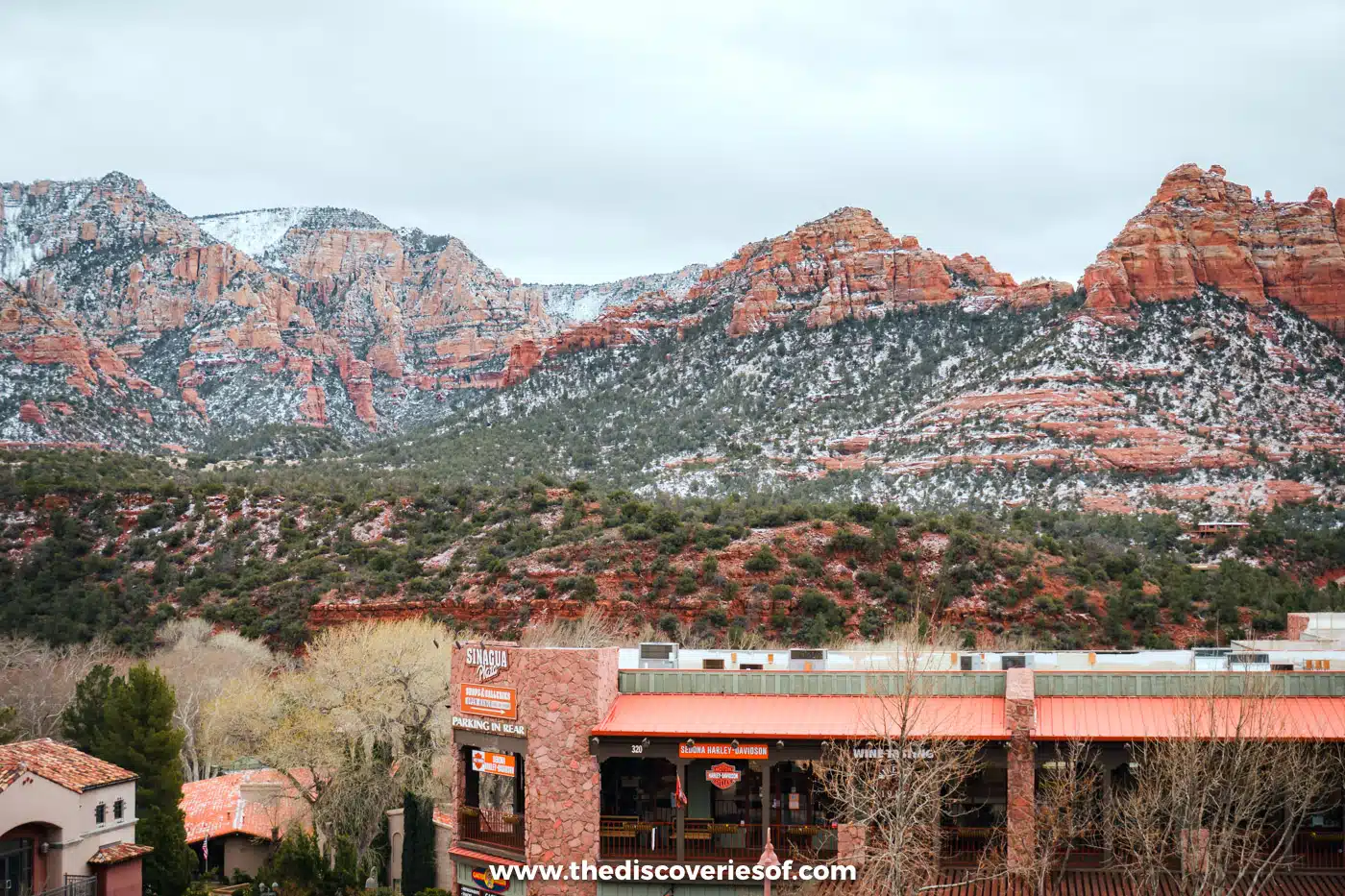
Next up, wind your way north to Sedona. So many Americans I spoke to named Sedona as their favourite place that I had to go and see what the fuss was about. It’s where spirituality meets spectacular landscapes, with some very commercial bits in between.
Towering red buttes, steep canyons and pine forests make it a wonderful place to find some calm in nature, and there’s a thriving arts scene and a well-known spa and wellness culture to go with it. I visited in February, when it was cold but much quieter than in summer, and I got to see the red rocks dusted with snow. Just west of town, Red Rock State Park makes a beautiful backdrop for a walk along Oak Creek.
If you’d rather not drive, there are plenty of tours from Phoenix, including this small-group Sedona and Grand Canyon day tour.
Hike Cathedral Rock, Airport Mesa or the Courthouse Butte Loop
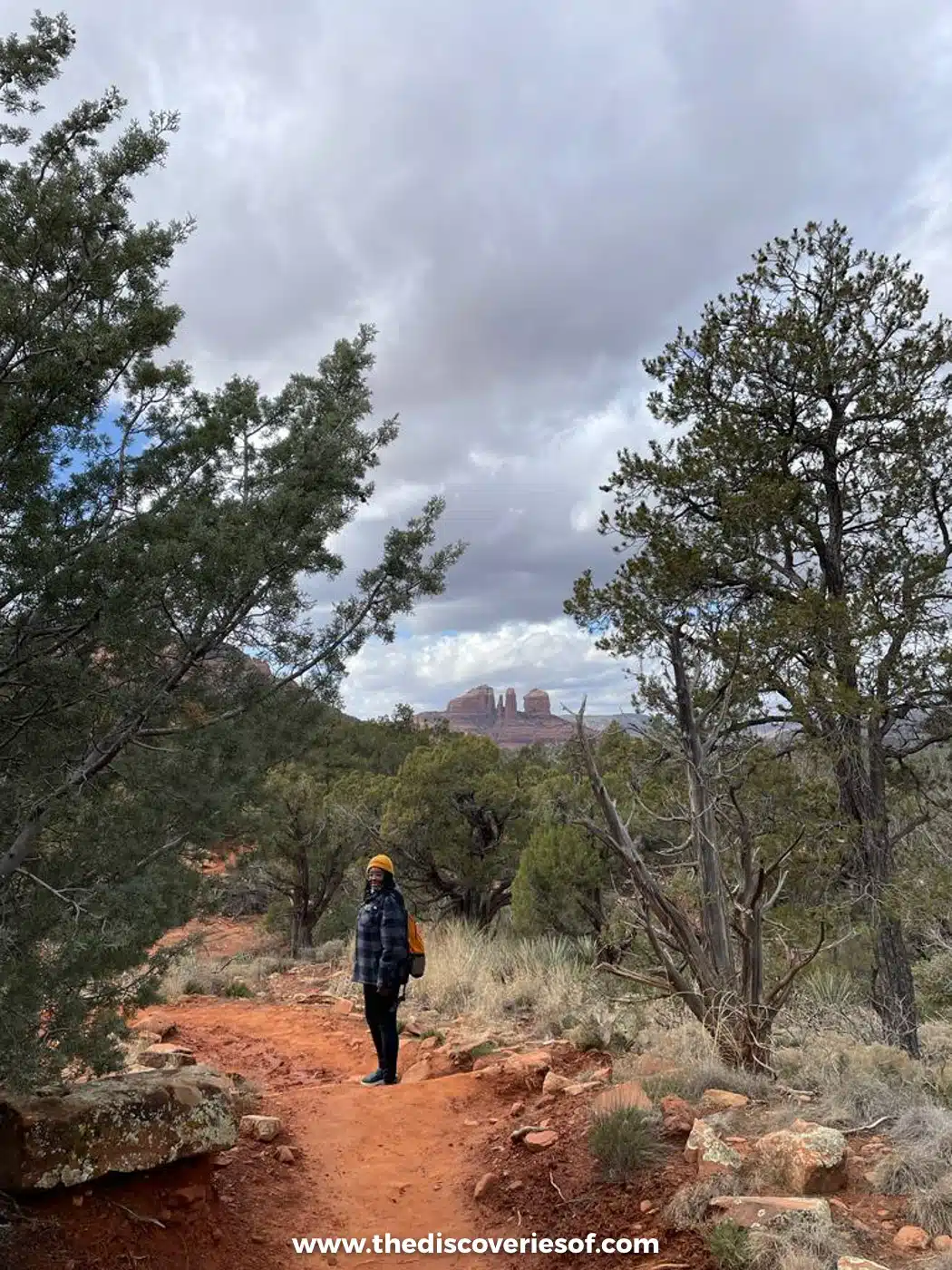
A visit to Sedona without at least one or two hikes would be a crime: there are more than 100 trails in the area.
The Courthouse Butte Loop was pretty much my favourite hike in Sedona. It’s a reasonable length, about 3.8 miles with around 300 feet of climbing, takes you all the way around Courthouse Butte and Bell Rock, and delivers big on expansive views of the red rocks.
The Cathedral Rock Trail is the most popular, with views of Sedona’s best-known red rock formation. It’s short but tough: about 1.2 miles round trip with around 700 feet of climbing, much of it scrambling up slickrock to a saddle between the spires. From Thursday to Sunday, the trailhead car park is closed to private cars, so take the free Sedona Shuttle.
For an easier option with panoramic views, head up to Airport Mesa. Walk the 3.5-mile Airport Loop Trail around the mesa, or just drive up to the Airport Scenic Lookout ($3 to park) for one of the best views in town, especially in the late afternoon. Many trailheads need a Red Rock Pass ($5 a day) to park.
If these sound too strenuous, take a Sedona vortex jeep tour instead, two and a half hours on backcountry roads with equally impressive views and far less walking.
Taste the wines of the Verde Valley
Wine and Arizona? It sounds like an odd combination, I know. But the Verde Valley, just south of Sedona, has its own official wine region (an American Viticultural Area since 2021), with vineyards along Oak Creek and the Verde River and tasting rooms in Cottonwood, Cornville and Jerome.
Alcantara Vineyards near Camp Verde, Page Springs Cellars and Oak Creek Vineyards on Page Springs Road are standouts, and the beautiful setting of the vineyards makes for an excellent half-day or full-day excursion. To leave the car behind, join a Verde Valley wine tour with pick-up in Sedona; options run from three to eight hours.
Read Next
Treat yourself to a spa session
Sedona is where many people come for rest, relaxation and rejuvenation, so take advantage of it before the pace picks up again at the Grand Canyon.
The most famous spa is Mii Amo at Enchantment Resort in Boynton Canyon, known for treatments using local clay and crystals, though it’s only open to guests staying at the resort. Otherwise, there are plenty of day spas in town for massages and body wraps, and Inner Journeys offers massage, energy healing and guided meditation if you want to lean into Sedona’s spiritual side.
Meet the animals at Out of Africa Wildlife Park
African wildlife in Arizona? Yes, really. Zoos are a touchy subject, but Out of Africa in Camp Verde, about half an hour south of Sedona, describes itself as conservation-focused and is home to tigers, lions, giraffes and rhinos. Its Predator Feed and the African Bush Safari tour, which includes feeding giraffes, are the highlights.
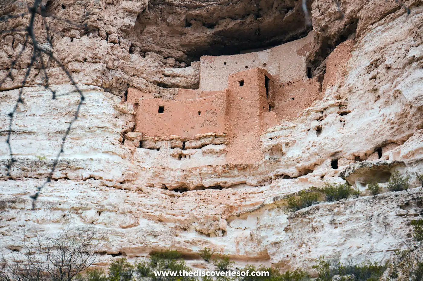
While you’re in Camp Verde, don’t miss Montezuma Castle National Monument, about 15 minutes away. These striking, well-preserved dwellings, built into a limestone alcove high on a cliff above Beaver Creek by the Sinagua people between about 1100 and 1425, are well worth a visit while you’re in the area. Entry costs $10 per adult, and the ticket also covers Tuzigoot National Monument.
Getting to Sedona
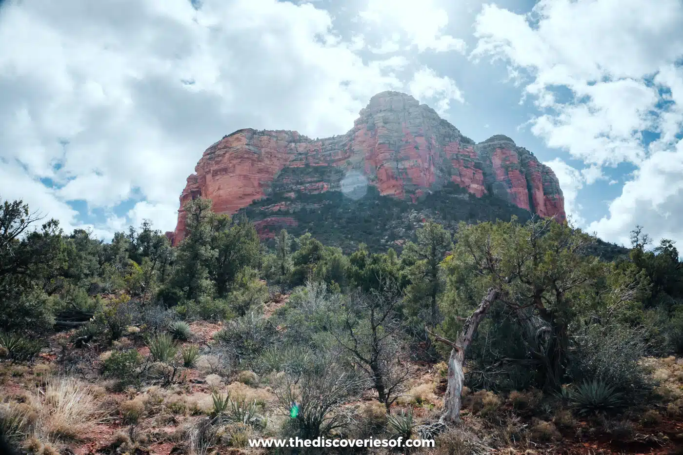
Sedona is about 117 miles from Phoenix, around two hours’ drive north on Interstate 17, turning off at exit 298 onto SR 179 through the Village of Oak Creek into Sedona. Allow extra time on Friday and Sunday afternoons, when traffic backs up on SR 179.
Suggested stay
I stayed at the Matterhorn Inn in Uptown Sedona, a revamped hotel with views of the red rocks from every room and a central location for exploring. For something with more space, Hilton Vacation Club Sedona Summit, on the plateau in West Sedona, has a range of rooms and suites, four heated pools and six hot tubs. See my guide to where to stay in Sedona for more.
Alternatively, check all accommodation in Sedona
Days 5 and 6: the Grand Canyon’s South Rim
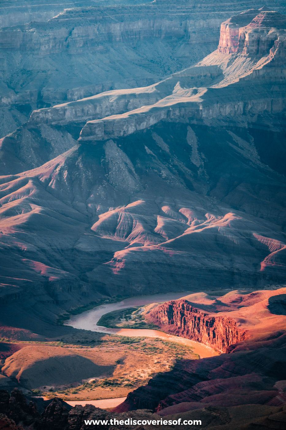
This is the part you’ve been waiting for. Arizona is the Grand Canyon State, after all, and no road trip here is complete without it. Carved by the Colorado River over five to six million years, the canyon is an easy entry on any USA bucket list, and there’s nothing quite like your first look: layer upon layer of rock dropping away into the abyss and winding off to the horizon as far as you can see.
Head for the South Rim, which is open all year and has the most to see. I spent three days there in early summer, staying at Yavapai Lodge inside the park, and two full days is enough to walk the rim, see the canyon from the air and catch a couple of unforgettable sunsets. My 2 days at the Grand Canyon itinerary has the hour-by-hour plan.
Walk the Rim Trail
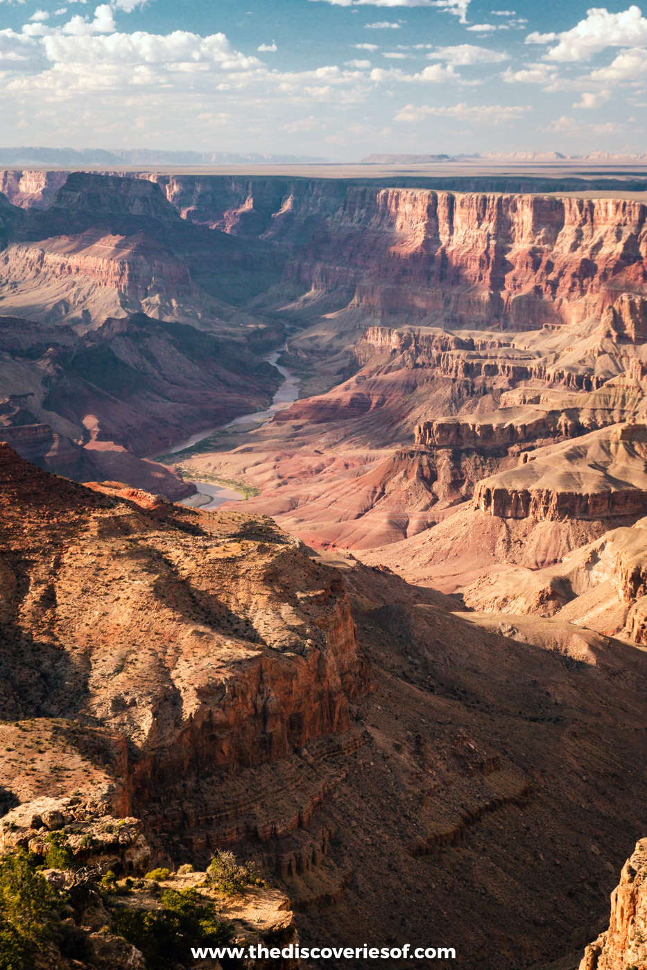
When the park is so mammoth, where on earth do you start? The Rim Trail. The sheer number of Grand Canyon hikes can be dizzying, but the Rim Trail was by far my favourite walk at the Grand Canyon. I pooh-poohed it at first because it sounded too easy, but I’m so glad I did it: it’s easy to follow, there’s just enough change in height and terrain to keep it interesting, and the views are incredible the whole way.
It runs for about 13 miles (21km) along the South Rim, from the South Kaibab trailhead to Hermits Rest, and most of it is paved. It isn’t flat, though, and between Powell Point and Monument Creek Vista it becomes a narrow dirt path very close to the edge, so take the shuttle for that stretch if you don’t like heights. You don’t need to walk it all: the free shuttle buses stop at the viewpoints along the way, so you can hop on and off. Hermit Road, the western section, is closed to private cars from March to November, so use the red shuttle there.
Top Tip
Pack a lunch, as there’s nowhere to buy food along most of Hermit Road, and bring salty snacks and a big water bottle (during the water restrictions, carry all the water you need). The rim is around 7,000 feet up, and I felt the altitude more than I expected.
Read Next
See the canyon from a helicopter
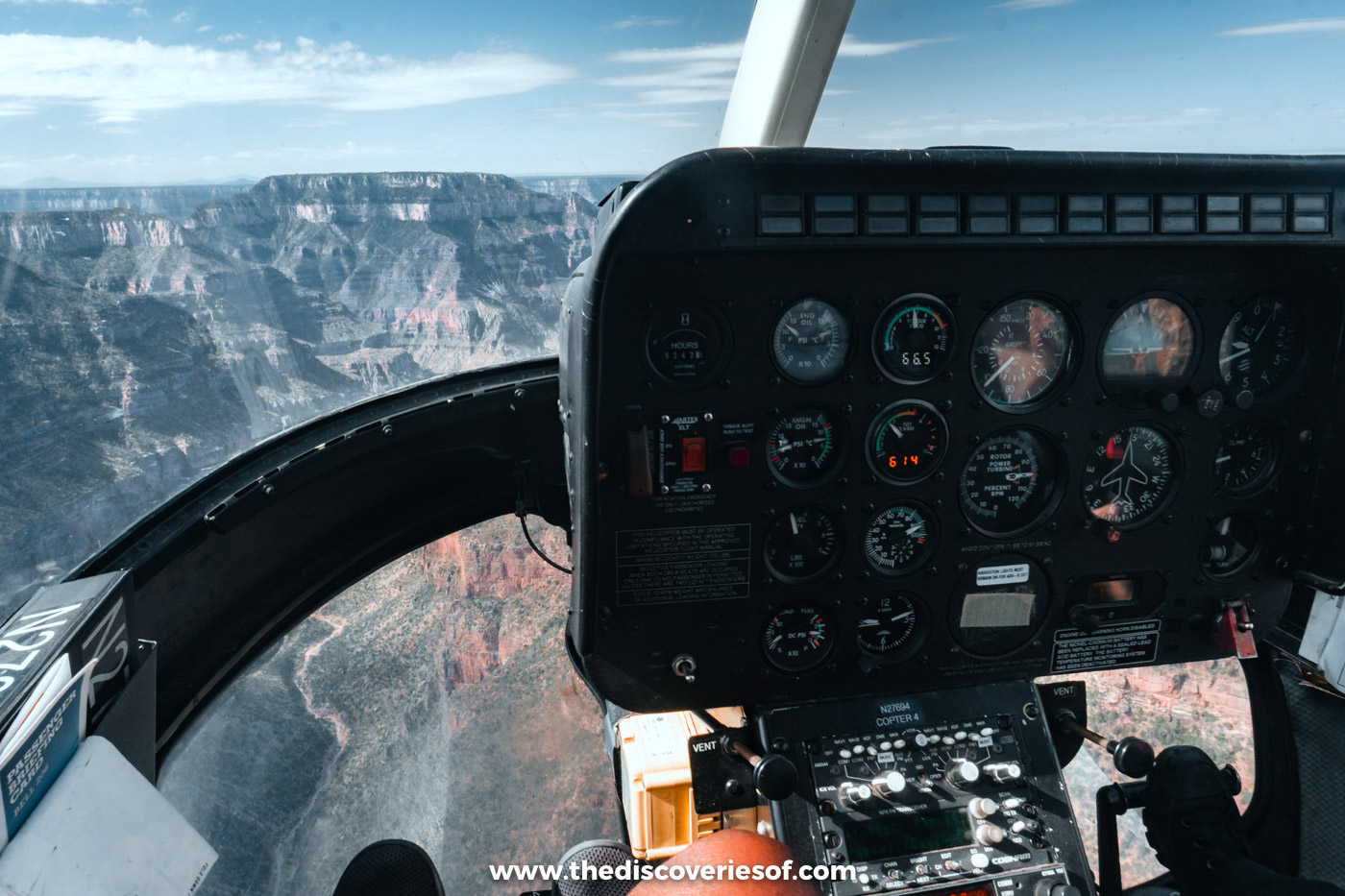
I flew with Papillon on their North Canyon tour from Grand Canyon Airport in Tusayan and loved every minute of it. You take off over the pine forest, then the ground falls away at the rim and the scrubland transforms into a miasma of colours and shapes. It’s also a great chance to see towards the North Rim, the lesser-visited side of the canyon.
The North Canyon flight lasts 25 to 30 minutes, which I’d recommend if you’re unsure about flying; otherwise, go for a longer route. This Grand Canyon helicopter flight starts from about $269 and has the option of adding a Hummer tour.
My tip: pay the extra for a front seat next to the pilot (it was $50 when I flew), bring photo ID and expect it to be bumpy on windy days.
Read Next
Hike below the rim on the Bright Angel or South Kaibab trails
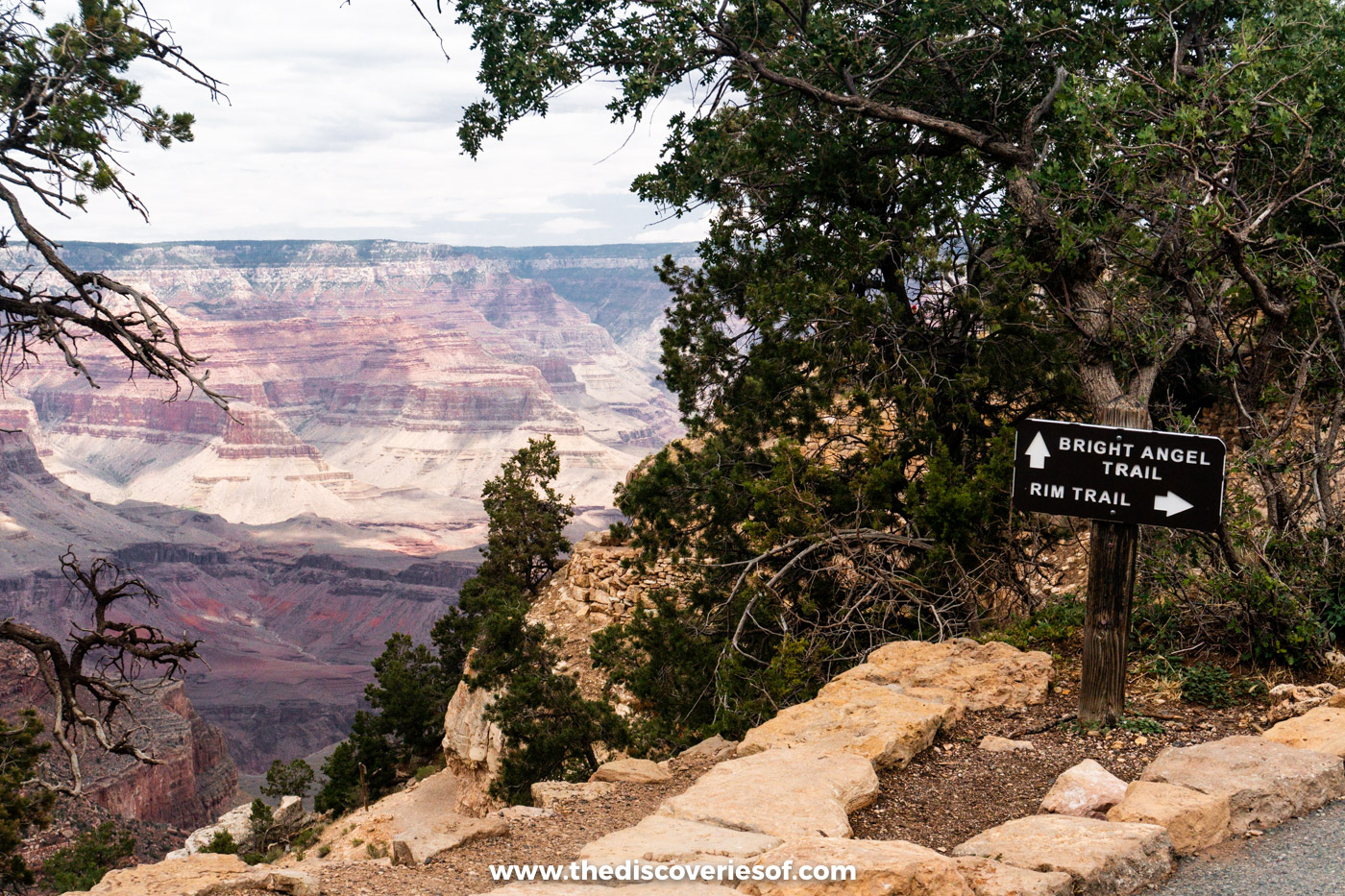
The Bright Angel and South Kaibab trails are the two classic ways to step below the rim, and hikers have been arguing about which is better for decades. Pick one and settle the argument for yourself.
The Bright Angel Trail starts in Grand Canyon Village and zigzags down past resthouses to Havasupai Gardens (formerly Indian Garden), 4.5 miles down, and on to Plateau Point, a round trip of about 12 miles with views straight down to the Colorado River. It’s a long trek, so bring lots of water and turn back in good time. The South Kaibab Trail, which starts near Yaki Point, follows a ridge with sweeping views from the start and has no water at all. Ooh Aah Point (1.8 miles round trip) and Cedar Ridge (3 miles round trip) make good half-day hikes.
Don’t try to hike to the river and back in a day, and remember that the climb out takes about twice as long as the walk down. Flash floods have closed parts of both trails in 2026 (in mid-October, the Bright Angel was open as far as Mile-and-a-Half Resthouse and the South Kaibab as far as the Tip-Off), so check the park’s trail updates before you set out.
Watch the sunset on Desert View Drive
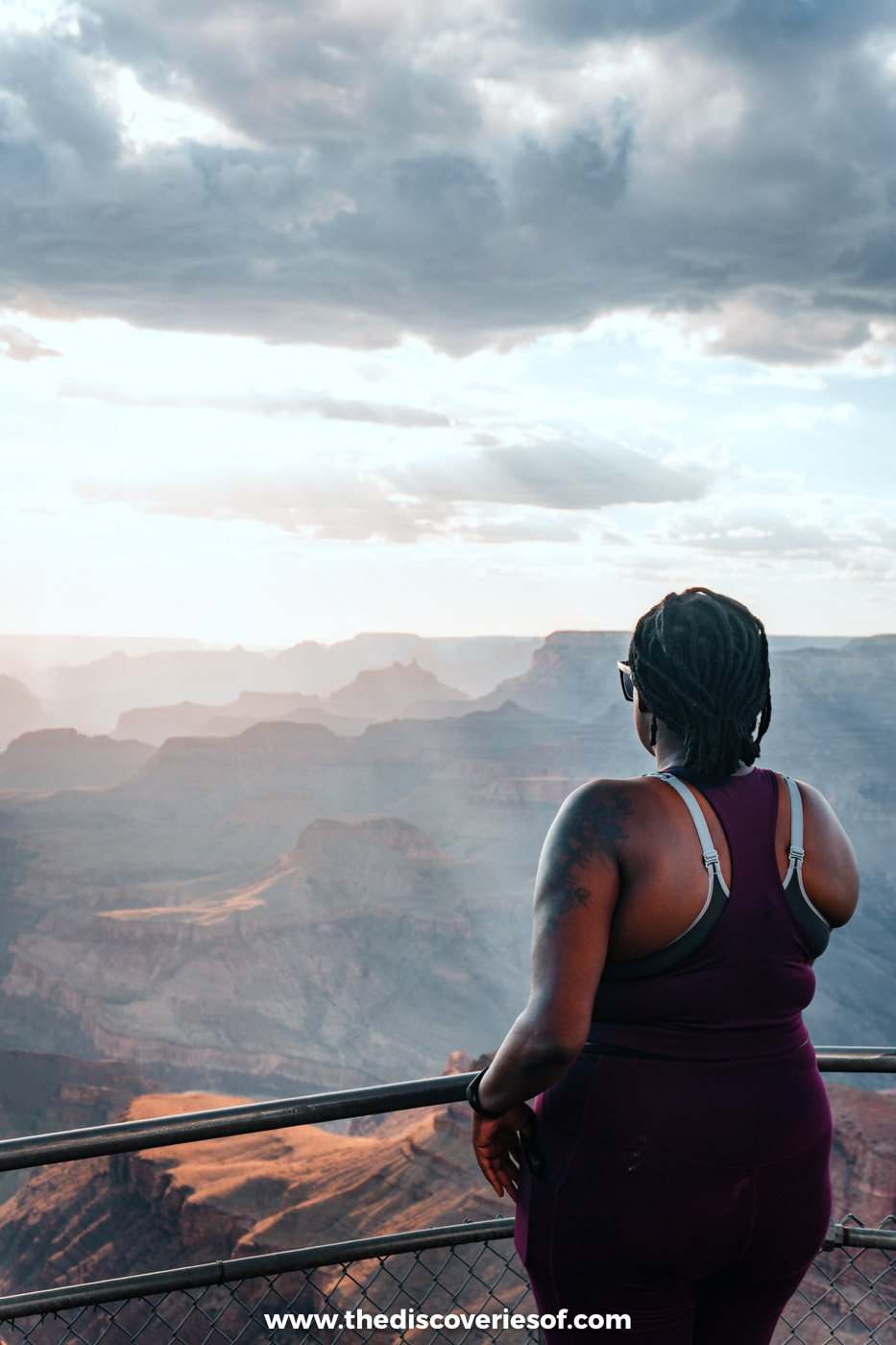
Desert View Drive, the stretch of Route 64 that runs east along the rim for about 23 miles, has a special place in the hearts of many, and it’s one of the best spots for stunning sunrises and epic sunsets.
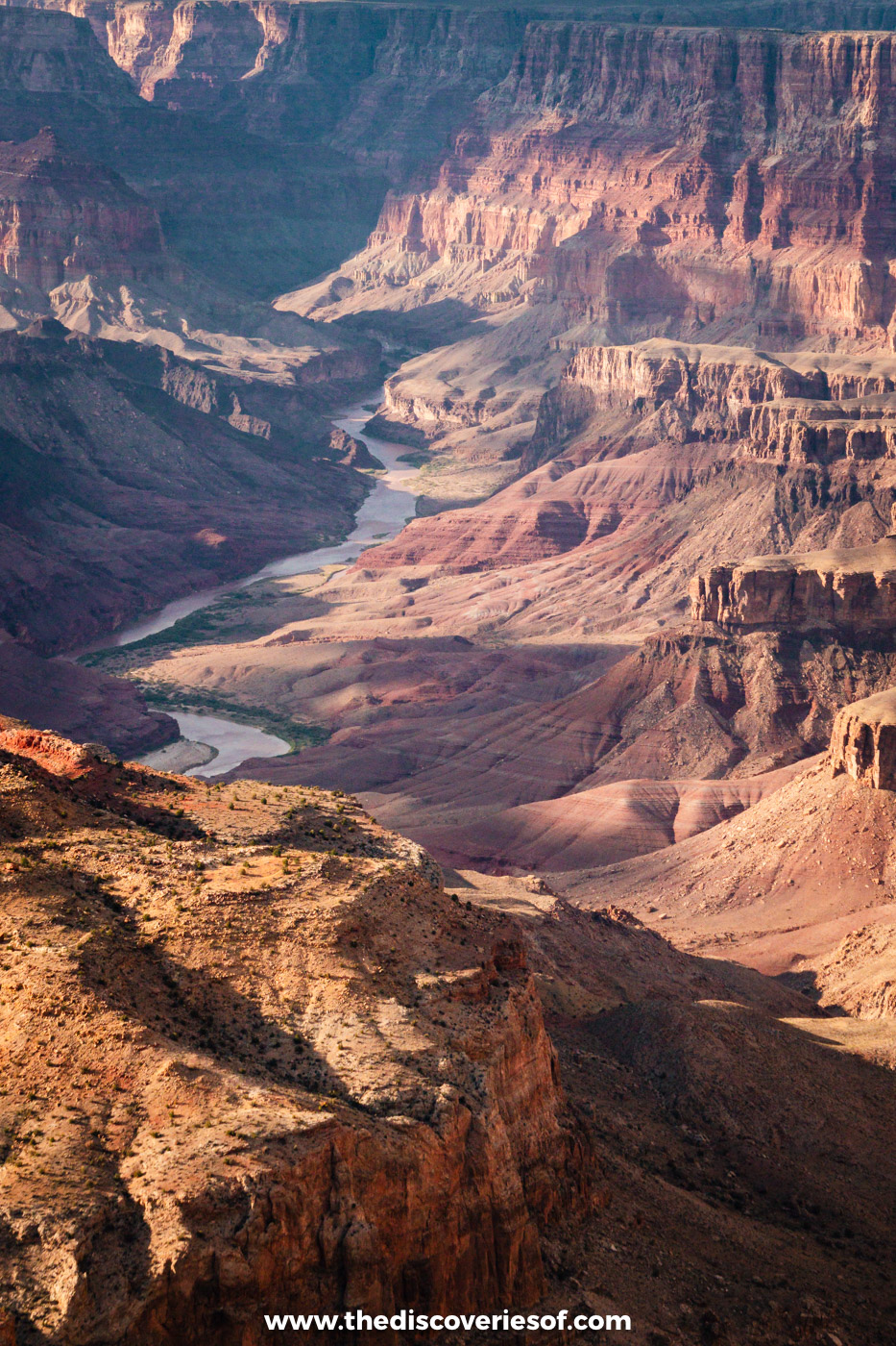
There are plenty of viewpoints to stop at along the way. Grandview Point and Navajo Point are favourites, and Yaki Point, at the western end, is reached only by the free shuttle. At the end of the road, Mary Colter’s Desert View Watchtower, finished in 1932, has some of the widest views on the South Rim. I watched my second sunset out here, and the eastern viewpoints are much quieter than the Hermit Road ones. Lipan Point, where I watched it, is closed for rehabilitation until 23 December 2026, but neighbouring Navajo Point and Desert View are just as good, with the river curling through the canyon below.
Top Tip
Desert View Drive leads to the park’s East Entrance, so if you run out of time, drive it on the morning of day 7 on your way to Page.
Getting to the Grand Canyon
The drive from Sedona to Grand Canyon Village is about 111 miles and takes around two and a quarter hours. Take SR 89A north through Oak Creek Canyon, a gorgeous drive in its own right, to Flagstaff, then US-180 north to the South Rim. Alternatively, take Interstate 40 west from Flagstaff to Williams and Route 64 north.
From Phoenix, it’s about three and three-quarter hours via Interstate 17, Interstate 40 and Williams.
Entry costs $35 per vehicle for seven days. Since 2026, non-US residents aged 16 and over also pay an extra $100 each unless they hold an America the Beautiful pass (see the tips below).
Suggested stay
I stayed at Yavapai Lodge inside the park, the best-value option, renovated and fairly basic, a short walk from the rim. While the in-park lodges are closed, stay in Tusayan, ten minutes from the South Entrance: The Grand Hotel at the Grand Canyon is a comfortable lodge-style base with an indoor pool. See my guide to where to stay at the Grand Canyon for more options.
Alternatively, check all accommodation at the Grand Canyon
Days 7 and 8: Page, Antelope Canyon and Monument Valley
Page is a small town in Coconino County, built in the 1950s to house the workers on Glen Canyon Dam, on a mesa above the southern shores of Lake Powell. It’s the base for some of the most extraordinary landscapes in the Southwest: the slot canyons of Antelope Canyon, Horseshoe Bend, the vast Glen Canyon National Recreation Area, Vermilion Cliffs National Monument and, a couple of hours east, Monument Valley.
The road is as much a part of the adventure as the places themselves. Driving north from the Grand Canyon, I caught glimpses of a landscape so stunning that it would have been a landmark itself had it not sat on the doorstep of such a mighty neighbour. When you arrive, have dinner at El Tapatio: it’s part of a small chain, but the Mexican food was epic. Go for a taco combination plate.
Walk through Antelope Canyon with a Navajo guide
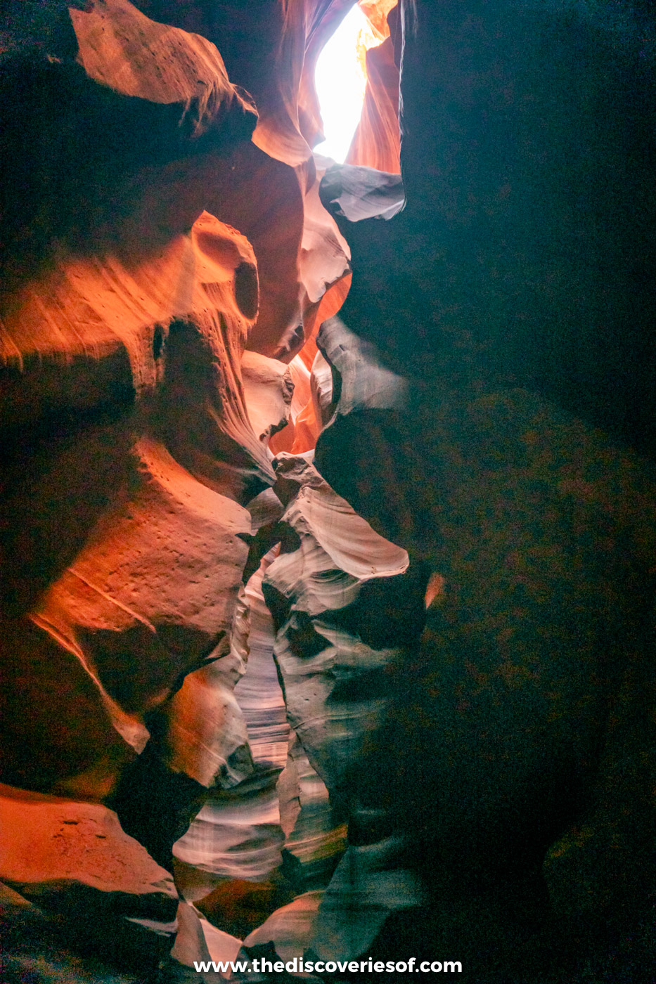
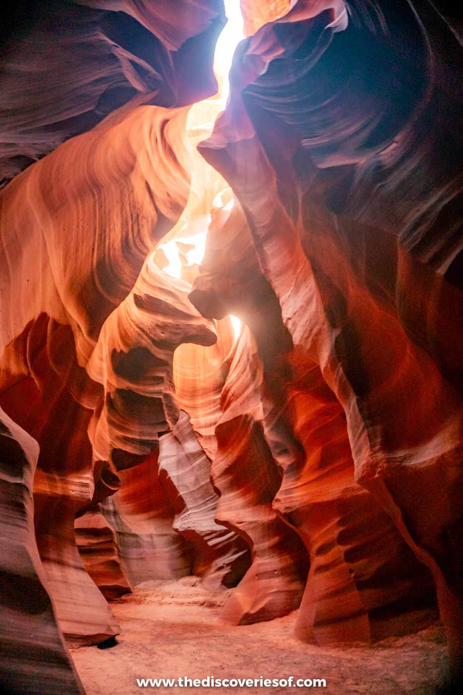
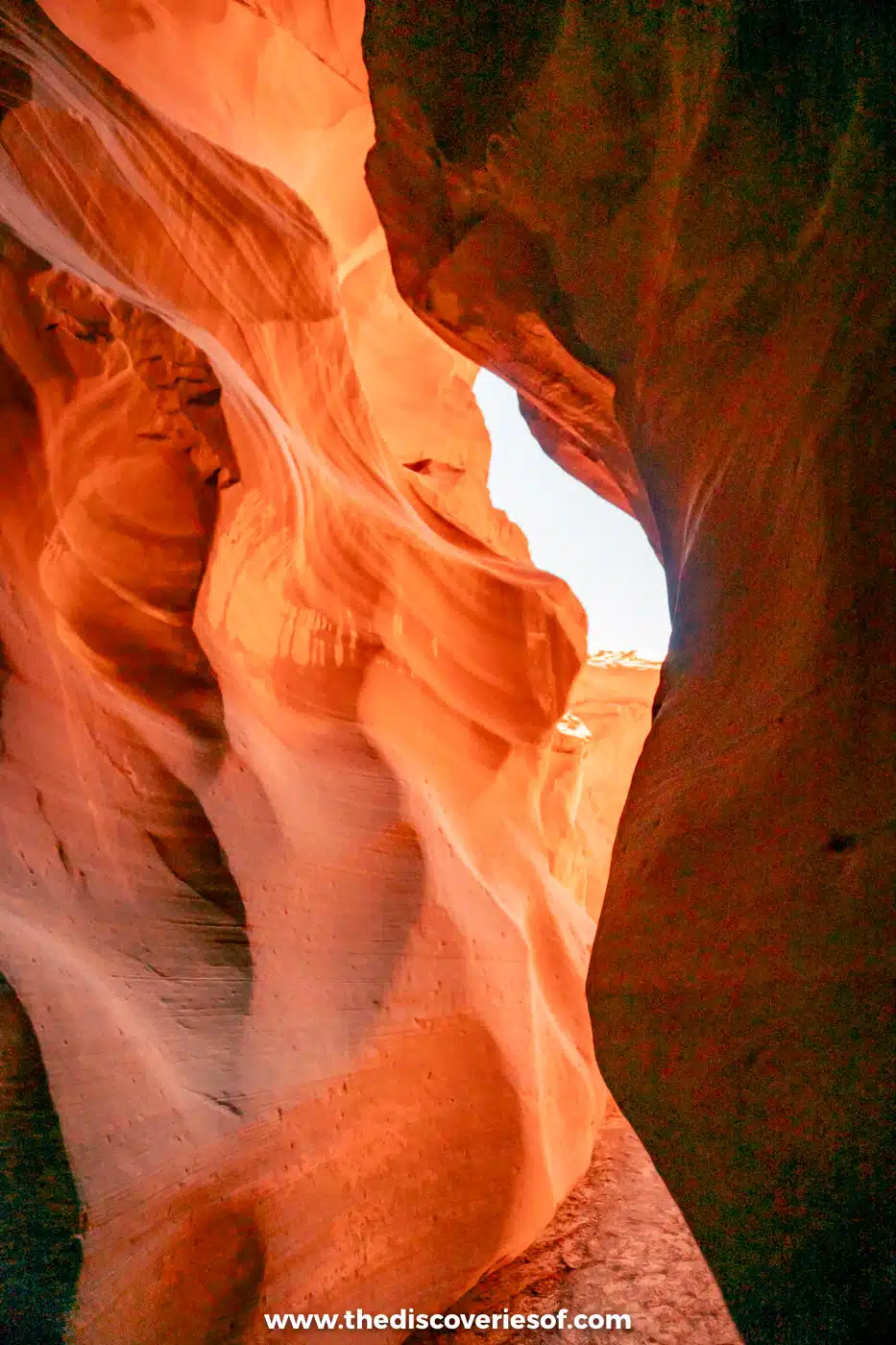
Unlike anywhere else on this trip, Antelope Canyon is a slot canyon: narrow, curving passages carved through the sandstone by millions of years of flash floods and wind, with walls that glow orange and purple as the light filters down from above.
It’s on Navajo land, and you can only visit on a tour with a Navajo guide, so book ahead. I did this Upper Antelope Canyon walking tour, which was great. Upper Antelope is the easiest to walk, at ground level, and it’s where the famous light beams appear around the middle of the day from late March to early October. If it’s booked up, Lower Antelope Canyon, with its ladders and stairways, or the quieter Canyon X are just as worth it. Tours start from about $75, and the $15 Navajo permit fee is usually included.
Top Tip
Arizona doesn’t use daylight saving time, but the Navajo Nation does, so in summer your tour time may be an hour ahead of the clocks in Page. Check which time zone your booking is in.
Catch sunset over Horseshoe Bend
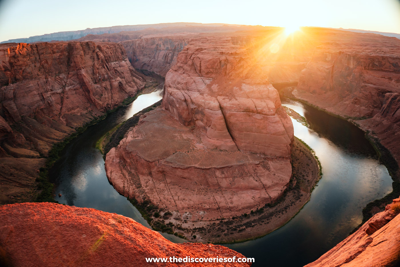
Sunrise here is lovely, but sunset at Horseshoe Bend is out of this world, as the orange light hits the great dome of sandstone that the Colorado River loops around, 1,000 feet below the overlook. You’re guaranteed some epic photos, though you’ll be sharing the view.
The walk to the overlook is really easy, about 20 to 30 minutes each way on a clear path (1.5 miles round trip), from a car park just off US-89, just south of town. Parking costs $10 per car, and national park passes aren’t accepted. If you’d rather not drive, this Antelope Canyon and Horseshoe Bend tour combines both with a Navajo guide and hotel pick-up in Page.
Afterwards, head to Birdhouse for fried chicken or Grand Canyon Brewing + Distillery next door for a cold drink (I went for the margarita).
Take in the scale of Glen Canyon Dam

You won’t quite grasp the size of Glen Canyon Dam until you’re up close. The concrete arch dam rises 710 feet (216 metres) above the Colorado River, holding back Lake Powell, and the Glen Canyon Dam Bridge beside it gives you a dizzying view straight down into the canyon.
The Carl Hayden Visitor Center, perched on the rim beside the dam, has exhibits on how it was built and how it works. Guided tours inside the dam have been suspended in recent years, so check with the visitor centre before you go. Lake Powell’s water levels hit a record low in 2026, and some marinas, ramps and boat tours have moved or paused as a result.
Take a day trip to Monument Valley
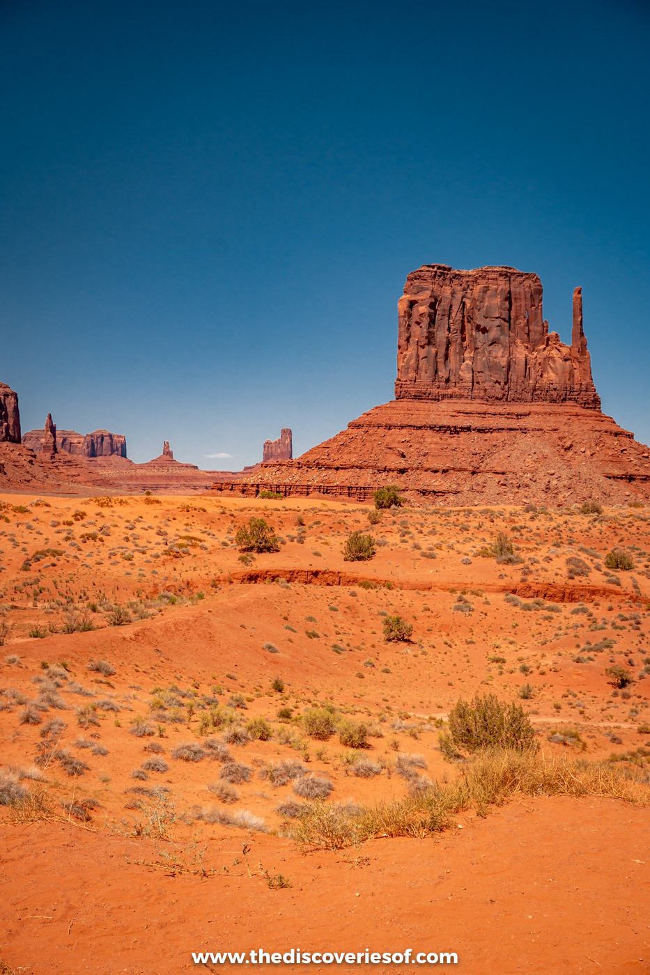
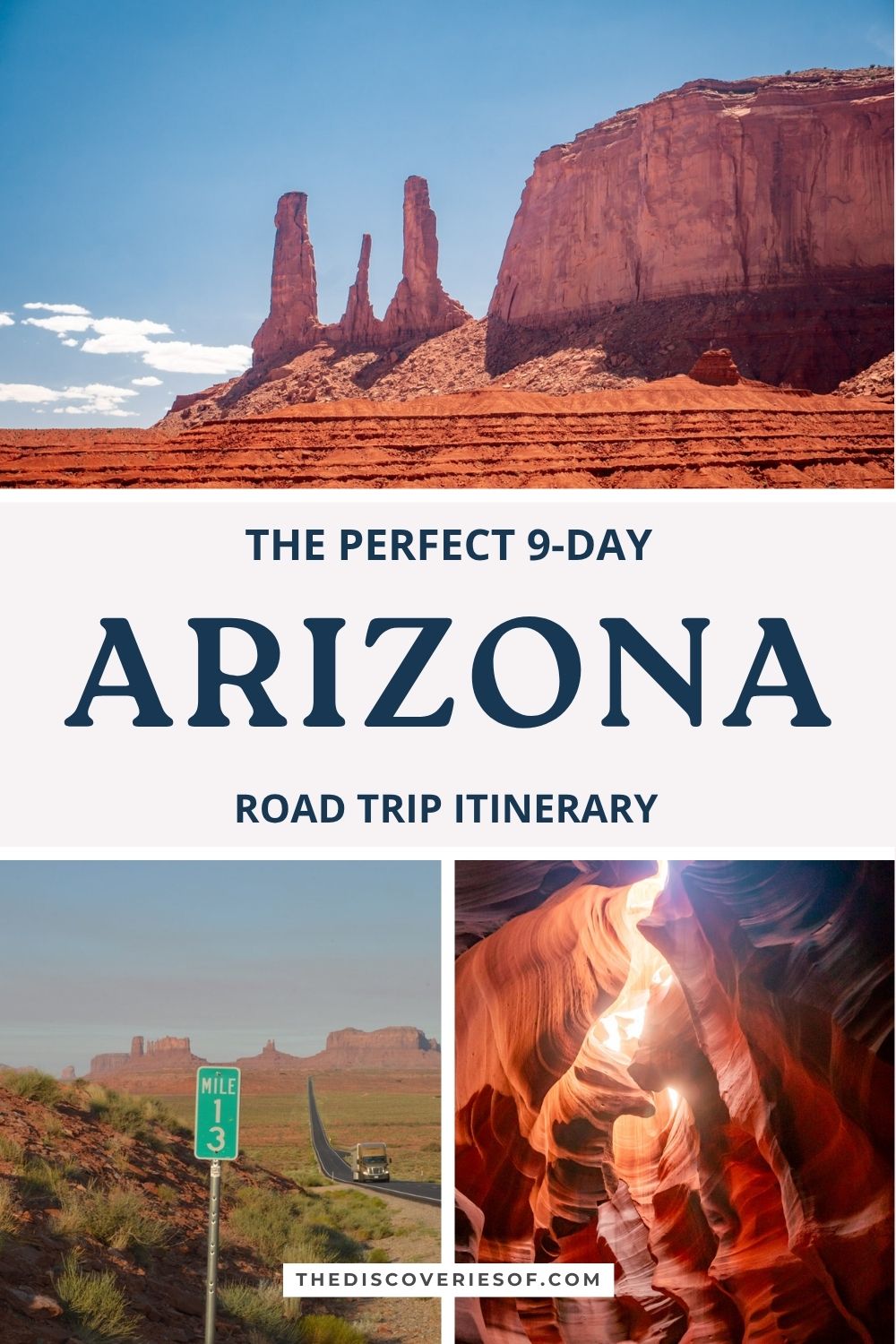
Monument Valley is a longish drive from Page, about two hours each way, but it’s worth it. The red buttes and mesas rising out of the desert on the Arizona-Utah border, some as much as 1,000 feet (about 300 metres) above the valley floor, are some of the most famous views in the American West.
It’s run by the Navajo Nation as a tribal park, and entry costs $10 per person (book online; national park passes aren’t accepted). The 17-mile (27km) Valley Drive is an unpaved, sandy loop past the Mittens, Merrick Butte and the Three Sisters that you can drive yourself in an ordinary car, though RVs and motorbikes aren’t allowed. To reach the backcountry, such as Mystery Valley and Ear of the Wind arch, you’ll need a Navajo guide: this Monument Valley highlights tour with backcountry access takes three and a half hours.
Carry on a few miles into Utah on US-163 to Forrest Gump Point, where the road runs dead straight towards the buttes, before heading back to Page.
Read Next
Getting to Page
From the Grand Canyon, leave the park along Desert View Drive and out through the East Entrance to Cameron, then head north on US-89 to Page. The drive takes about two and a half hours. From Phoenix, it’s about four and a quarter hours north on Interstate 17 and US-89 via Flagstaff.
Suggested stay
I stayed at the Best Western View of Lake Powell, a good-value hotel on the rim of the mesa with views over Glen Canyon, a pool and a free breakfast. Garner Hotel Page – Lake Powell Area (formerly the Baymont by Wyndham) is a simple mid-range alternative, five minutes’ drive from the lake.
Alternatively, check all accommodation in Page
Day 9: back to Phoenix

Back to Phoenix you go for the final day, which makes it a breeze to catch a flight home or head on to your next destination. The drive from Page is about 270 miles and takes around four and a half hours via US-89, Flagstaff and Interstate 17, so set off early and break the journey in Flagstaff.
Wander the cactus trails at the Desert Botanical Garden

A botanical garden is the last thing you might expect to find in the desert, but the Desert Botanical Garden in Papago Park shows just how much life the Sonoran Desert holds. It covers 55 acres and holds around 55,000 plants, including more than 4,800 species and around 420 that are rare and endangered, from giant saguaros to agaves and wildflowers.
It’s all laid out along five short trails, so you can walk the lot in a couple of hours. Adult tickets start at $32.95, parking is free, and the hours change with the seasons, so check before you go. In spring and autumn, look out for the butterfly pavilion.
Dine at Cibo
To cap off your trip, have dinner at Cibo, a much-loved downtown pizzeria in an early 20th-century bungalow on Fifth Avenue. It serves wood-fired pizzas, pasta and Italian sandwiches, with a laid-back patio strung with fairy lights, perfect for toasting the end of a magical trip. Save room for one of its sweet crepes. Reservations are suggested, though it keeps room for walk-ins.
Have more time? Add these to your itinerary
Saguaro National Park
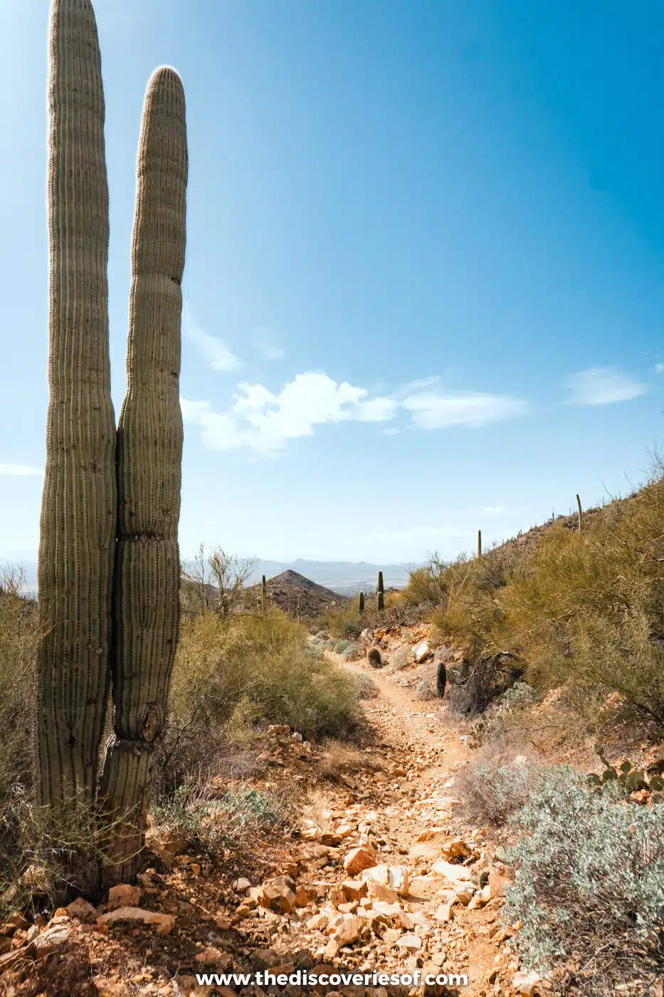
Saguaro National Park, on either side of Tucson about two hours south of Phoenix, protects forests of the saguaro, the largest cactus in the US. Of its two districts, the West has the most stunning scenery, and it’s where I spent my time. For a hike, I highly recommend the King Canyon and Gould Mine loop, an easy 2.4-mile walk through a cacti-covered canyon with a picnic spot halfway. The desert heat can kill, literally, so carry plenty of water: there’s only drinking water at the visitor centre.
Entry costs $25 per vehicle for seven days, and cards only. There are no campgrounds you can drive to, but you can backpack to six backcountry campsites in the Rincon Mountains of Saguaro East with a permit. Until 24 November 2026, Kinney Road is closed near the Arizona-Sonora Desert Museum, so follow the signed detour via McCain Loop. Read my guide to the best hikes in Saguaro National Park.
Suggested stay: Best Western InnSuites Tucson Foothills Hotel & Suites
Tucson
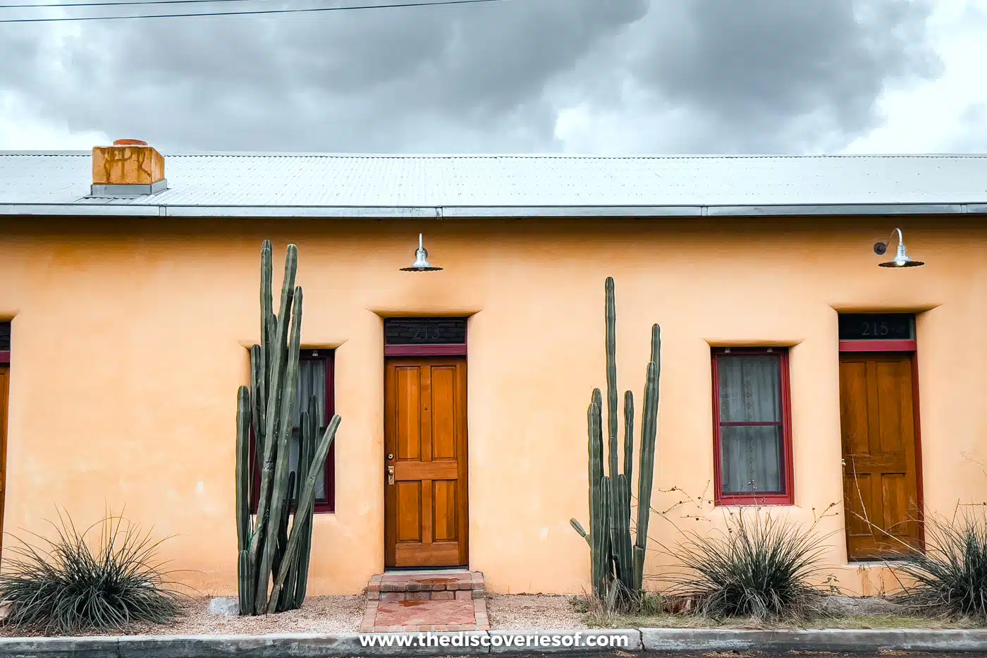
Arizona’s second-largest city, Tucson, deserves at least a couple of nights, with a blend of culture, Sonoran food, urban adventures and stunning desert scenery. I wandered the adobe streets of Barrio Viejo, ate my way from insanely good (and hearty) breakfasts at Cup Cafe to contemporary Southwestern cooking at Tito & Pep, and found Mission San Xavier del Bac stunning outside and in.
Don’t miss the Arizona-Sonora Desert Museum, part zoo, part botanical garden, for a deep dive into the Sonoran Desert. Allow a couple of hours, walk the Desert Loop Trail, and look out for the javelinas and coyotes. Adult tickets cost $29.95. Tucson is also a brilliant base for photography and stargazing, with the observatories of the surrounding mountains on its doorstep.
Suggested stay: I stayed at the Graduate by Hilton Tucson, retro meets contemporary, with mountain views and a rooftop pool and bar. For a resort with a casino, try Casino Del Sol Resort Tucson.
Petrified Forest National Park

You’ll find this unique natural wonder in north-eastern Arizona, straddling Interstate 40 near Holbrook, about three and a half hours from Phoenix or three from the Grand Canyon. A 28-mile road runs through the park from the Painted Desert in the north to the Rainbow Forest in the south.
In the Rainbow Forest, short trails such as Giant Logs lead past a nearly limitless display of petrified wood, and the Rainbow Forest Museum explains how 200-million-year-old trees turned to stone. But the real prize is at the centre of the park: the petroglyphs of Newspaper Rock and Puerco Pueblo, a 100-room village that Ancestral Puebloan people lived in about 600 years ago. The park is open from 8am to 5pm, and entry costs $25 per vehicle (cards only).
Suggested stay: La Quinta Inn & Suites by Wyndham Holbrook Petrified Forest
Seligman (Route 66)
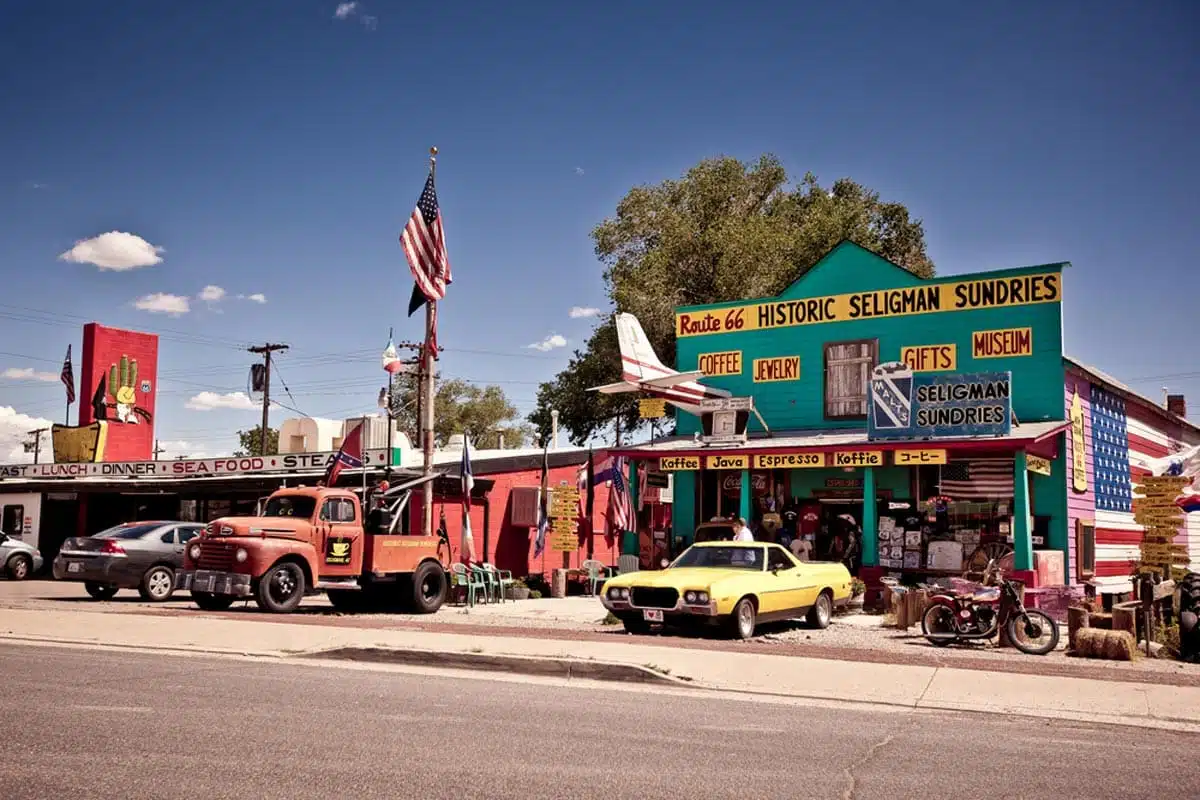
If you love classic Americana, this quirky little town on the historic Route 66 seems captured in time. It calls itself the birthplace of Historic Route 66: when the interstate bypassed the town in 1978, local barber Angel Delgadillo founded the Historic Route 66 Association of Arizona in 1987, kick-starting the revival of the old road. His gift shop is a must, as is the Snow Cap Drive-In, opened by his late brother Juan in 1953. Seligman is about 45 minutes west of Williams, so it’s an easy detour on the way to or from the Grand Canyon.
Suggested stay: Historic Route 66 Motel
Handy tips for planning your Arizona road trip
Top tips
- Book your accommodation in advance, especially at the Grand Canyon and in Sedona, which fill up incredibly quickly. Book Antelope Canyon tours and the helicopter flight ahead too.
- Be weather conscious. Summers are scorching, and the monsoon season, from July to mid-September, brings sudden storms and flash floods that can close slot canyons and trails. Wildfires can close roads at short notice, and the desert heat can kill, literally, so carry far more water than you think you need.
- Buy an America the Beautiful pass. It costs $80 for US residents and $250 for non-residents and covers everyone in your car at the Grand Canyon, Saguaro, Petrified Forest and Montezuma Castle. Since 2026, non-residents aged 16 and over pay an extra $100 each at the Grand Canyon unless they hold the pass. It doesn’t cover Antelope Canyon, Horseshoe Bend or Monument Valley.
- Watch the clocks. Arizona stays on Mountain Standard Time all year, but the Navajo Nation (including Antelope Canyon and Monument Valley) uses daylight saving time.
- Carry a card. Several parks, including the Grand Canyon, Saguaro and Petrified Forest, no longer take cash at the gate.
What to pack

- The right shoes for hiking and outdoor exploring, like my favourite Tropicfeel canyon shoes.
- A separate pair of all-purpose shoes. The Allbirds tree runners are perfect for urban adventures and those long car rides.
- Hiking essentials, including hiking poles and a hydration pack.
- Sunscreen and a hat.
- Insect repellent.
- A reusable water bottle, so you can fill up on the go (and save the planet).
- Layers: it can be scorching in Phoenix and freezing on the rim of the Grand Canyon on the same trip, especially in winter.
- All your other road trip essentials, and don’t forget a camera to capture some epic shots.
Useful resources
- Skyscanner: handy for finding great deals on flights to and from Phoenix.
- Booking.com: the best place to find accommodation in each stop, from hotels to campsites, at competitive prices.
- GetYourGuide: guided tours with knowledgeable, friendly guides, with private and group options.
Best time to visit
Spring (March to May) and autumn (late September to November) are the best times for this road trip, with warm days and cool nights. I’ve been in both early summer and February. In summer, Phoenix regularly tops 110°F and Page tops 100°F, so hike at dawn and save the afternoons for museums and pools. In February, it was cold in Sedona and on the rim, but the parks were much quieter and I got to see the red rocks under snow. Check road conditions in winter, when snow and ice can close roads around Flagstaff and the Grand Canyon.
Getting around
It wouldn’t be a road trip through Arizona without a car, and it’s the only practical way to link these stops. Car hire prices vary a lot, so compare before you book. Here are the best car hire options for Arizona road trips:
There are no toll roads on this route, but fuel stations are few and far between on some stretches, especially around Monument Valley, so fill up when you can.
Top Tip
Picking up a car from Phoenix-Mesa Gateway Airport can be cheaper than from Phoenix Sky Harbor, sometimes by enough to justify a taxi between the two.
Map
Read next
- The best things to do in Arizona
- The best things to do at the Grand Canyon
- Stunning hikes in Grand Canyon National Park
- Where to stay at the Grand Canyon
- The best things to do in Page, Arizona
- 3 days in Sedona: the perfect Sedona itinerary
- 10 days in the American Southwest: the perfect Southwest road trip itinerary
Love this? Save and share on Pinterest

Discover the top things to do, insider tips and hidden gems in our USA Travel Guides.
Read the guides →