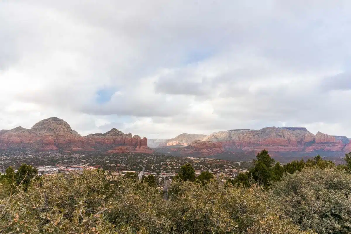
Sweeping vistas, stunning red rocks and heart-pumping elevation – these brilliant hikes in Sedona will have you feeling like a true explorer. Here’s my pick of the best.
There are so many magical things to do in Sedona that you might worry about trying to fit in a hike or two. But, let me tell you, this quiet little town is much more than the gateway to awe-inspiring vortexes.
Whether you fancy an easy stroll to some of Sedona’s top sights or want to brave a challenging climb to one of Sedona’s most spiritual locations (Cathedral Rock, I’m looking at you), there are plenty of trails nearby to suit all levels of trekker.
Ready to discover the best hikes in Sedona? These are the trails not to miss.
Best Hikes in Sedona, Arizona
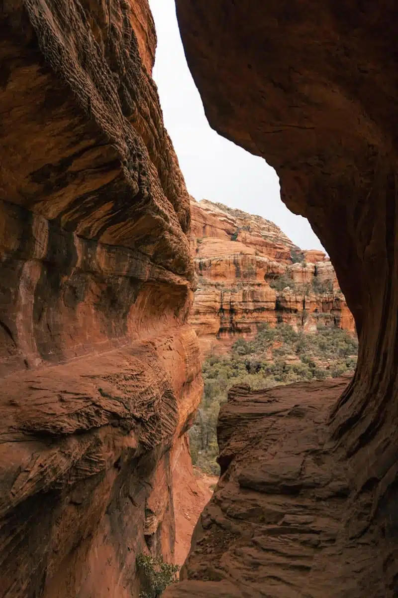
Birthing Cave Trail
Length: 2 miles
Time: 1 hour
Difficulty: Easy
Just like the traditional Hopi People who gave the Birthing Cave its name, it’s time you have a spiritual rebirth on this easy hike in Sedona. This two-mile hike has a gentle elevation gain of 291 feet (89 metres), so the climb makes up for its lack of shade.
Starting at Long Canyon Road, this winding trail passes through a delicate region of cryptobiotic soil, where agave and Pointleaf Manzanita are abundant. The first 0.6 miles of the track are relatively easy, but things change quickly out here in the Sonoran Desert.
It’s a steep incline to the pinnacle of the trail, where stunning views await. But the best scenery is yet to come — if you’re up to the final climb. The views of the cone-like cave are magical, but stretch those legs a little further and climb into the small cave for an unfathomable view of the countryside.
Top Tip: As the Protection Act of 1979 oversees this land, you can’t take or damage any artefacts, so it’s essential you’re respectful of this hike in Sedona.
Airport Mesa Loop Trail
Length: 3.3 miles
Time: 1 hour 25 minutes
Difficulty: Easy
Every Sedona itinerary should include visiting Airport Mesa; this 3.3-mile loop trail has it all. 360-degree views? One of the best Sedona vortex hikes around? You bet.
This gentle trail passes Table Top Mountain as you navigate the relatively flat and rocky path. And whether you believe it or not, Airport Mesa is also one of the strongest electromagnetic vortexes in the area, which apparently boosts positive masculine energy.
If you’re not there for the vortex, you’ll have views of almost everything up here, from Cathedral Rock in the south to Chimney Rock up north. Whatever you do, take my advice and time your hike for sunset, when Airport Mesa is illuminated in a myriad of oranges and reds.
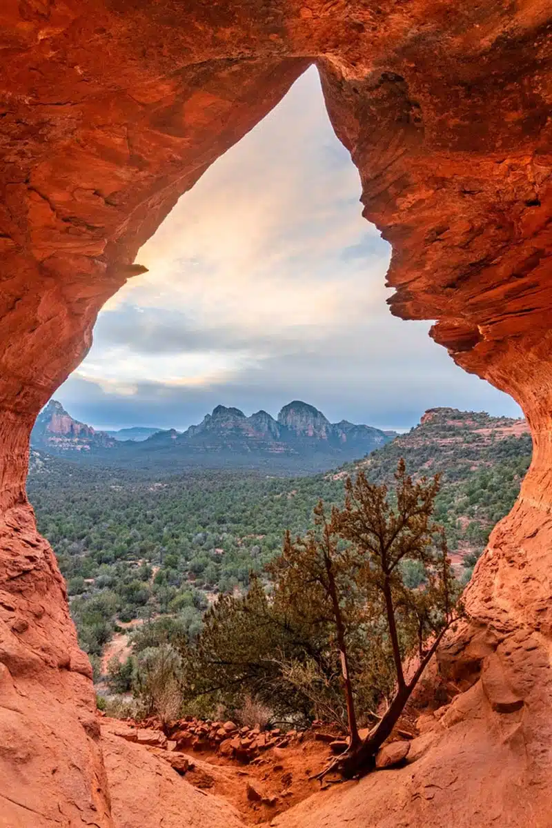
Fay Canyon Trail
Length: 2.2 miles
Time: 1 hour 15 minutes
Difficulty: Easy
Sticking with easy Sedona hikes, the Fay Canyon Trail is one of the prettiest trails through the Coconino National Forest. Okay, you don’t have sweeping canyon views here, but getting up close to some enigmatic wildlife makes this one of the best Sedona trails around.
Sycamores and Arizona Cypress line the trail and provide a reprieve from the intense sun, while unique rock formations are around every corner. The box canyons and steep red rock cliffs are stunning, but just wait until you glimpse Fay Canyon Arch.
Roughly half a mile into the walk, a spur leads to this magical landmark. As you enter this large natural arch, take a peek through the other side of the canyon, where rays of light flood into the space.
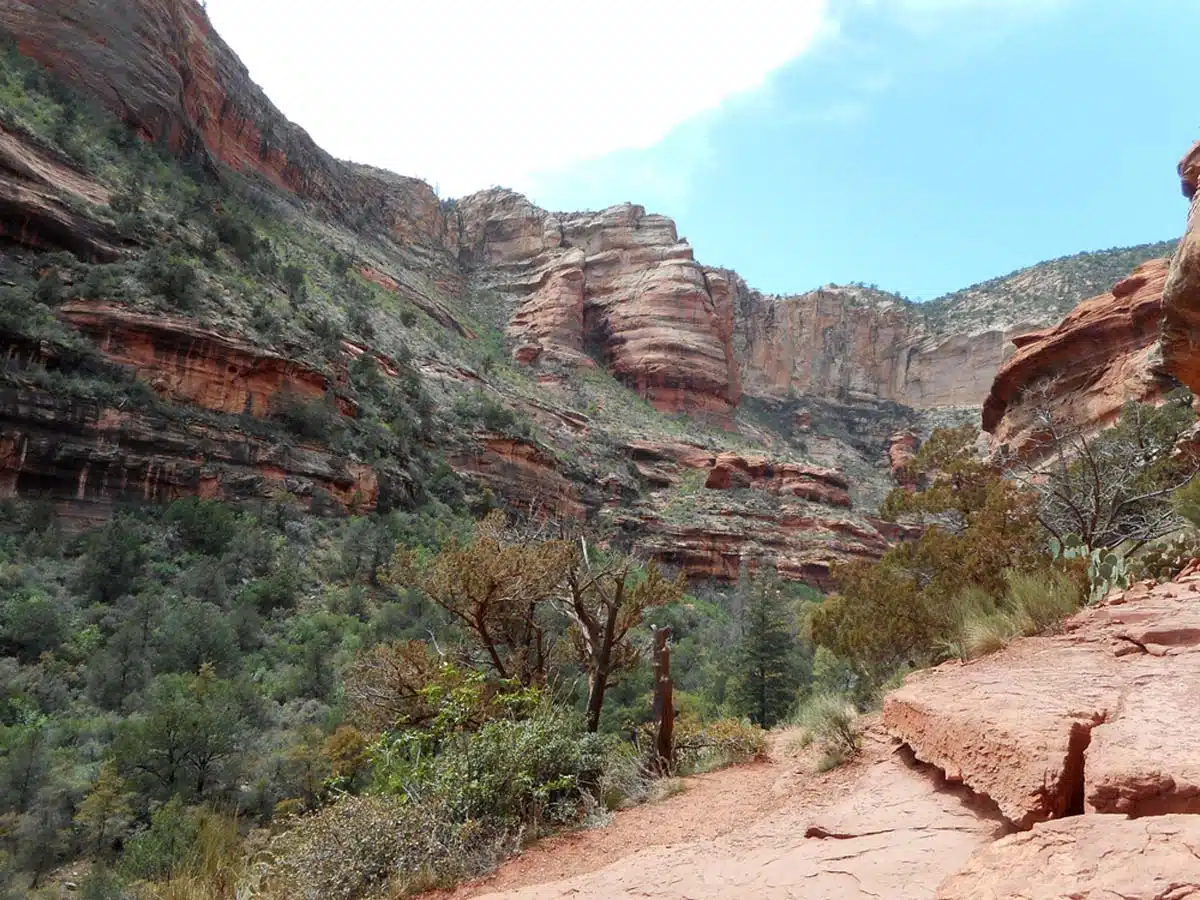
West Fork of Oak Creek Trail
Length: 6.5 miles
Time: 2 hours 30 minutes
Difficulty: Easy
I understand the apprehension of taking on the heftier West Fork Trail, but its length is made easy thanks to its gentle gradient and smooth path. Did I mention it has water — and lots of it?
You’ll pass over Oak Creek many times throughout the hike. But, before you even enter the canyon, the sites begin, as the Mayhew Lodge ruins set the tone for a magnificent trek.
Just over a mile into this trek, you’ll meet up with a magical cascade that makes this a Sedona waterfall hike. Throughout the hike, you’ll walk along Oak Creek and see how water bends the landscape to its will.
Top Tip: If you’re a quiet hiker, you may even see javelina and whitetail deer drinking from the creek. So make sure you bring your camera (no flash, though!)
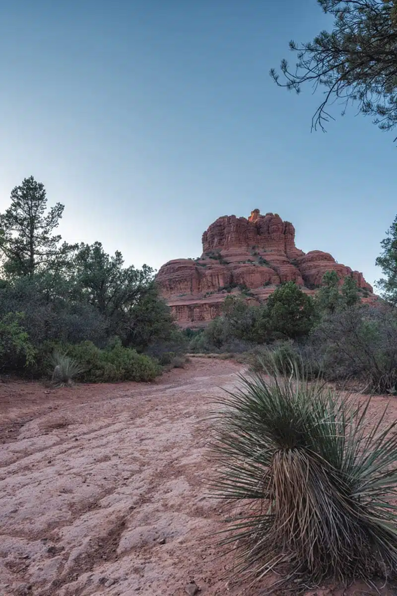
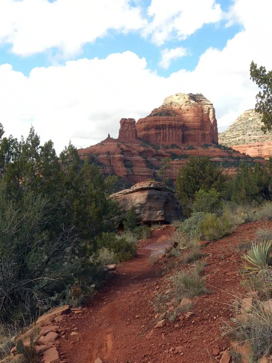
Courthouse Butte Loop Trail
Length: 3.9 miles
Time: 1 hour 30 minutes
Difficulty: Medium
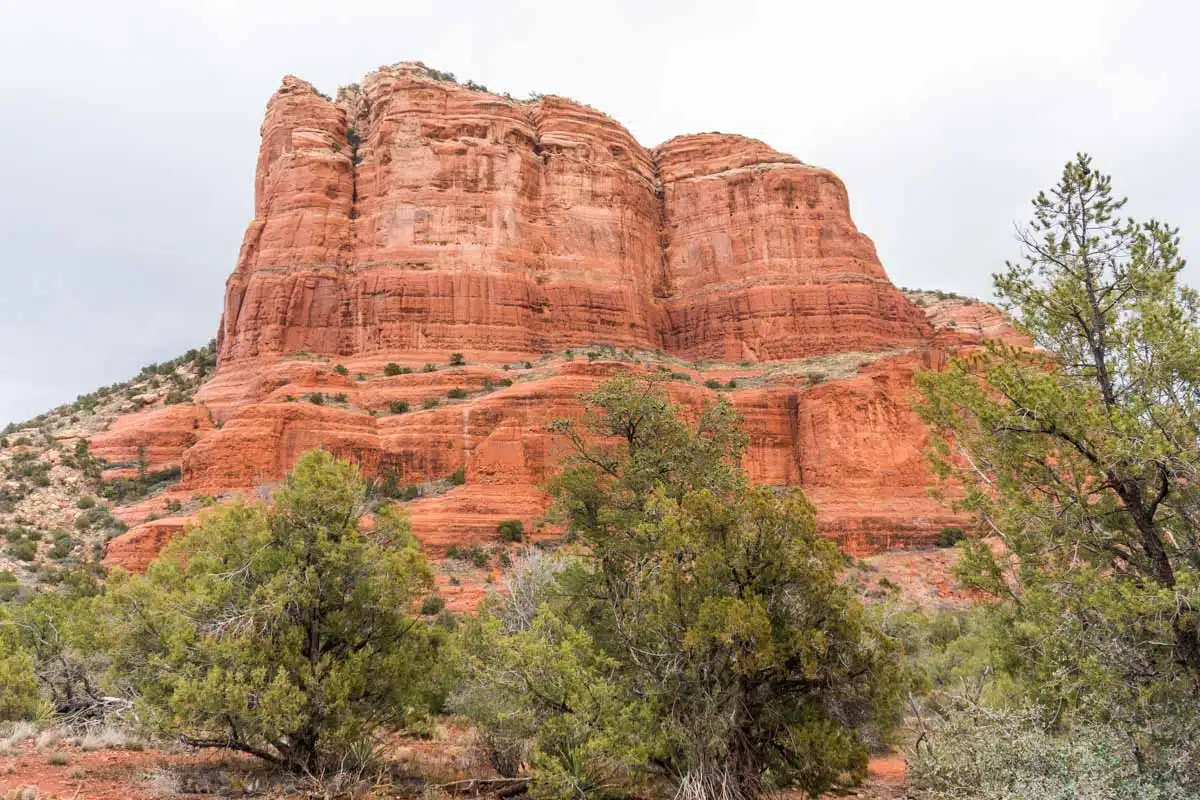
If you had to ask me, the Courthouse Butte loop path, with an elevation gain of 357 feet (109 metres), is easily the best hiking trail in Sedona. As its name suggests, Courthouse Butte towers just under 1,000 feet (304 metres), making it almost unmissable.
Don’t worry. You’re not hiking up this massive structure. Rather, it’s a moderate trek around the landmark, where you can admire it from all its alluring angles.
And to make things even better, there are several water sources throughout the hike, like Dairy Springs. I highly recommend a splash of water to the face to cool you down during the walk.
The Sedona beauty doesn’t end there, as you’ll also loop around Bell Rock (more on this next) and get a chance to feel its powerful vortex at work.
Bell Rock Trail
Length: 0.8 miles
Time: 45 minutes
Difficulty: Medium
Conquering the loop trail of Bell Rock is cool and all, but how does reaching the top of this iconic landmark sound? Pretty cool, I think.
Whether you decide to continue going beyond the trail’s end is up to you, but either way, majestic scenery is on the agenda. Although the original elevation gain is a whopping 203 feet (62 metres), taking on the extra 241 feet (73 metres) is well worth the burning thighs.
It’s also a super popular vortex hike in Sedona, so prepare for many fellow explorers.
Top Tip: Bring your handy GoPro with you and try to get an early start, as the sunrise at Bell Rock is sublime.
Devil’s Bridge Trail
Length: 3.9 miles
Time: 2 hours 30 minutes
Difficulty: Medium
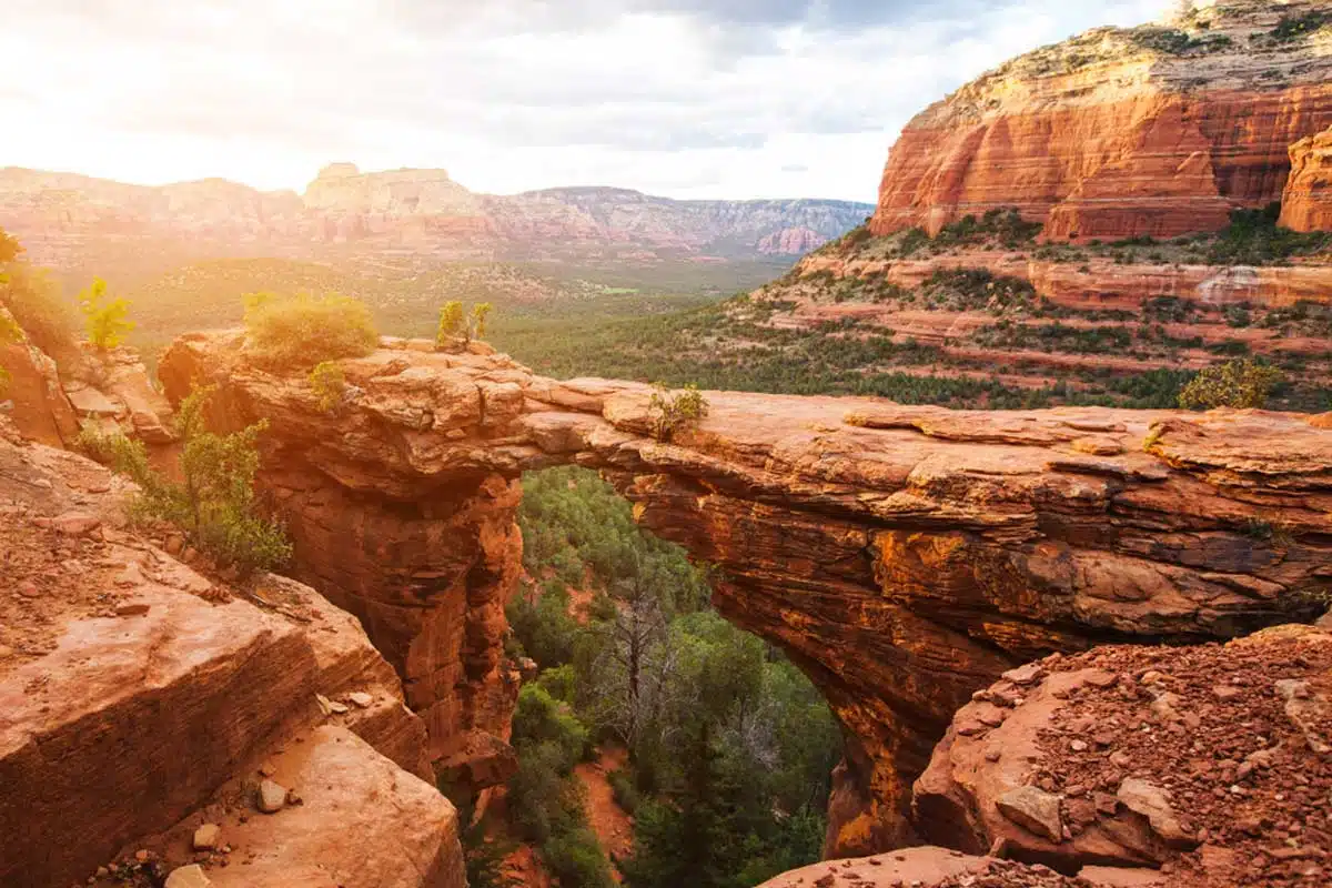
Of the top hikes in Sedona, Devil’s Bridge has the most dramatic scenery. Starting at the Dry Creek trailhead, it’s a gentle stroll for 1.1 miles (2 km) before meeting Devil’s Bridge’s official trailhead.
Take a sharp right onto the path, and then that’s where the real fun — and heavy breathing — begins. The next 0.6 miles is where the uphill battle begins, as the incline increases by a ludicrous 521 feet (159 metres).
You may be cursing the whole way up. And I don’t blame you. But the awe-inspiring views from Sedona’s largest natural sandstone arch will make up for all of it. Standing atop the bridge 54 feet (16 metres) above the ground will give you a whole new lease on life….
Just don’t look down if you’re afraid of heights.
Doe Mountain Trail
Length:1.5 miles
Time: 30 minutes
Difficulty: Medium
Looking for a short but sweet hike with plenty of wildlife? Doe Mountain is a dog-friendly hike through a wildlife sanctuary for many animals, from mule deer to bobcats.
It’s a lung-busting climb, but its zigzagging approach gives the thighs a slight reprieve now and then. Once you reach the top of the mesa, the red earth below with spots of green Ponderosa Pine will have you loving life.
Just remember there’s not much shade at the summit, so it’s better to take on this Sedona Arizona hike in the early morning or late afternoon. Besides, who doesn’t want to admire the sunrise or sunset from this epic vantage point?
Brins Mesa Trail
Length: 3.6 miles
Time: 1 hour 45 minutes
Difficulty: Medium
Hopefully, this trail in Sedona Brins a smile to your face just like it did to mine (I know that was a bad joke). But the majestic out-and-back Brins Mesa hike, with an elevation of 652 feet (199 metres), will give you a dopamine rush.
Its incline is gradual — which is why it has a moderate difficulty – and there’s plenty to take in as you trek through the valley floor. Keep an eye out for eagle nests in Cottonwood trees above and the infamous Saguaro cactus on the ground.
There’s plenty of shade throughout the trek. The towering cliff face of Brins Butte provides plenty of shadow through the afternoon, and The Fin offers reprieve in the morning.
Mescal Mountain Trail
Length: 6 miles
Time: 2 hours 15 minutes
Difficulty: Medium
Get ready for a long journey with many twists and turns along the way. Mescal is an epic out-and-back trail that ebbs and flows, with an elevation gain of 521 feet (159 metres).
Although you never actually reach the mountain’s summit, you won’t miss out on breathtaking vistas. Most of the trek takes you along the mountain’s ridge as you approach Dry Creek.
Don’t let its name deceive you, though. This river still flows strong (especially in July) and makes for a refreshing pit stop before returning home.
PS: It’s only a 20-minute drive from downtown, but it’s also one of the more popular spots for hiking near Sedona. So try to avoid the midday buzz.
Cathedral Rock Trail
Length: 1.2 miles
Time: 40 minutes
Difficulty: Hard
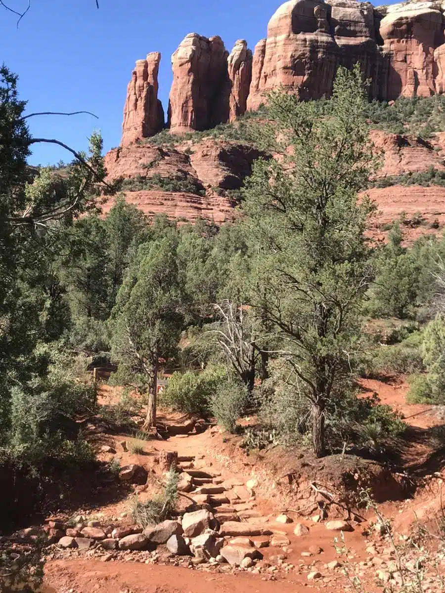
Up, up, and away you go to the top of Sedona’s most powerful vortex site. The Cathedral Rock Trail may be one of the shorter hikes around, but boy, does it kill your hammies with an elevation gain of 738 feet (226 metres).
It’s also a popular hike because it offers the best views of Baldwins Crossing and Red Rock State Park. I said it once, and I’ll say again, this is a real leg killer, so don’t be surprised if you have to take a breather every half a mile.
All in all, Cathedral Rock is one of the best trails in Sedona and an absolute must-see for its stunning rock formations. It won’t disappoint, that’s for sure.
Top Tip: There is parking at Back ‘O Beyond Road, but it is only accessible from Monday to Wednesday. You’ll need to use the Sedona Shuttle any other day to get to the trailhead.
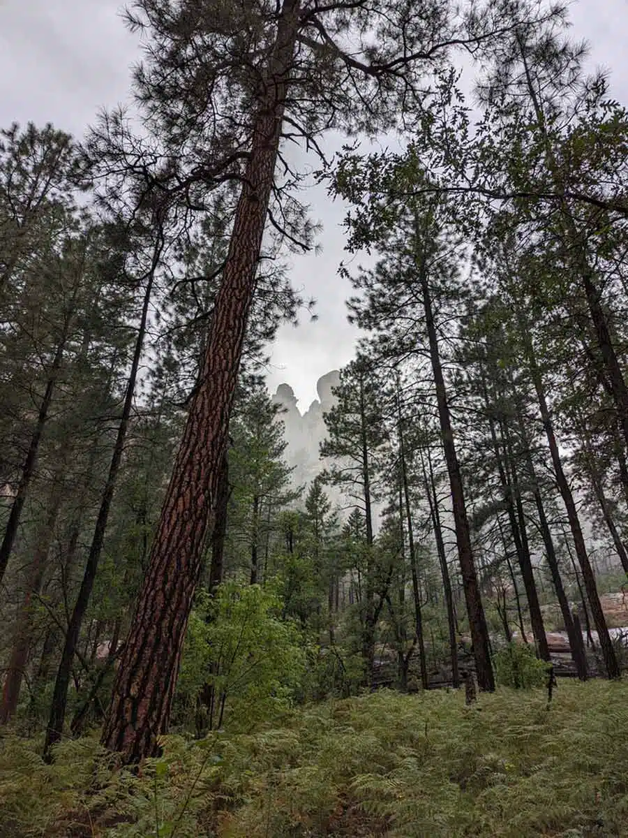
Subway Cave Via the Boynton Canyon Trail
Length: 9 miles
Time: 5 hours
Difficulty: Hard
Quite possibly the hardest and coolest hike in Sedona has to be the day-long trek to Subway Cave. Starting at the Boynton Canyon Trailhead on Forest Service Road 152B, this trail dances through the canyon to Subway Cave.
Although the cave is the star, there’s still plenty to see along the way, such as the Boynton Canyon Vortex roughly half a mile into the hike.
You’ll pass the glorious Enchantment Resort to your left. The pool there will look oh-so inviting on a hot day, but the Boynton Canyon Creek further ahead will provide some cool respite.
Once you reach the cave, take a moment to bask in its grandeur (and shade) before considering the long walk back.
Soldier Pass Loop Trail
Length: 4.5 miles
Time: 2 hours 30 minutes
Difficulty: Hard
The Soldier Pass Loop is undeniably difficult. And, after taking on this epic adventure through stunning rock pools and towering sandstone arches, you’ll feel like a real marine. It really earns the title of Soldier Pass, as you’ll clamber up 839 feet (253 metres) of rugged terrain all the way to Soldier Arch.
But before you get there, you’ll meet up with the seven sacred pools of Sedona roughly half a mile into the hike. Of all the spiritual spots in Sedona, these cascading rock pools flowing into one another might just be my favourite.
Don’t turn back just yet, as the Soldier Pass Cave and Arch are still very much in sight. Besides, watching the magical sunlight filter into the ochre-coloured cave is something you can’t miss when visiting Sedona.
Top Tip: Like the Cathedral Rock Trail, you will need to use the Sedona Shuttle to get to the trailhead from Thursday to Sunday. It also gets super busy, so try to plan ahead.
Montezuma Castle and Well Trails
Length: 1 mile
Time: 25 minutes
Difficulty: Easy
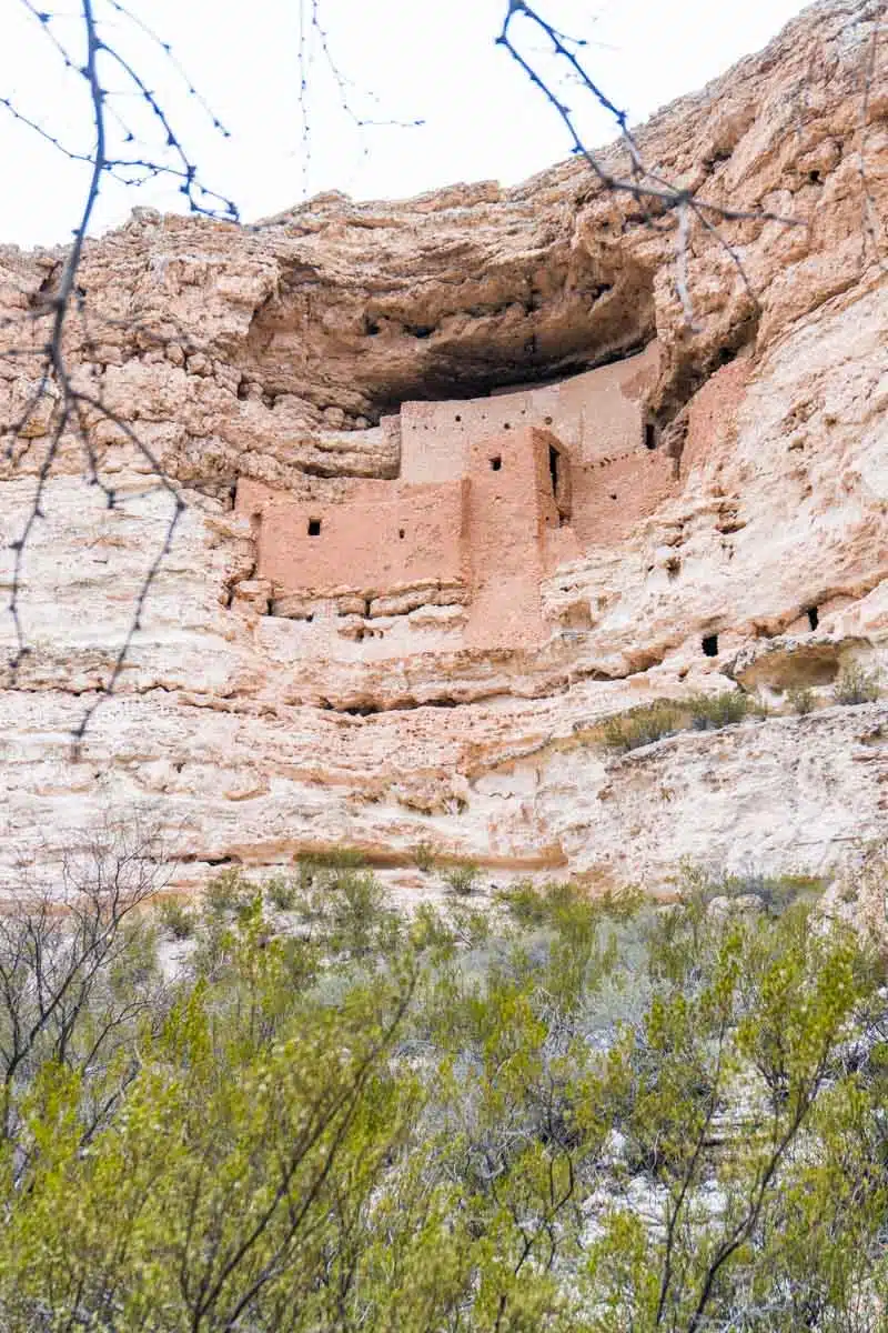
Taking on the Montezuma Castle and Well Trails is a no-brainer – this hike is short and downright unforgettable. First, you should know that this is more of a day trip from Sedona, with an hour-and-a-half drive, but it won’t disappoint.
Montezuma Castle is a staggering 900-year-old monument with 20 rooms and sits 100 feet above the Verde Valley on a Limestone cliff face. It sounds insane, right? This hike provides the best opportunity to marvel at the Sinagua People’s ingenuity and skill.
And the archaeological intrigue doesn’t end there, as the Montezuma Well Trail passes cliff dwellings that overlook the majestic body of water. I recommend pairing these two short hikes near Sedona, as you’re already in the area.
Note: There is a small entrance fee of $10 per adult.
Best Sedona Hikes: Practical Tips
- Sedona has its fair share of black bears in the Verde Valley region. So if you’re hiking in that region, be vigilant. If you come across a black bear, slowly walk away sideways so you can keep an eye on them without tripping. Taking bear spray when hiking in Sedona, Arizona, is also a good idea.
- It’s a good idea to pack light. You will need a lightweight daypack, a good quality water bottle, and waterproof hiking trainers.
- Fancy roughing it under the stars? Read my guide to camping in Sedona to discover everything you need to know.
- Remember that it gets boiling in Sedona in summer, so try and go hiking around Sedona in spring (March-May) or fall (September-November).
Sedona Hiking Trails: Map
Sedona Hikes: Read Next
Love this? Save and share on Pinterest!


Discover the top things to do, insider tips and hidden gems in our USA Travel Guides.
Read the guides →