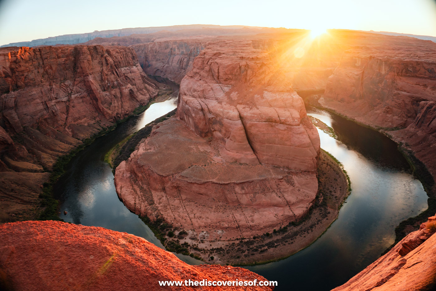

Horseshoe Bend is one of Arizona’s best-known sights, and it’s easier to reach than you might think. This is how to visit, from the short walk out to the overlook to the best time of day, the fees and where to stay.
It’s not often that I use words like spectacular or breathtaking on this site, but there’s no denying that Horseshoe Bend is both. A dramatic curve carved by the mighty Colorado River, it’s on many an Arizona bucket list for good reason.
I walked out to the overlook for sunset on my road trip through northern Arizona in early summer, and the trail was far easier than I expected: a clear path with very little change in height, taking about 20 to 30 minutes each way. This guide covers everything you need to know before you go, from the walk itself to fees, crowds and the best light.
Is Horseshoe Bend worth visiting?
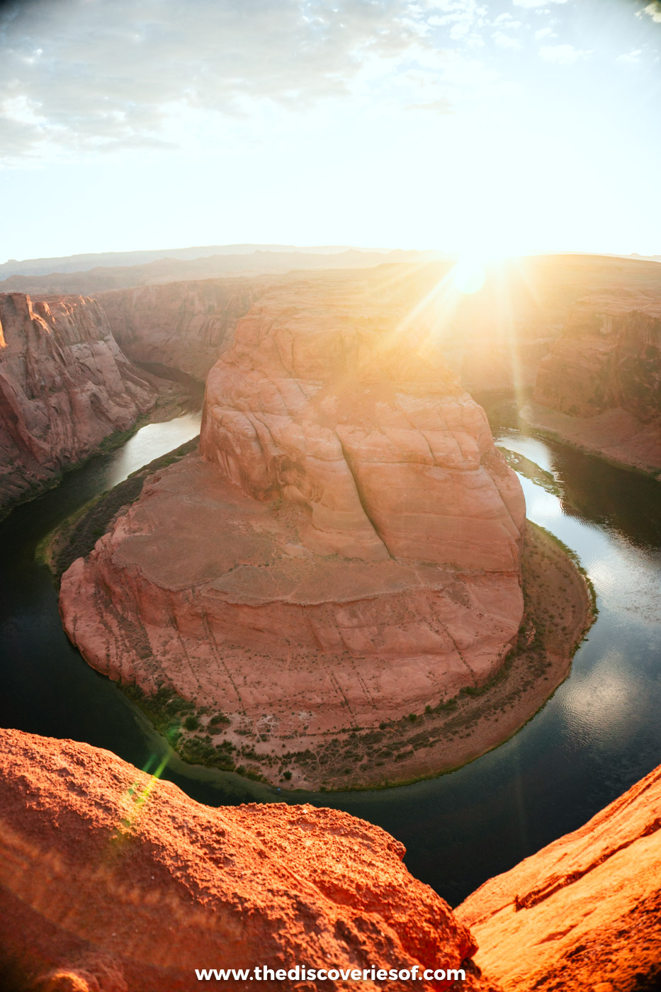
Is Horseshoe Bend worth visiting? Definitely. It may not have Bryce Canyon’s hoodoos or the scale of some of the other big draws of the Mighty Five, but it’s a sight to behold all by itself.
Here, the Colorado River loops almost all the way round a sandstone outcrop in a tight horseshoe, about 270 degrees, around 1,000 feet below the rim. The river has been slowly carving its way down through the rock for around 5 million years, leaving a great dome of rock rising from the belly of the canyon, snuggled in the middle of the horseshoe.
You can’t truly appreciate it until you’re right on top, looking over the edge with that weird sensation in your belly and an awe-inspired “woah” escaping from your lips.
Horseshoe Bend: what to know before you go
Where is Horseshoe Bend?
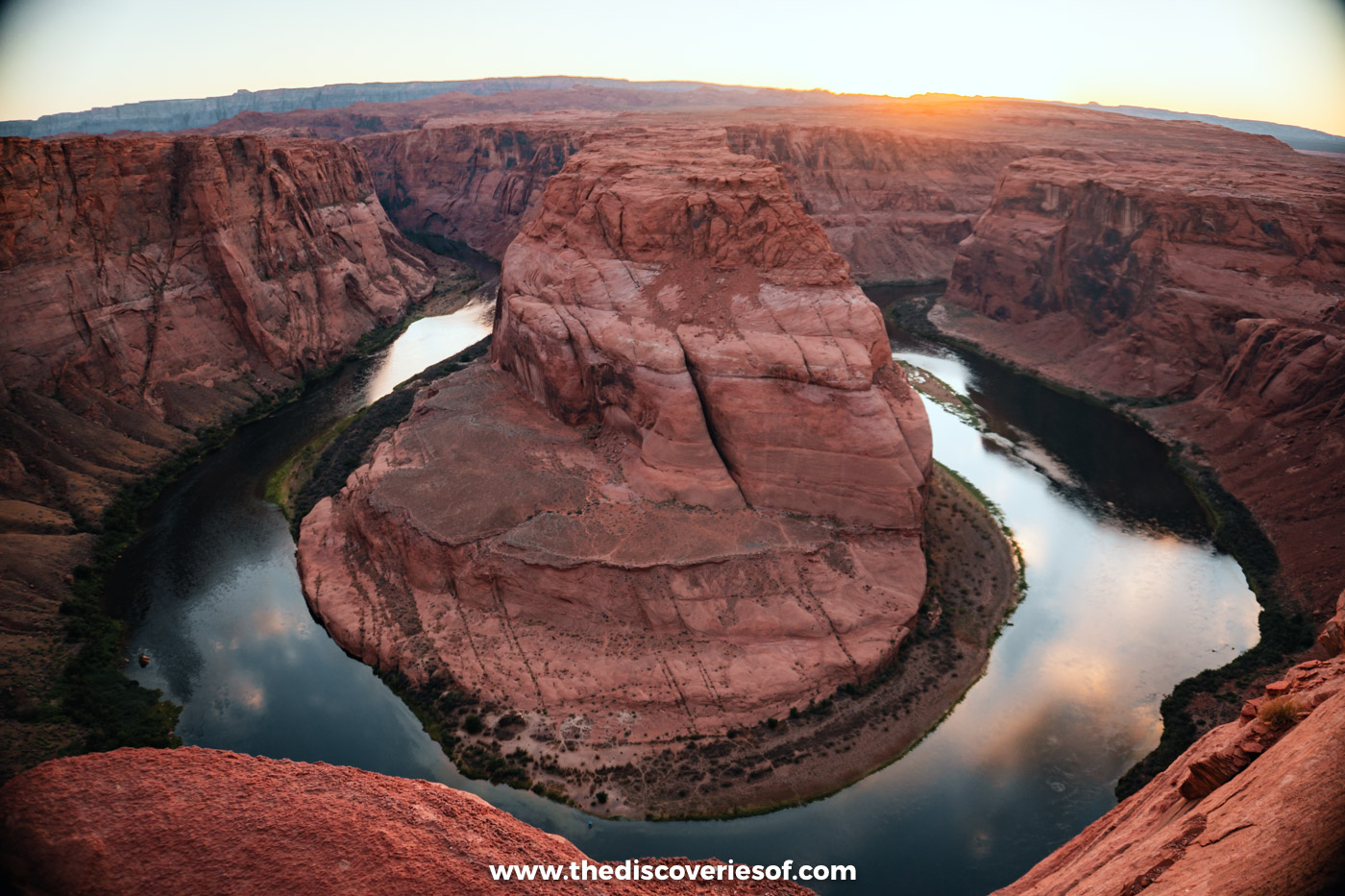
The bend sits in Glen Canyon National Recreation Area, just outside the town of Page, Arizona, about 5 miles south of the Carl Hayden Visitor Center at Glen Canyon Dam. Grand Canyon National Park (which has more than its fair share of its own spectacular views) begins about 9 miles downstream.
The car park is run by the City of Page, and the land south of the trail and overlook belongs to the Navajo Nation. Antelope Canyon is only 10 to 15 minutes away by car, so it’s easy to see both in a day.
The Horseshoe Bend trail: easier than you think
From the car park, a 1.5-mile (2.4 km) round-trip trail leads out to the overlook. The path is wide, hardened and accessible, and it’s very easy to follow: this really is a stroll rather than a hike, and it took me about 20 to 30 minutes each way.
The way out is gently downhill, so the small climb (about 130 feet) comes on the way back, usually in the heat. There are two shade structures along the trail but none at the overlook, and there’s no water or toilets beyond the car park.
The railings are on the viewing platform only. Much of the rim is unfenced, and the sandstone can crumble, so keep well back from the edge, especially if you step away from the platform for photos. Drones aren’t allowed.
What to bring for the walk
If you’re visiting in the hot summer months, bear the following in mind. There’s no water source on the trail, so bring more than you think you need: too much rather than too little, because it gets hot. Summer highs in Page average around 96°F (36°C), and the trail is in direct sun for most of the day.
Wear a good pair of closed walking shoes (I love the Tropicfeel Canyon shoes, as they’re super-comfy and supportive), because the sand gets melt-your-soles hot. Wear sunscreen, bring sunglasses and a hat, and take weather warnings seriously.
Sand storms, summer thunderstorms, high winds and intense heat are all possibilities between mid-July and September, during the monsoon season, so check the forecast before you set off.
The best time of day for Horseshoe Bend photos
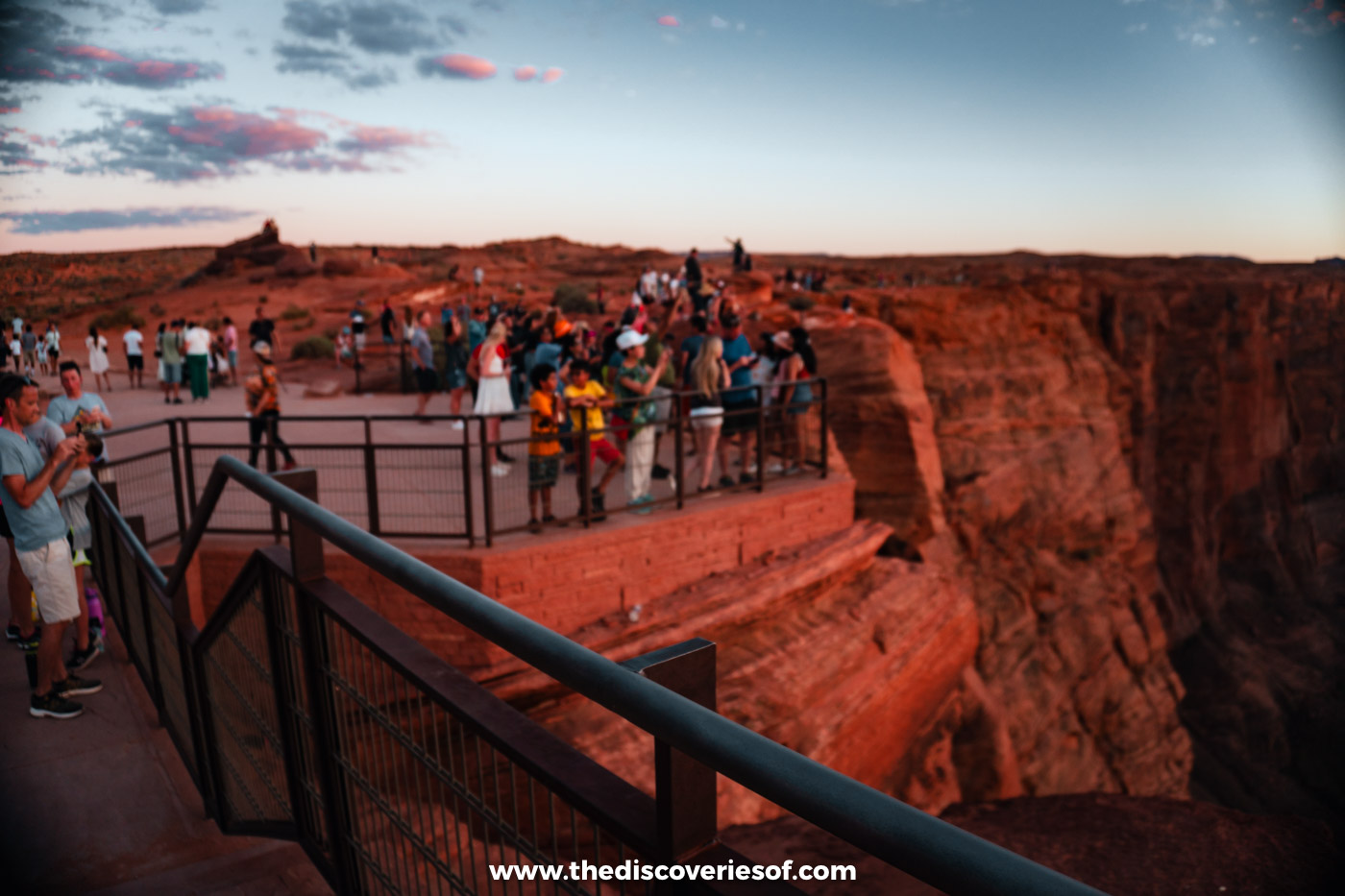
I went for sunset, when the sun drops towards the horizon behind the canyon and lights up the sandstone in fiery tones. It’s a beautiful time to be there and the heat of the day has generally eased off, but you won’t have it to yourself: the platform was packed when I visited.
If you want more elbow room, go at sunrise, which is the quietest time of day. Midday brings even light on the river and fewer shadows across the canyon, which suits photographers who want to see the whole bend, but it’s also the hottest time to walk the trail. The car park is busiest between about 9am and 2pm from May to September.
When to visit Horseshoe Bend
Spring and autumn are the best seasons to visit, with warm days and smaller crowds. October is lovely: it’s still warm-ish, and there are far fewer people competing for that sunset view.
If you visit in summer, remember you’re in the desert, and the trail is in direct sun all day. Winters are cold but often clear, with highs of around 46°F (8°C) in December and January.
Planning your visit to Horseshoe Bend
How to get to Horseshoe Bend
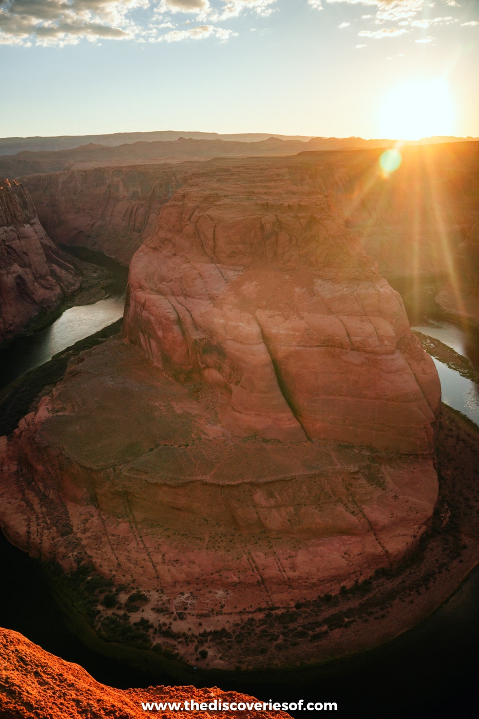
Getting there is easy. From Page, head south on US-89 to milepost 545, about 5 miles from town, and turn into the signed car park. From there, follow the trail to the overlook, and head back once you’re done.
Horseshoe Bend fees and opening hours
- Parking: $10 per car or RV and $5 per motorcycle, paid to the City of Page. National park passes, including America the Beautiful, aren’t accepted.
- Opening hours: sunrise to sunset, every day of the year. You don’t need a reservation, and overnight parking and camping aren’t allowed.
Seeing Horseshoe Bend from the river or the air
Do you need a tour? Of course you can, and with a car it’s very easy. But a few tours offer a different perspective:
- From Las Vegas: if you’re short on time, day trips from Las Vegas combine Horseshoe Bend with a guided visit to Antelope Canyon. It’s a very long day (around 13 to 15 hours), but the driving is done for you.
- From the river: the half-day smooth-water float with Wilderness River Adventures leaves from Lees Ferry and travels upriver to the bend, so you see it from the bottom of the canyon. It runs from March to October; book through Lake Powell Resorts.
- From the air: scenic helicopter flights from Page fly over the bend.
More easy walks near Page
- Hanging Garden Trail: an easy walk of about a mile round trip near Glen Canyon Dam, to a sandstone alcove where ferns grow out of the rock.
- Page Rimview Trail: a 10-mile loop around the mesa that Page sits on, with views over Lake Powell; walk a short section if you don’t fancy the full loop.
- Spencer Trail: a steep, strenuous climb of about 2 miles each way from Lees Ferry, 42 miles from Page, with huge views over Marble Canyon. Avoid it in the summer heat.
Where to stay for Horseshoe Bend
Best Western View of Lake Powell Hotel (mid-range)
This is where I stayed in Page, and it’s a good-value base just 10 minutes from the trailhead. Wake up to a free breakfast and views over the Glen Canyon rim before heading out. The rooms have free wifi, flat-screen TVs and air conditioning, and there’s a swimming pool and fitness centre.
Check rates and availability on Booking.com
Hyatt Place Page Lake Powell (upmarket)
This modern hotel on Navajo Drive has a pool, fitness centre and free wifi, a free breakfast and a bar for an evening drink after a day out. It’s a short walk from Birdhouse and Grand Canyon Brewing + Distillery.
Check rates and availability on Booking.com
Map
Read next
- Unmissable things to do in Arizona
- Arizona road trip itinerary
- The best things to do in Page, Arizona
- Upper vs Lower Antelope Canyon: which to visit
Love this? Save and share on Pinterest

Discover the top things to do, insider tips and hidden gems in our USA Travel Guides.
Read the guides →