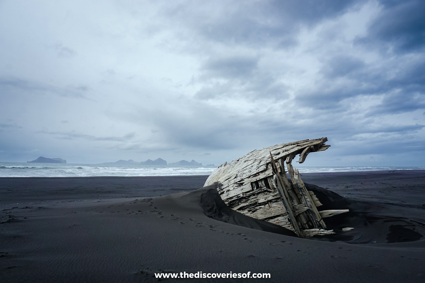

A wreck sinking into an empty black beach. Icebergs striped with ash from eruptions long ago. A waterfall that hides inside a cliff, and a sky that wouldn’t stop dancing. This is the south of Iceland as I saw it, in my own photos, over one spring trip and one autumn one.
It’s no secret that I love Iceland. Even in the land of fire and ice, where every view seems more dramatic than the last, the south stopped me in my tracks again and again: the sheer scale of it, the colours, the noise of the water.
I came twice. In early May the mountains were still white and I saw the south with local guides, bouncing over dunes in a super jeep and squeezing into canyons. Around the September equinox I came back with a hire car and drove east as far as the icebergs and back to Hella in one long, unforgettable day.
Here’s the strange thing about this coast. There are so many incredible landscapes that you can start taking them for granted. Please don’t. Every corner, every turn in the road, seems to hide another one.
May: snow on the peaks, moss on the lava
Þingvellir, before the green came back
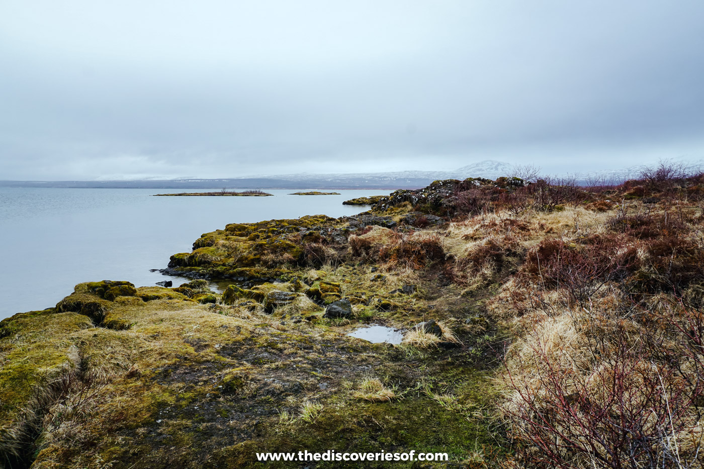
Everyone comes to Þingvellir for the rift. What I remember is the lake. Knots of old lava wrapped in moss the colour of rust, because spring hadn’t quite reached it yet, still pools that held the sky, and snow on every mountain across the water. It was as if the island hadn’t quite woken up.
On the Golden Circle, under an hour from Reykjavik. More in my Golden Circle guide.
Hekla, from a respectful distance
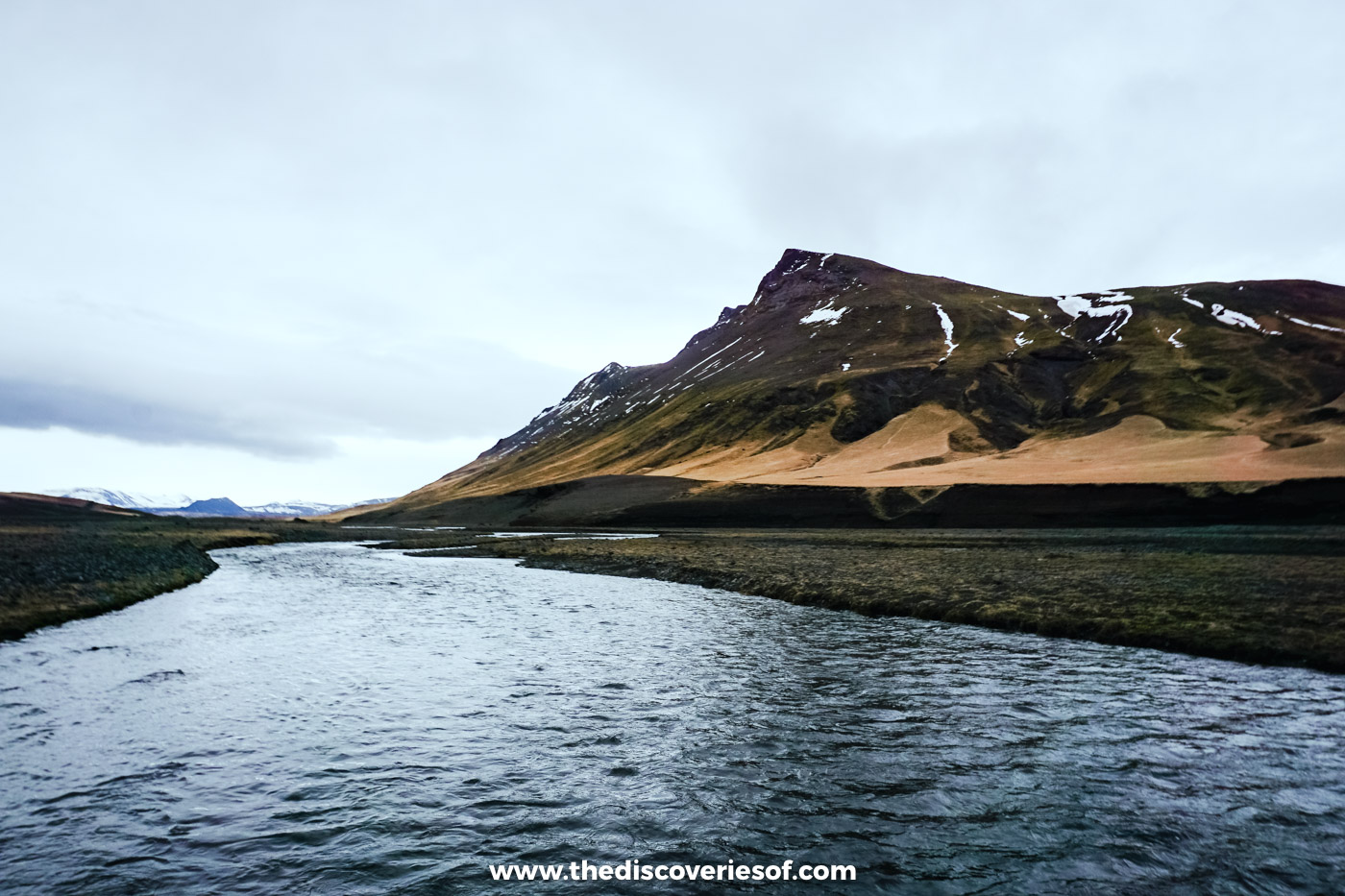
Medieval Europe called Hekla the gateway to hell, and it’s still one of the country’s most restless volcanoes. I only ever saw it from afar, several kilometres away, and it still looked pretty damn impressive. Closer to hand, the old lava is buried under moss so deep and springy it’s almost impossible not to sink into it.
Inland from Hella. My hidden gems guide has the day.
Gluggafoss, a waterfall with windows
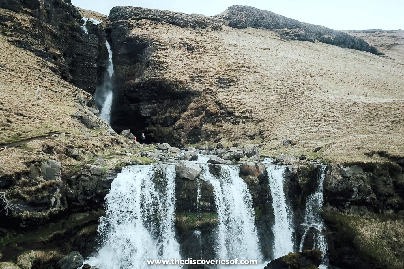
Of all the waterfalls I saw on my trips, this is the strangest. The water ducks in and out of the soft rock, bursting through holes it has carved for itself, the gluggar or windows that give it its name, before fanning out over the rocks below. Hardly anyone comes this way.
Up the quiet Fljótshlíð valley. It’s in my waterfalls guide.
Landeyjafjara, and the wreck on the sand
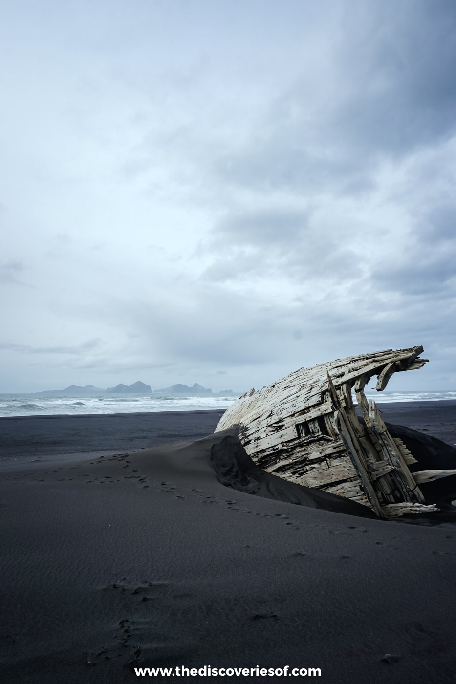
Getting here was half the fun: a super jeep lurching over sand dunes and ploughing through standing water, which is very much my kind of adventure. Then the beach opened up, and I was blown away by the colours and the scale. Black sand for kilometres, white surf, the Westman Islands floating in a haze far out to sea. Flocks of birds overhead, a couple of seals offshore and the ribs of an old wooden boat slowly being swallowed by the sand. No other visitors at all.
By Landeyjahöfn, mostly 4×4 only. More in my Reynisfjara guide.
Seljalandsfoss, from the inside out
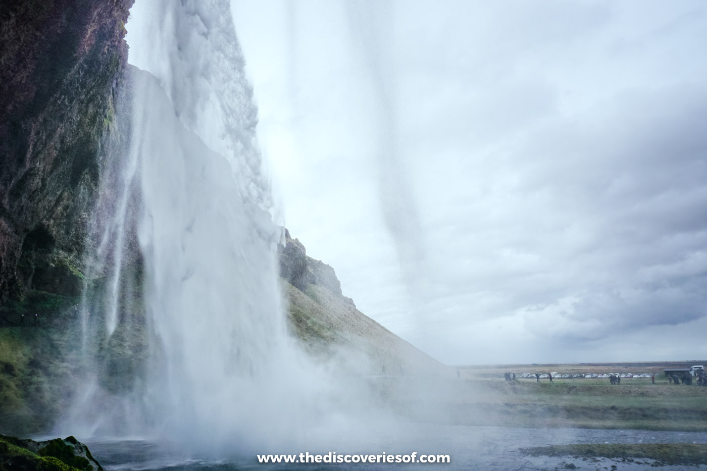
The path behind Seljalandsfoss turns a waterfall inside out. One minute you’re looking up at it; the next you’re behind the curtain, looking through falling water at the flat green plain and the sea beyond. I did it in May, and again in September.
A word to the wise: mind your camera. The spray back there is powerful, and it will find your lens.
Just off the Ring Road. How to walk behind Seljalandsfoss.
Gljúfrabúi, the waterfall inside the cliff
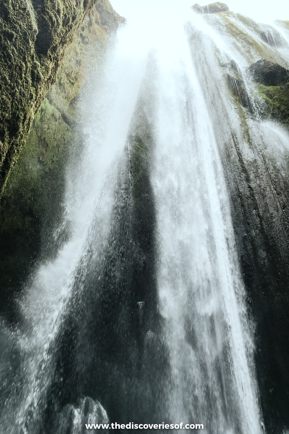
I had no idea what was coming when my guide steered me towards a narrow cleft in the cliff, a fast stream rushing out of it. A few steps over the stones (my feet didn’t stay dry), the rock opened into a tall green chamber with the water thundering into it from high above. You can’t admire this one from a distance. You stand in it, in the roar, with the mist closing in on every side, and that’s what made it one of my favourites.
A few minutes’ walk from Seljalandsfoss. How to get into Gljúfrabúi.
Þórsmörk, through the gap
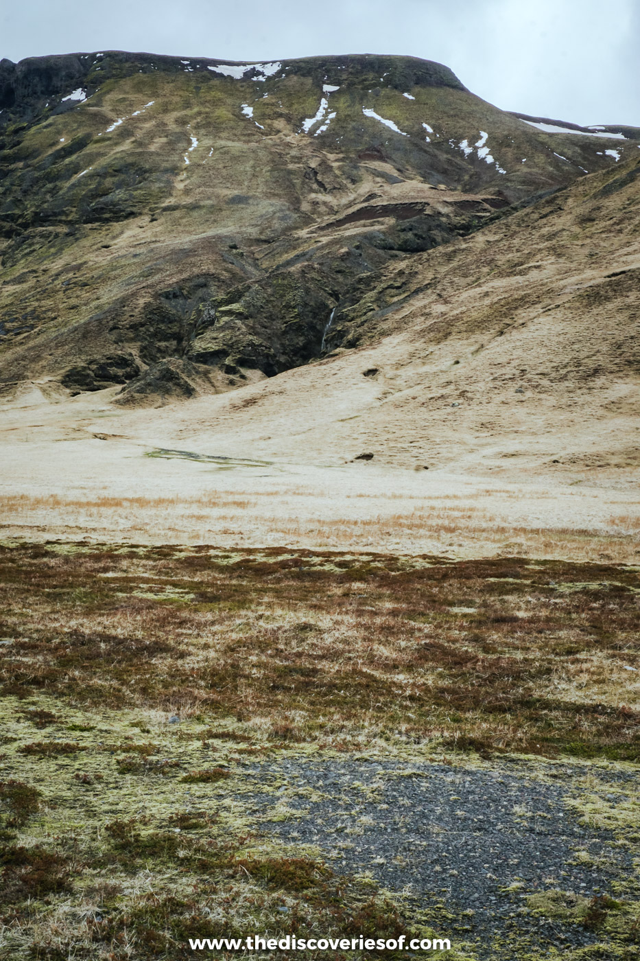
I’ll admit I was a little wary. Squeezing myself between two enormous slabs of rock, in a country where the earth moves as often as it does here, didn’t sound wholly sensible, and I spent most of the squeeze looking decidedly pensive. Was it worth it? Totally. Dipping into caves and icy canyons in the hills above the valley floor, with no other visitors in sight, was one of the best things I did in May.
Super jeep, summer bus or on foot only. My Þórsmörk guide.
Eyjafjallajökull, white then green
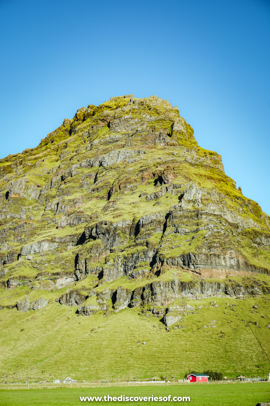
The volcano that grounded Europe’s flights in 2010 looks surprisingly serene from the road. In May its ice cap was white to the shoulders above black plains. By September the farmland beneath it had turned a green so vivid it almost looked painted, with moss-covered crags rising out of the fields as if someone had dropped them there.
Above the Ring Road between Seljalandsfoss and Skógar. Day four of my 7 day itinerary.
September: one long day east
Skógafoss, and a soaking
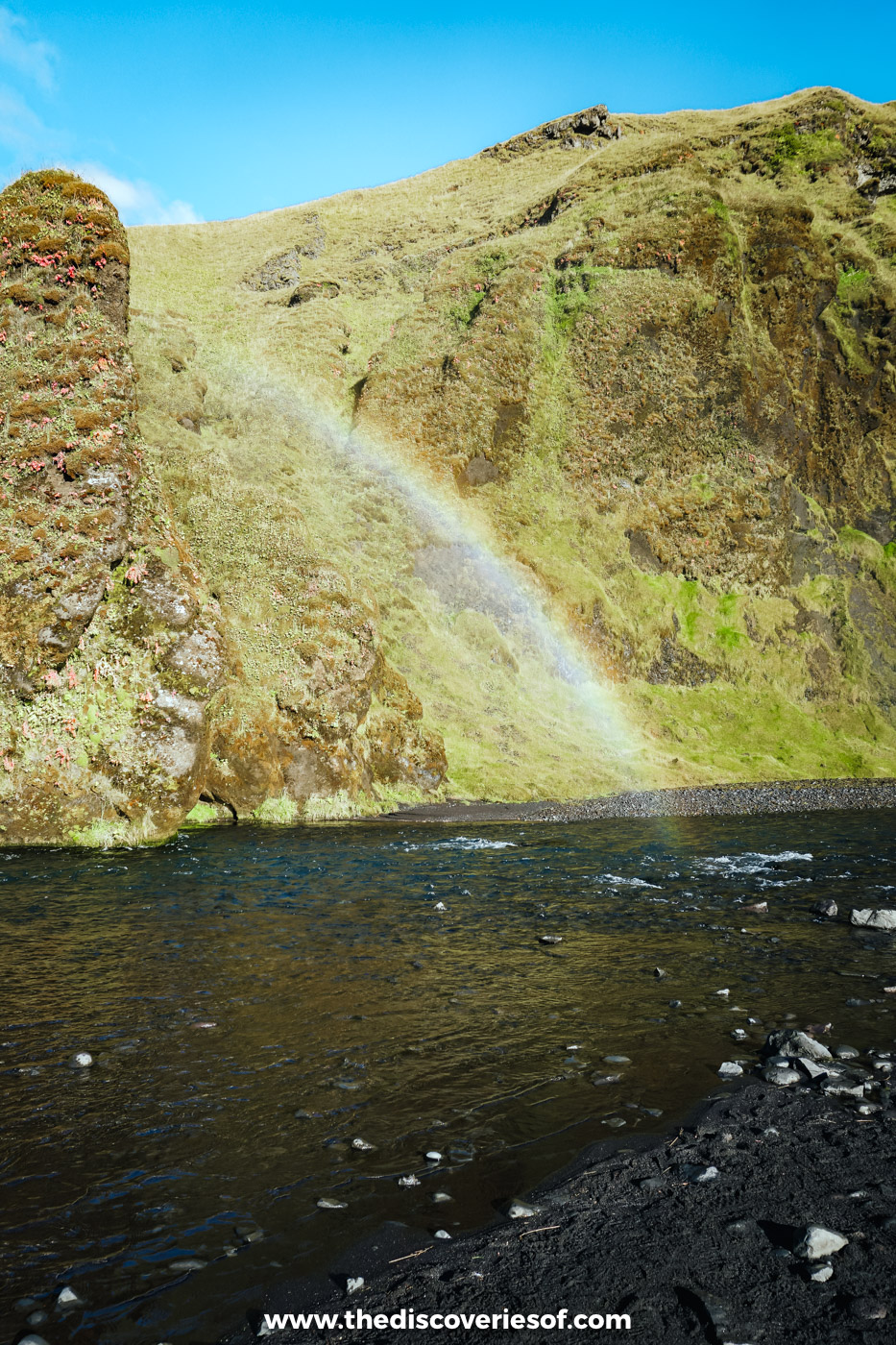
The sky was a clean, cloudless blue, so I walked straight up to the pool. Within a few minutes I was soaked through, and it was worth it: the sun was shining straight into the spray, and rainbows were arcing over the river below.
In Skógar, beside the Ring Road. My Skógafoss guide.
Reynisdrangar, from the air
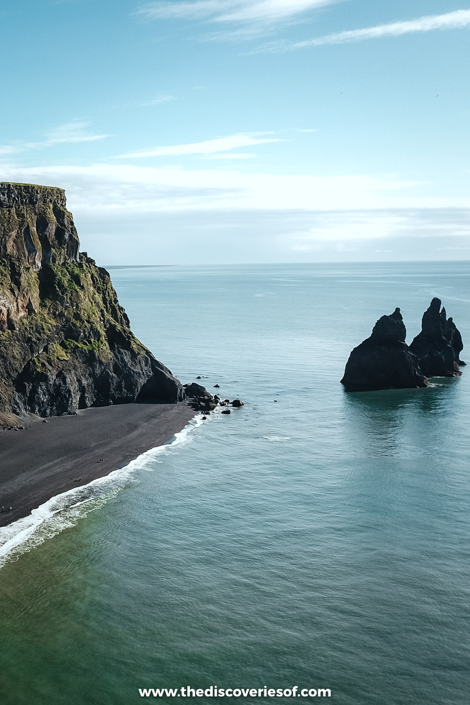
From the sand, the sea stacks are a jagged silhouette. I wanted a different angle, so up went the drone, and from above they look almost too perfect, as if someone had carefully set them down in the Atlantic. Legend says they’re trolls who lingered too long and were caught by the sunrise.
Off the tip of Reynisfjall, near Vík. The legend and the viewpoints.
Reynisfjara, black and white
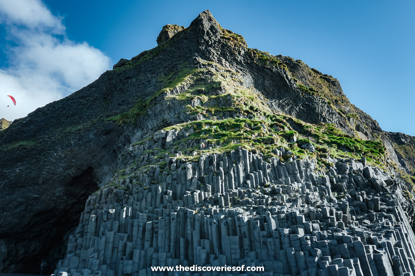
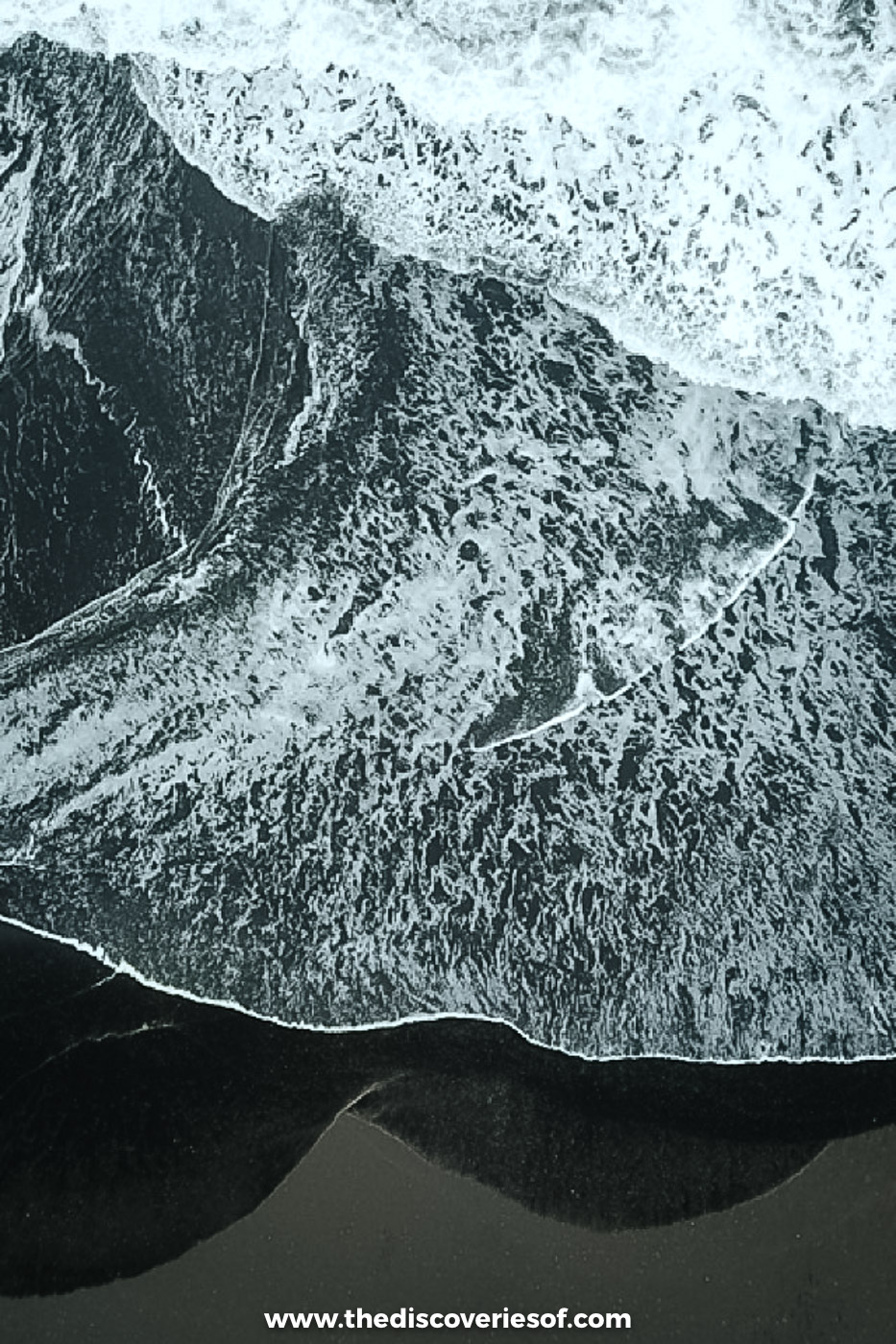
Foamy white waves against jet-black sand. I don’t know about you, but that contrast is guaranteed to make me lose my mind, every single time. At the end of the beach, the cliff breaks into neat stacks of basalt columns, which look almost too geometric to be natural. It’s as dangerous as it is beautiful, though: never turn your back on these waves.
West of Vík. Read my Reynisfjara guide before you go.
Stjórnarfoss, found by chance
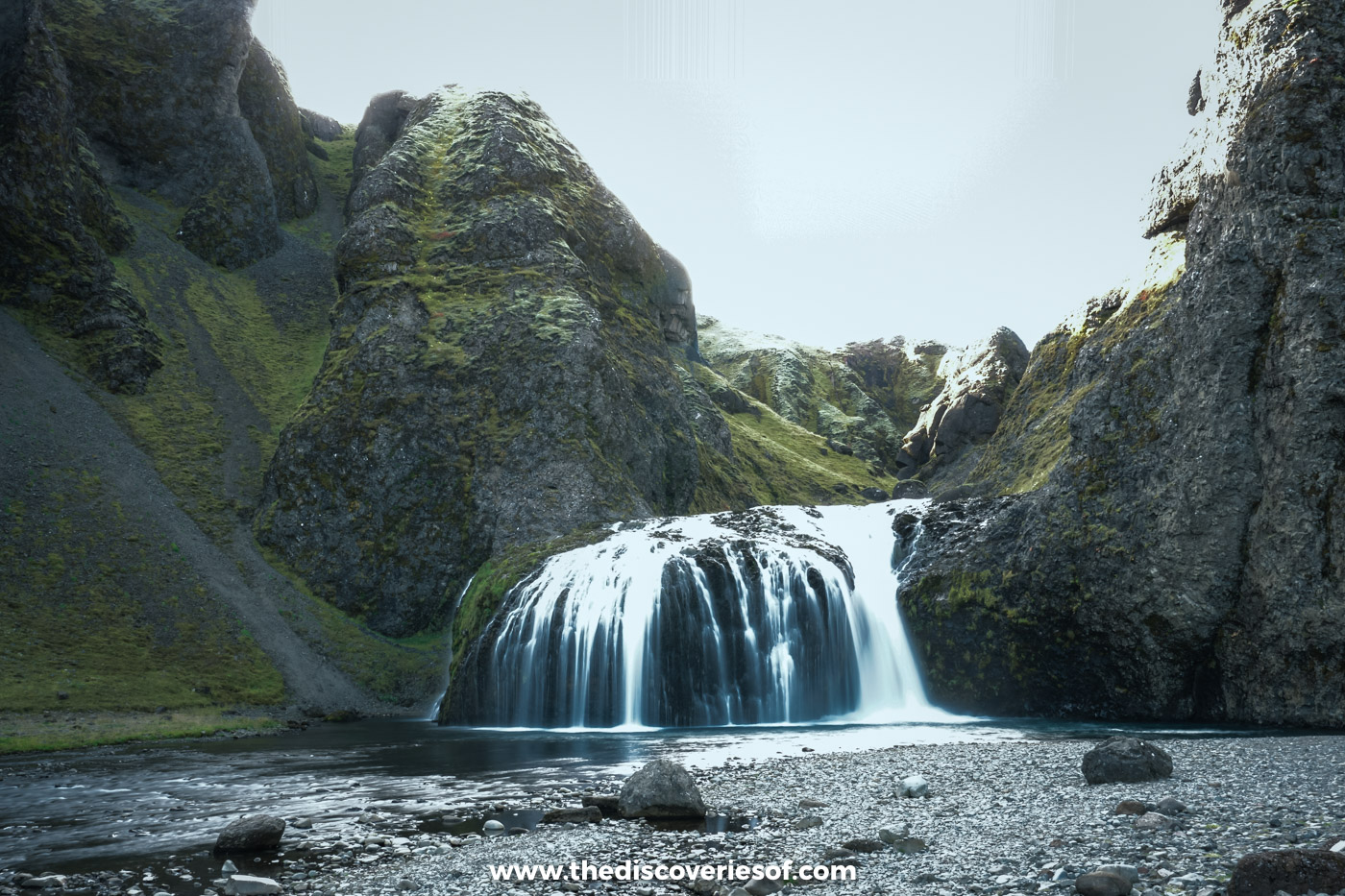
This one wasn’t on my list. I stumbled across it on the drive east, and I’m so glad I did: a small two-step fall dropping into a pool so clear you can count the stones, cupped in mossy rock. This is the joy of driving here. Pull over, walk five minutes, and there’s a waterfall with nobody else at it.
By Kirkjubæjarklaustur. It’s in my waterfalls guide.
Lómagnúpur, the cliff at the end of the road
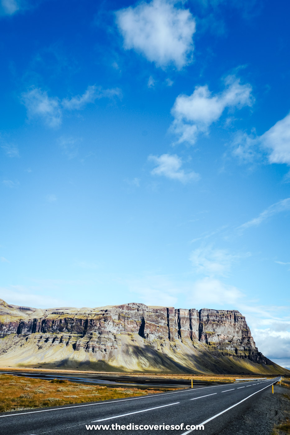
East of Kirkjubæjarklaustur the farms fall away, and the road runs dead straight towards one colossal wall of rock. Lómagnúpur rises almost sheer for about 670 metres, and in Njáls saga a giant strides out of it in a dream to name the men who are about to die. Under a blue sky, it just looked magnificent.
On the Ring Road, west of Skaftafell. Kay’s Ring Road guide.
Jökulsárlón, the diamonds I actually want
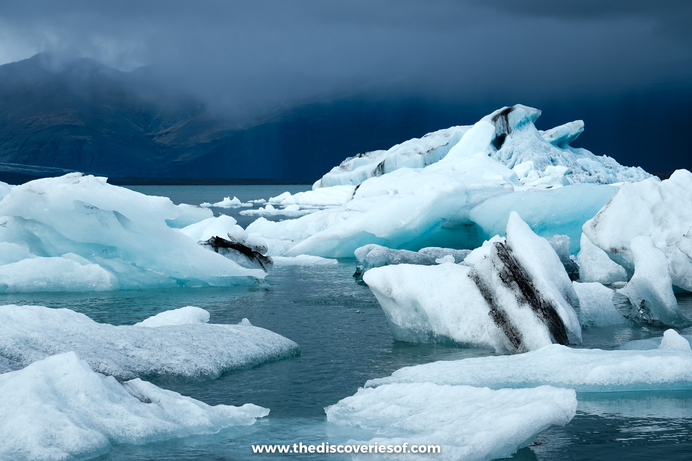
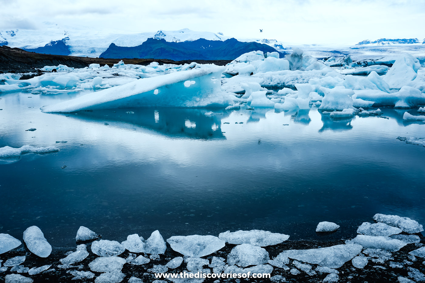
Diamonds really are this girl’s best friend. Not the kind you put on a ring, the kind that float. Jökulsárlón is filled with icebergs broken off the glacier behind it, ranging from brilliant white to a blue so deep it seems to glow, many of them striped with dark bands of volcanic ash. It’s where fire and ice meet most beautifully. In September there was hardly anyone around, and the further I wandered along the shore, the stiller it felt.
At the far end of the south coast. My Jökulsárlón guide.
Fjallsárlón, close enough to count the cracks
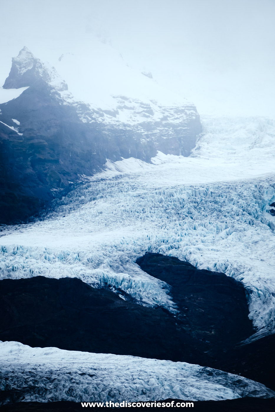
Ten minutes from the big lagoon, and somehow wilder. Here the glacier tumbles right down the mountain in a chaos of blue-white crevasses and stops almost at the water’s edge. After the drifting icebergs, this is ice that hasn’t broken free yet.
Just west of Jökulsárlón. More in my Jökulsárlón guide.
Svartifoss, my maybe favourite
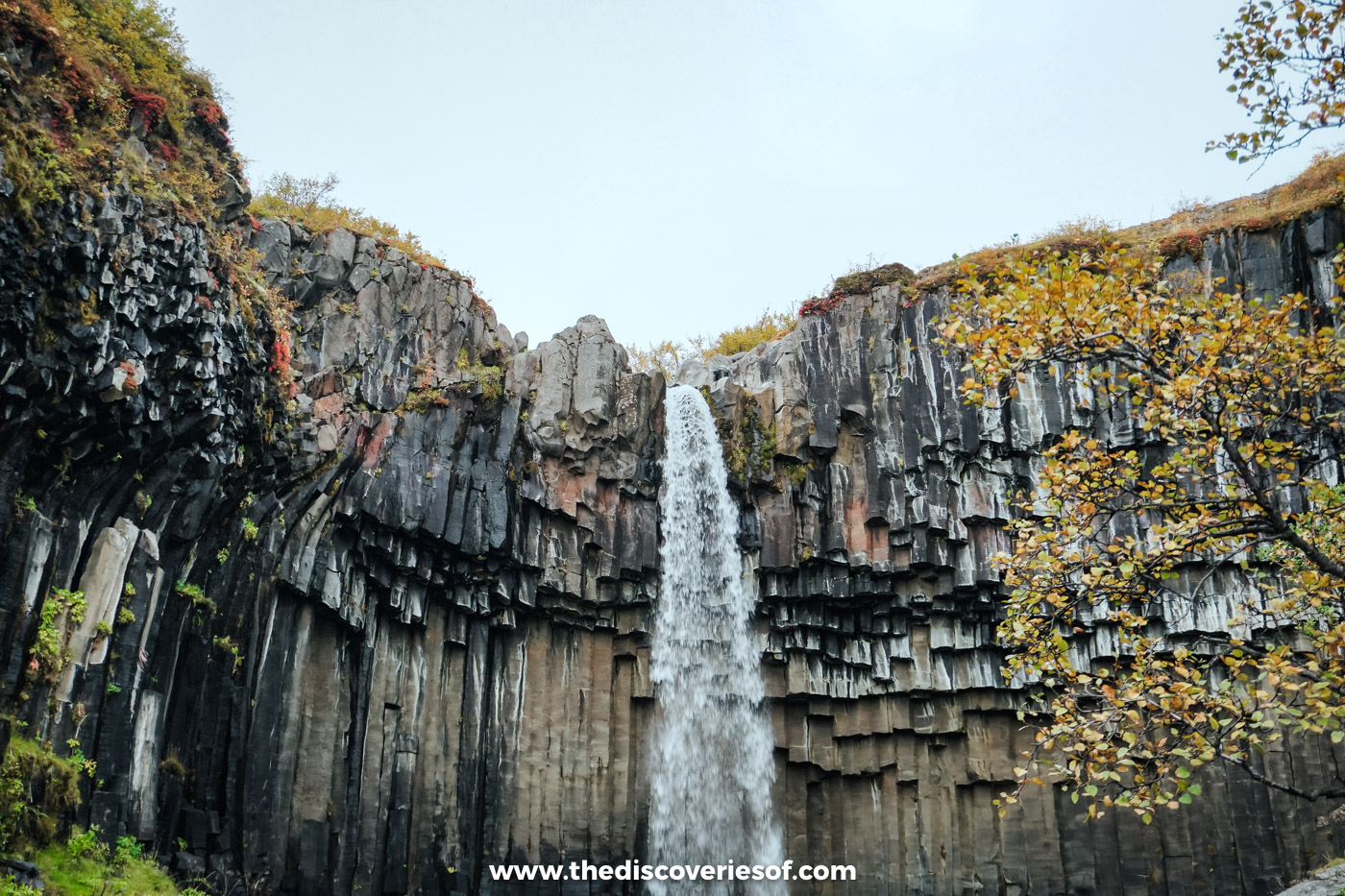
Is this my favourite waterfall in Iceland? Possibly. A thin ribbon of white falls between black basalt columns, their broken ends dangling overhead like enormous icicles, and in September the slopes around it were rust and amber. It was my last big stop on the way back from the ice. The path is steep for the first stretch, then it levels off, and the moment it comes into view makes every step worth it.
A 45-minute walk at Skaftafell. The Svartifoss hike.
The sandur, turning pink
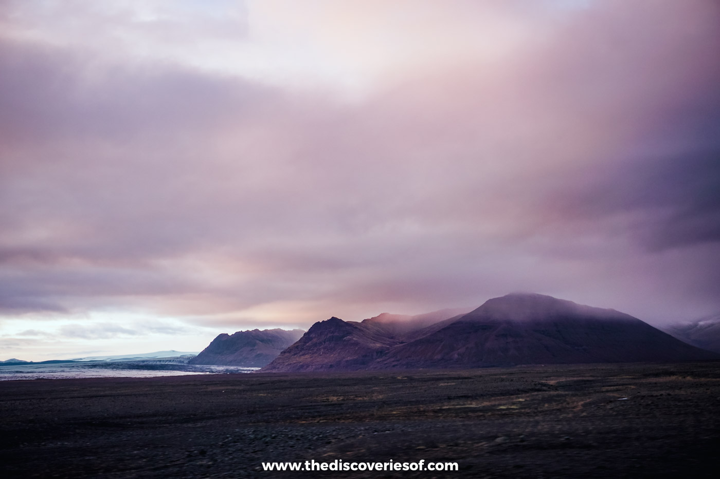
Heading back west, the sky over the black plains turned pink and violet and the road ran straight at the mountains. With a hire car, it’s the view that decides when you pull over, not a timetable.
Route 1 across Skeiðarársandur. My Iceland travel tips.
The last day, and the lights
Urriðafoss, one last waterfall
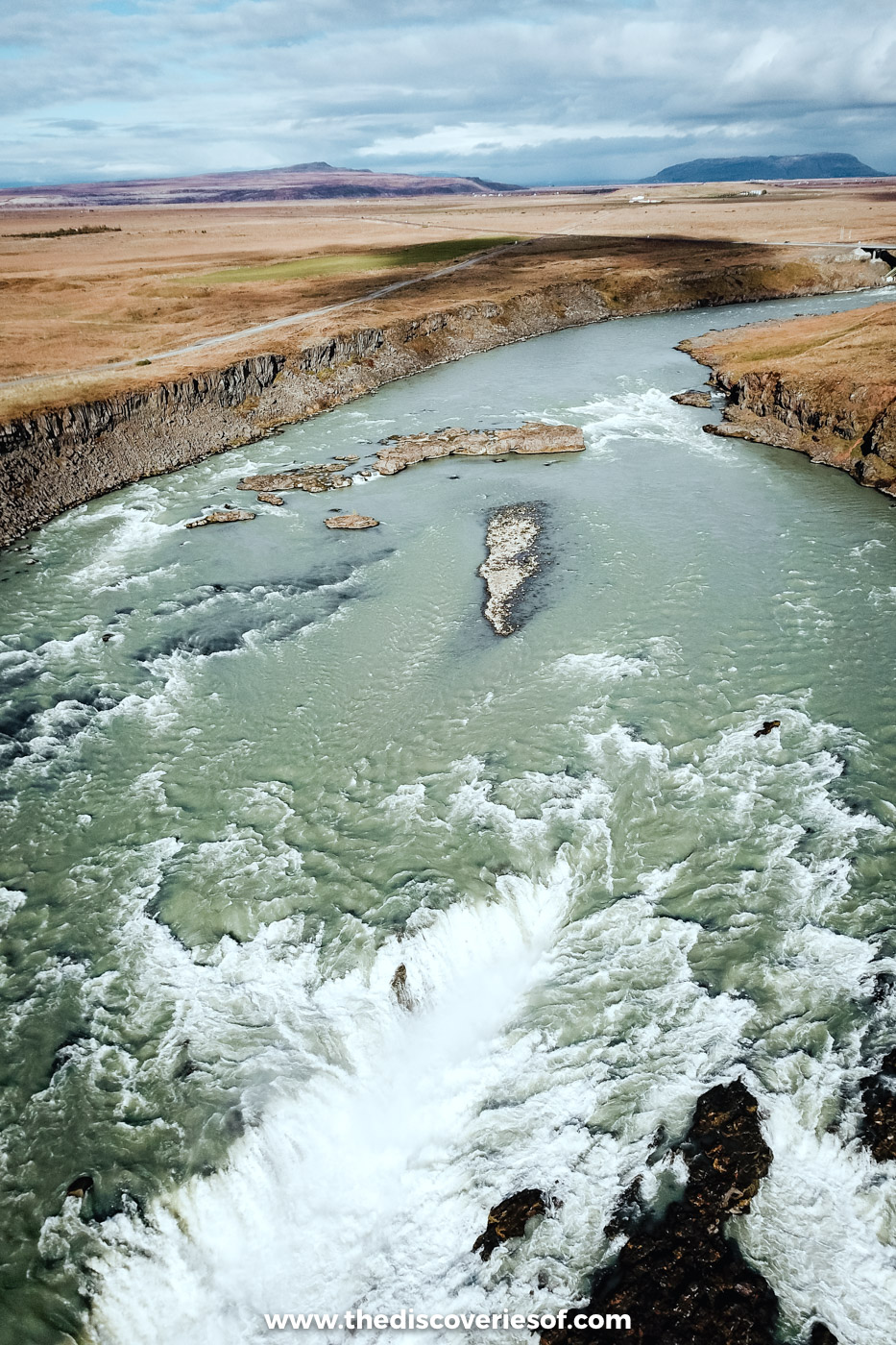
Picture it: your last day in Iceland, and you’re already a little sad. I’d found a waterfall on the map that looked interesting but turned out to be tricky to find. A short walk from the car, the whole river suddenly opened out in front of me, spilling white across a long, broken shelf of dark lava. No falls in Iceland carry more water, and with only a fisherman and a local family out enjoying their Sunday, I had it almost to myself. I sent the drone up, and I still rank it among the very best things I saw.
A few minutes off Route 1, near Selfoss. How to find Urriðafoss.
Gullfoss, flashing gold and green
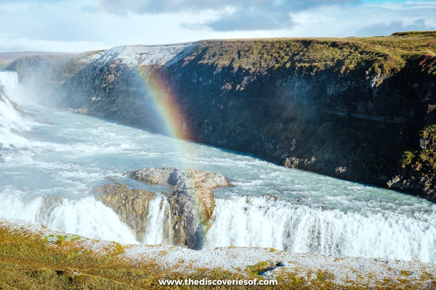
In May, Gullfoss had been grey and wintry. In September it was a different waterfall entirely: millions of litres thundering into the canyon, the sun catching the spray so the white water flashed with gold and green, and rainbows everywhere. It’s never quiet here. Once you’re at the railing, you won’t mind.
At the end of the Golden Circle. My Gullfoss guide.
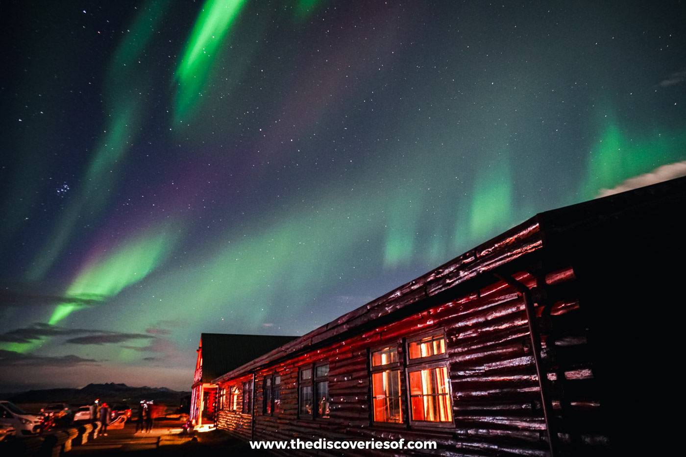
The Northern Lights, two nights running
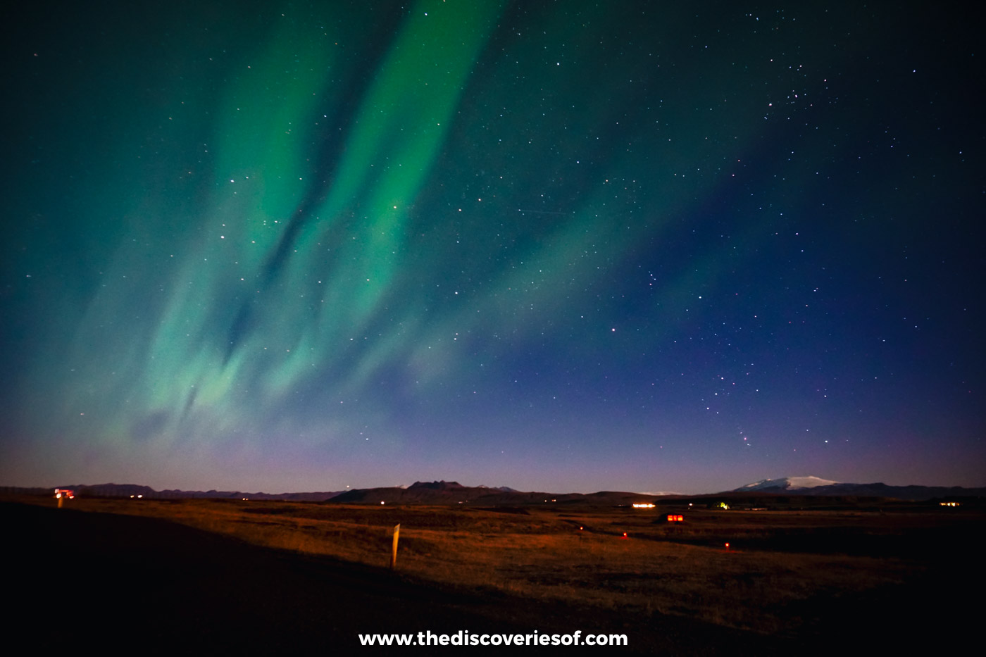
I’ve been low-level obsessed with the Northern Lights ever since I learned they existed as a child, and I went to Iceland that September on a wing and a prayer, hoping for even a glimpse. Instead the sky gleamed with colour, the lights swaying and swirling above me, bright, mesmerising and almost unbelievable. Almost. The forecast hadn’t even rated that night. Seeing them, two nights in a row, has to go down as one of the most incredible experiences of my life.
From the dark countryside near Hella. My Hotel Rangá review and the best time to see them.
So there they are: the South Iceland landscapes that, for me, you really do need to see to believe. Pack your bags. It’s time for an adventure.
Map
Read next
- Iceland landmarks: 29 must-sees
- Iceland waterfalls: 25 of the best
- Iceland off the beaten path: 11 hidden gems
- 7 day Iceland itinerary
- Best time to visit Iceland
- Iceland travel guide
Love this? Save and share on Pinterest

Discover the top things to do, insider tips and hidden gems in our Iceland Travel Guide.
Read the guides →