
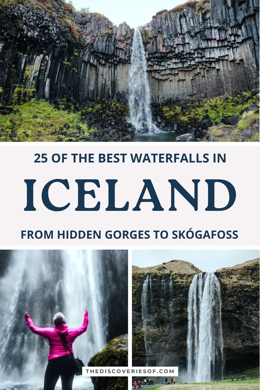
Iceland’s waterfalls are an incredible sight to behold, and no trip to the country is complete without chasing a waterfall or two. Here are 25 of the best, from the south coast classics to the wild falls of the north, with how to reach each one, what parking costs and a map to find them.
Iceland, you are a total stunner. Of all the countries I’ve visited, Iceland has to be up there as one of the best when it comes to natural attractions.
I’ve been three times now, in early May, around the September equinox and in early December, and every trip has completely blown me away. Otherworldly landscapes, glacial lagoons, the Northern Lights, black sand beaches: it’s a roll call of natural wonders.
If there’s one thing the country does particularly well, though, it’s waterfalls. Big, small, tall and skinny, short and stout, this is the land of waterfalls. In May I walked behind Seljalandsfoss and squeezed into the gorge at Gljúfrabúi with snow still on the peaks. In September I drove the south coast in a single day, soaked myself at the foot of Skógafoss and stopped at Svartifoss on the way back.
Awesome as chasing waterfalls is here, the country has over 10,000 of the things. It’s mayyyybe a bit ambitious to visit them all in one trip. I’ve narrowed it down to the 25 Iceland waterfalls I’d put first: the eight I’ve seen for myself lead the list, followed by the best of the rest, from Golden Circle detours to the giants of the north.
The best waterfalls in Iceland
Seljalandsfoss, the waterfall you can walk behind
Seljalandsfoss is a must-see stop on any visit to the south coast, and easily one of the most famous waterfalls on the island. It sits just off the Ring Road where Route 249 turns towards Þórsmörk, about an hour and a half’s drive from Reykjavik.
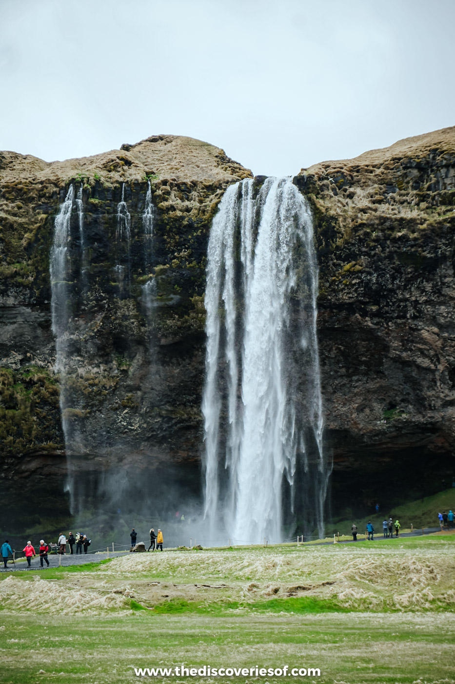
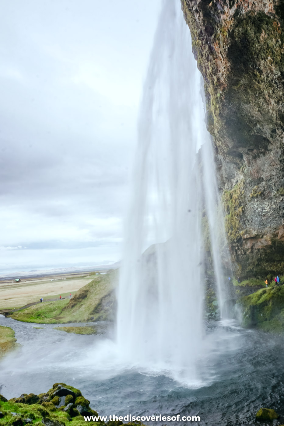
But what’s so special? The setting, for one. The 60 metre Seljalandsfoss drops from the top of an old sea cliff in front of a natural amphitheatre, and that position means that (as long as the conditions are OK) you can walk right round behind the water.
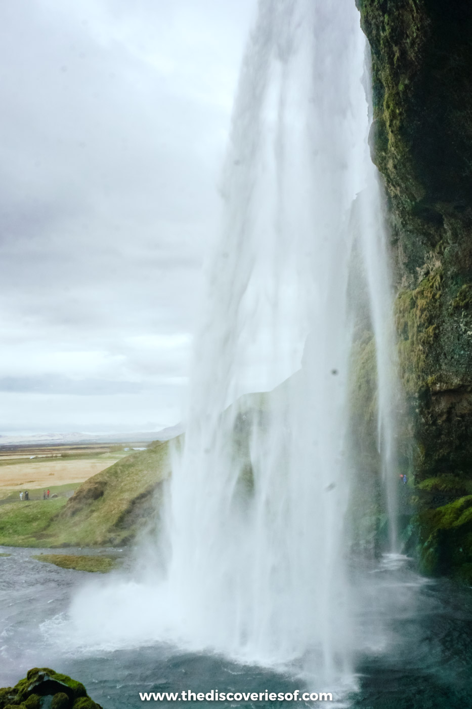
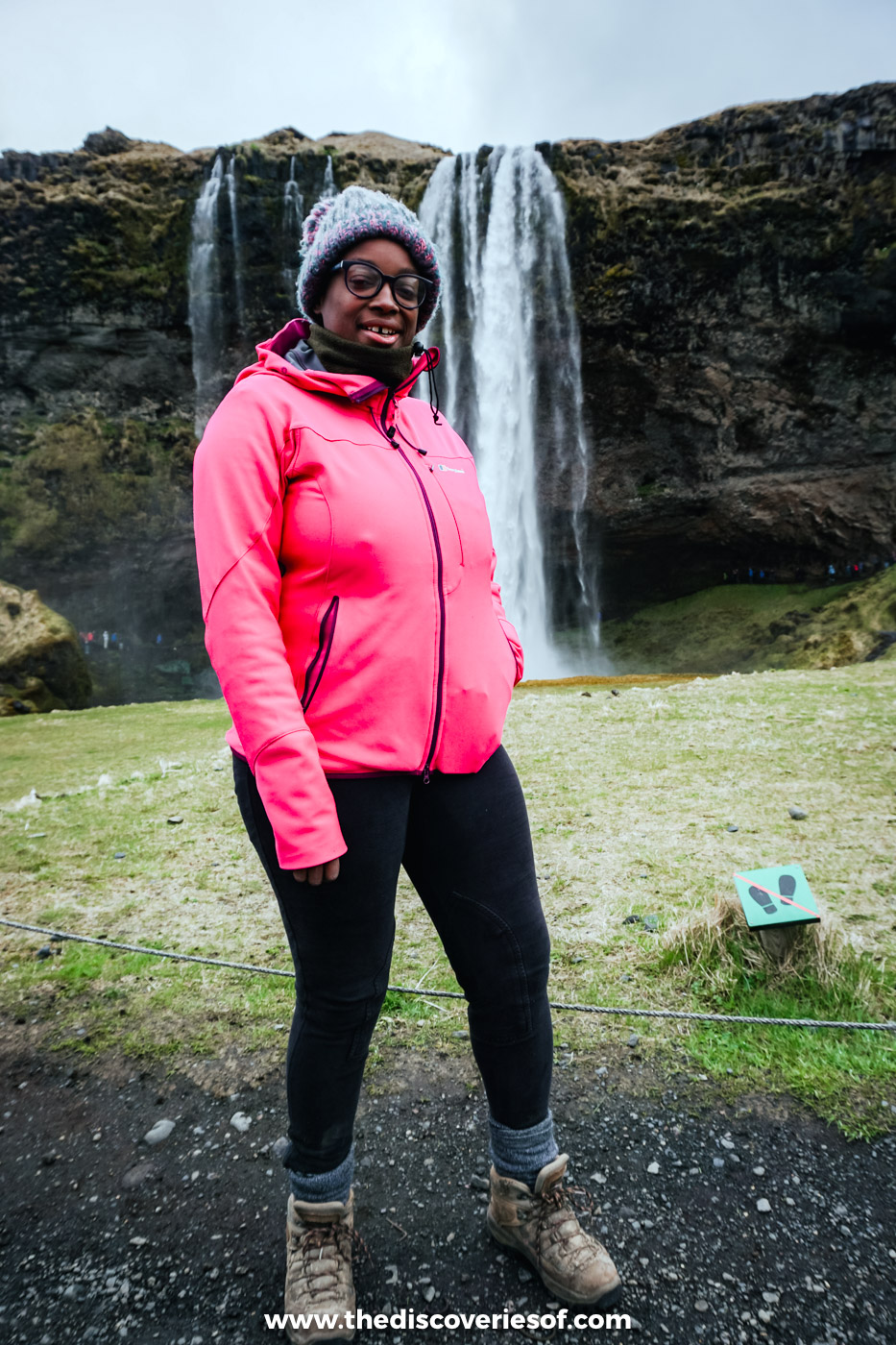
I did exactly that in May. Pull on your hiking boots and edge your way along the slippery path that loops behind the falls, and you get the thunder, the spray and a view out over the flat green plain through a curtain of water. There’s nothing quite like it. Mind your camera, though: the spray is powerful, and you will get wet, so bring a waterproof jacket. It’s also one of Iceland’s most romantic spots.
Beware, the path behind the falls is often too icy to use in winter, when you’ll have to make do with the view from the front and sides. Even in summer I’d recommend wearing sturdy footwear to do it.
Top Tip
Parking at Seljalandsfoss costs 1,000 ISK and the ticket is valid all day, so leave the car where it is and walk the 500 metres north to Gljúfrabúi.
Gljúfrabúi, the falls hidden inside a gorge
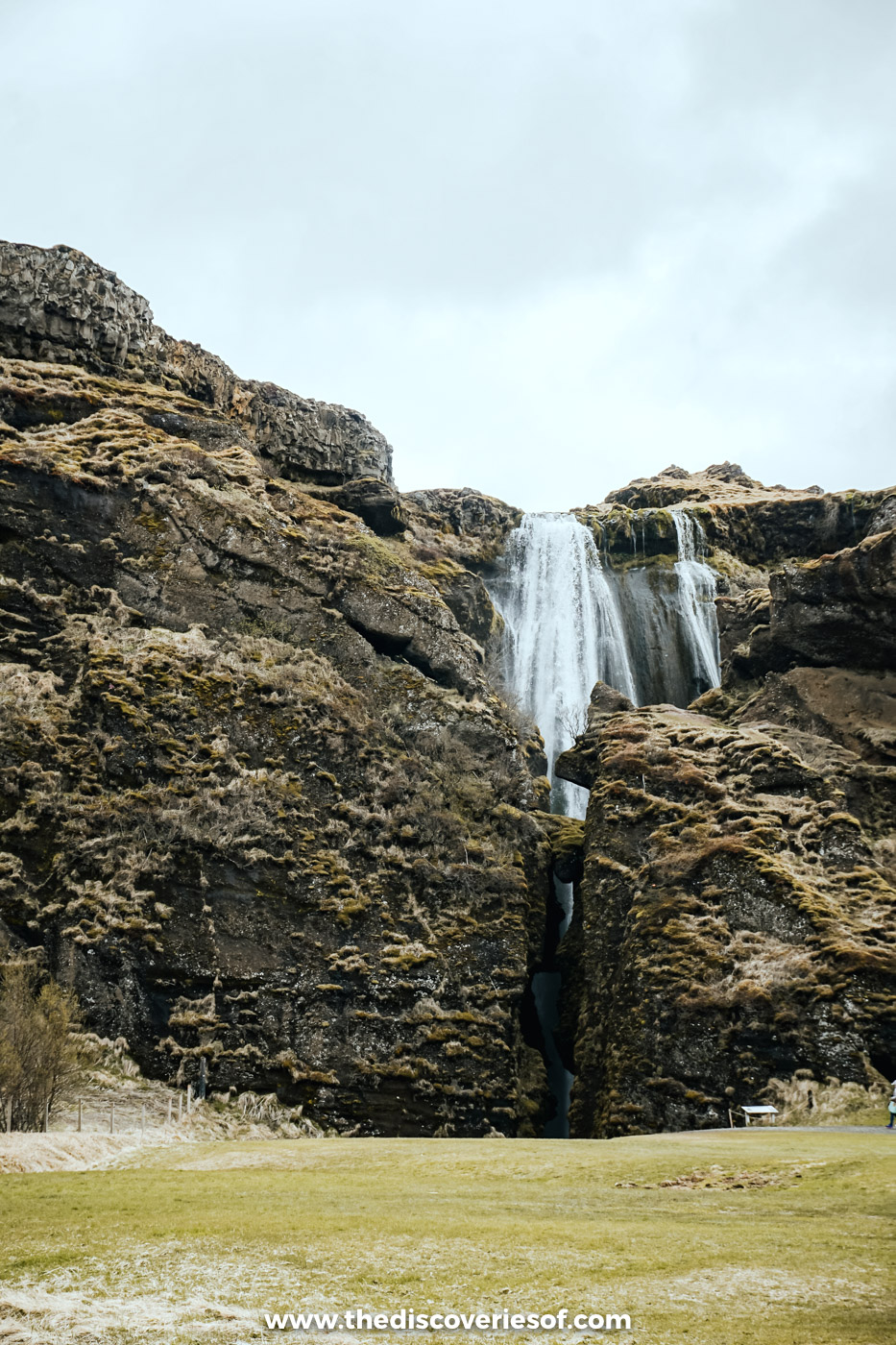
Just a few minutes’ walk from Seljalandsfoss, Gljúfrabúi is a secret waterfall and one of my favourite hidden gems. The name means something like “canyon dweller”, which is exactly what it is: a 40 metre fall tucked inside a narrow cleft in the cliff, so you can barely see it from the path.
OK, maybe a badly kept secret. When I visited there were quite a few people shimmying their way along the small stream that leads to the falls themselves.
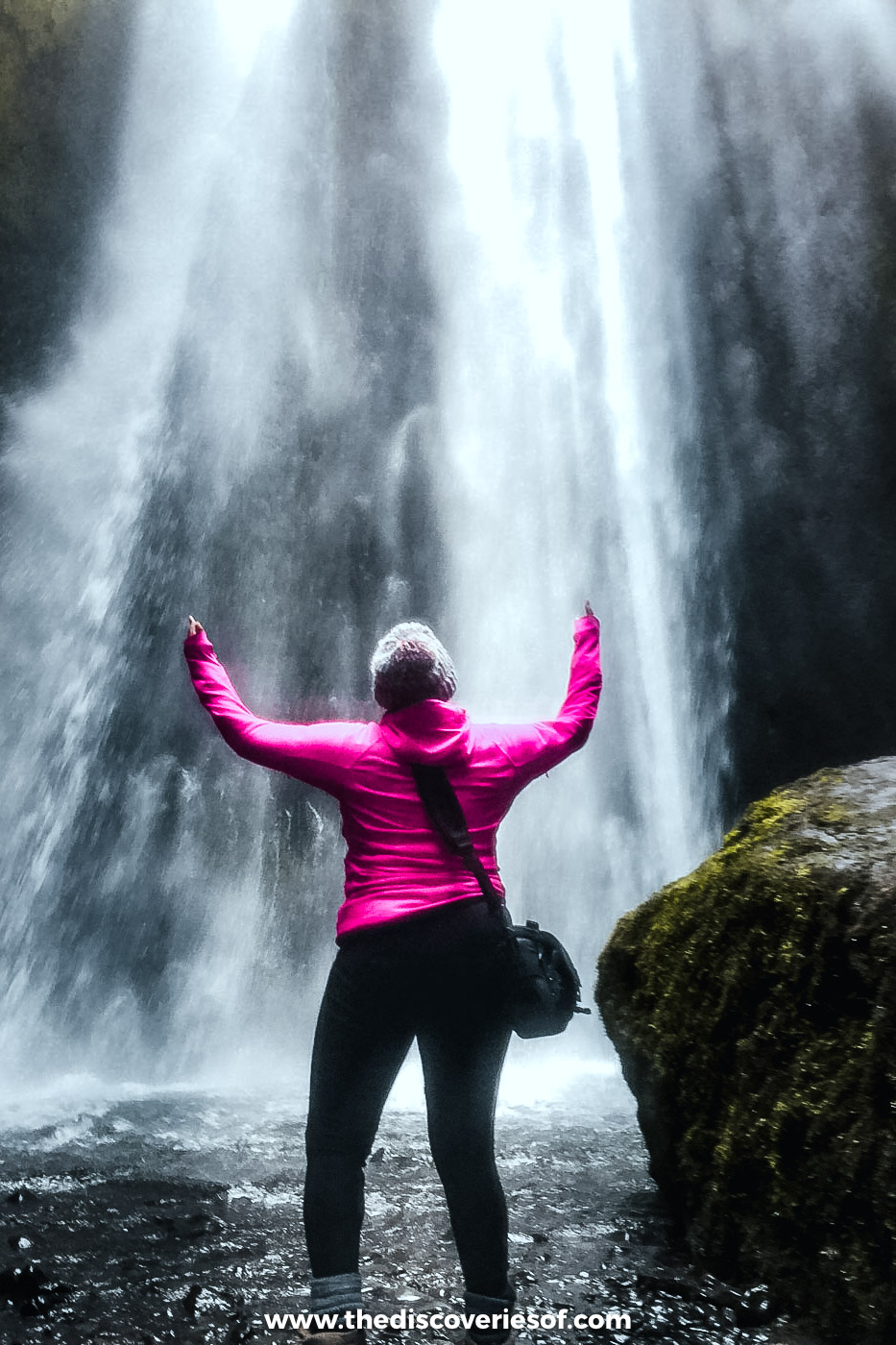
I didn’t know what to expect when my guide led me into that narrow canyon, a fast-flowing stream running through it. What I found at the end was one of my favourite waterfalls of all, because of how immersive it is. Unlike most falls, the only way to see Gljúfrabúi is up close, standing in the chamber it falls into while the mist wraps itself around you.
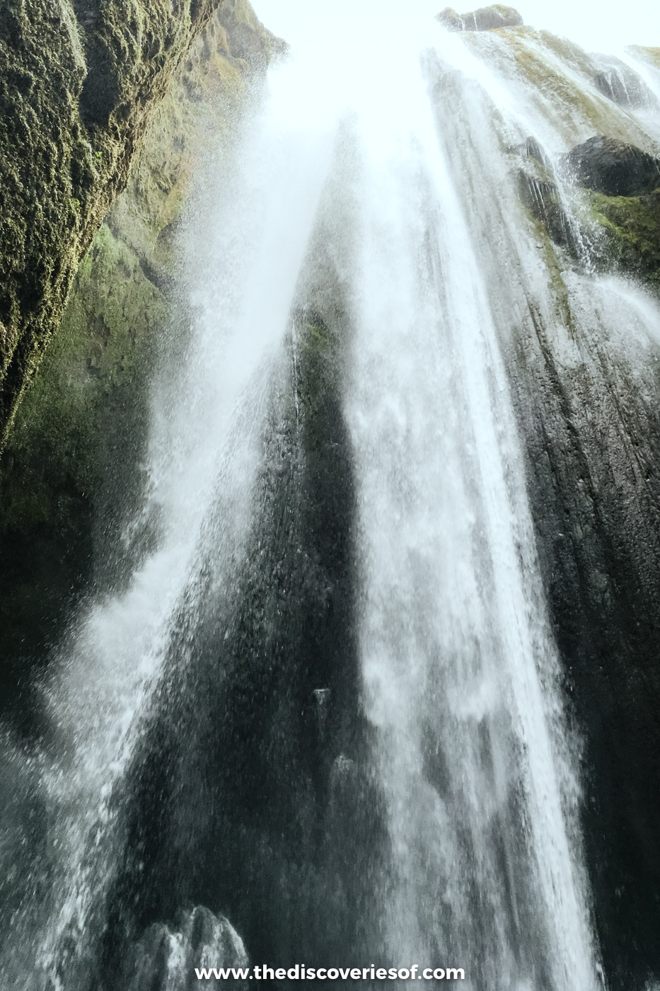
You’ll either need a good pair of waterproof hiking boots or some good balancing skills to hopscotch your way along the stepping stones without getting soggy feet. Even if you do get your feet wet, it’s worth it. The sight (and roar) of the water plunging into the tall, narrow chamber is a memorable experience. Be prepared to get just the tiniest bit soaked from the spray.
Top Tip
The entrance is easy to miss: look for a narrow crack in the cliff and follow the sound of the stream. For a second angle, you can scramble up the rocks to the right of the gap for a partial view across the top of the falls; skip it if it’s wet or icy.
Skógafoss, the south coast’s rainbow machine
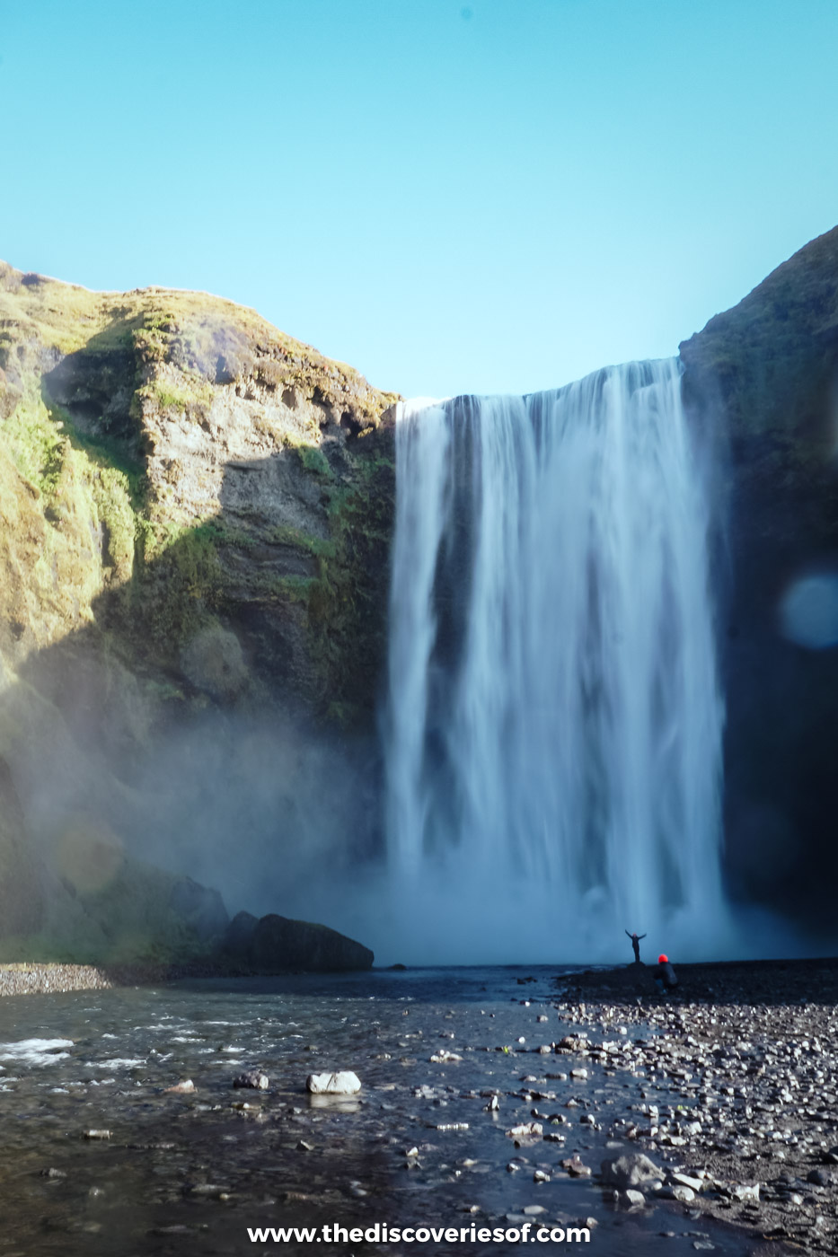
Perched on the edge of the Ring Road about 30 minutes west of Vík, Skógafoss is one of the best waterfalls on the south coast. Fed by the river Skógá, it’s a near perfect sheet of water, around 25 metres wide, dropping 60 metres to a shallow basin.
One of my favourite things about waterfall chasing in Iceland is that you get to see so many rainbows. Skógafoss is no exception: the power of the falls throws up a mist where you’ll almost certainly spot a rainbow (or two). See what I mean?
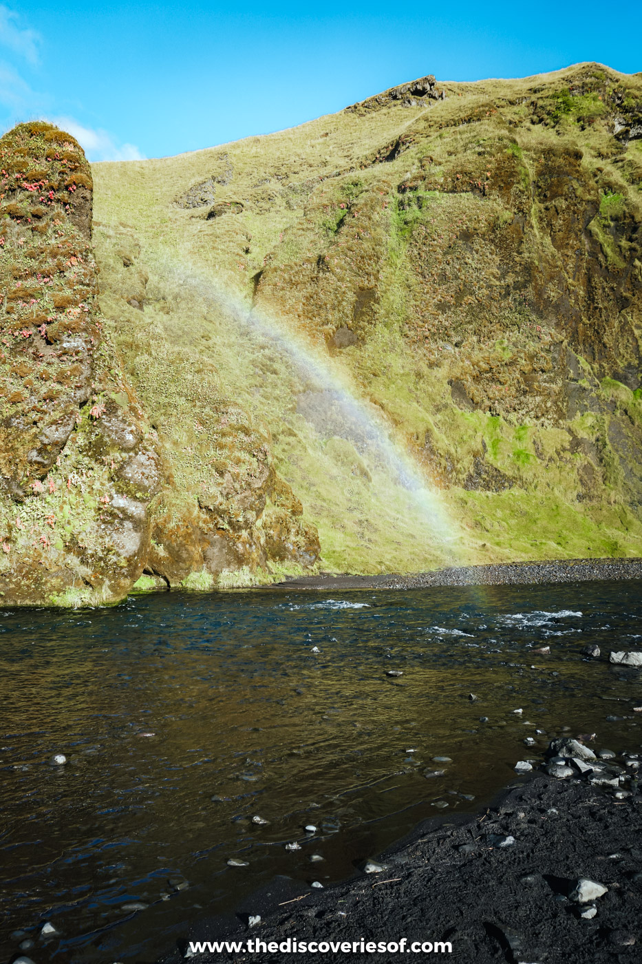
It was a bright, sunny morning when I stopped here in September, on my way east to Jökulsárlón, and I ended up pretty much soaking wet after a few minutes at the bottom. It’s a short, flat walk from the car park (1,000 ISK through the Parka app) to the foot of the falls, or you can climb the staircase of around 500 steps on the right-hand side to a viewing platform at the top. The view down the valley to the sea is well worth the effort, and the path beyond it is the start of the Fimmvörðuháls trail over to Þórsmörk.
Local legend says the Viking settler Þrasi hid a chest of gold behind the falls. Nobody has found it yet.
Do
Short on time or not driving? This South Coast waterfalls, black sand and glacier tour from Reykjavik stops at Seljalandsfoss and Skógafoss, then carries on to Sólheimajökull, Vík and Reynisfjara in a day.
Svartifoss, my favourite, ringed by black basalt columns
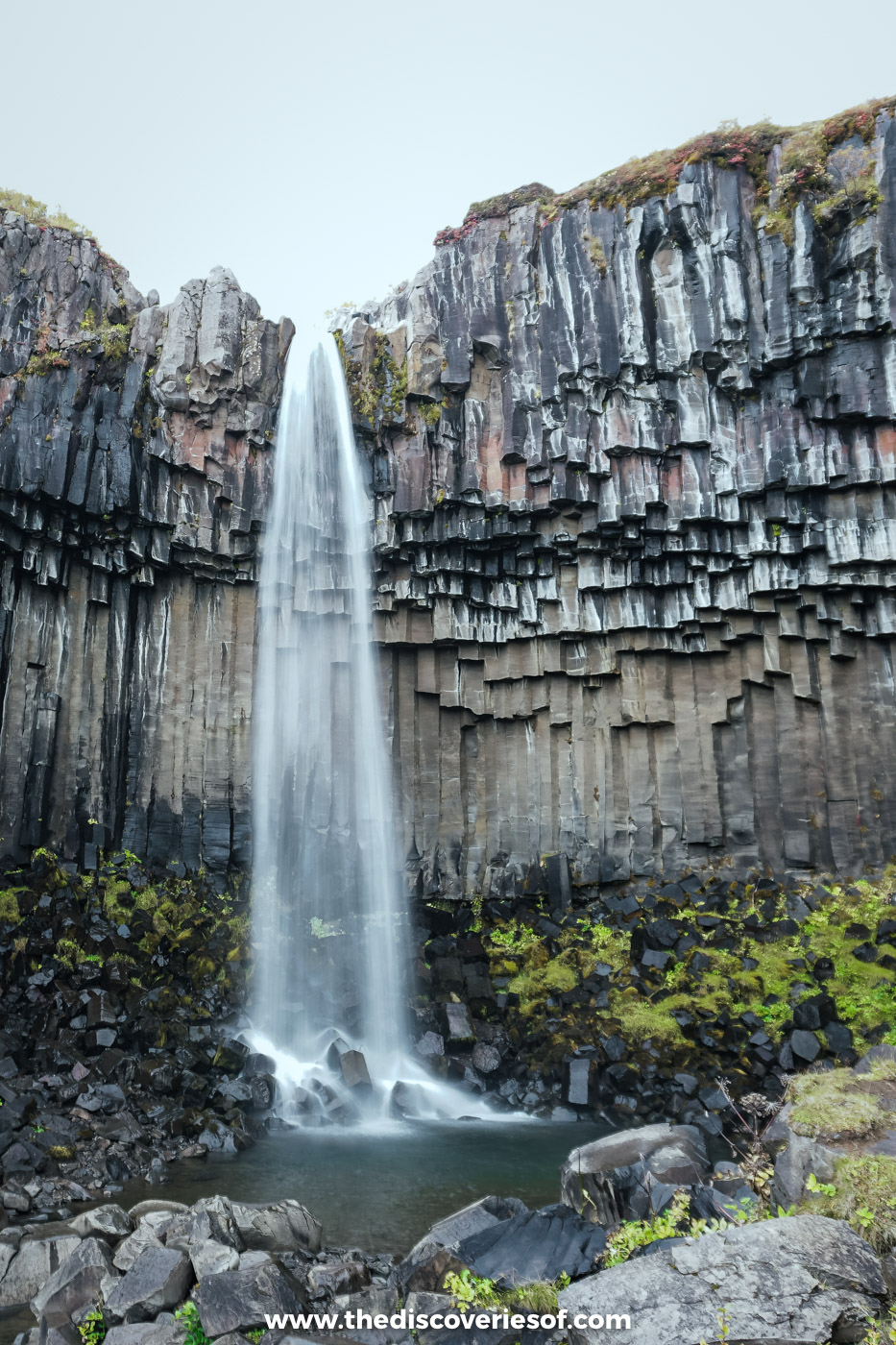
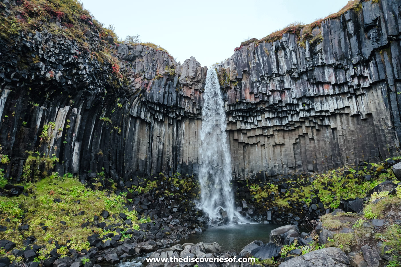
Of all the famous waterfalls I’ve visited in Iceland, Svartifoss (black falls) is my favourite. I hadn’t seen anything quite like it. Surrounded by a cluster of gleaming black basalt columns that hang from the cliff like organ pipes, the setting is surreal and the effect otherworldly. Honestly, it looks like something straight out of Mordor.
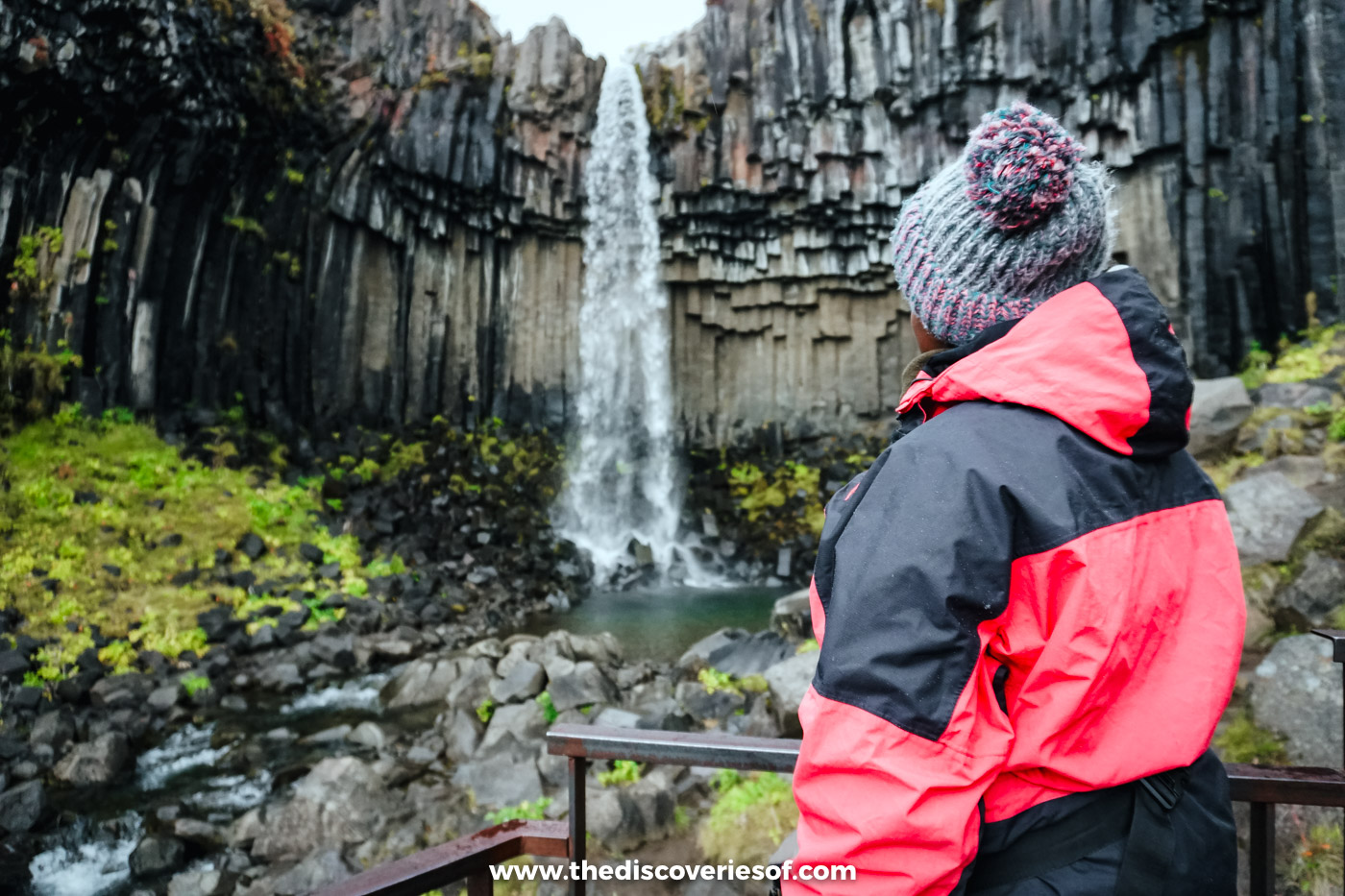
This is my flabbergasted face. Really.
Like the Reynisdrangar sea stacks, the columns were formed from lava spewed out in volcanic eruptions. As the lava cooled slowly, it cracked into the black hexagonal pillars we see today, a process known as columnar jointing. Whatever the reason, this is one of the country’s weirdest but most wonderful waterfalls.
You can’t get underneath the falls themselves, but even from the viewing platform the sight is something special, and a perfect place to photograph a waterfall in Iceland. I popped in on the long September drive down to Jökulsárlón, and it was early evening by the time I arrived, with the birch and heather around the falls turning red and gold.
Svartifoss is in the Skaftafell area of Vatnajökull National Park, and you’ll need to hike to it, though it isn’t a tough hike. It’s about 45 minutes up from the visitor centre: a bit of a pull up from the car park at first, then the path levels off and is easy enough to manage, even with a tripod in tow. If you have more time, the S2 loop (5.8 km, about two hours) carries on to the Sjónarsker viewpoint and the old turf farmhouse at Sel.
Tickets
The falls are free, but the park charges a daily parking fee at Skaftafell of 1,110 ISK for a car with five seats or fewer. It’s valid until midnight, and it’s half price at Jökulsárlón if you’ve already paid at Skaftafell that day.
Gullfoss, the Golden Circle’s thundering finale
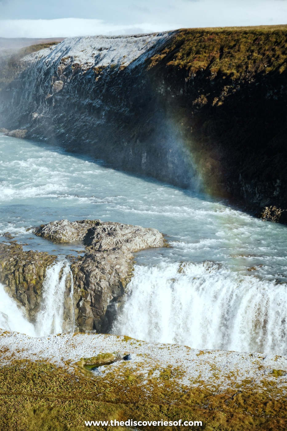
Gullfoss is without a doubt the most famous waterfall in the country and one of its most recognisable landmarks. Flowing from the glacial river Hvítá, it’s nowhere near the tallest, but it’s certainly one of the most impressive. It drops 32 metres in two stages, an upper step of about 11 metres and then a 21 metre plunge, into a narrow gully, and it’s impossible to get anywhere near it without being blown away by its sheer power.
I’d read about it, seen the pictures and watched the videos before I went, but nothing prepared me for the size of it. I’ve seen it in two very different moods: grey and wintry in May, and bright with rainbows in September.
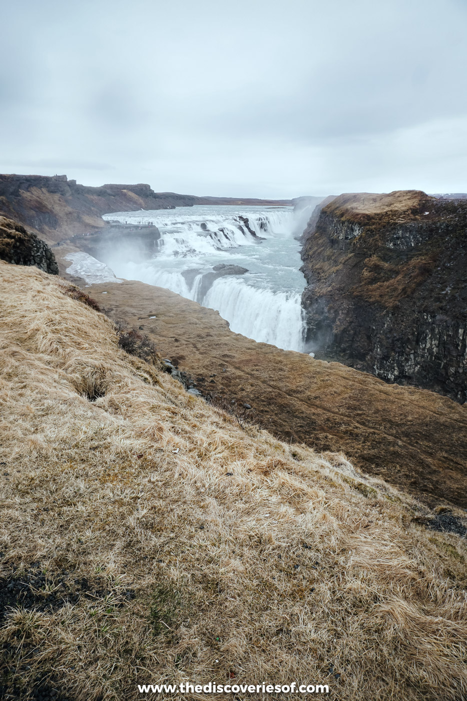
Thundering and fast-flowing, it’s noisy, enthralling and guaranteed to be one of the highlights of your trip. Sure, there are a tonne of tourists and the paths get pretty hectic, but really, you won’t care. Parking is free, and the lower path closes in winter when it’s icy.
Urriðafoss, the biggest falls by volume you’ve never heard of
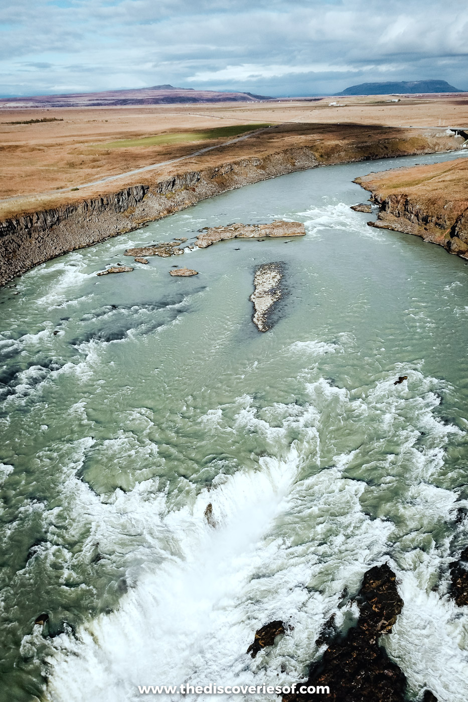
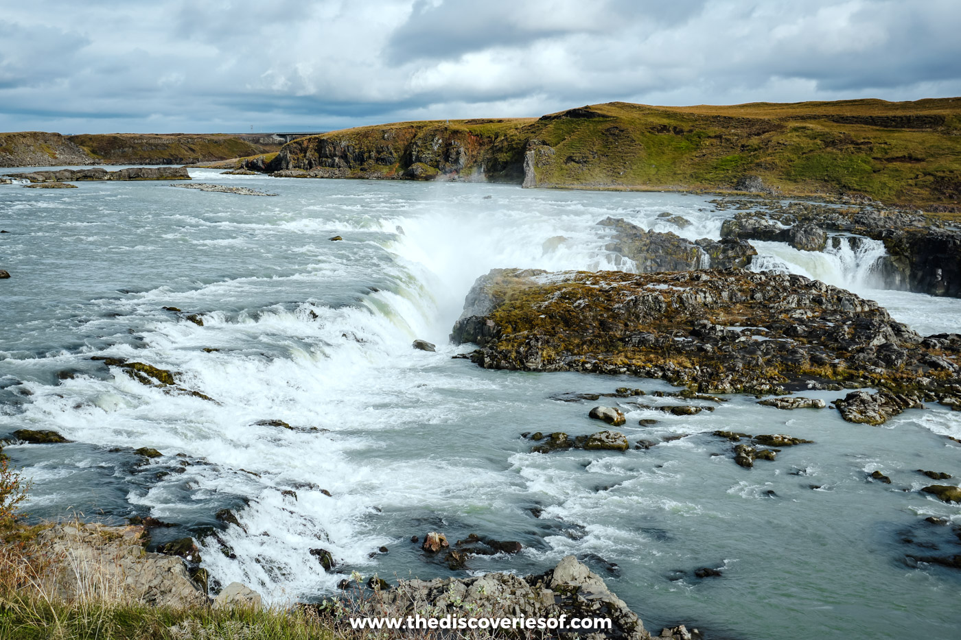
Urriðafoss was one of my personal favourite waterfalls, and one of my favourite spots on the island full stop. It isn’t tall, just a few metres, but it carries more water than any other waterfall in the country, around 360 cubic metres a second on average, spread across a ragged drop roughly 200 metres wide. It’s part of the Þjórsá, the longest river in Iceland, which gathers water for kilometre after kilometre before tumbling over the falls.
Even so, it’s not very well known, despite being a short detour off the Ring Road. Go figure.
Picture this. It’s the last day of my September trip, a Sunday, and I head for a waterfall on the map that looks interesting but turns out to be hard to find. I pull in, walk a short way down a path, and there it is. Apart from a family and a fisherman who’d decided it was a beautiful place to spend a Sunday morning, I had it to myself. Who could blame them?
Where better to send up the drone? See what I mean…
Getting There
Urriðafoss is on the Ring Road between Selfoss and Hella. Just before the Þjórsá bridge (heading east), turn onto the signed Urriðafossvegur; the car park is under a kilometre from the main road. Keep to the viewing paths, as the path down to the water is for anglers.
Stjórnarfoss, the one I found by accident
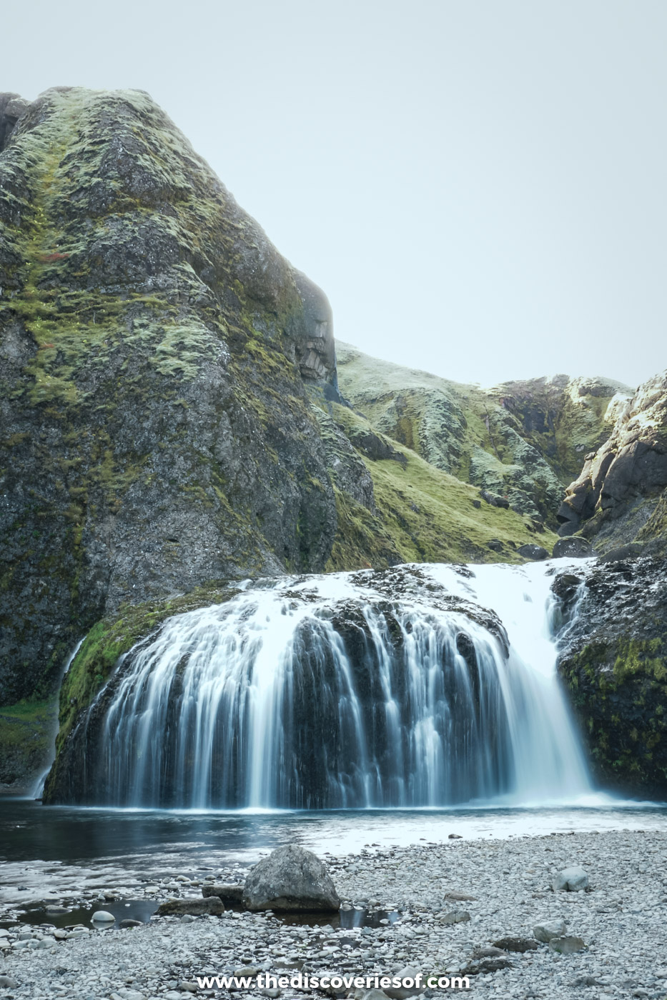
One of the great things about Iceland is that practically every road leads to something cool. I stumbled across this waterfall by accident on my September drive east, and I was so glad that I did.
It’s not big and it’s not crazily impressive, but its picturesque, peaceful setting, a two-step fall into a clear pool ringed by mossy rock, makes it a lovely stop if you’re on the Ring Road in the south. I can’t think of many other places where you can hop out of the car for lunch, walk five minutes and find a waterfall like this all to yourself.
Stjórnarfoss is a short detour off the Ring Road just west of Kirkjubæjarklaustur, with a small car park and a level walk of a few minutes. Pair it with Systrafoss in the village, further down this list.
Gluggafoss, the waterfall with windows
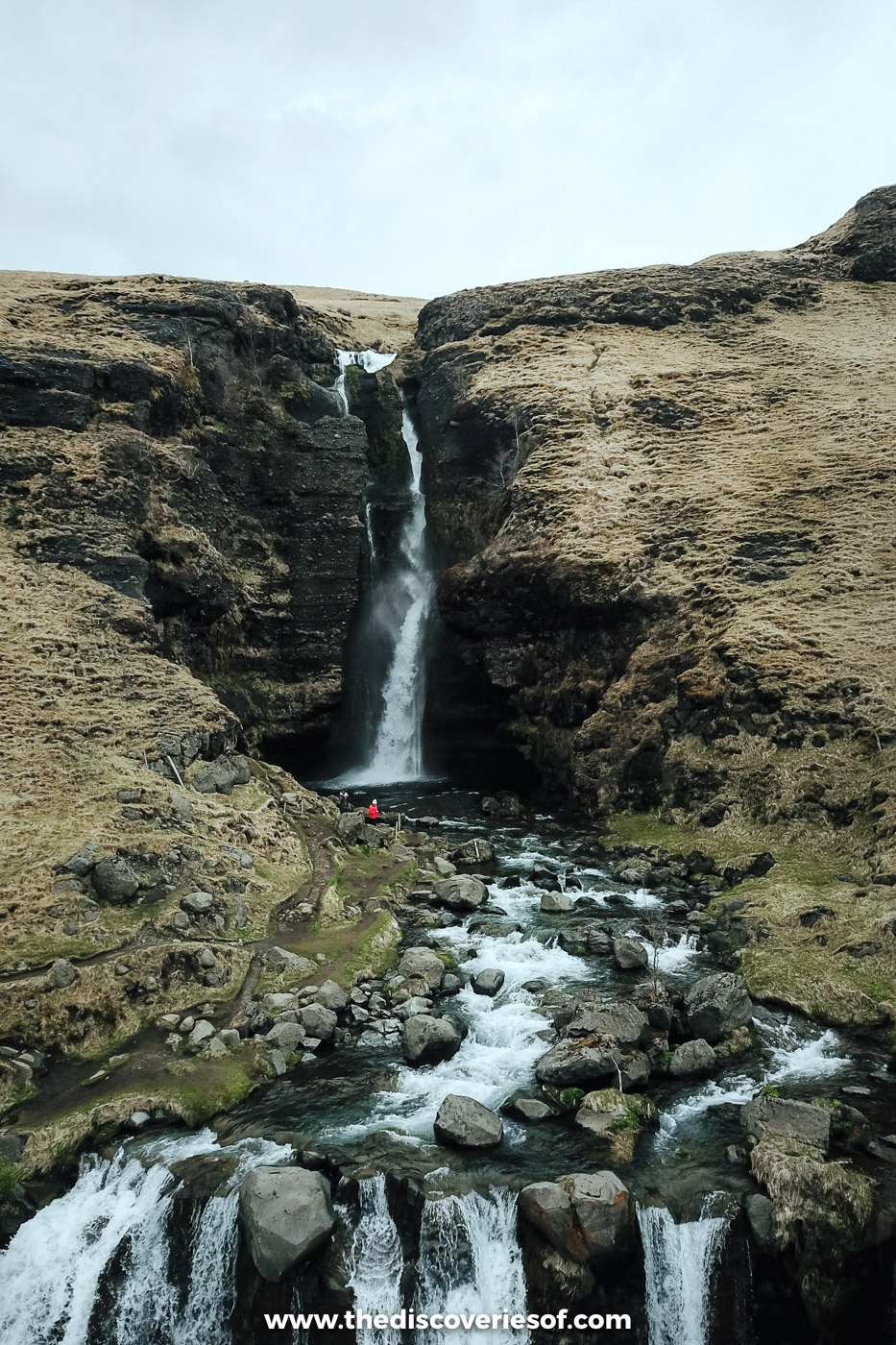
Gluggafoss is one of the country’s best secret waterfalls, so much so that you’re almost guaranteed to have it to yourself. It’s a 52 metre fall on the river Merkjá (it’s also called Merkjárfoss) in the quiet Fljótshlíð valley, and it’s pretty unique: the water disappears into the rock and gushes out again through small windows, or “gluggar”, as they’re called in Icelandic.
The effect comes from the force of the water eroding the soft palagonite of the upper cliff, which sits on harder basalt below, so the shape of the falls is slowly changing as they carve away at their surroundings.
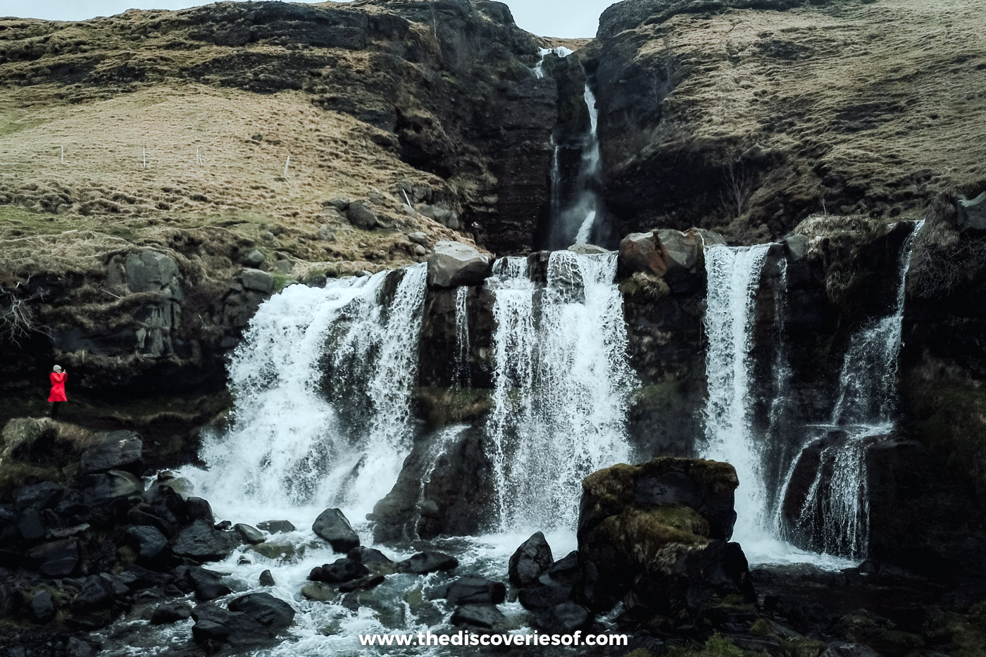
I came here on a May day out exploring the quieter corners of the south, and it’s still one of the oddest waterfalls I’ve seen anywhere in the country.
Getting There
Gluggafoss is about 17 km from Hvolsvöllur along Route 261, the Fljótshlíð road. There’s a small free car park beside the falls.
Kvernufoss, Skógafoss’s quiet neighbour
Kvernufoss is a wonderful waterfall hidden in a gorge just east of Skógafoss, and most people driving past have no idea it’s there. Park by the Skógar Museum, go through the gate to the right of the museum buildings and follow the path up the valley: it’s about 1.5 km there and back, so allow 30 to 45 minutes.
Like Seljalandsfoss, you can walk behind it when conditions allow, but the rocks are slippery and it’s best avoided in winter. Parking costs 750 ISK, paid at the sign or through the Parka app.
Brúarfoss, the bluest water on the Golden Circle

Brúarfoss is another of Iceland’s off-the-beaten-path gems. The falls aren’t large, but no matter: it’s the near unbelievable contrast between the bright blue glacial water and the dark volcanic rock that gives Brúarfoss its appeal.
Access has changed in the last few years. A few years ago the landowners closed the old shortcut through the summer-house area, but since 2023 a 3 km private road from Route 37 (between Laugarvatn and Geysir) has led to an official car park at Hlauptunga, about 200 metres from the falls. Parking there costs 750 ISK per car through Parka or at the machine. If you’d rather walk, a 3.5 km riverside trail runs up to the falls from a free lay-by at the Brúará bridge on Route 37, passing smaller cascades along the way.
Faxi, a wide Golden Circle detour
Faxi is a broad, low waterfall on the Tungufljót river near the village of Reykholt, only a few minutes off the main Golden Circle loop. It’s only about 7 metres high but around 90 metres wide, and there’s a salmon ladder beside it to help fish make their way upstream.
It’s an easy add-on between Geysir and Gullfoss on the way back towards Reykjavik, and far quieter than either.
Öxarárfoss, the waterfall in Þingvellir’s rift
Öxarárfoss is a gem that’s easy to add to your Golden Circle itinerary. It sits inside Þingvellir National Park, where the river Öxará tumbles about 13 metres over the edge of the Almannagjá rift, the gash in the earth between the North American and Eurasian plates.
The falls flow all year, and in winter they partly freeze into curtains of ice. The closest car park is P2 below Öxarárfoss; the park’s parking fee is 1,000 ISK for a car with five seats or fewer, paid at the machines or online.
Þórufoss, a Game of Thrones location near Reykjavik
Þórufoss is a pretty waterfall on the Laxá í Kjós river, about 45 minutes from Reykjavik on Route 48, the back road towards Þingvellir. It’s easily accessible: the car park is right beside the road, and a short walk brings you to the edge of the gorge.
Fans may recognise it from Game of Thrones, where it appeared in season four. The river below is one of the country’s best-known salmon rivers.
Glymur, a hike to Iceland’s second-highest waterfall

Coming in at 198 metres, Glymur is the second-tallest waterfall in the country. For years it was thought to be the tallest, until Morsárfoss, revealed by a retreating glacier in Vatnajökull National Park, was measured and found to be higher.
Glymur is popular for a number of reasons, not least because it’s one of the famous waterfalls closest to Reykjavik: about an hour’s drive away at the head of the Hvalfjörður fjord. Before you get too excited, you should know that you can’t drive to it. The loop from the car park is around 7 km and takes three to four hours, through a cave, across the river and up steep paths along the canyon edge.
The log across the river Botnsá is usually only in place from June to September; outside those months the crossing is much harder, and the hike isn’t recommended in winter. Hiking boots at the ready.
Hraunfossar, waterfalls pouring out of a lava field

Hraunfossar is one of the best waterfalls within reach of Reykjavik, in the Borgarfjörður area of west Iceland near Reykholt and Húsafell. The name translates as “lava falls”, thanks to the huge lava field, Hallmundarhraun, that the water streams out of.
Rather than one big drop, it’s a series of rivulets spilling out of the rock along about 900 metres of riverbank, and they often look a brilliant blue against the dark volcanic stone. It’s the kind of thing that only happens in Iceland, right? A waterfall bursting out of a lava field and surging down into the Hvítá river.
Oh yeah, did I mention that the water comes from the Langjökull glacier, filtering through the porous lava for a long time before it reaches the falls? This country, though.
A stone’s throw upstream is Barnafoss, the “children’s falls”, named after a local legend of two children who drowned crossing a natural stone bridge here.
Háifoss, a giant at the edge of the highlands

The name means “high falls”, and at 122 metres, Háifoss is the fourth-tallest waterfall in the country. It drops from the river Fossá into a deep canyon, with its smaller neighbour Granni falling alongside, not far from the ever-brewing Hekla volcano.
Getting there is half the adventure. From Route 32 in the Þjórsárdalur valley, it’s a 7 km drive along Road 332, a rough gravel track that’s much bumpier than it looks. A 4×4 is the sensible choice (check your hire agreement), and the road is best between June and mid-September when it’s free of snow. Check road.is before you set off.
Hjálparfoss, a double fall framed by basalt
Hjálparfoss is a twin waterfall on the Fossá near the bottom of the Þjórsárdalur valley, just off Route 32 and only a short drive from the Háifoss turning. Two streams pour over a ledge of curved and twisted basalt columns into a single pool. Unlike its big neighbour, it’s reached by a short gravel road from Route 32 through the Vikrar lava field, so there’s no need for a 4×4.
It’s a quick stop, but well worth it if you’re heading up the valley.
Systrafoss, the sister falls with a dark legend

Two narrow waterfalls running alongside each other inspired the locals to give this the rather cute name Systrafoss, the sister falls. Cute, that is, until you hear the eerie legend behind them.
Kirkjubæjarklaustur was home to a convent in medieval times, and folklore tells of two nuns who were burned at the stake after being accused of some rather serious bad behaviour (selling their souls to the Devil and blaspheming against the Pope, among other things. The scandal). They were buried on Systrastapi, the rock pillar just outside the village.
After the Reformation, the nun who’d spoken against the Pope wasn’t in the wrong any more. Very sad, right? But it’s OK, because flowers are said to have grown on her grave, while nothing ever grew on her sister’s.
Away from strange tales and badly behaved women, Systrafoss isn’t that powerful, but it’s often named as one of the prettiest falls in the south. It’s easy to get to: the falls drop from the lake Systravatn right above Kirkjubæjarklaustur, a short detour from the Ring Road, and a path climbs up beside them to the lake.
Kirkjufellsfoss, the most photographed view on Snæfellsnes
Kirkjufellsfoss is a small set of falls just outside Grundarfjörður on the Snæfellsnes peninsula, and it’s famous less for its size than for its backdrop: the cone of Kirkjufell mountain rises right behind it, a view that appears on postcards (and in Game of Thrones) across the country.
The main car park beside the falls charges 1,000 ISK, paid through the EasyPark app and monitored by cameras. Come early or late to avoid the coach crowds, and keep to the paths, which get muddy.
Goðafoss, the waterfall of the gods

Goðafoss might not be that tall, at only about 12 metres, but what it lacks in stature it makes up for in width, curving in a 30 metre horseshoe across the Skjálfandafljót river. It’s right by the Ring Road in north Iceland, about half an hour’s drive east of Akureyri.
It’s more than just a pretty picture. The waterfall plays a starring role in the country’s conversion to Christianity, hence the name, which translates as “waterfall of the gods”. In the year 1000, the lawspeaker Þorgeir Ljósvetningagoði decided at the Alþingi that Iceland should become Christian, and on his return home he’s said to have thrown his statues of the old Norse gods into the falls.
It’s the kind of plot twist that wouldn’t look out of place in our very own modern-day saga, Game of Thrones.
Aldeyjarfoss, basalt columns at the edge of the highlands

Beautiful and bizarre in near-equal measure, Aldeyjarfoss is one of the most amazing waterfalls in the north. Big talk, right? The Skjálfandafljót (the same river as Goðafoss, further upstream) drops about 20 metres through a narrow channel into a pool framed by hexagonal basalt columns. The contrast between the white water and the dark stone is a photographer’s dream.
It sits at the northern end of the Sprengisandur highland road. From Goðafoss, follow Route 842, about 40 km of gravel, for roughly 50 minutes to the farm at Mýri, then the last 4 km on the F26, which is open to 4x4s only (in an ordinary car, park before the F-road and walk). It’s a summer trip: the F-roads close outside the season. The official viewpoint is a 10 to 15 minute walk from the car park; the far bank, reached via Route 843 and a 20 minute walk, is quieter but shows less of the pool.
Dettifoss, the beast of the north

Dettifoss’s nickname, The Beast, tells you everything you need to know about it. One of the most powerful waterfalls in Europe, it’s one of the most striking you’ll ever see.
About 100 metres wide and 44 metres tall, it’s fed by the glacial river Jökulsá á Fjöllum, which flows from the Vatnajökull glacier, and an average of around 193 cubic metres of water thunders over it every second. You heard me right: every second.
It’s in the northern part of Vatnajökull National Park. Route 862 on the west side is paved, though it gets only limited winter service, while Route 864 on the east side is gravel and closes once the autumn snow arrives. From the west car park, the D1 path to Dettifoss is a 1.5 km round trip.
Selfoss, Dettifoss’s wide little sister
Selfoss (not to be confused with the town in the south) sits just upstream of Dettifoss on the same river. It’s only about 10 metres high, but it’s wide and wonderfully ragged, with dozens of separate channels spilling over the edge of the canyon.
The D2 trail from the Dettifoss car park takes in both falls in an easy 2.5 km, about an hour. Don’t skip it.
Hengifoss, red stripes and a 128 metre drop

Even on an island packed with waterfalls, Hengifoss is guaranteed to make you stop and stare. At about 128 metres it’s the third-tallest waterfall in the country, and the name translates as “hanging falls”.
Like Svartifoss, its surroundings are a testament to millennia of geology at work. The cliff behind it is striped with thin red layers of clay sandwiched between dark basalt, which makes for a pretty picture.
Beware, it’s a bit of a hike to get there, in the Fljótsdalur valley near Egilsstaðir in east Iceland. The trail is about 2.5 km each way with around 300 metres of climbing, so allow two to three hours there and back. Don’t despair: halfway up you pass Litlanesfoss, framed by its own tall basalt columns, and the views along the way are more than worth the puff. Parking costs 1,000 ISK.
Dynjandi, the jewel of the Westfjords

Dynjandi’s ethereal appearance means people compare it to a lot of things: wedding cakes, bridal veils… None of the comparisons quite do it justice.
In the wild and untamed Westfjords, the top fall is around 100 metres tall and spreads out in a tier of smooth cascades, with a string of smaller falls below it. Like many of the country’s waterfalls, you’ll need to walk to the top, but it’s a short climb of 15 to 20 minutes from the car park, passing the lower falls on the way. It’s steep in places, but you should be fine if you’re reasonably fit and mobile.
Parking costs 750 ISK, paid through the Glaze app. The mountain roads either side can close in winter, so check road.is before you go.
Tips for visiting Iceland’s waterfalls
- Dress for the spray. Wear sturdy, waterproof hiking boots, as many falls need a walk to reach them and the paths can be slippery, and bring a waterproof jacket. It’s amazing how quickly you can get totally drenched from the seemingly innocuous mist.
- Check before you drive. Some of these falls can only be reached on roads that aren’t suitable for 2WD cars, and others can’t be reached at all in winter. Check road.is for road conditions and safetravel.is for alerts, and keep away from unfenced edges.
- Budget for parking. Most of the big falls now charge for parking, usually 750 to 1,110 ISK a day, collected by camera, app (Parka, EasyPark, Glaze) or machine rather than at a barrier. Pay promptly, as unpaid charges are added to hire car bills with a fee on top.
- Pick your season. Late spring and early summer bring the fullest falls once the snows have melted, but most of these waterfalls look spectacular all year round, and the paths are quietest early and late in the day. My guide to the best time to visit Iceland has more.
- Base yourself in the south. For the south coast falls, stay between Hella and Hvolsvöllur: I based myself at Hotel Rangá on both my May and September trips (here’s my Hotel Rangá review), and my guide to where to stay in Iceland covers the rest of the island. Lonely Planet’s Iceland travel guide is useful if you’re travelling to a few different places.
Map
So, there we are: 25 must-see waterfalls. I hope that you have a wonderful trip!
Read next
- Visiting Gullfoss waterfall: what you need to know
- Iceland’s hidden spots: getting off the beaten path
- When to visit Iceland: season by season
- What to pack for Iceland: a step by step guide
- The best things to do in Reykjavik
- What to do in Iceland
- Stunning landmarks in Iceland
- The best hikes in Iceland
- Iceland’s Golden Circle: the complete guide
- Black sand, blue ice and a sky full of green: South Iceland through my lens
Love this? Save and share on Pinterest

Discover the top things to do, insider tips and hidden gems in our Iceland Travel Guide.
Read the guides →