
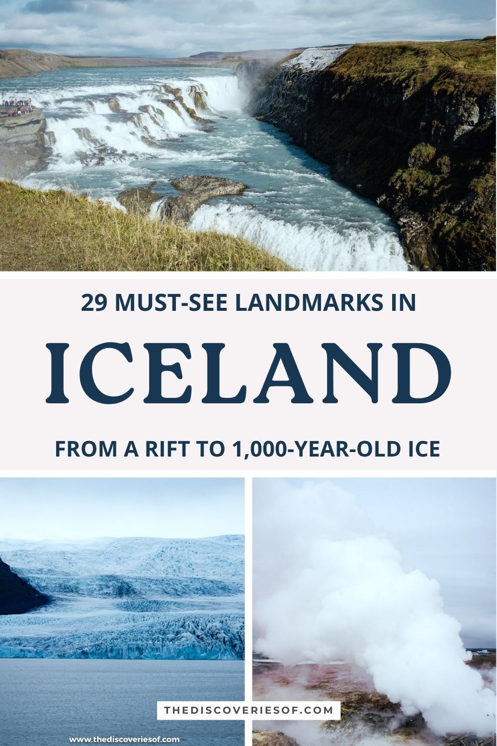
These Iceland landmarks reveal a country of spectacular natural beauty: a rift where two continents are pulling apart, the geyser that gave every other geyser its name, a lagoon full of ancient icebergs and a church that took 41 years to build. Here are the most famous sights in the country (and a few lesser-known gems), with what they cost and how to reach them.
There are some places on this earth that are so surreal and majestic, they take your breath away.
Iceland is one of those places!
I’ve written a tonne about my Iceland travels here on The Discoveries Of and for good reason. I. Just. Can’t. Stop. Going. Back. Spring, the autumn equinox and the short, dark days of December: each of my three trips showed me a completely different side of the island.
With its snow-capped mountains, pristine glaciers and volcanic landscapes, it’s no wonder that it grabs so many people’s attention.
If you’re planning a trip (or you just want a bit of travel inspiration), make sure you check out these 29 must-see landmarks, from the Golden Circle and the south coast to Reykjavik, the Highlands and the far north.
The most famous landmarks in Iceland
Þingvellir National Park, where two continents pull apart
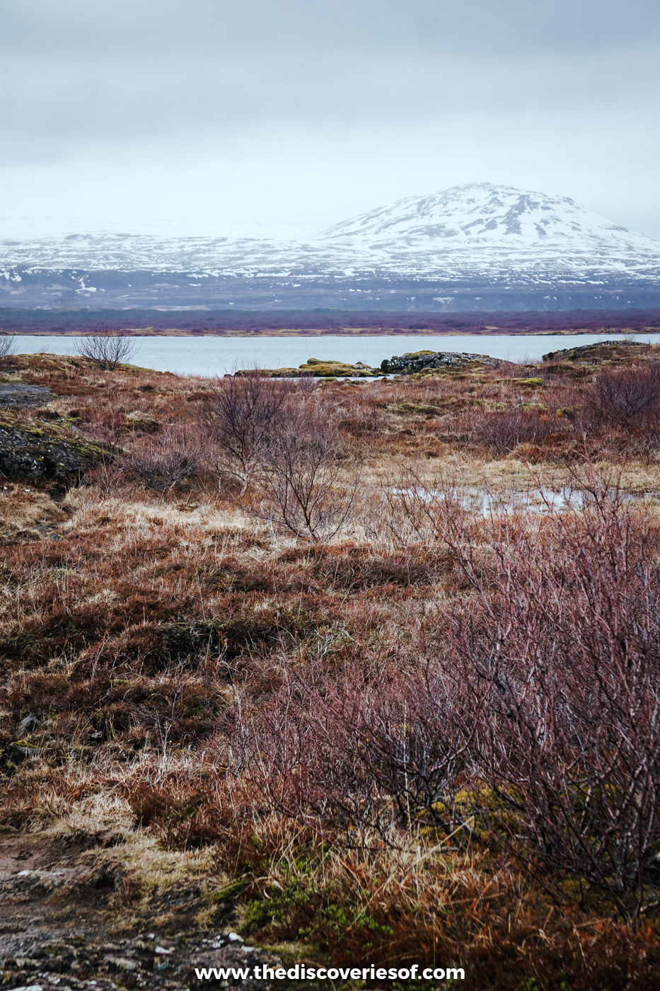
About 45 minutes’ drive north-east of Reykjavik, Þingvellir National Park is a must-visit for anyone touring the country, and it was part of my Golden Circle day in May.
This UNESCO World Heritage Site is where the Icelandic parliament, the Alþingi, was founded in 930 AD (yes, you read that right), and it met here in the open air until 1798. It’s also one of the few places on earth where you can walk along the boundary between two tectonic plates. The North American and Eurasian plates are drifting apart here, and the path down through the Almannagjá gorge runs between towering walls of rock on the edge of the North American plate.
Visitors can explore the park’s lava fields, mossy fissures and the shore of Þingvallavatn, the largest natural lake in the country, or take a hike on one of the many trails that wind their way through the park. The highlight of Þingvellir National Park for many is its beautiful waterfall, Öxarárfoss, which tumbles over the edge of the rift. Gorgeous. Parking costs ISK 1,000 a day.
Geysir and Strokkur, the original geyser and its eager neighbour
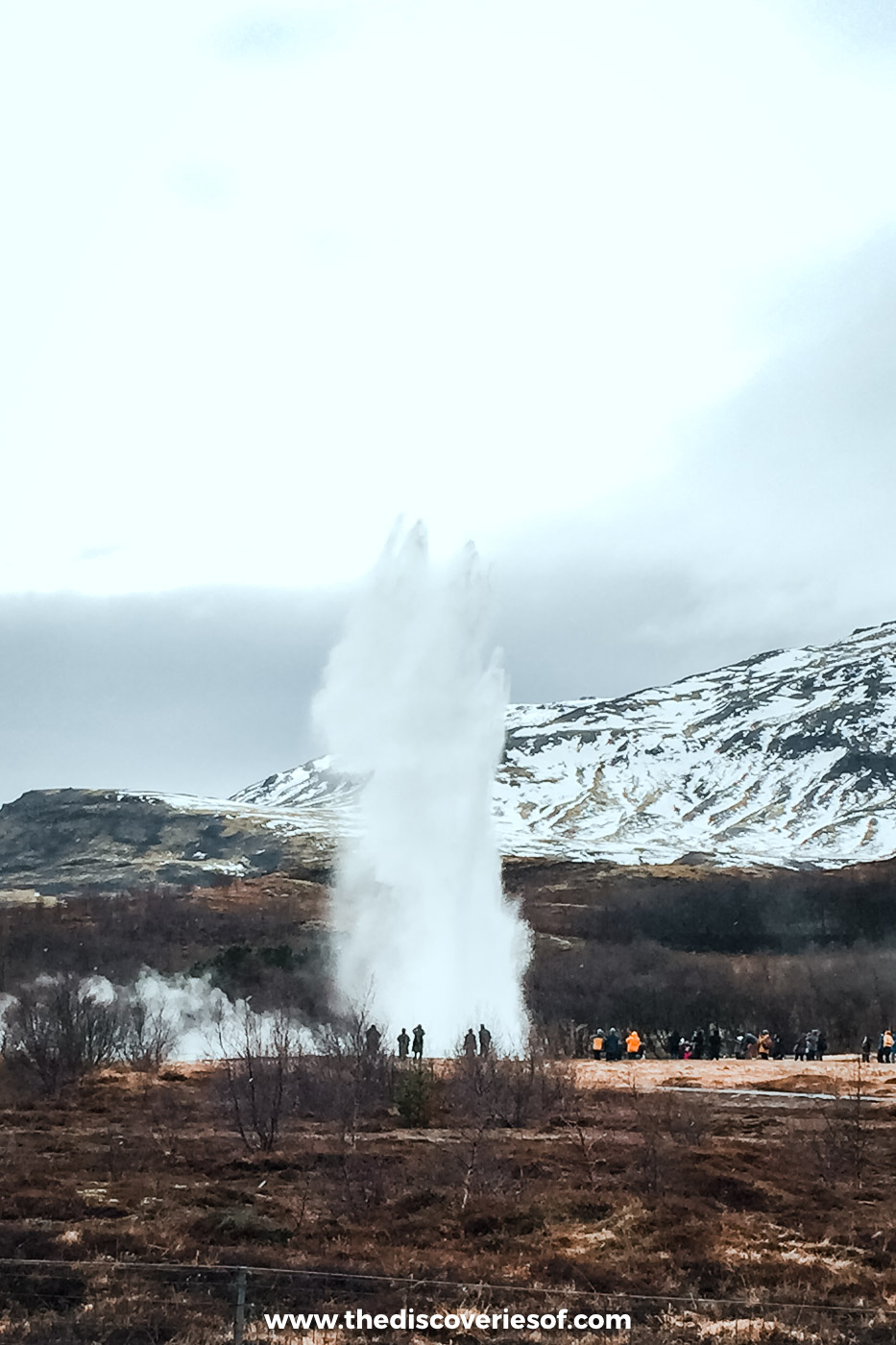
About 50 minutes east of Þingvellir in the Haukadalur valley, the Geysir geothermal area is a must. Let’s face it: who doesn’t want to see jets of hot water and steam shooting high into the air?
I’d trekked around the Atacama Desert and ended up among the steaming vents of El Tatio, so I thought I’d seen my share of geysers. Then I met Strokkur. Trying to photograph it is a bit like playing fastest finger first on Who Wants to Be a Millionaire: hesitate for a split second and you’ve missed it.
There are actually two famous geysers here. The Great Geysir, which gave its name to every geyser in the world (from the Icelandic verb geysa, to gush), rarely erupts these days. Its neighbour Strokkur is the reliable one: stand at a safe distance and it sends a column of water 15 to 20 metres into the air every five to 10 minutes, and occasionally much higher.
Once you’re done, wander over to Blesi, a hot spring split into two pools, one clear and one an opaque milky blue. Look, but don’t touch: the water across the whole field is scalding, so stay behind the ropes. The site itself is free; parking costs ISK 1,000 through the Parka app.
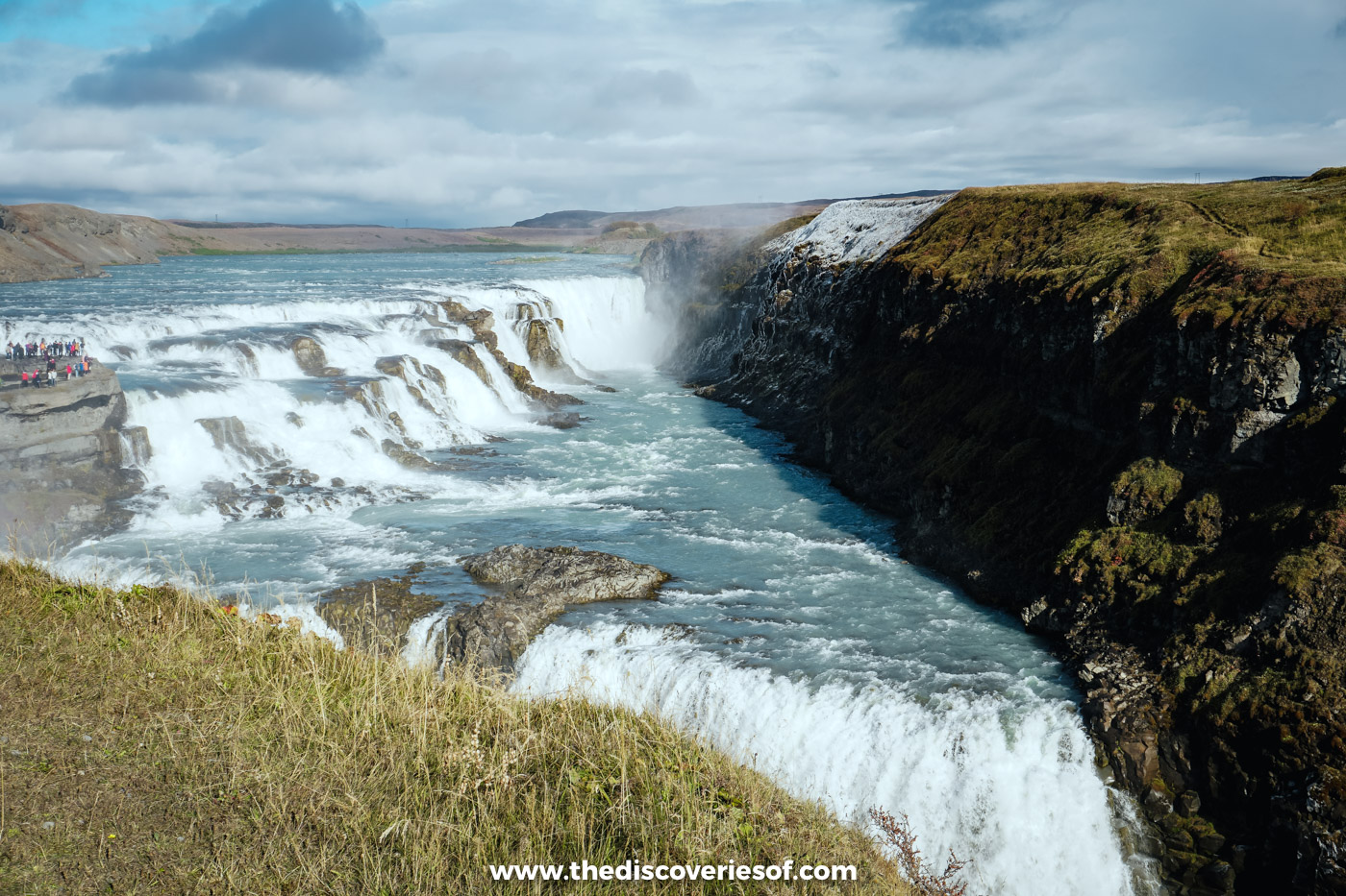
Gullfoss, the golden falls in two giant steps
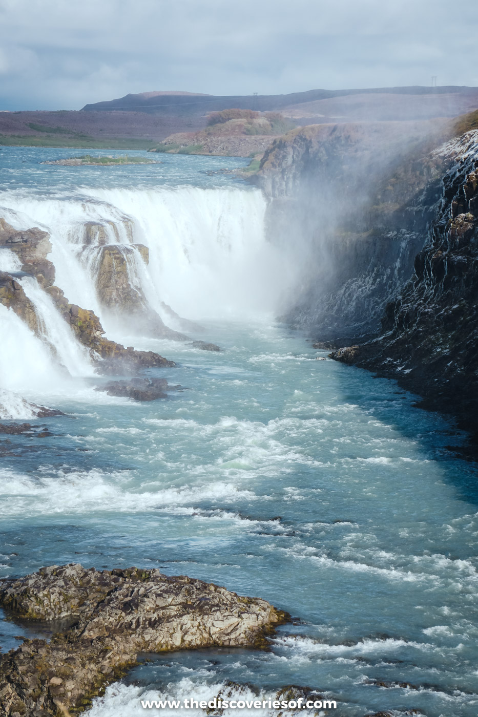
Gullfoss is one of Iceland’s most famous waterfalls, and it’s a must-see destination for anyone visiting the country. The glacial river Hvítá cascades down two steps, about 32 metres in all, into a deep canyon, creating rapids and whirlpools as it flows.
It had been on my travel wish list for a long, long time before I finally got there on my May trip, and I went back again in September.
The best way to view Gullfoss is from the top of the waterfall, where you can see the river plunge over the edge into the abyss. Prepare to get wet from the spray! Parking is free, and near the visitor centre there’s a memorial to Sigríður Tómasdóttir, the farmer’s daughter remembered for fighting to save the falls from a hydropower scheme.
Kerið, a blue lake in a red crater
Kerið is a volcanic crater thought to be around 6,500 years old, roughly 270 metres long and 170 metres wide, with walls that drop about 55 metres to the water.
That’s all interesting enough, but it’s the lake’s beautiful deep blue colour against the red and black volcanic rock that will make you pay attention.
You can walk around the rim of the crater for amazing views, or take the steps down to the water’s edge. It’s on Route 35, about 15 minutes north of Selfoss, so it’s an easy detour on the Golden Circle, and the entrance fee is ISK 700 per person, paid at the gate.
Hekla, the volcano once called the gateway to hell
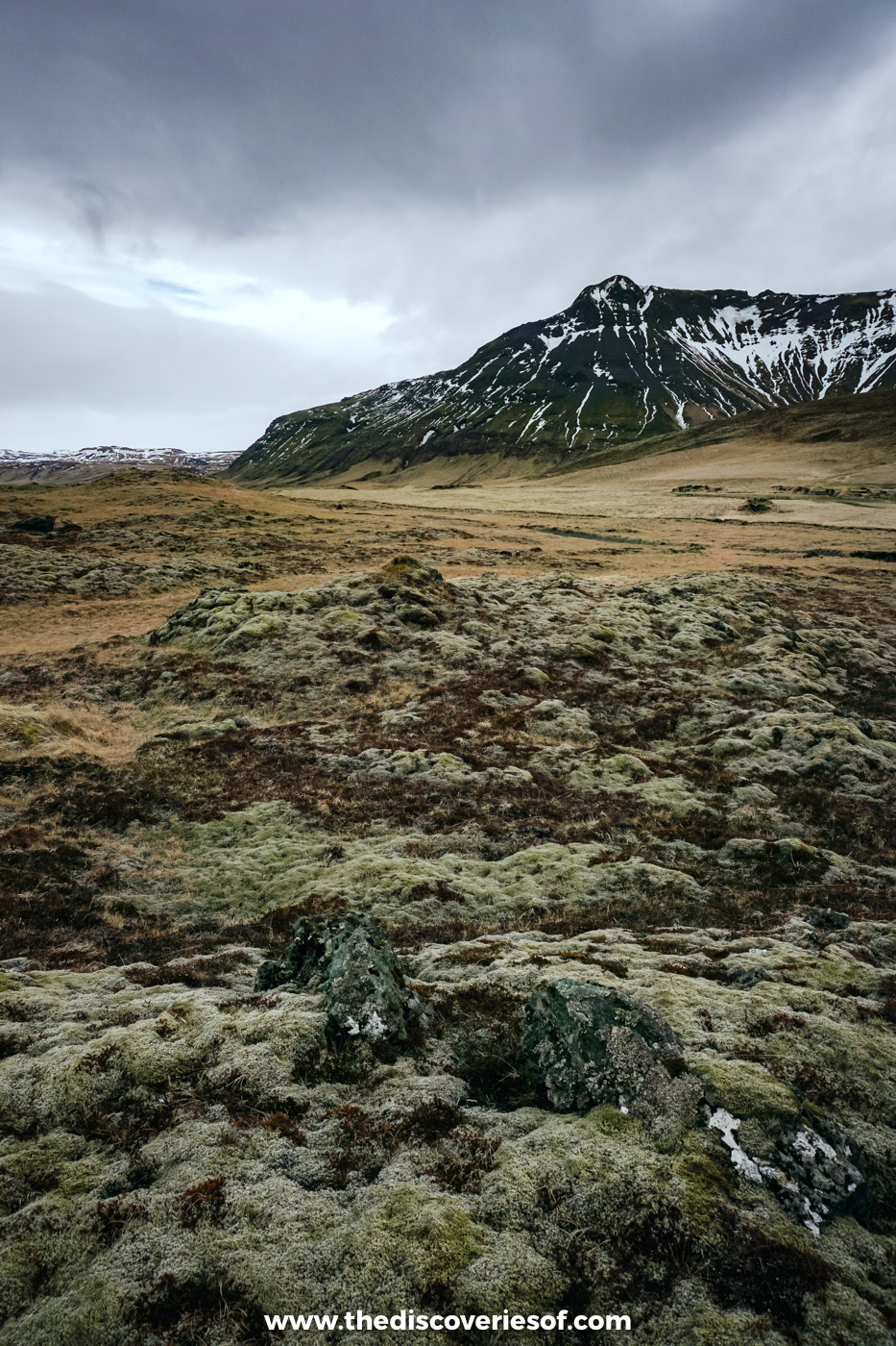
Rising to around 1,490 metres above the plains inland from Hella, Hekla is one of the most active volcanoes in the country, with more than 20 eruptions since 1210. In the Middle Ages, much of Europe believed it was the gateway to hell. It last erupted in February and March 2000, and scientists keep a close eye on it.
I’ve only seen Hekla from a distance, on a May day tracking down some of the south’s hidden gems, and I couldn’t resist lying down in the thick moss that carpets the lava fields around it. If you’d like to get closer, the summit hike takes three to four hours in summer, and the drive to the trailhead needs a 4×4.
Read Next
Seljalandsfoss, the waterfall you can walk behind
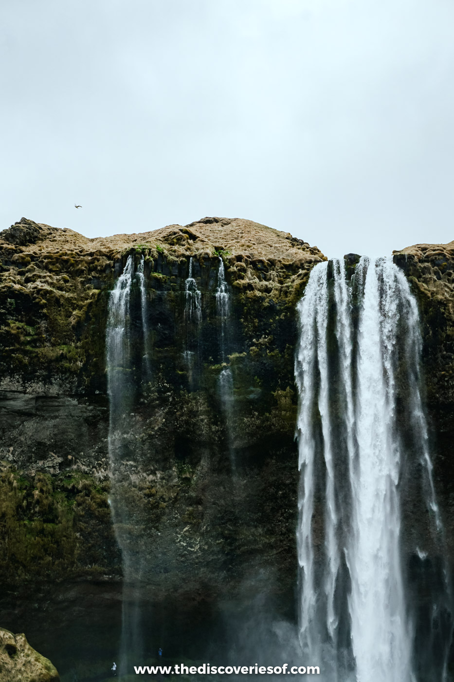
Seljalandsfoss is another one of the country’s most famous waterfalls, and the first big one you reach on the south coast, less than two hours from Reykjavik.
It drops about 60 metres from the top of an old sea cliff, and it stands out from the other falls because you can actually walk behind it! It’s a cool experience and one I’d highly recommend, although it does get a bit slippy in places, so wear some sturdy shoes!
On my May visit I followed the path all the way round the back of the falls and looked out through the water across the flat green plain. The path is usually closed in winter when it’s icy. Parking costs ISK 1,000 and the ticket lasts all day, so you can leave the car and walk a few minutes north to Gljúfrabúi, a smaller waterfall hidden inside a cleft in the cliff.
Skógafoss, a 60 metre curtain of water
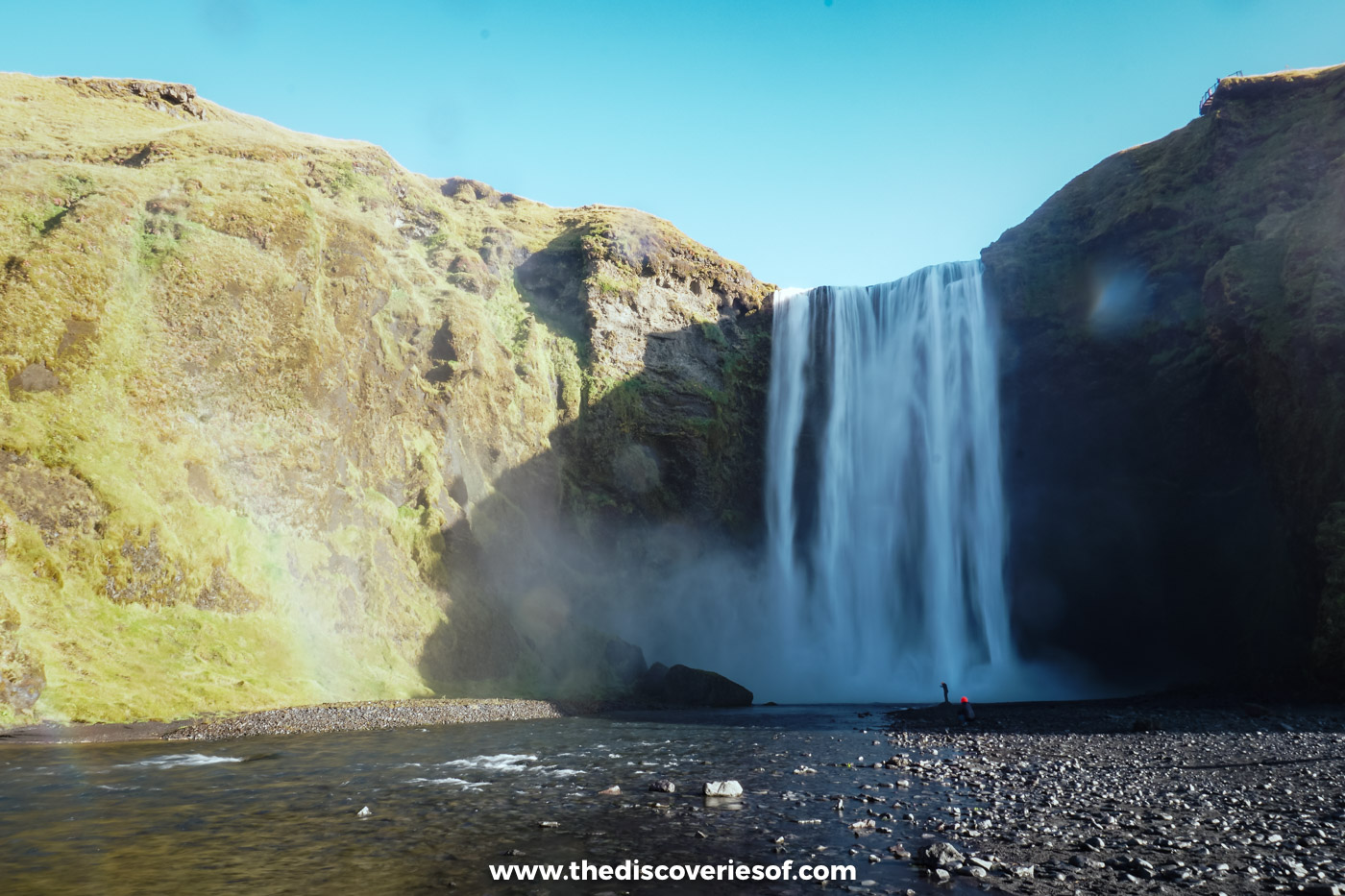
Skógafoss is one of the country’s most famous waterfalls, and it’s definitely worth a visit! It’s on the Skógá river, right by the Ring Road about half an hour west of Vík, and it has a total height of 60 metres (197 feet), falling in a sheet of water about 25 metres wide.
Fun fact about Skógafoss: it was one of the filming locations for Game of Thrones. You see it at the beginning of season 8, when Jon Snow and Daenerys take their thrilling dragon ride and land in front of a waterfall.
I’d definitely recommend doing the short hike to the top of the waterfall: the views are more than worth the effort. There are around 500 steps up the right-hand side to a viewing platform. Parking costs ISK 1,000 through the Parka app.
Do
Not driving? This south coast tour from Reykjavik stops at Seljalandsfoss, Skógafoss and Reynisfjara in a day.
The Sólheimasandur plane wreck, alone on the black sand
Few sights capture the eerie emptiness of the south coast quite like the wreck of a US Navy plane lying on a vast plain of black sand. The aircraft, a Douglas C-117 (a military version of the DC-3), made an emergency landing on Sólheimasandur in 1973. Everyone on board survived, but the fuselage was left where it stopped, and it has since become one of the most photographed spots in the country.
From the car park on the Ring Road (ISK 750 through Parka), it’s a flat walk of about 4 kilometres each way across the sand, so allow two hours there and back, or take the shuttle bus that runs from the car park. There’s no shelter at all, and two visitors died of exposure out here in January 2020, so don’t set off in a storm or after dark, and please don’t climb on the wreck.
Dyrhólaey, the arch at the end of the beach
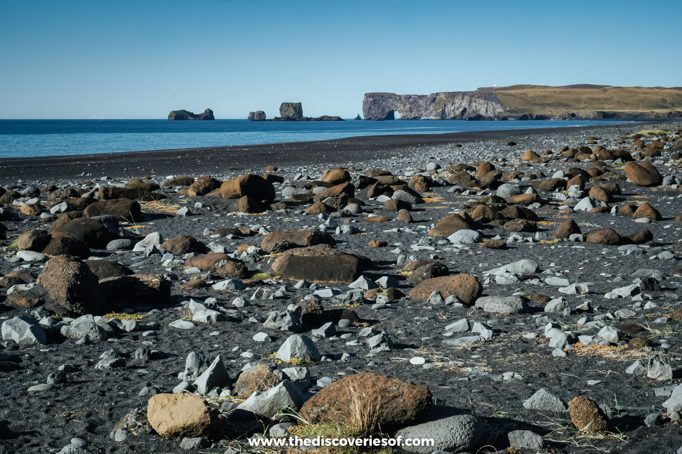
Look west from Reynisfjara and you’ll see a headland with a huge rock arch standing out into the sea. That’s Dyrhólaey, a 120 metre promontory whose name means something like “door hill island”, and it’s one of the most dramatic viewpoints on the south coast.
The lighthouse on top looks along the black sand to Reynisdrangar in one direction and across to the glaciers in the other, and puffins nest on the cliffs in summer. You can’t walk there from Reynisfjara: drive back to Route 1 and take Route 218, a steep gravel road, to the upper car park (ISK 750 through Parka). Dyrhólaey is a nature reserve, and access can be restricted between 1 May and 25 June while birds are nesting, so check the signs at the turn-off.
Reynisfjara black sand beach and the Reynisdrangar sea stacks
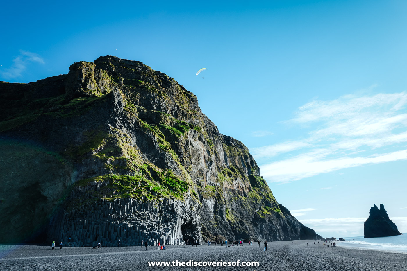
This black sand beach is one of the most stunning natural landmarks in the country and should be guaranteed a spot on your itinerary for its sheer scale and beauty. The beach is located near Vík on the south coast.
Reynisfjara is known for its dark sand, impressive cliffs and powerful waves. The cliffs of Reynisfjall at its eastern end are lined with hexagonal basalt columns, and if you look out to sea you’ll see jagged pillars of rock jutting out of the water.
Those are the Reynisdrangar sea stacks, which stand just offshore. Legend has it that they are petrified trolls!
Top Tip
The waves here are genuinely dangerous. Sneaker waves surge far further up the beach than the ones before them and have killed several people, including in August 2025. Check the warning light at the entrance: on yellow, keep at least 30 metres from the water; on red, stay off the lower beach altogether. Parking costs ISK 1,000 in the lower car park through the Parka app.
Fjaðrárgljúfur, the canyon Justin Bieber made famous

Fjaðrárgljúfur is one of the country’s most beautiful landmarks. The canyon was formed by the Fjaðrá river, and it’s up to 100 metres deep and about two kilometres (just over a mile) long. It has a layer of mossy green on it, giving it the appearance of an enchanted forest.
It appeared, alongside Skógafoss, in the Game of Thrones dragon ride, but it was Justin Bieber who really put it on the map: so many people came after his 2015 music video that the canyon had to close in 2019 to let it recover.
You can take the trail along the rim to viewing platforms with incredible views down into the gorge, but please stay on the path. It’s just off the Ring Road on Route 206, west of Kirkjubæjarklaustur. Parking costs ISK 1,000 through Parka, and the trail can close for a while during the spring thaw.
Vatnajökull National Park, 14 per cent of the country under one name
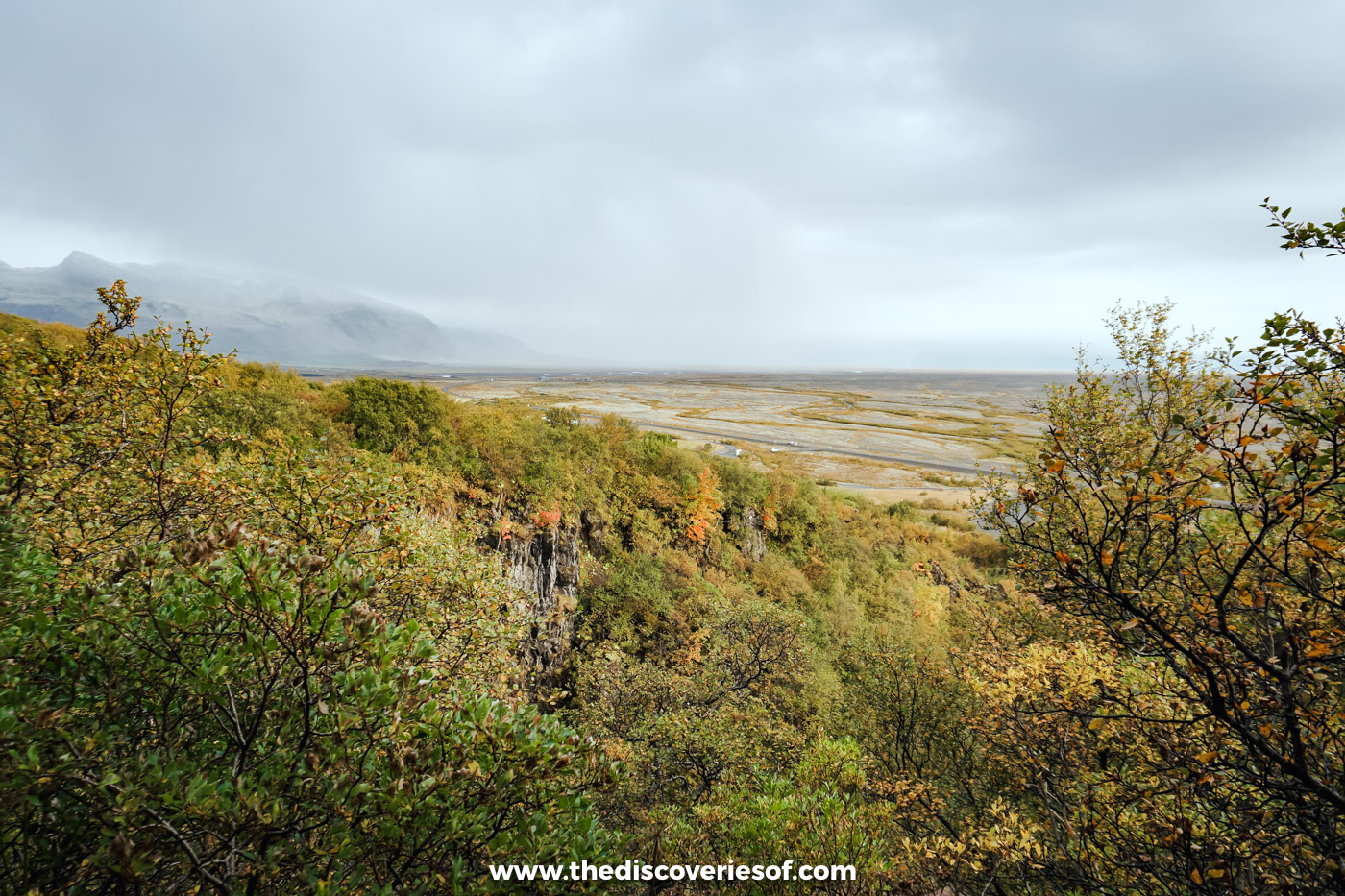
Visitors should definitely make a stop at Vatnajökull National Park, the second-largest national park in Europe. It covers about 14 per cent of Iceland and became a UNESCO World Heritage Site in 2019.
At its heart is Vatnajökull itself, the biggest ice cap in the country and one of the largest in Europe, along with the volcanoes beneath it and the outlet glaciers, lagoons and lava fields around its edges. I saw its southern edge at Skaftafell in September, when the birch scrub had turned gold.
The park offers plenty of opportunities for exploration and adventure, from Skaftafell in the south to the Dettifoss waterfall and Ásbyrgi canyon in the north, with hiking trails that wind through the rugged landscape and lead to some incredible viewpoints. You can also camp, kayak on the glacial lagoons or take a guided glacier walk to get up close and personal with the ice (never go onto a glacier without a guide).

In winter, the glacier hides one of the most stunning natural sights in the country: its ice caves, with their deep blue ice and impressive formations. They’re carved by meltwater and change every year, and most of the ones visited are in Breiðamerkurjökull, the outlet glacier behind Jökulsárlón. They’re only safe from about October to March, with a licensed guide who checks conditions every day. My guide to the best things to do in Iceland has the tours.
Svartifoss, framed by basalt organ pipes
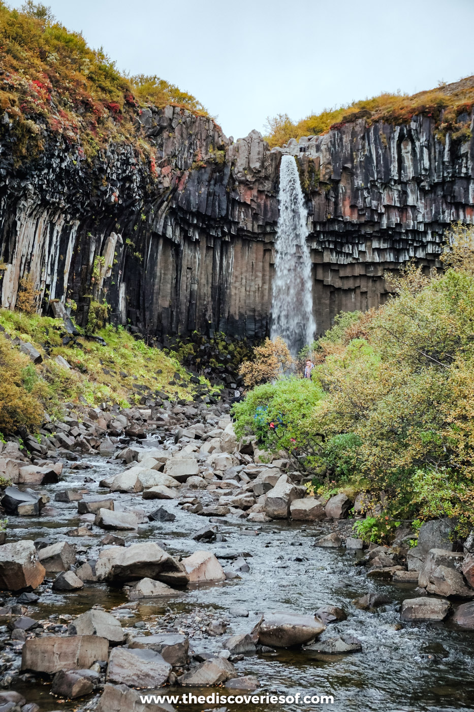
Located in the Skaftafell area of Vatnajökull National Park, Svartifoss is a spectacular landmark that is well worth a visit.
The country isn’t short on waterfalls, with more than its fair share of jaw-dropping cascades dotted around the island. Even so, I think Svartifoss is one of the most unique thanks to a striking formation of black basalt columns that surround it. It’s hard to believe these dark pillars are completely natural, but they are.
It’s about a 45-minute walk up from the Skaftafell visitor centre. My guide to the best waterfalls in Iceland has the trail and the rest of the story.
Fjallsárlón, the glacier lagoon next door
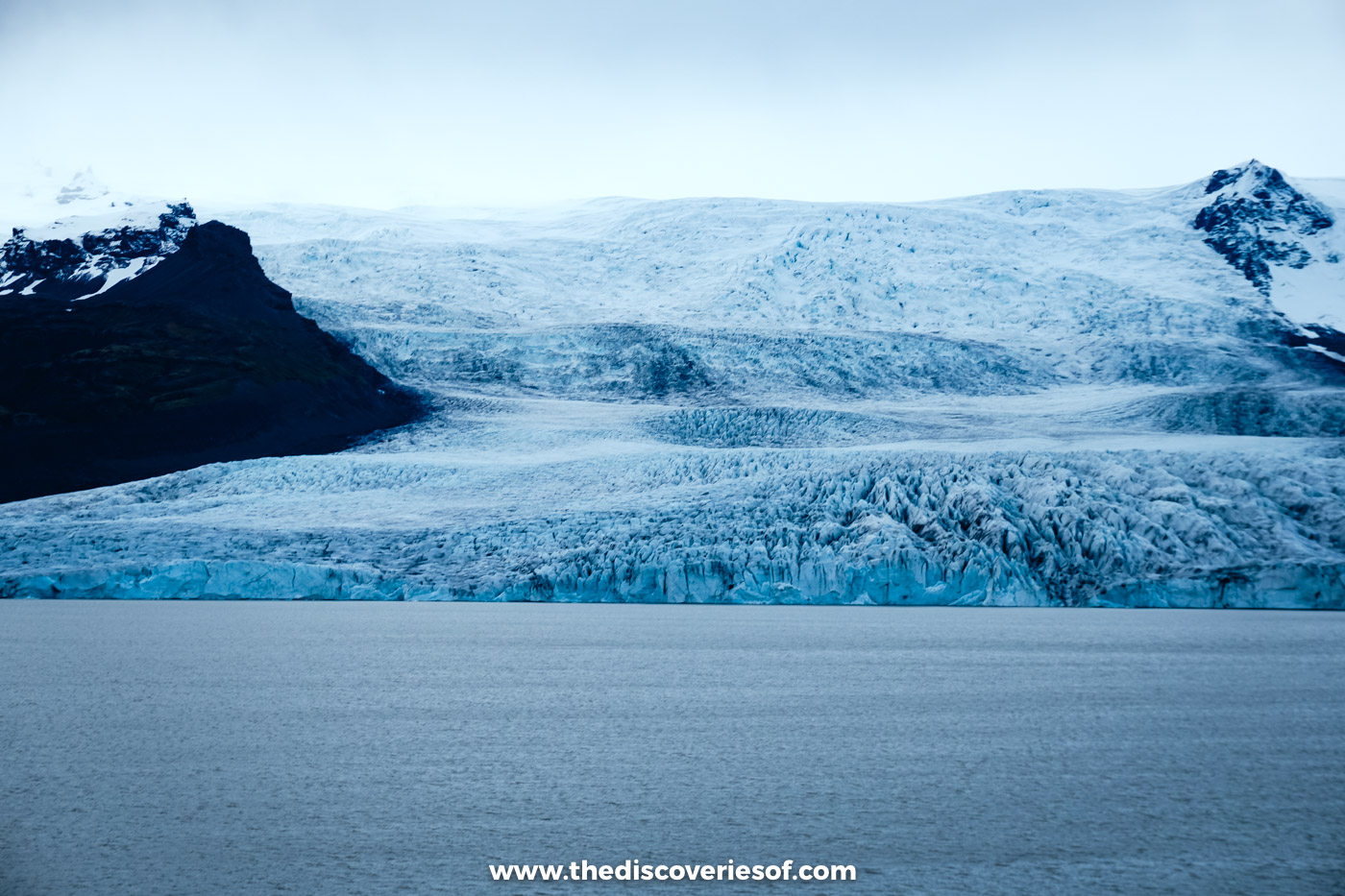
About 10 kilometres west of Jökulsárlón, Fjallsárlón is a smaller, quieter glacier lagoon where the Fjallsjökull glacier slides right down to the water, close enough to pick out the crevasses on its face.
I called in on the drive back west from the big lagoon that September evening. There’s a café, FROST, by the car park, and boat trips on the lagoon in the warmer months.
Jökulsárlón glacier lagoon and Diamond Beach
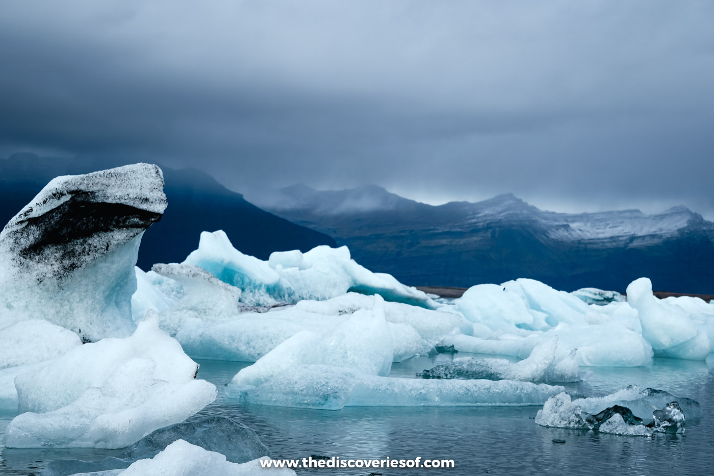
Jökulsárlón Glacier Lagoon is one of the most beautiful landmarks in the country. Fact! The lagoon sits at the foot of Breiðamerkurjökull, an outlet glacier of Vatnajökull, and it’s filled with icebergs that break off the glacier and drift slowly out to sea. A few of them are thought to be made of ice more than 1,000 years old.
The lagoon itself is young. It only began to form in the 1930s as the glacier retreated, and at 284 metres it’s now the deepest lake in the country. It’s a long way east, about four and a half hours’ drive from Reykjavik, and it was the turning point of my September road trip along the south coast.
Visitors can take a boat tour on the lagoon or simply relax and take in the incredible views from the shore.
Don’t forget to cross the road to the nearby Diamond Beach either, where chunks of ice washed out of the lagoon glitter on the black sand. It was getting late by the time I wandered over, and only a scattering of ice was left, so how much you see is down to the tides, the wind and a bit of luck.
Vestrahorn and Stokksnes, a jagged mountain over black dunes
On the south-east coast, about 15 minutes’ drive east of Höfn, the jagged ridge of Vestrahorn rises about 450 metres straight out of the black sand dunes of the Stokksnes peninsula. On a still day, the shallow pools on the beach mirror its peaks, which is why it’s one of the most photographed mountains in the country.
The land is privately owned, so you pay a small fee (about ISK 1,000 per adult) at the Viking Café at the end of the road. Look out for the replica Viking village nearby, a film set built for a movie that was never made.
Hallgrímskirkja, the church that took 41 years to build
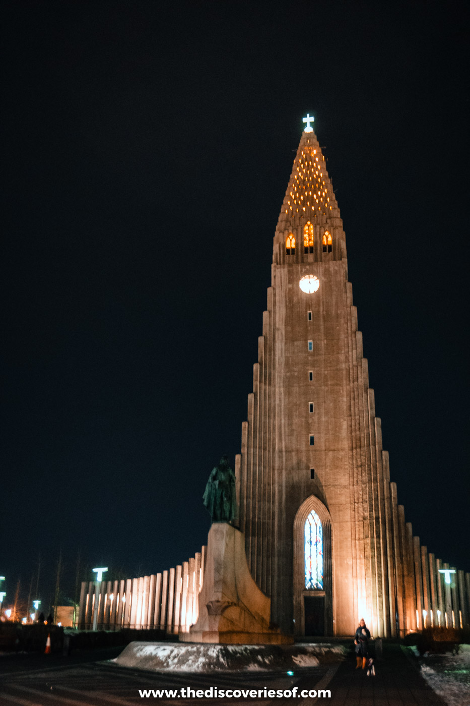
If you’re looking for an iconic Icelandic landmark, be sure to visit Hallgrímskirkja Church. You can see its tower from almost anywhere in Reykjavik.
The church wasn’t built in a hurry. The state architect, Guðjón Samúelsson, was commissioned to design it in 1937, building work began in 1945, and it wasn’t finally consecrated until 1986. Its stepped concrete front is said to echo the basalt columns you’ll see all over the country, and at 74.5 metres it’s one of the tallest buildings in Iceland.
The church features a large bell tower that offers spectacular views of Reykjavik and surrounding areas, as well as an impressive pipe organ inside its main hall. Entry to the church is free; the tower costs ISK 1,500 for adults, with tickets sold in the church shop on the day. My guide to the best things to do in Reykjavik has more on the city.
Harpa, Reykjavik’s glass concert hall

The Harpa Concert Hall is one of those Icelandic landmarks that is just stunning. Combining the best of Icelandic design with modern architecture, it’s situated on the harbour in downtown Reykjavik and has become one of the city’s most popular attractions since its opening in 2011.
Its honeycomb of glass panels, designed by the artist Olafur Eliasson with Henning Larsen Architects, catches the light during the day and glows at night when it’s lit up.
PS: it’s just as cool inside too. The foyers are free to wander, or you can book tickets for a concert or reserve a table at Hnoss, where I’ve eaten myself, for some delicious Icelandic cuisine.
Sun Voyager, the dreamboat on the waterfront
You know that sculpture you always see when you see pictures of Reykjavik? That’s Sólfar, the Sun Voyager, on the waterfront by Sæbraut, about 10 minutes’ walk east of Harpa.
The sculpture was created by Jón Gunnar Árnason and unveiled in 1990. It looks like a Viking ship, but the artist described it as a dreamboat, an ode to the sun.
Not only does the sculpture look beautiful, but it’s also a great location for nabbing incredible views across the bay to Mount Esja, especially at sunset.
The Blue Lagoon (check before you go)

The Blue Lagoon is one of the country’s most popular attractions, and you can see why: milky blue water steaming in the middle of a black lava field. I’ll admit it’s one famous name on this list I’ve never been to; on my trips I’ve picked Sky Lagoon and a local pool instead.
The lagoon is fed by mineral-rich seawater from the nearby Svartsengi geothermal power plant, and the silica in it gives the water its colour. You can enjoy a variety of spa treatments or simply relax in the water. Tickets start at ISK 11,990 for the Comfort package and need booking ahead.
There’s an important caveat. The lagoon sits beside the Sundhnúkur crater row near Grindavík on the Reykjanes peninsula, which erupted nine times between December 2023 and August 2025. It was evacuated and closed several times, and in November 2024 lava swallowed its car park. It has reopened after each eruption, but magma is still building up beneath the area and it can close at short notice. Check bluelagoon.com and safetravel.is before you go, and read the refund terms when you book.
Reykjanes Lighthouse and the wild south-west tip
The Reykjanes Peninsula is a beautiful part of the country that doesn’t get as many visitors as it deserves.
The peninsula features many sights to see and things to do, but my top pick is the Reykjanes Lighthouse. The first lighthouse in Iceland was built here in 1878, on the Valahnúkur cliffs, but earthquakes and the surf damaged it so badly that it had to be replaced. Today’s tower went up on Bæjarfell hill in 1907 and 1908, and it’s been guiding ships ever since.
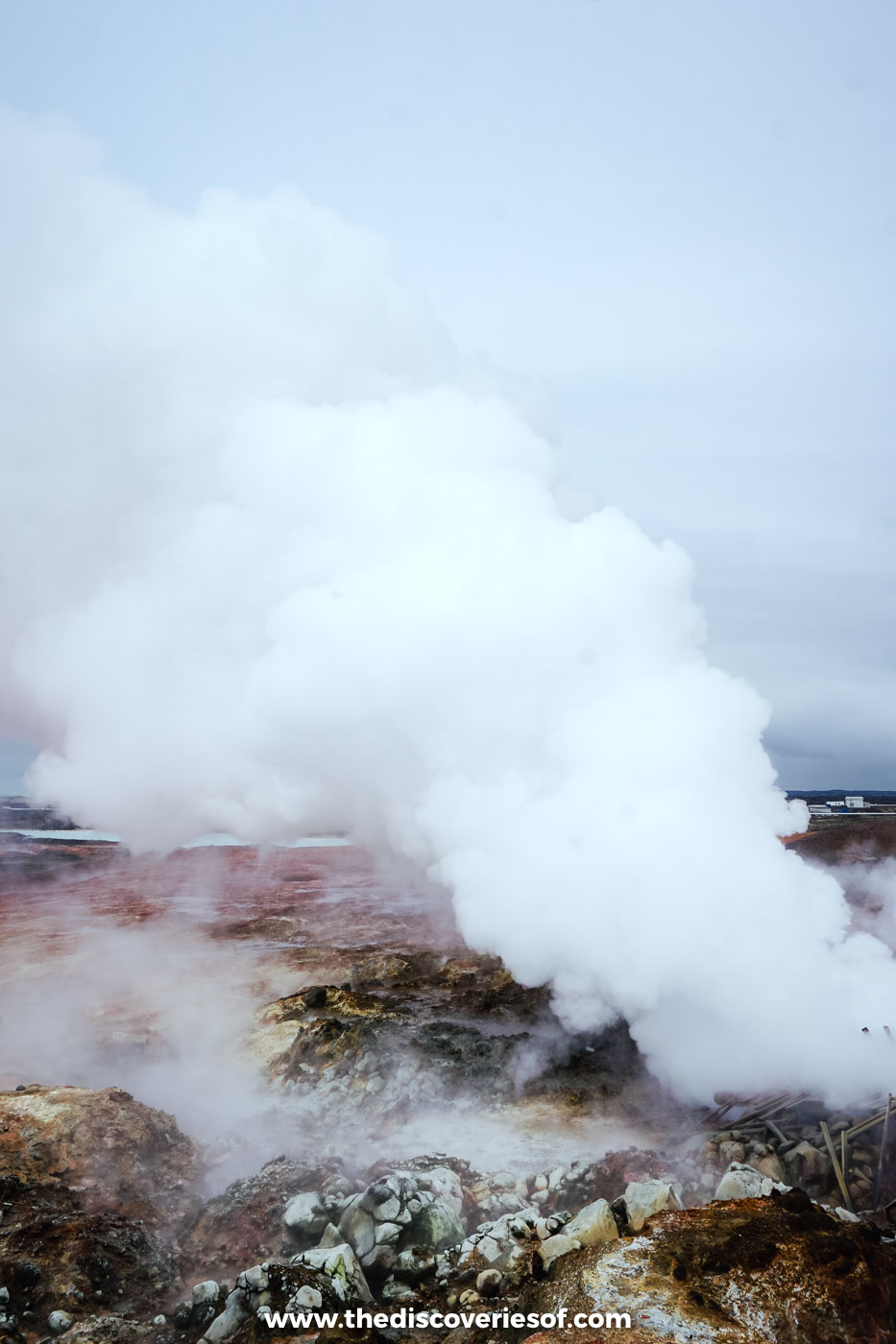
Walk up Bæjarfell to the lighthouse for an amazing view of the sea and the wild coastline below, then explore the bubbling mud pools and steam vents of Gunnuhver just inland. Parts of the Valahnúkur cliffs are off limits because of cracks, and roads around Grindavík can close during eruptions, so check safetravel.is first.
Landmannalaugar, the rainbow mountains of the Highlands
Landmannalaugar is the Highlands at their most colourful: mountains striped in red, orange, yellow and green rhyolite, a black lava field and a natural hot spring where hikers soak their legs. It’s also the start of the Laugavegur trek, one of the most famous hikes in Iceland.
It’s only reachable in summer, roughly from late June, along F-roads that need a 4×4 (with river crossings at the end), or on a highland bus. Between 20 June and 14 September, private cars arriving between 9am and 4pm must book a parking slot in advance.
Hveravellir, a hot spring oasis in the Highlands

Located off the main ring road and a long way off the beaten path, Hveravellir Nature Reserve offers visitors a glimpse of the Highlands’ wild landscapes.
It sits at about 650 metres on the Kjölur route between the Langjökull and Hofsjökull glaciers, and the nature reserve is home to steaming fumaroles and bubbling hot springs. There’s also a natural hot pool you can bathe in next to the mountain lodge, and the area is tied up with legends of the 18th-century outlaw Fjalla-Eyvindur.
Hveravellir also boasts some beautiful Icelandic wildflowers in summer, so be sure to keep your eyes peeled for these delicate blooms. You’ll need a 4×4 to drive the F35 to get here, and the road is usually open only from June to September.
Hvítárvatn, the glacier lake that feeds Gullfoss
Hvítárvatn is one of the Highlands’ most beautiful landmarks. The lake lies at the eastern foot of the Langjökull glacier, north of Gullfoss along the Kjölur road, and it’s the source of the Hvítá, the very river that thunders over Gullfoss further downstream. Its pale, milky water, coloured by glacial silt, gives it the name “white river lake”.
It covers about 30 square kilometres and is up to 84 metres deep. It doesn’t tend to be anything like as busy as spots such as Gullfoss, so it’s a cool little landmark if you’re not such a fan of the crowds. The lake is reached from the F35 in summer, and the old mountain hut at Hvítárnes, built in 1930, is said to be haunted.
Gerðuberg, a wall of basalt columns

The Gerðuberg Cliffs are a wall of basalt columns at the start of the Snæfellsnes peninsula in west Iceland, about an hour and a half’s drive from Reykjavik. They’re an impressive sight, even by the country’s high standards!
The columns are hexagonal and remarkably regular, between 7 and 14 metres high, and were formed when the lava from a volcanic eruption cooled and cracked. The best way to experience the cliffs is to walk along their base: it’s free, it only takes a few minutes from the parking area, and it’s an easy stop on the way to Kirkjufell.
Kirkjufell, the arrowhead mountain
Kirkjufell, “church mountain”, is the 463 metre peak on the north coast of the Snæfellsnes peninsula near Grundarfjörður, and its perfect cone is one of the most photographed sights in the country. Game of Thrones fans will know it as the arrowhead mountain beyond the Wall.
The classic view is from Kirkjufellsfoss, the little waterfall across the road, with parking at ISK 1,000 through the EasyPark app. Admire it from below: after several fatal falls, the landowners have banned climbing it. This Snæfellsnes peninsula day tour from Reykjavik includes a stop.
Dynjandi, the Westfjords’ bridal veil

I know, I know: another waterfall, but it would be a crime to create a guide to the country’s must-see landmarks and not include Dynjandi.
Located in the Westfjords region, Dynjandi is known for its impressive size and beauty, thanks to the fact that its top fall is about 100 metres tall and fans out like a bridal veil, with six smaller falls below it, seven in all.
You can hike up to the top of the waterfall for amazing views (it’s a steep 15 to 20 minutes from the car park), or simply enjoy the beauty from below. Parking costs ISK 750 through the Glaze app, and the mountain roads either side can close in winter.
Lake Mývatn and the steaming fields of Hverir
Lake Mývatn in north Iceland is a landscape shaped by fire. Around its shores you’ll find the twisted lava towers of Dimmuborgir, the huge black crater of Hverfjall and the Mývatn Nature Baths.
Just east of the lake, right beside the Ring Road, Hverir (also called Námafjall) looks like another planet: hissing steam vents, bubbling mud pots and ground stained yellow, orange and red, with a strong smell of sulphur. Stick to the marked paths, as the ground is hot and the crust can be thin. Parking costs ISK 1,200 through Parka.
Ásbyrgi, the canyon shaped like a hoofprint
Ásbyrgi is a horseshoe-shaped canyon in the northern part of Vatnajökull National Park, under an hour’s drive east of Húsavík. It’s about 3.5 kilometres long, with cliffs up to 100 metres high around a birch and willow wood, and a rock island called Eyjan running down the middle.
Geologists say it was carved by catastrophic glacial floods. Legend has a better story: it’s the hoofprint of Sleipnir, the god Odin’s eight-legged horse. Pair it with Dettifoss, one of Europe’s most powerful waterfalls, a short drive south.
Tips for seeing the sights
- Budget for parking. Most of the big sights now charge for parking, usually ISK 750 to 1,200 a day, paid through an app (Parka, EasyPark or Glaze), at a machine or by camera. Unpaid charges end up on your hire car bill with a fee on top.
- Check the roads and the warnings. Look at road.is for road conditions and safetravel.is for alerts before every drive. F-roads to the Highlands are open only in summer and need a 4×4, and the Reykjanes peninsula can be affected by eruptions.
- Go early or late. The Golden Circle and south coast sights get busy by mid-morning in summer; the long summer evenings, and the quieter shoulder months, are the time to have them to yourself. My guide to the best time to visit Iceland has more.
- Base yourself in the south. For the Golden Circle and the south coast, stay between Hella and Hvolsvöllur: I stayed at Hotel Rangá in both May and September (here’s my Hotel Rangá review), and my guide to where to stay in Iceland covers the rest of the island.
Map
Read next
- Unmissable things to do in Iceland
- When’s the best time to visit Iceland?
- Cool things to do in Reykjavik
- Stunning waterfalls in Iceland you shouldn’t miss
- Visiting Iceland’s Golden Circle
- Discovering Iceland’s hidden gems
- Driving Iceland’s Ring Road
Love this? Save and share on Pinterest

Discover the top things to do, insider tips and hidden gems in our Iceland Travel Guide.
Read the guides →