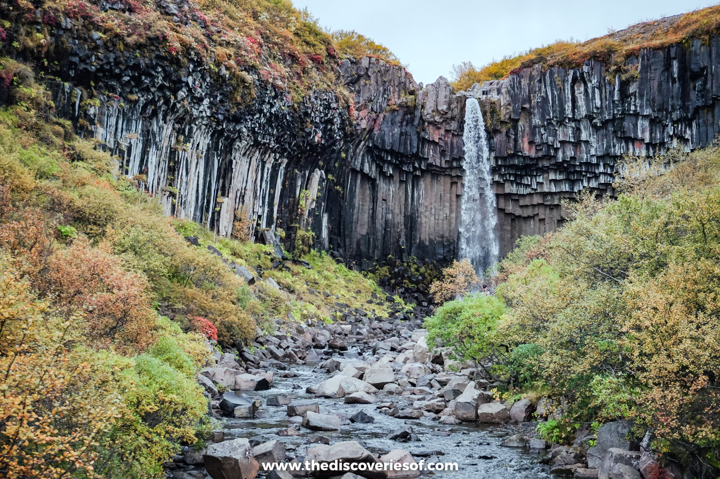

The Svartifoss hike climbs from the Skaftafell visitor centre to a waterfall that drops between hanging columns of black basalt. Here’s how to walk it: the route and how long it takes, what parking costs, when to go, winter conditions and what else to see nearby.
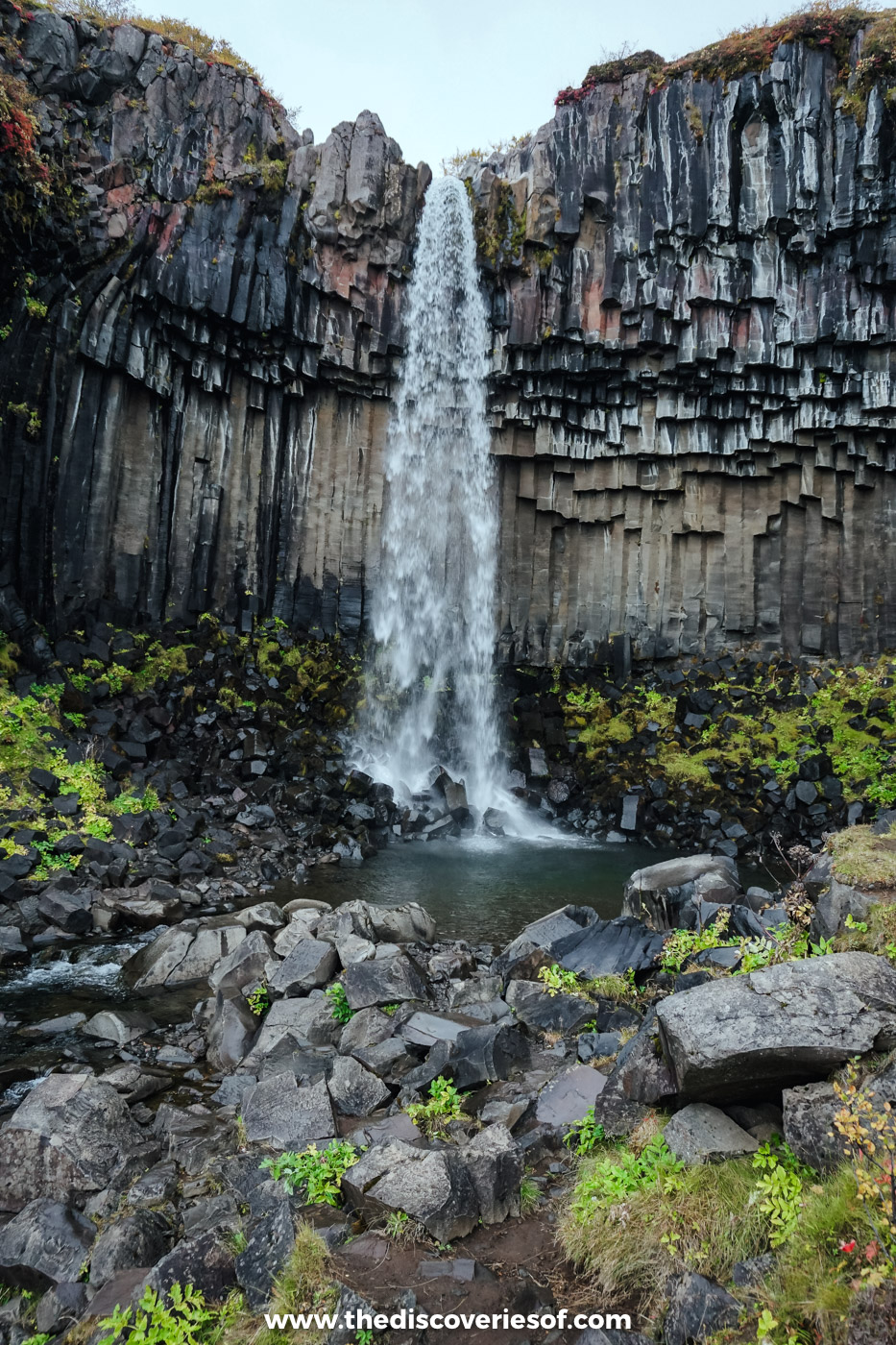
Of all the waterfalls I’ve seen in Iceland, and there have been a lot of them, this is the one I rate highest. It isn’t the tallest or the loudest. What makes it is the setting: a slim ribbon of white water falling over a curtain of black geometric columns, a pattern so precise it’s hard to believe it was made by volcanic activity rather than a stonemason. It’s unlike any other waterfall I’d come across.
I came on my September self-drive, on the long day I spent driving from Hotel Rangá out to Jökulsárlón and back. Skógafoss and Reynisfjara came on the way east; after a wander among the icebergs, Svartifoss was my stop on the way back west.
Unlike plenty of the falls on the south coast, you can’t see this one from the road. You have to park up and walk. It’s a bit of a pull up from the car park, but then it levels off, and the reward at the end is more than worth the puff. It’s free, too: the only thing you pay for is parking.
Svartifoss at a glance
- Where: Skaftafell, in the southern part of Vatnajökull National Park, just off Route 1 (the Ring Road) between Kirkjubæjarklaustur and Höfn.
- The walk: about 1.5 km and 45 minutes up from the visitor centre, with around 140 metres of climbing, most of it near the start. Allow about two hours for the full S2 loop, or an hour and a half there and back.
- Difficulty: easy to moderate. A steady climb, then a gentle path and some steps down to the falls.
- Cost: the falls are free. Parking at Skaftafell costs ISK 1,110 a day for a car with up to five seats.
- Best time: May to September for clear paths and long days; mid to late September for autumn colour.
- Winter: the path stays open all year but is often icy, so bring ice spikes.
- Drones: not allowed.
Why the black falls are worth the climb
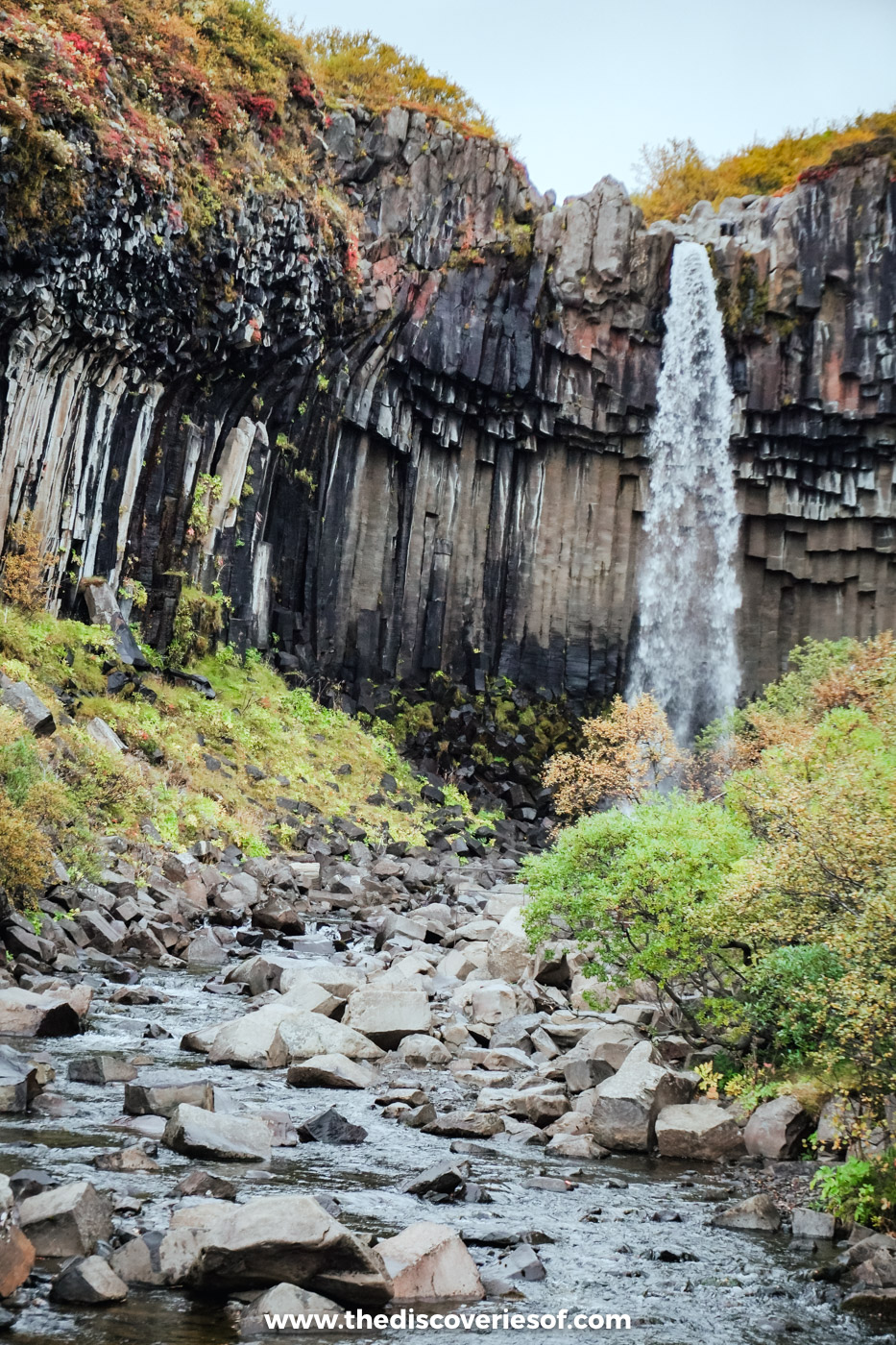
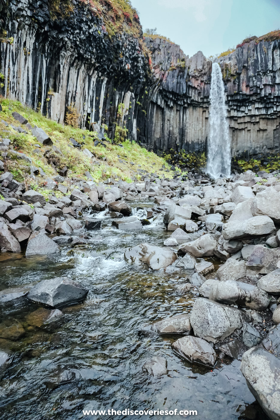
Svartifoss means “black falls”, and the name is all about the rock. The water drops about 20 metres over a lip of dark lava, and the cliff around it is made of hundreds of basalt columns. On either side they stand like pillars; above the falls their broken ends hang down like the vaulted ceiling of a cathedral. Fallen sections lie in the stream below, which is how you can tell the shape is natural: they’re just as neatly six-sided as the ones still in place.
The columns formed when a thick lava flow ran across Skaftafellsheiði, the moorland above, and filled an old river bed. As the lava cooled slowly, it shrank and cracked into columns at right angles to the cooling surface, a process called columnar jointing. Over time, the stream cut down through the flow and exposed them. You can see the same thing on a bigger scale at the eastern end of Reynisfjara beach.
The pattern has left its mark on Icelandic architecture too. Basalt columns like these are said to have inspired Guðjón Samúelsson, the state architect behind the National Theatre and Hallgrímskirkja in Reykjavik. Stand at the foot of the church after you’ve been here and you’ll see the resemblance.
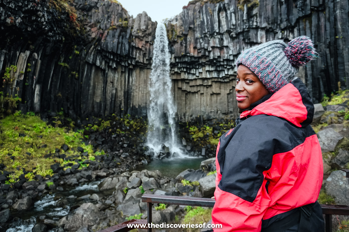
There’s no walking behind this one, and no clambering about at the base. The path stops at a viewing area across the stream, which is close enough to take in the scale of the columns, feel a little of the mist and get the classic photo.
The Svartifoss hike, step by step
From the visitor centre to the top of the gorge
The walk starts beside Skaftafellsstofa, the visitor centre, and is signed for Svartifoss (it’s the first part of the park’s S2 route). For the first 250 metres or so you follow the edge of the campsite, then the path turns right and starts to climb.
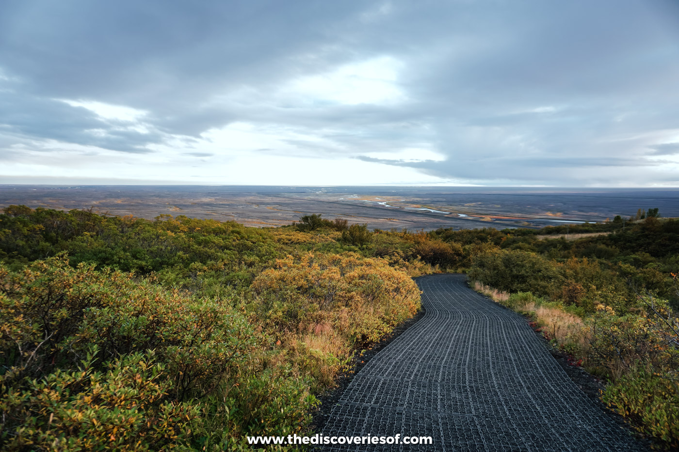
This is the stretch that makes you puff. You gain about 140 metres in 1.5 km, most of it early on, on a wide path of packed earth, mats and the odd wooden step. Once you’re up on the heath, though, the gradient eases off and the rest is a gentle walk. Look back as you go: the view opens out over the flat black plain of Skeiðarársandur towards the sea.
Three smaller falls on the way
You pass three smaller waterfalls on the climb, each a short step off the path: Þjófafoss, Hundafoss and Magnúsarfoss. None of them is the main event, so don’t linger too long, but they make a good excuse for a breather.
Down to the viewing area
The path brings you out at a viewpoint above the gorge, looking down on the falls and the stream below. From here, steps lead down into the ravine and across a footbridge to the viewing area facing the columns.
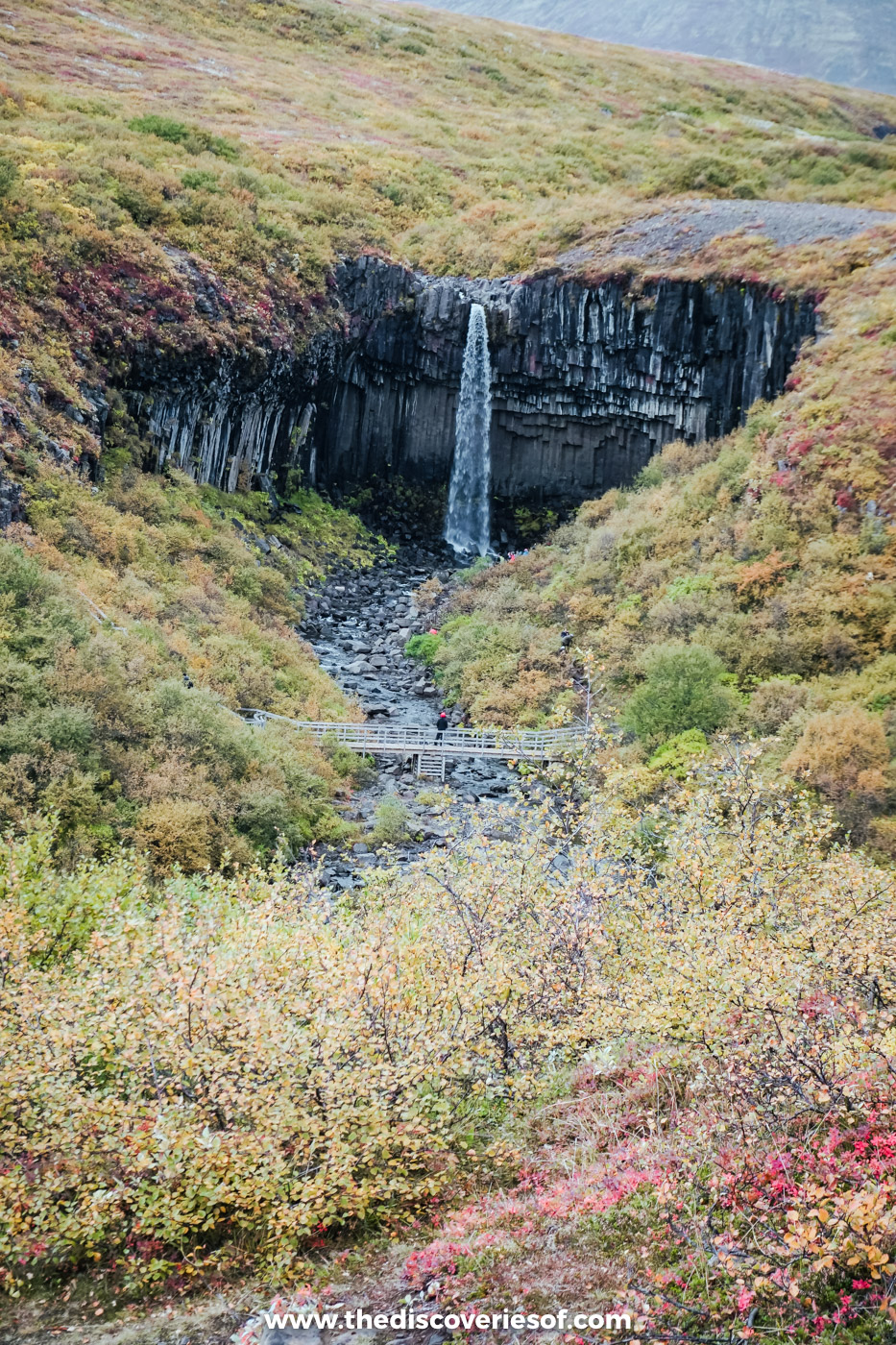
When I came in September, the slopes of the gorge were rust, orange and red with autumn scrub, which set off the black rock brilliantly. In summer it’s all green; in winter the columns can be hung with icicles.
Round the loop, not back the same way
Rather than retrace my steps, I carried on round the loop back to the car park, and I’d recommend doing the same: you see the gorge from a different side and you aren’t just walking the same path in reverse. This is the park’s S2 route. From the footbridge, stone steps climb the far side of the gorge, and the path continues to the Sjónarsker viewpoint and the old turf farmhouse at Sel before dropping back down to the visitor centre via Lambhagi. The whole loop is 5.8 km and takes about two hours, with around 250 metres of climbing in all.
Short on time? Walking back the way you came is quicker, as it’s downhill all the way.
Fitter walkers can extend it to Sjónarnípa (route S6, 7.1 km, two and a half to three hours), a viewpoint with a fine view over the crevassed tongue of Skaftafellsjökull. The big day out is Kristínartindar (route S4, about 18 km, six to eight hours), which is for experienced hikers only.
Top Tip
Pay for parking before you set off: cameras read number plates, and an unpaid fee is passed to your hire company with a surcharge. If you’ve already paid in full at another Vatnajökull National Park site that day, such as Jökulsárlón, you get 50% off, as long as you use the same payment method.
Getting there and parking
Skaftafell sits on Route 1, about 330 km east of Reykjavik. Rough driving times without stops:
- Reykjavik: about four and a half hours
- Hella and Hotel Rangá: about three hours
- Vík: about one hour 45 minutes
- Kirkjubæjarklaustur: about 50 minutes
- Jökulsárlón: about 45 minutes
- Höfn: about one hour 45 minutes
That out-and-back day from Rangá was a highlight of the trip, but it added up to the best part of seven hours behind the wheel. It’s doable, but a night somewhere between Kirkjubæjarklaustur and Höfn gives you far more time at each stop. My 7 day Iceland itinerary builds one in, and if you’re circling the whole island, Kay’s Ring Road guide has the full route.
Parking is at the visitor centre. The park charges ISK 1,110 a day for a car with up to five seats, ISK 1,440 for six to nine seats and ISK 450 for a motorbike. Pay at the machines or online through Parka (which adds a small transaction fee); the ticket is valid until midnight, so you can come and go as you like. The visitor centre has an information desk and toilets, and staff can tell you about path conditions.
Without a car, it’s harder. Strætó’s long-distance route 52 between Reykjavík and Höfn runs along the south coast four days a week (check stops and times on straeto.is), and multi-day south coast tours often stop at Skaftafell. Most one-day tours from Reykjavik to Jökulsárlón are already very long days, so check the itinerary leaves time for the walk before you book.
When to do the Svartifoss hike
May to September is the easiest time. The path is clear of snow, and the days are long. June, July and August are the busiest months.
Mid to late September is my pick. The crowds have thinned, and the birch and heather around the gorge turn the colours you see in my photos. For a month-by-month view, see when is the best time to visit Iceland.
October to April brings snow, ice and short days, with only four or five hours of daylight around the winter solstice. The walk stays open, and a frozen Svartifoss is a sight in itself, but the path can be very slippery. Ice spikes are a must, and a guided walk is a sensible option if you’re not used to winter conditions.
As for the time of day, the gorge throws shadows across the falls when the sun is low, so the middle of the day gives the most even light for photos.
What to wear and how to stay safe
- Grippy boots. The mats and steps get slippery in the wet, and from autumn to spring the path is often icy. Pack ice spikes outside summer.
- A waterproof jacket. The spray here is light compared with Skógafoss or Seljalandsfoss, so the jacket is mostly for the weather, which can change fast this close to the ice cap. My Iceland packing list covers the rest.
- Stay on the path. Keep to the marked trail and the viewing area, and stay off the fallen columns in the stream bed. Rock does break away from the cliff.
- Check before you go. Read the vedur.is forecast and any safetravel.is alerts before you leave, and in winter ask at the visitor centre how the path is.
- Leave the drone in the car. Recreational drones are banned at Svartifoss and across most of Skaftafell. The only place they’re allowed is in front of Skaftafellsjökull, and then only at set times of day.
Nearby stops worth adding
- Skaftafellsjökull. A 4.1 km loop from the same car park (an hour to an hour and a half) leads to the snout of the glacier. Same parking ticket.
- A glacier hike. Skaftafell is the base for guided walks on the ice, such as this easy Falljökull glacier hike (about three hours, half of it on the glacier). Never go onto the ice without a guide.
- Hofskirkja. One of the last turf churches in the country, at Hof, about 20 minutes east.
- Fjallsárlón. About 40 minutes east, a smaller glacier lagoon where the ice tumbles almost to the water. I stopped here too, on the same drive. It’s covered in my Jökulsárlón guide.
- Jökulsárlón and Diamond Beach. About 45 minutes east, icebergs drift across the lagoon and wash up on the black sand.
- Stjórnarfoss and Fjaðrárgljúfur. About an hour west, near Kirkjubæjarklaustur: a peaceful two-step fall I came across by chance on this drive, and a deep, twisting canyon. Both are in my guide to Iceland waterfalls.
Quick answers before you go
How long does it take to walk to Svartifoss?
About 45 minutes up from the visitor centre car park. Walking back the same way, allow an hour and a half in all; the S2 loop, which carries on round the other side of the gorge and back to the car park, takes about two hours.
Can you visit in winter?
Yes. The path is open all year, but expect ice and snow from roughly October to April. Wear ice spikes, start with plenty of daylight in hand and check conditions at the visitor centre.
Can you walk behind it or swim in the pool?
No. The path ends at the viewing area across the stream, and you should stay off the rocks and fallen columns below the falls.
Is it worth the walk?
For me, without question. Plenty of the south coast’s waterfalls are bigger, but none has a setting quite like this, and the walk itself, with the smaller falls and the views back over the sandur, is half the pleasure. For the rest of the falls I’d put on a south coast road trip, see my guide to Iceland waterfalls.
Map
Read next
- Iceland waterfalls: 25 of the best
- Jökulsárlón glacier lagoon
- Reynisfjara black sand beach
- 7 day Iceland itinerary
- Things to do in Iceland
- Iceland travel tips
Love this? Save and share on Pinterest

Discover the top things to do, insider tips and hidden gems in our Iceland Travel Guide.
Read the guides →