
No waterfall in Iceland moves more water than Urriðafoss, yet most people driving the south coast sail straight past the turning. Here’s why it deserves the detour, with how to find it, what parking costs, where to stand, when to go and what to see nearby.
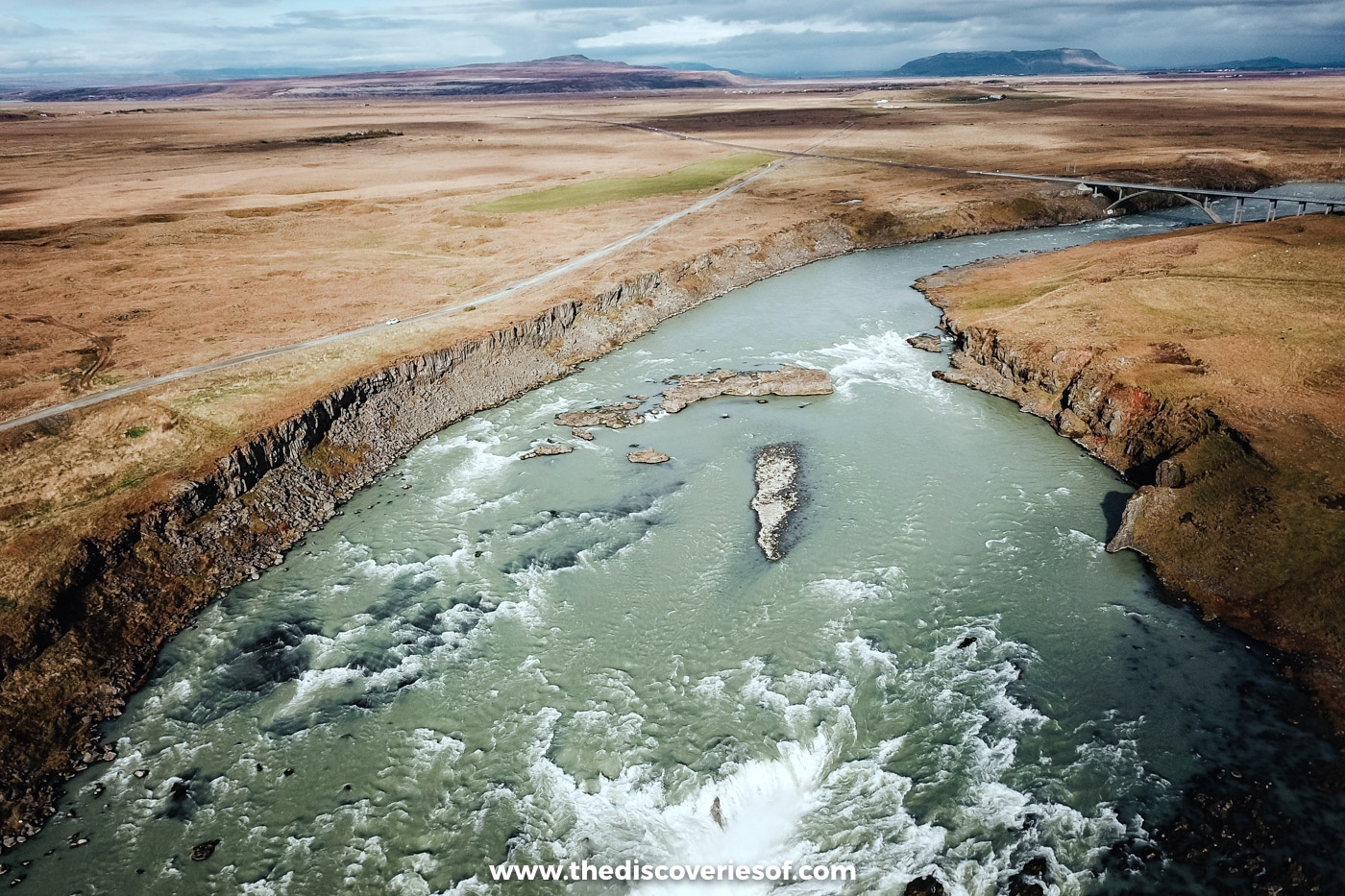
My September trip came to an end on a Sunday, and I wanted one more waterfall before I left. I’d spotted one on the map that I knew next to nothing about, tucked down a side road near the Þjórsá bridge, east of Selfoss. It took some finding. But once I’d parked and followed the path towards the noise, a whole river opened out in front of me, churning white over a ragged ledge of dark rock.
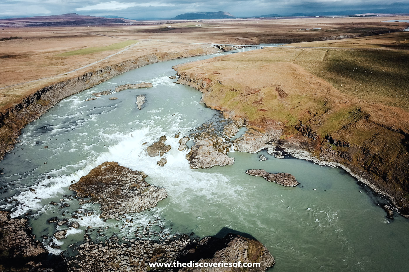
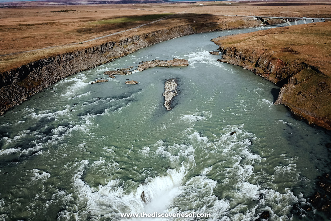
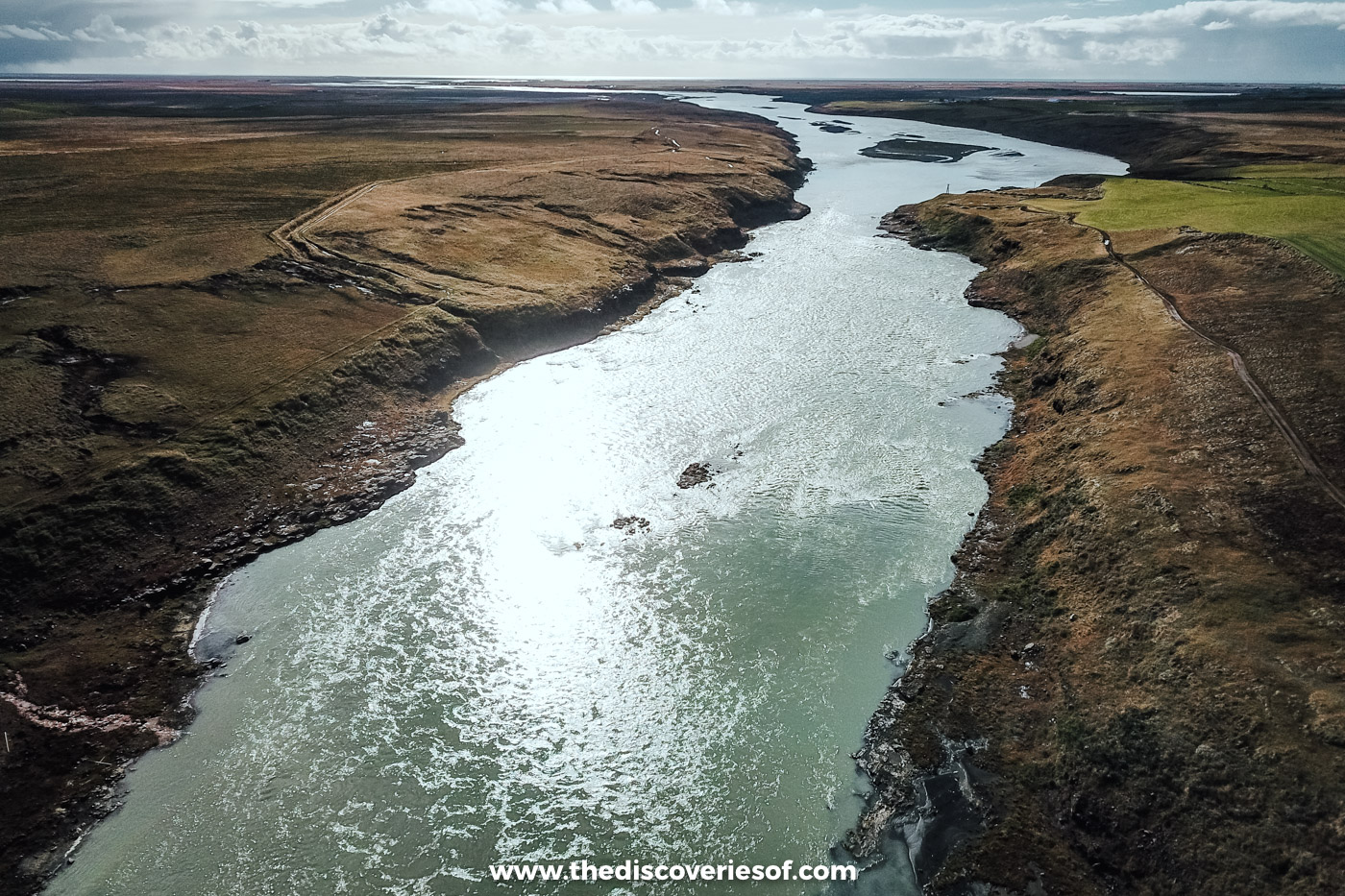
I didn’t have it entirely to myself. A fisherman was casting into the water below the falls, and a family had come out to enjoy it too, which seemed to me a perfectly good way to spend a Sunday. Otherwise it was empty. I put my drone up to see the falls from above (the aerial shots on this page are the result), and by the time I left, it had become one of my favourite spots anywhere on the island.
If you’re driving the south coast, take the detour. It adds half an hour to your day, and there’s every chance you’ll have one of the country’s great waterfalls almost to yourself.
Urriðafoss at a glance
- Where: on the Þjórsá river in the south, a minute or two off Route 1 between Selfoss and Hella, about an hour’s drive from Reykjavik.
- Size: a drop of only about 6 metres, spread across a ledge a couple of hundred metres wide.
- Flow: an average of about 360 cubic metres every second, the highest of any waterfall in the country.
- Cost: free to visit. Parking costs ISK 750 for up to two hours, and the first 10 minutes are free.
- Time needed: 20 to 30 minutes, or longer if you bring a picnic.
- Facilities: benches and picnic tables, but no toilets or café. The nearest are in Selfoss.
- Open: all year round.
Why the falls are bigger than they look
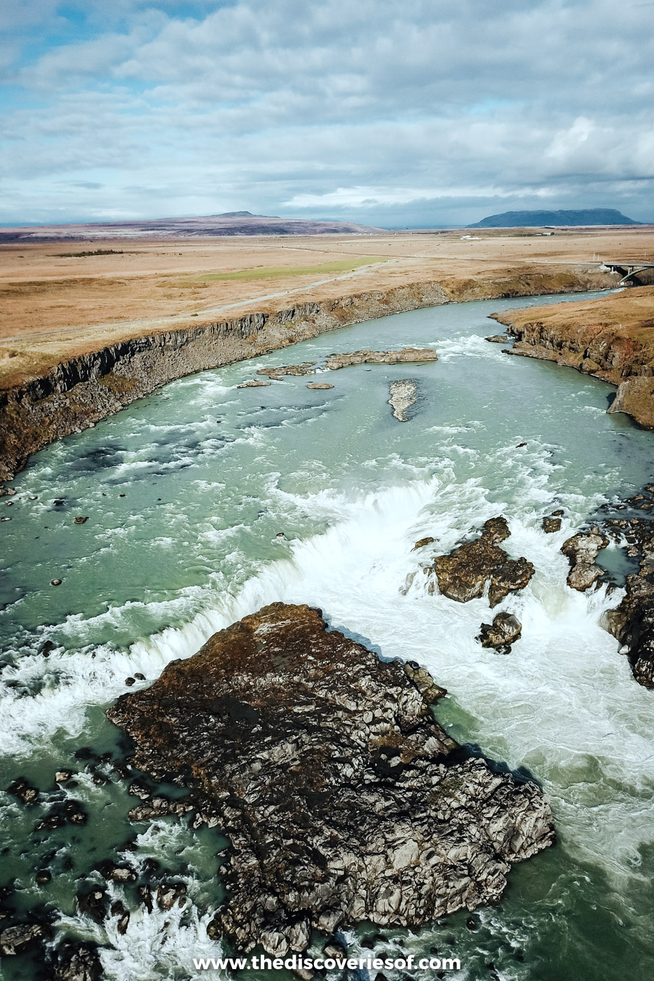
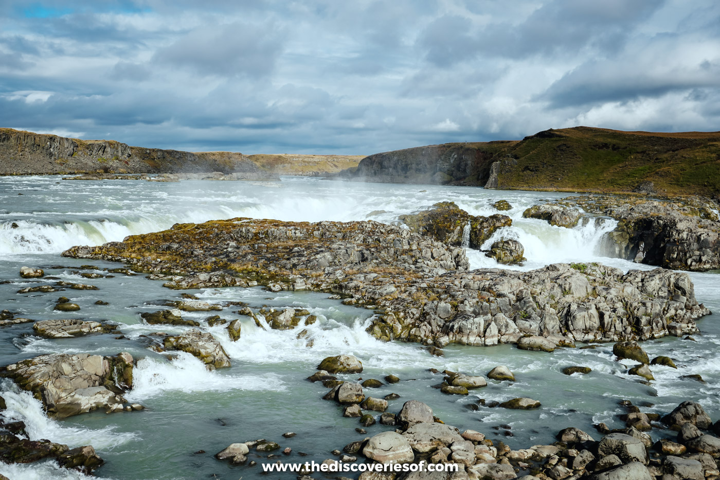
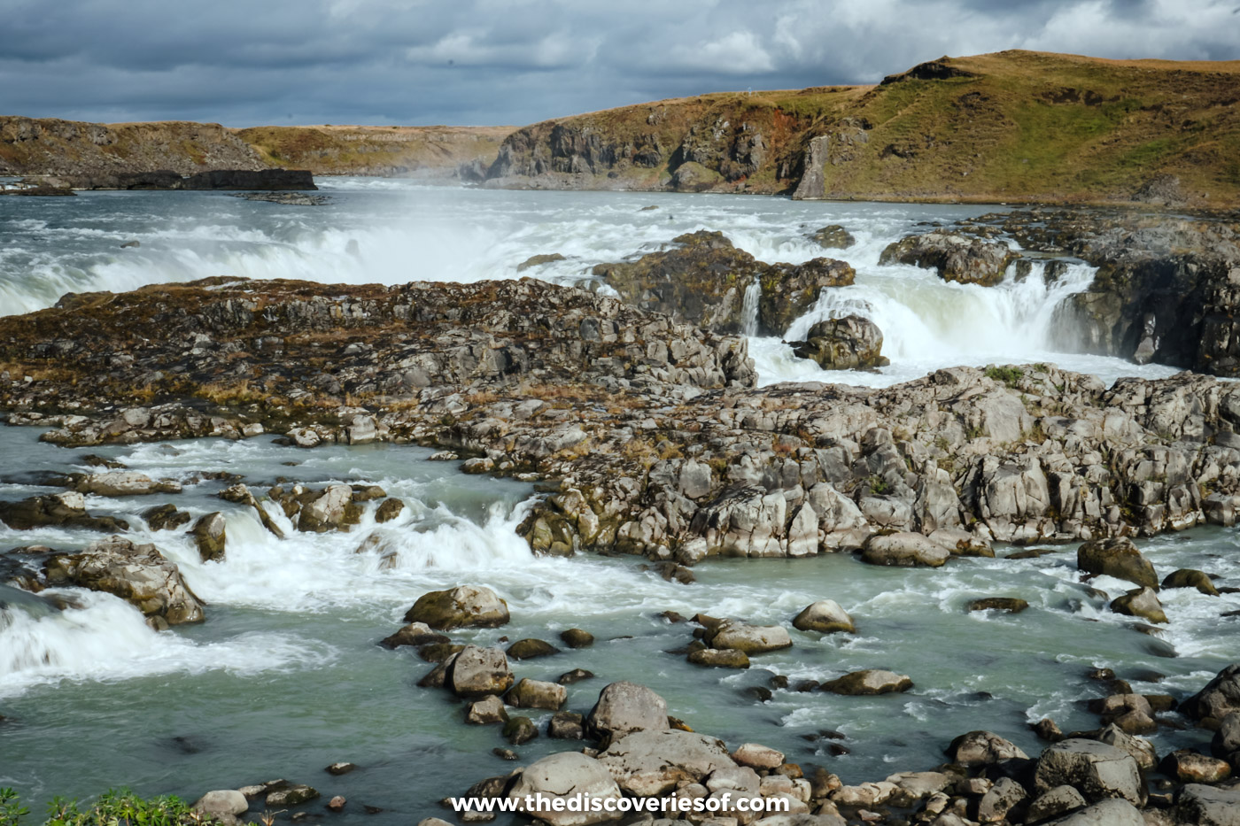
At first sight, this doesn’t look like a record breaker. There’s no tall plunge and no deep canyon, just a broad, broken step where the river drops a few metres and goes on its way. The scale only sinks in when you watch the volume of water hurtling over it.
On average, around 360 cubic metres pour over the edge every second. That’s roughly 360 tonnes of water, nearly twice the average flow of the famous Dettifoss in the north (about 193 cubic metres a second). Dettifoss still wins on power, thanks to its 44-metre drop. For sheer quantity of water, though, nothing in the country comes close to this one.
All of that water comes from the Þjórsá, the country’s longest river at 230 km. It rises at the Hofsjökull ice cap in the central highlands and gathers meltwater and tributaries all the way down, which is why it runs a milky grey-green: that’s glacial silt. It meets the Atlantic not far downstream.
The rock it tumbles over has a story of its own. The falls sit at the edge of the Þjórsá Lava (Þjórsárhraun), which poured out of the Veiðivötn area in the highlands around 8,600 years ago. It covers something like 970 square kilometres, making it the largest lava flow in Iceland and the biggest known from any single eruption since the last ice age.
Trout in the name, salmon in the river
Urriði means trout in Icelandic, but it’s salmon that make the Þjórsá famous. They run up the river each summer and gather in the pool below the falls, and farmers along its banks have netted them for generations. Anglers with permits fish here too, which is why the path down to the water’s edge is private: it’s for them, not for sightseers.
Will the falls survive?
In 1927, a company called Títan won permission to build a power station here, linked to a new railway to Reykjavik. It never happened. Landsvirkjun, the national power company, has since drawn up plans for a hydropower station at the falls with an underground powerhouse, which would divert most of the river through a tunnel and release it below. If it’s built, little would be left of the waterfall, and local people have campaigned against it for years.
In 2022, the Althing, the national parliament, put the project on hold in the country’s master plan for energy and nature. A review in 2024, though, recommended moving it back into the category that allows development. Nothing is settled, so I wouldn’t leave it off a south coast trip on the basis that you’ll catch it next time.
Walking to the falls
There’s very little walking involved. From the car park, a short, easy path leads to viewing points along the west bank, including a viewing platform that looks straight across the falls. This is the only side you can reach them from.
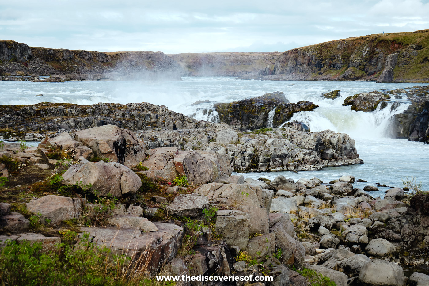
Stay on the viewing paths. The trail that carries on down to the river is the anglers’ private route, the rocks by the water are wet and slippery, and the current is ferocious: this is not a place to scramble down for a closer look.
The falls are wide and low, which makes them surprisingly tricky to photograph from the bank. A wide-angle lens helps, and so does walking along to the different viewpoints rather than shooting everything from one spot. From the air, you see the whole sweep of the river at once.
Top Tip
Flying a drone? The rules for small drones here match the EU’s: register as an operator first (visitors from outside the EU can do it at flydrone.is), keep the drone in sight, stay under 120 metres and keep well clear of people, including anglers on the bank.
Getting there and parking
Heading east from Selfoss on Route 1, look for the signed turning onto Urriðafossvegur just before the bridge over the Þjórsá. The car park is less than a kilometre down that road. Coming from the east, cross the bridge first and then turn left. Typing the waterfall’s name into your satnav or Google Maps will get you there.
Rough driving times without stops:
- Reykjavik: about an hour (around 75 km)
- Keflavík airport: about an hour and a half
- Selfoss: about 15 minutes
- Hella: about 20 minutes, and Hotel Rangá, where I stayed, under half an hour
- Vík: about an hour and a half
Parking is run by Parka, and cameras read your number plate on the way in. The first 10 minutes are free; after that it’s ISK 750 for up to two hours for a car with up to seven seats (larger vehicles pay more), plus a small online payment fee. Pay through the Parka app or website within 24 hours of leaving. Miss that and a late fee of ISK 1,960 is added and the bill goes to the vehicle’s owner, which for a hire car means your rental company, usually with its own admin charge on top.
There’s no bus stop at the falls, and it rarely features on coach tours, so you really need a car. If you’re hiring one, I’ve rounded up current car hire and fuel costs.
When to visit Urriðafoss
There are no opening hours: you can visit at any time of year.
June to August brings the longest days and the salmon run, and it’s the busiest time of year, though it’s rarely as crowded as the big south coast falls.
September is when I went. The summer crowds had gone, and the moorland around the river had turned a tawny brown. For a month-by-month view, see my guide to the best time to visit Iceland.
October to April means short days, snow and ice. In cold spells, ice can build up along the river around the falls, which is a sight in itself, but the access road and paths can be slippery. Check road.is for conditions and vedur.is for the forecast before you set out, and see my Iceland travel tips for winter driving.
As for fitting it in, it works well as a first or last stop on a south coast road trip, as it’s on the main road to and from Reykjavik and the airport. My 7 day Iceland itinerary saves it for the final day.
Nearby stops worth adding
- Selfoss. The nearest town, about 15 minutes west, with fuel, supermarkets and cafés.
- Kerið. A red volcanic crater with a blue lake at the bottom, about half an hour away. It’s one of the optional stops in my Golden Circle guide.
- Gullfoss. Route 30 heads north from just west of the falls through Flúðir to Gullfoss, about an hour and 10 minutes away, so you can join the Golden Circle from here.
- Þjórsárdalur. Follow the same river inland for about 50 minutes to Hjálparfoss, a double fall over twisted basalt columns, and the mossy gorge at Gjáin.
- The LAVA Centre. About half an hour east in Hvolsvöllur, the best place to get to grips with the volcanoes you’ll see on the south coast. It’s in my guide to things to do in Iceland.
- Seljalandsfoss and Gljúfrabúi. About 45 minutes east: the waterfall you can walk behind and its neighbour Gljúfrabúi, hidden inside a gorge.
Quick answers before you go
Is it worth the detour?
For me, absolutely. It’s minutes from the main road, it’s rarely crowded, and the sheer volume of water is something you don’t get at the taller, more famous falls. For more of the waterfalls I’d put on a south coast drive, see my guide to Iceland waterfalls.
Do you have to pay?
The falls are free, but parking isn’t: ISK 750 for up to two hours in a standard car, with the first 10 minutes free.
Is it the most powerful waterfall in the country?
It has the highest average flow, at around 360 cubic metres a second. Dettifoss is the more powerful because its water falls much further.
Can you get down to the water?
No. The path to the riverbank is private and reserved for anglers with fishing permits. Keep to the viewing paths and the platform.
Map
Read next
- Iceland waterfalls: 25 of the best
- Iceland off the beaten path: hidden gems to discover
- Seljalandsfoss: how to walk behind the waterfall
- Iceland’s Golden Circle
- 7 day Iceland itinerary
- Things to do in Iceland
Love this? Save and share on Pinterest


Discover the top things to do, insider tips and hidden gems in our Iceland Travel Guide.
Read the guides →