


One of them is a salt flat so big and so flat it has been used to calibrate satellites. Another is a glacier that has started, quietly, to shrink. A third you can only see properly from a small plane. Some of these landmarks are a bus ride from a capital city; others take a flight, a boat and a long walk. Here is what makes each one special, and what it takes to get there now.
South America is a continent of big landmarks. Some are the work of nature on a scale that is hard to take in until you are standing in front of it; others are the work of empires, artists and architects, from Inca stonemasons to a painter who spent 36 years building his own house on a cliff.
These are the famous landmarks of South America that I think deserve a place on any bucket list, from the Andes to the Atlantic and the far south of Patagonia. Some of my best travel memories are on this list: I have crossed the Bolivian altiplano twice, walked the W Trek in Torres del Paine on my own, watched the sun come up over the Valle de la Luna with nobody else around and seen Iguazú from both sides of the border, five years apart. Rio is a city I have gone back to again and again since my first trip to Brazil.
For each landmark you’ll find why it matters, how to get there, what it costs at the time of writing and the details that have changed recently, because quite a lot has.
The most famous landmarks in South America
Walk among the terraces of Machu Picchu, Peru

Of all the landmarks on the continent, Machu Picchu might be the most famous, and it lives up to it. The Inca citadel was built around 1450, most likely as a royal estate for the emperor Pachacuti, on a saddle of rock 2,430 metres up between two peaks, with the Urubamba River looping far below. More than 150 buildings, from temples to houses and storerooms, sit among hundreds of agricultural terraces, linked by stone staircases that still feel impossibly steep.
Most visitors arrive by train from Cusco or Ollantaytambo to Aguas Calientes, the town at the foot of the mountain, then take the bus up the switchback road to the gates. Aguas Calientes grew up very fast, and you can pay a lot for not very much, but I still think it is the best place to stay if you aren’t hiking in. I stayed at the Inkaterra Machu Picchu Pueblo Hotel, set in gardens and cloud forest on the edge of town, and it made the perfect base for the ruins and for exploring the valley around them.
Tickets
Tickets are sold only through the Ministry of Culture’s official site, tuboleto.cultura.pe. A standard circuit ticket costs foreign adults S/163 since May 2026, when a conservation charge was added, and more with Huayna Picchu or Machu Picchu Mountain. Entry is by hourly slot from 6am, numbers are capped at 5,600 a day in high season, and an authorised guide is officially required.
There are three circuits around the citadel, and each ticket covers just one, so choose before you book. If you have more time, the Inca Trail to Machu Picchu is a four-day trek that follows the old Inca road to the Sun Gate. Permits are limited, sell out months ahead and the trail closes every February for maintenance. Short on time? A full-day tour from Cusco takes care of the trains, the bus and the guide. My guide to beating the crowds at Machu Picchu has the timings, and there’s more to see across Peru.
Trace the Inca stonework of Cusco and the Sacred Valley, Peru

Before the Spanish arrived, Cusco was the capital of an empire that ran the length of the Andes, and the colonial city still stands on Inca foundations. Fitted stone walls line the old streets, a convent sits on top of the Qoricancha sun temple, and on the hill above town, the zigzag ramparts of Sacsayhuamán are built from blocks weighing well over 100 tonnes, laid without mortar.
North of the city, the Sacred Valley follows the Urubamba River several hundred metres lower down, which makes it a gentler place to acclimatise. Terraces climb the mountain above Pisac, Ollantaytambo still lives on its Inca street plan, the sunken circular terraces of Moray were probably used to test crops, and at Maras, thousands of salt pans step down the hillside, worked since before the Incas.
I loved Cusco, and I headed out into the Sacred Valley from there. Give the city a few days of its own rather than passing straight through on the way to Machu Picchu.
Tickets
The Boleto Turístico del Cusco covers Sacsayhuamán, Pisac, Ollantaytambo, Chinchero and Moray. It’s sold in person at the sites and the ticket office on Avenida El Sol: S/130 for 16 sites over ten days, or S/70 for a single circuit (Circuit III is the four valley sites, over two days). The cathedral and the Qoricancha church charge separately, and Maras costs foreigners S/20, seen from the paths only. Pisac is about an hour from Cusco by road and Ollantaytambo up to two, by tour, taxi or colectivo.
Lose the horizon on the Salar de Uyuni, Bolivia

No salt flat on earth is bigger than the Salar de Uyuni: 10,582 square kilometres of white crust at 3,656 metres, left behind when a prehistoric lake dried out. It is so flat that it has been used to calibrate satellites, and the salt cracks into hexagons that run all the way to the horizon.
I have crossed the altiplano to get here twice. The first time, I came from Tupiza on a four-day trip that ended with a pre-dawn start and the sun rising over the salt with not another vehicle in sight. It is still one of my favourite travel moments anywhere. The second time, in July, I set out from San Pedro de Atacama in Chile with Cordillera Traveller, past red and green lagoons full of flamingos and up to nearly 5,000 metres, with nights near Laguna Colorada that dropped to around -15°C.
Out in the middle, the rocky island of Isla Incahuasi bristles with giant cacti, with a view across the white from the top (entry is 30 bolivianos). Between January and March, rain can turn the flats into a vast mirror, though it can also flood the routes and close the border crossing.
You can see the salar on a day trip from the town of Uyuni, but the classic way in is a three- or four-day 4×4 tour from Tupiza or from San Pedro de Atacama, which is how you see the lagoons too.
Getting There
Shared four-day tours from San Pedro start at about US$300. Bring cash for the park fees, including 150 bolivianos for the Eduardo Avaroa reserve, as there are no cash machines along the way.
Spot flamingos on the red water of Laguna Colorada, Bolivia
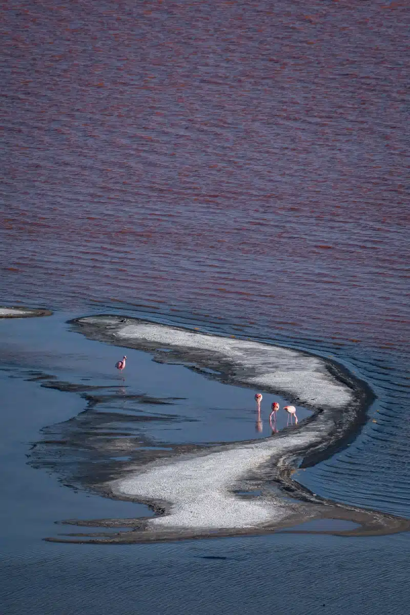
In the far south-west of Bolivia, inside the Eduardo Avaroa Andean Fauna National Reserve, Laguna Colorada is a lake the colour of brick, rust or red wine, depending on the hour. Pigmented algae and reddish sediment are behind it, and the shade shifts with the sun and the wind. Islands of white borax break up the surface, making the red look stranger still.
The lagoon sits at 4,278 metres and spreads across some 60 square kilometres, yet it averages only about 35 centimetres deep. That shallow, mineral-rich water is perfect flamingo territory: all three Andean species feed here, James’s flamingos in the greatest numbers, and it has been a protected Ramsar wetland since 1990.
I reached it on my July crossing from San Pedro de Atacama (see the Salar de Uyuni entry above). The blood-red water barely looked real to me, more like a landscape seen through infrared goggles, and flamingos were picking their way through the shallows just below the shore.
Tickets
The lagoon is covered by the 150-boliviano Eduardo Avaroa reserve ticket, paid in cash at the ranger post as you enter. Keep it, as rangers check it again on the way out. You’ll see the lagoon on a 4×4 tour: the three-day circuit from Uyuni, four-day trips from Tupiza, or tours from San Pedro, which cross the border at Hito Cajón (4,480 metres) and usually reach the lagoon by mid-afternoon on day one. Stay out of the water and keep drones well away from the flamingos.
Hike to the granite towers of Torres del Paine, Chile
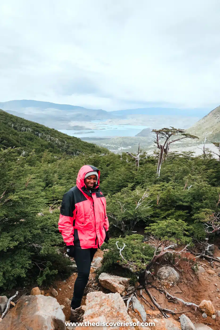
Three granite spires rising straight out of the Patagonian steppe give Torres del Paine its name, and the national park around them is one of the great hiking destinations on the planet: glaciers, turquoise lakes, the horn-shaped peaks of Los Cuernos and guanacos grazing by the road.
The park had been on my wish list for as long as I can remember, and when I finally went, it was January, the height of the southern summer. I hiked the five-day W Trek on my own, from west to east, which saves the walk up to the towers for the end. It was the longest hike I’d ever attempted at that point, and in five days I had rain, blazing sun and gusts strong enough to knock me off my feet. The safety talk at Erratic Rock in Puerto Natales, with its warnings of 80 km/h winds, had me wondering what I’d signed up for. It turned out to be one of the most memorable things I’ve ever done.
You don’t need to do the whole W to see the landmark itself. The hike to the Mirador Base Torres, where the towers stand above a glacial lagoon, is a long day from the Welcome Centre near Hotel Las Torres.
Tickets
Everyone needs a park ticket bought in advance online from CONAF’s Pases Parques site (cash is no longer taken at the gates). The multi-day ticket for foreign adults has been around CLP 48,500. Campsites and refugios on the W must be booked before you arrive, and they fill up fast for December to February.
Hear the ice crack at the Perito Moreno Glacier, Argentina
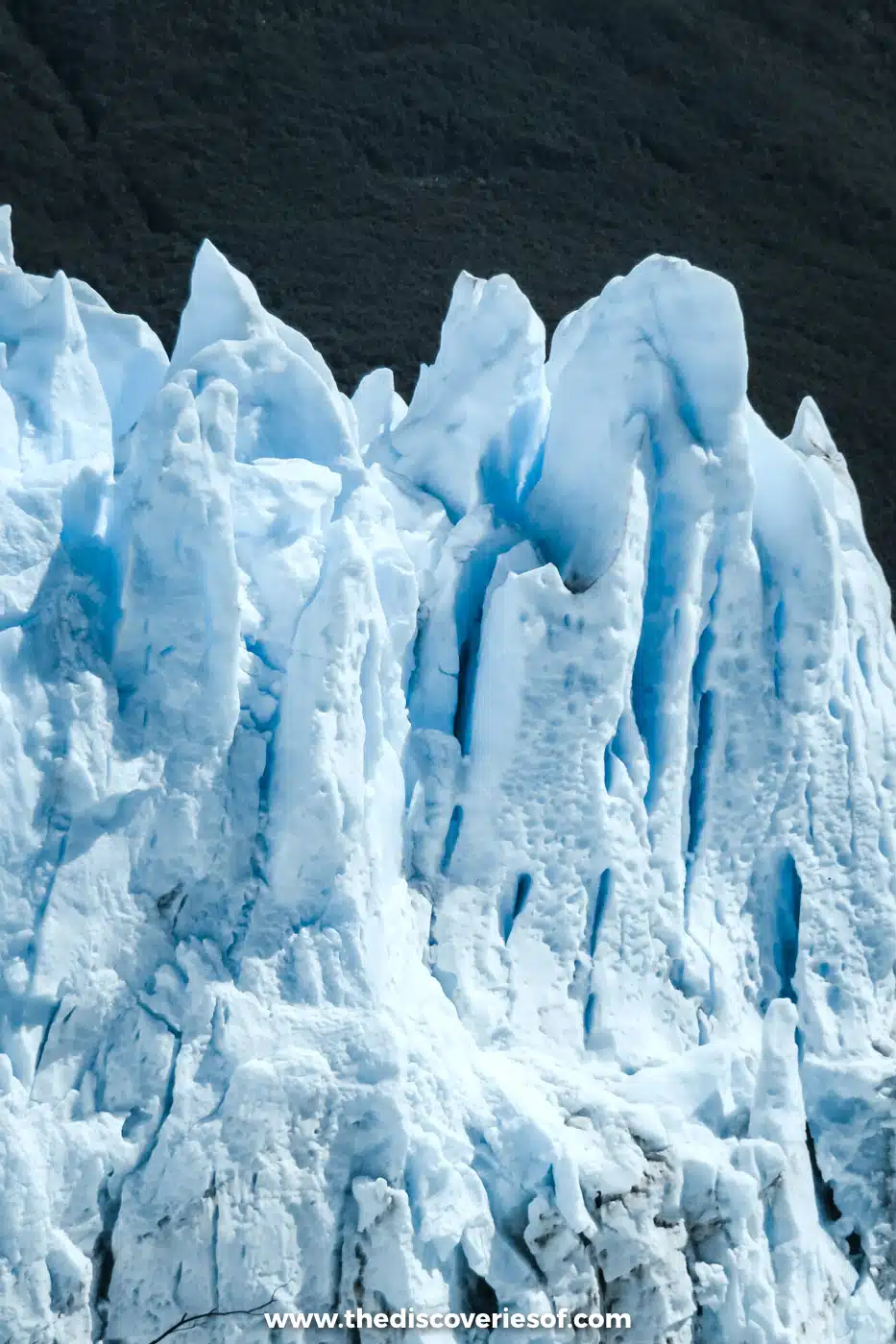
The Perito Moreno Glacier is a wall of ice around five kilometres wide and up to 70 metres high, flowing about 30 kilometres from the Southern Patagonian Ice Field into Lago Argentino, in Los Glaciares National Park. What makes it unforgettable is the noise. Every so often there’s a crack like a gunshot and a slab of ice the size of a building drops into the lake, and the sound reaches you before you’ve worked out where it came from. On its own, it would justify the long trip south, and the zoom on my little compact camera was what let me catch the ice mid-fall.
The glacier was famous for decades as one of a handful of glaciers anywhere that wasn’t shrinking. That has changed. A study published in August 2025 found it had been broadly stable until 2019 but has since pulled back by more than 800 metres in places, and it is thinning fast at the front. It is still extraordinary to stand in front of, but it is a reason to go sooner rather than later.
A network of boardwalks faces the ice, close enough to feel the cold coming off it, and boat trips run along its south face. To walk on the glacier itself, book the Minitrekking on the Perito Moreno Glacier, with crampons and a guide.
Getting There
The glacier is about 80 km from El Calafate, around 90 minutes’ drive, and you can get there by bus, tour or hire car. Foreign visitors pay AR$50,000 a day to enter the park, and the park is open from 8am to 8pm from October to April, closing at 6pm from May to September.
I love El Calafate as a base, and El Chaltén, beneath Fitz Roy, is three hours up the road.
Trek beneath the spires of Fitz Roy and Cerro Torre, Argentina
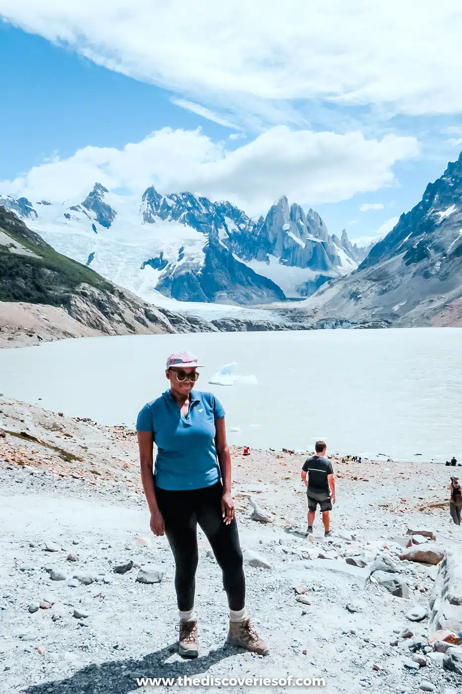
At the northern end of Los Glaciares National Park, two granite towers rise almost sheer above the forest and ice. The Tehuelche called Fitz Roy Chaltén, the smoking mountain, after the cloud that so often wraps its summit. Cerro Torre is a slimmer needle, and an Italian claim to have climbed it in 1959 is still disputed. Both are reached on foot from El Chaltén, and my guide to the best hikes in El Chaltén covers every trail.
I went on a day trip from El Calafate, and it may well be my favourite outing from the town. On a bright, clear day in January I walked to Laguna Torre and stood on the moraine watching icebergs from the glacier drift beneath Cerro Torre. With one day, it’s the hike I’d pick: about 18km there and back, with far less climbing than the Fitz Roy hike. The classic Fitz Roy view, over Laguna de los Tres, takes roughly 20km to 24km return and ends in a steep, loose 400-metre climb, so stay a night or two in town for it.
Tickets
Since October 2024, the trails need a Parques Nacionales ticket, bought online in advance and checked at the trailheads. Foreign visitors pay AR$50,000 a day, with 50% off a second visit inside 72 hours, or AR$100,000 for three days. Buses from El Calafate take about three hours, from around US$30 each way, with the town’s day-visitor charge included. From May to September, poles and crampons are compulsory.
Watch the light change in the Valle de la Luna, Chile

A few kilometres from San Pedro de Atacama, the Valle de la Luna really does look like the surface of the moon: ridges of salt and clay folded and sharpened by wind, a giant dune, and rock formations such as the Three Marys, all in shades of pink, cream and rust that shift by the minute as the sun moves.
I drove in at dawn on a campervan road trip through the Atacama and had the whole valley to myself, which is still one of my favourite memories from four trips to Chile. That kind of visit isn’t possible any more: the gates don’t open until 8am or 9am now, depending on the season, and tickets must be bought online in advance for a fixed date. Going at opening time is still the quietest way to see it.
Tickets
Tickets are sold only through the valley’s official website, which is run by the local indigenous communities together with CONAF. Adults pay CLP 10,800. The trails close between 4:30pm and 5:30pm, and the Mirador de Ckari, the classic sunset viewpoint, has been closed since late May 2026, so check before you book a sunset tour.
The valley is one of a string of extraordinary sights around San Pedro, from altiplano lagoons to hot springs, all in my round-up of the best things to do in the Atacama Desert.
Catch sunrise at the El Tatio geysers, Chile

High in the Andes north of San Pedro de Atacama, El Tatio is the biggest geyser field in the Southern Hemisphere and the third biggest in the world, after Yellowstone and Russia’s Valley of Geysers. Around 80 geysers erupt among hundreds of fumaroles, boiling pools and crusts of mineral sinter at about 4,320 metres, in a basin ringed by volcanoes.
I’ve been for sunrise twice: once at the end of a campervan road trip through the Atacama, and again in July, when it was -15°C at the field. Both were worth the alarm at 3am. The field is at its most active in the freezing air before dawn, with columns of steam rising everywhere you look, and it calms down once the sun warms the ground. Stay for the moment the first light catches the steam over the southern field.
Tickets
The Atacameño communities of Toconce and Caspana manage the field, which opens daily from 6am to 4pm. Adults pay CLP 15,000 in cash at the gate. It’s about 89km from San Pedro, roughly an hour and a half by road, and most tours leave town between 4:30am and 5am with breakfast and the entry fee included. Spend a few days acclimatising in San Pedro first, wear thick-soled shoes and every layer you own, and keep to the marked paths: the crust around the vents is thin.
Climb the painted hills of Valparaíso, Chile
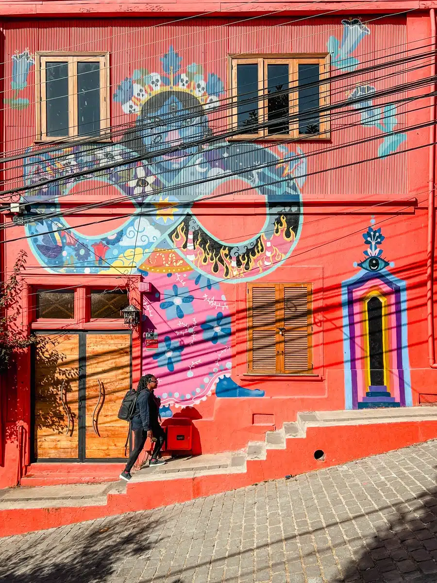
Chile’s great port city tumbles down dozens of steep hills to the Pacific, and Valparaíso still looks much as it did in its late 19th-century heyday, when it was the leading merchant port on South America’s Pacific coast. British and German merchants built mansions, churches and promenades on Cerro Alegre and Cerro Concepción, and funiculars known as ascensores were hauled up the slopes to reach them. The Panama Canal ended the boom in 1914, which is partly why so much survived, and UNESCO inscribed the historic quarter in 2003.
I spent a July day here on a coast tour from Santiago, with stops at a Casablanca Valley winery and in Viña del Mar. It was midwinter, yet the sky was a clear, brilliant blue. I took the Ascensor Reina Victoria up to Cerro Alegre, followed the mural-covered stairs across to Cerro Concepción, saw Neruda’s house, La Sebastiana, and refuelled with an empanada de pino at La Conquistada that was a meal in itself.
Getting There
Buses from Santiago’s Terminal Alameda run several times an hour, take 1 hour 30 minutes to 2 hours and cost about CLP 4,500 to 8,000. Seven ascensores are running in 2026, Reina Victoria, Concepción and El Peral among them, from 7am (8am at weekends) to 9:30pm; foreign visitors pay CLP 1,000 a ride in cash. Artillería has been closed since 2021. The UK Foreign Office warns that muggings are frequent here, so keep valuables hidden in the lower town and take a taxi after dark.
Feel the roar of Iguazú Falls, Argentina and Brazil
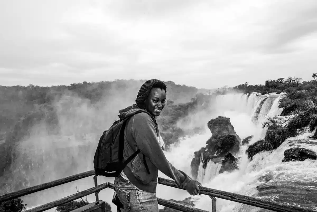
Iguazú is the largest waterfall system in the world: around 275 separate falls spread along 2.7 kilometres of the Iguazú River, on the border between Argentina and Brazil. The heart of it is the Devil’s Throat, a U-shaped chasm where the main flow of the river drops 82 metres into a permanent cloud of spray. On a sunny day, the mist is full of rainbows.
On my first visit, the sound struck me as much as the sight: a constant, thundering roar that you feel as much as hear. There was a five-year gap before I made it to the other side of the border, and when I did, I wished I’d gone sooner. The two sides are completely different. In Argentina, a network of walkways and a little train take you right over and alongside the falls, including a catwalk to the lip of the Devil’s Throat. In Brazil, a single, easy trail gives you the panorama of the whole system, ending on a platform out in the spray.
Tickets
Each country runs its own national park with its own ticket. On the Argentine side, foreign visitors pay AR$60,000 from June 2026; the Brazilian side charges separately in reais.
If you only have one day, a both-sides tour handles the border crossing for you.
The surrounding rainforest is a UNESCO World Heritage Site on both sides, home to toucans, butterflies by the thousand and gangs of coatis that will steal your lunch given half a chance.
Stand beneath Christ the Redeemer, Brazil

Arms spread 28 metres wide across the summit of Corcovado, 700 metres above Rio de Janeiro, Christ the Redeemer is the most famous landmark in Brazil and one of the most recognisable statues in the world. The Art Deco figure was completed in 1931: 30 metres of reinforced concrete clad in a mosaic of soapstone tiles, standing on an eight-metre pedestal, and in 2007 it was voted one of the New Seven Wonders of the World.
Rio is a city I have gone back to again and again since my first trip to Brazil, and the statue is one of those landmarks you can see from almost everywhere in it, watching over the beaches, the favelas and the forest. Up close, the views down over Sugarloaf, Copacabana and Guanabara Bay are every bit as spectacular as the statue.
The most scenic way up is the Corcovado cog train, which climbs through the Atlantic Forest of Tijuca National Park in about 20 minutes, with departures every 20 minutes. Official vans also run from the Paineiras visitor centre. Fit walkers can hike up from Parque Lage in two to three steep hours; go with a guide or a group, as there have been robberies on the trail.
Tickets
The train costs R$134 for adults, the same price all year, and the Paineiras vans R$87. The escalators near the top are being replaced with inclined lifts, so for now expect around 80 steps on the final stretch.
Ride the cable car up Sugarloaf Mountain, Brazil

Sugarloaf Mountain (Pão de Açúcar) is the granite dome that rises 396 metres straight out of the Atlantic at the mouth of Guanabara Bay, and it’s the other half of Rio’s famous skyline. The cable car, which first ran in 1912, goes up in two stages: from Praia Vermelha to Morro da Urca, then on to the summit, about three minutes each.
I’ve hunted down plenty of viewpoints in Rio, and none of them beats the top of Sugarloaf. Go up in the early evening, and you can watch the sun set behind the city and see Christ the Redeemer lit up on Corcovado across the water.
You can’t walk to the very top without technical climbing gear and a guide, but you can hike the first stage. The Pista Cláudio Coutinho path starts at Praia Vermelha, and a trail branching off it climbs through the forest to Morro da Urca in about 30 minutes, where you can buy a ticket for the second cable car. Hike up, ride on, I say.
You can buy an official Sugarloaf cable car ticket online before you go.
Tickets
An adult ticket costs from R$205. The cable car runs daily from 7:30am, with the last cars up at 7:30pm and the park open until 9pm. There are bars and restaurants at both stops.
Wander the painted houses of Caminito, Argentina

This next landmark is as quirky as they come. Caminito is a short pedestrian street in La Boca, the old port neighbourhood of Buenos Aires, lined with houses of corrugated metal painted in clashing blues, yellows, reds and greens. The tradition goes back to the immigrant dock workers, many of them Italian, who painted their homes with whatever was left over from the ships.
The street itself was turned into an open-air museum in 1959 by the local painter Benito Quinquela Martín, and it takes its name from a 1926 tango by the composer Juan de Dios Filiberto, who grew up nearby. Today, tango dancers perform outside the restaurants, and artists sell paintings and crafts along the pavements. The Boca Juniors stadium, La Bombonera, is a few blocks away.
I went to Buenos Aires for two days and stayed for two weeks, and La Boca is one of the three neighbourhoods I’d tell anyone to make time for, along with San Telmo and Palermo. Caminito can feel a little like a stage set in the middle of the day, so wander the streets around it too, and stick to the busy areas, as the neighbourhood beyond the tourist blocks isn’t one to explore on foot after dark. My three-day Buenos Aires itinerary fits it in.
Count the colours on Rainbow Mountain, Peru

I’ve written about Rainbow Mountain in Peru at length before, and it’s still one of the most colourful landmarks in South America. Vinicunca’s slopes are striped in red, ochre, gold, lavender and green, layers of mineral-rich sediment that have been folded and tilted over millions of years, with iron oxides giving the reds and other minerals the yellows and greens.
For a long time the mountain was largely hidden under snow and ice. As that cover retreated, the stripes came into view, and from the mid-2010s photos of them turned a remote ridge in the Andes into one of Peru’s biggest attractions, thanks, it seems, to a warming climate (sense my sarcasm).
The viewpoint is at around 5,030 metres, so this is a hike to take seriously, and it’s best done after a few days acclimatising in Cusco. The most popular way to go is on a day tour from Cusco, which picks you up at around 3am for the three-hour drive, followed by one to two hours of steady uphill walking. Tours usually include the community entrance fee; the side trip to the Red Valley costs S/30 extra in cash. Go as early as you can, as the clouds often roll in by late morning.
Fly over the Nazca Lines, Peru

Etched into the desert of southern Peru between about 500 BC and AD 500, the Nazca Lines are hundreds of giant figures, straight lines and geometric shapes, including a monkey, a spider, a condor and a hummingbird around 90 metres long. They were made by removing the dark, iron-stained stones on the surface to reveal the paler ground beneath, and the dry, stable climate has preserved them for 2,000 years. Why they were made is still debated, though most archaeologists link them to water and ritual. They have been a UNESCO World Heritage Site since 1994.
The figures are so big that they only really make sense from the air. Light aircraft fly from the small airport at Nazca on 30- to 35-minute circuits over the main figures, and expect to pay around US$105 to US$120 all in, including the airport tax and the tourist ticket. Mornings are usually calmer, and the planes bank steeply, so skip a big breakfast. Longer, pricier flights also leave from Pisco, near Paracas, which pairs well with a boat trip to the Ballestas Islands.
If flying doesn’t appeal, a 13-metre observation tower beside the Pan-American Highway gives you a view of three of the figures for a few soles.
Meet the wildlife of the Galápagos Islands, Ecuador

About 1,000 kilometres off the coast of Ecuador, the Galápagos Islands were the very first place inscribed as a UNESCO World Heritage Site, in 1978, and they are the natural landmark that changed science. The islands’ finches, tortoises and mockingbirds helped Charles Darwin develop his theory of evolution after his visit in 1835.
What makes them extraordinary is how unafraid the wildlife is. Sea lions doze on park benches, marine iguanas pile up on black lava, blue-footed boobies dance a few feet from the path, and the Galápagos penguin, the only penguin species found north of the equator, fishes in the cool currents off Isabela and Fernandina.
Flights from Quito and Guayaquil land on Baltra or San Cristóbal. From there, you either base yourself on the inhabited islands (Santa Cruz, San Cristóbal and Isabela) and take day trips by boat, or join a cruise, which is the only way to reach the more remote islands.
Tickets
Foreign adults pay a US$200 national park fee on arrival (raised from US$100 in August 2024), plus US$20 for the transit control card bought before you fly.
Gaze up at Angel Falls, Venezuela

I’ll make a bold statement: Angel Falls (Kerepakupai Merú in the Pemón language) is one of the most impressive natural landmarks in South America. It is the tallest uninterrupted waterfall in the world, at 979 metres, with a single plunge of 807 metres from the rim of Auyán-tepui, one of the vast table-top mountains in Canaima National Park.
Reaching it is an adventure in itself. There are no roads: you fly into the village of Canaima, then either take a scenic flight past the falls or travel upriver by motorised dugout canoe and walk through the forest to a viewpoint at the foot of the falls. The river trips only run when the water is high enough, roughly in the rainy season from about June to November, which is also when the falls are at their most powerful. In the dry months, they can thin to a trickle. You’ll need a local operator for all of it.
It is a place you experience with every sense: the roar, the spray, the scale of the tepui walls. If you couldn’t tell, I’m seriously smitten with these falls.
Top Tip
Check the latest travel advice before you plan anything. The UK Foreign Office currently advises against all but essential travel to most of Venezuela, and against all travel to some border and mining areas of Bolívar state, the state that Canaima is in.
Cross the gorge to Las Lajas Sanctuary, Colombia

Colombia’s Las Lajas Sanctuary looks like something out of a fairy tale: a grey and white neo-Gothic basilica built into the side of the Guáitara River gorge, standing on a bridge about 50 metres above the water and rising 100 metres from the canyon floor. The current church took 33 years to build, from 1916 to 1949.
It marks the spot of a miracle said to have happened in 1754. A local woman, María Mueses de Quiñones, and her deaf-mute daughter, Rosa, sheltered from a storm among the great lajas (flat slabs of rock) by the river, where Rosa saw an image of the Virgin Mary on the rock and spoke for the first time. That image is still there, framed by the altar. Pretty impressive, if you ask me.
The sanctuary is just outside Ipiales, in the far south of Colombia, less than 11 kilometres from the Ecuador border. Taxis and minibuses run from the town in about 15 minutes, and a cable car links the sanctuary with the village of Las Lajas above.
Top Tip
Ipiales is the usual crossing point between Colombia and Ecuador at Rumichaca, so the sanctuary makes an easy stop on an overland trip between Quito and southern Colombia. The UK Foreign Office advises against all but essential travel within 5 km of the Ecuador border, but Ipiales and the Rumichaca crossing are exempt: check the current advice before you go.
Walk the walls of Cartagena’s old town, Colombia

On the Caribbean coast of Colombia, Cartagena de Indias has some of the most complete colonial fortifications in the Americas. Founded in 1533, it became one of Spain’s most important ports, and the walls, around 11 kilometres of them, were built over two centuries to protect it from pirates and rival empires. The walled city and its fortresses have been a UNESCO World Heritage Site since 1984.
Inside the walls, the old town is a grid of cobbled streets, flower-draped balconies and pastel houses, with grand churches and plazas such as the Plaza de Santo Domingo, where Fernando Botero’s reclining bronze, Gertrudis, has become a landmark in its own right. Walk along the top of the walls at sunset, when the sea breeze kicks in, and cross to the Castillo San Felipe de Barajas, the largest Spanish fortress in the Americas, on a hill just outside the old town. Getsemaní, the neighbourhood next door, is the place for street art and a livelier evening.
Come face to face with the moai of Easter Island, Chile

Easter Island, or Rapa Nui, is one of the most remote inhabited places on earth: a speck of volcanic rock in the Pacific Ocean about 3,700 kilometres west of mainland Chile. It was settled by Polynesian voyagers, probably around AD 1200, and the Rapa Nui people carved the giant stone figures called moai over the following centuries.
There are nearly 1,000 moai on the island, averaging about four metres tall. Most were carved from volcanic tuff at the Rano Raraku quarry, where hundreds still lie half-finished in the hillside, and most are thought to represent deified ancestors, set on stone platforms called ahu with their backs to the sea, watching over their villages. The 15 restored figures of Ahu Tongariki, lined up against the waves, are the classic sunrise shot.
Flights leave from Santiago, so most visitors spend a day or two in the capital on the way.
Getting There
LATAM is the only airline that flies to the island, mostly from Santiago, about five and a half hours away. Foreign visitors need a Rapa Nui National Park ticket, which costs about US$80, is valid for ten days and is cheaper paid in Chilean pesos, and since 2022 most archaeological sites can only be visited with a registered local guide.
Find La Mano on Playa Brava, Uruguay

While you might not recognise the name, I guarantee you’ll recognise this one. La Mano is a giant concrete hand, five fingertips rising out of the sand on Playa Brava in Punta del Este, Uruguay’s glossiest beach resort.
The Chilean sculptor Mario Irarrázabal made it in 1982 during an open-air sculpture meeting in the town, and its official name, Monumento al Ahogado (monument to the drowned man), is a nod to the strong waves on this side of the peninsula, where swimming is often risky. He went on to make hands in other places, including the Mano del Desierto in Chile’s Atacama Desert. La Mano is the one that became a national icon, and you’ll often find a queue of people waiting for a photo on top of a finger.
It sits at Parada 1 on Playa Brava, a short walk from the centre of Punta del Este, and it’s free to visit at any time. Go early in the morning or late in the evening for photos without the crowds.
Stay for sunset at Casapueblo, Uruguay

Casapueblo is a magnificent clifftop landmark at Punta Ballena, about 13 kilometres from Punta del Este. Its white, curving walls and terraces wouldn’t look out of place in Mykonos, though the artist who built it compared it to a hornero’s nest, the mud nest of a local bird.
The Uruguayan painter and sculptor Carlos Páez Vilaró started it in 1958 around a small wooden hut made of planks from the beach, and kept building, mostly by hand, for 36 years, as his studio and summer home. He died here in 2014. Today, the main dome houses a museum and gallery of his paintings, sculpture and ceramics, and the rest of the building is the Club Hotel Casapueblo, with a restaurant on its terraces.
Time your visit for the end of the day. Every evening since 1994, as the sun sinks into the sea, a recording of Páez Vilaró reading his poem to the sun is played on the terraces. Book a guided tour of Punta del Este from Montevideo to see both Casapueblo and La Mano in a day.
Tips for visiting South America’s landmarks
- Book the big ones early. Machu Picchu, the Inca Trail, the campsites and refugios in Torres del Paine and the Valle de la Luna all sell tickets online for fixed dates, and the first three can sell out months ahead in high season.
- Respect the altitude. Machu Picchu, Rainbow Mountain, the Salar de Uyuni and El Tatio are all high, and Rainbow Mountain and the altiplano crossing from San Pedro go above 4,500 metres. Spend a few days acclimatising in Cusco or San Pedro de Atacama first, and drink plenty of water.
- Pair the landmarks that sit together. Christ the Redeemer and Sugarloaf share a city, the Valle de la Luna and the Salar de Uyuni are linked by the tour from San Pedro, and the Perito Moreno Glacier and Torres del Paine are six hours apart by bus. The 2-week South America itineraries put several of these together.
- Fly the long distances, drive the wild places. Distances are huge, so flights are worth it between regions. Hiring a car makes less sense in the big cities, but it opens up the Atacama and Patagonia, where a car lets you beat the tour buses to the viewpoints.
- Check the travel advice. Venezuela and parts of Colombia’s border regions carry Foreign Office warnings, and rules at national parks change often, so check the official sites before you book.
Map
Read next
- Got 2 weeks in South America? Six itineraries that actually work
- The ultimate South America bucket list
- Famous landmarks in Brazil
- Stunning landmarks in Argentina
- Incredible things to do in Chile
- Unmissable things to do in Argentina
- Stunning places to visit in Bolivia
- Torres del Paine W Trek: a step-by-step guide to hiking the W in Patagonia
- Awesome places to visit in South America
- San Pedro de Atacama to Uyuni: my honest guide to the four-day tour
- 21 Bolivian landscapes so surreal they look like another planet
Love this? Save and share on Pinterest

Discover the top things to do, insider tips and hidden gems in our South America.
Read the guides →