Crete is one of the great hiking islands in the Mediterranean — and I don’t think nearly enough people treat it that way. Here are the walks that have stayed with me.
Crete gets a lot of credit for its beaches, its food, its Venetian harbours and its Minoan ruins — and rightly so. But the island’s hiking is something else. More than 400 gorges carve through the limestone mountains, the White Mountains rise above 2,400 metres, and the E4 long-distance trail runs the entire length of the island from east to west.
I’ve been coming back to Crete for years, and every time I find myself wanting to do more of it on foot. The scale of the island means you can move from dramatic mountain gorges to coastal trails to high alpine plateaus within a single visit — and it all looks wildly different.
These are the walks that have genuinely earned their place on the list.
Best Walks in Crete
Samaria Gorge
16km · 5–7 hours · Medium–Hard
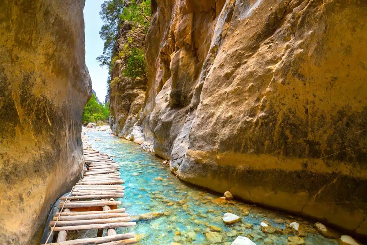
Samaria is the big one — Europe’s longest gorge, running 16km through the heart of the White Mountains in Crete’s west, and the hike most people have heard of before they even arrive on the island. The crowds are real, and if you go in July or August you’ll be sharing the trail with an uncomfortable number of fellow walkers. That’s the honest truth. But it’s still worth it, because Samaria earns the hype in a way that not everything famous can claim.
The route enters from the north at Xyloskalo, near the Omalos Plateau, and descends through the gorge to the coastal village of Agia Roumeli on the Libyan Sea — where the reward for five-plus hours of walking is a cold beer and the option to swim. The narrowest point, the Iron Gates, where the walls close to just three or four metres across and soar hundreds of metres above your head, is genuinely unforgettable.
Go early, go outside July and August if you can, and go prepared — the descent is relentless on the knees. The park typically opens in May and closes by the end of October, but exact dates are set annually based on safety conditions (in 2026, for example, the opening was delayed to 19 May for geological inspections) — check the official Samaria National Park site before you travel.
Agia Irini Gorge
7km (12.5km extended) · 3–4 hours · Medium
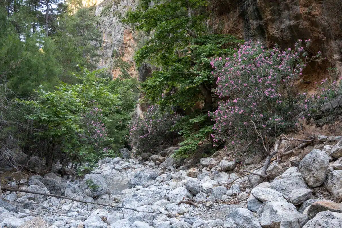
If Samaria feels like too much of a commitment — the crowds, the logistics, the ferry back — Agia Irini is the answer. It’s less than half the length, considerably less busy, and honestly just as beautiful in its own way.
The trail begins in the village of Agia Irini and runs south through a canyon of towering limestone walls dotted with small caves, thick with wild herbs, cypress and maple. The Kri-kri — the endangered Cretan wild goat — lives here and occasionally makes an appearance along the cliffside. You’ll smell the herbs before you see much of anything else, which is a good sign.
The standard trail is 7km. If you have the energy and the time, keep going past the gorge exit to the small seaside village of Sougia, where you can sit at a taverna above the Libyan Sea and feel extremely pleased with yourself. That extended version adds another 5.5km, so plan accordingly.
Preveli Beach
7.5km · 2–3 hours · Moderate
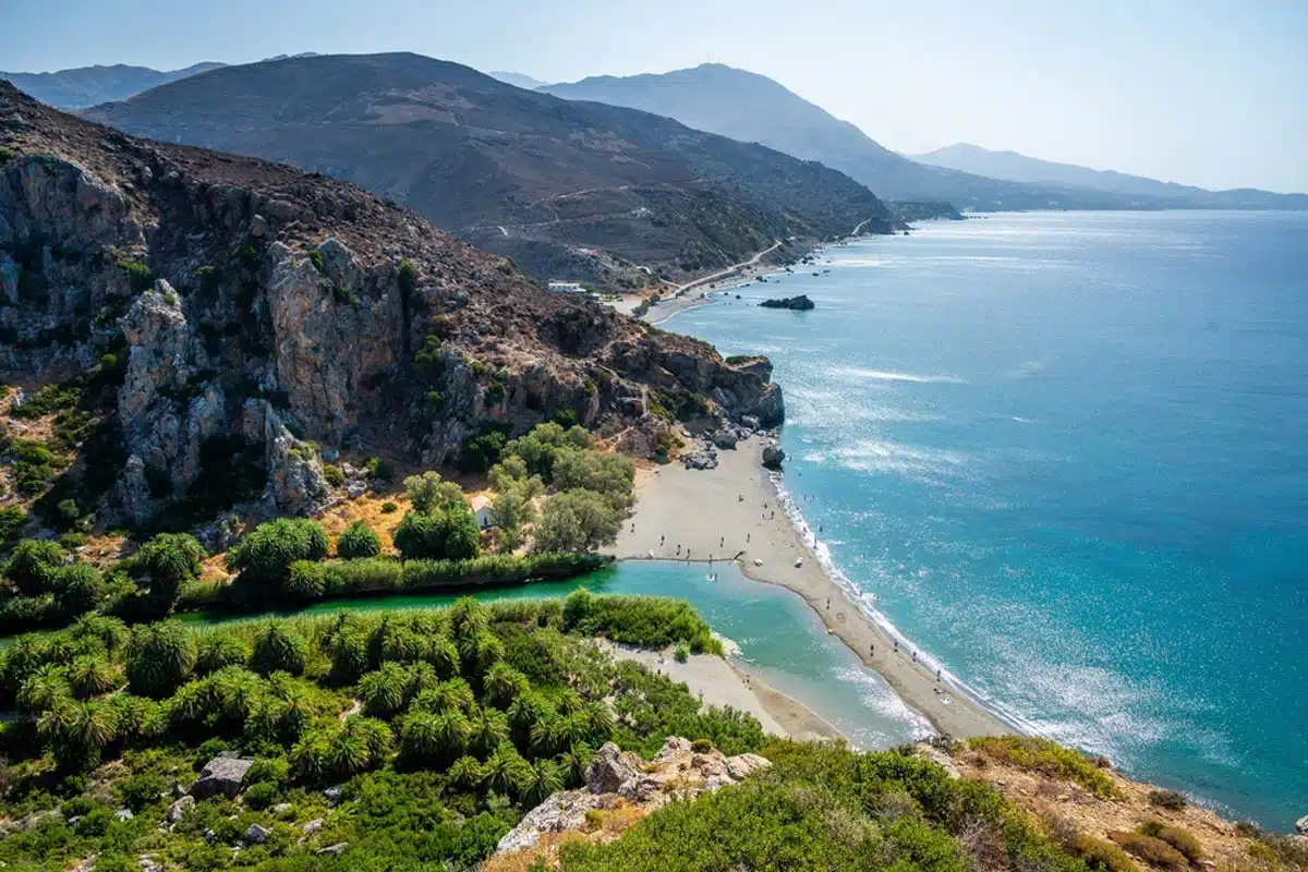
Preveli might be my favourite walk in Crete — a bold claim given the competition, but the combination of the river gorge, the palm forest and the beach at the end makes it unlike anything else on the island.
The circular route starts at the Megali Gefira Bridge over the Megalopotamos river and heads east along the bank to Preveli Beach, where the river meets the sea in a shallow lagoon flanked by one of the largest wild palm forests in Europe. The Glymmenos Volakas rock formation sits out in the water just offshore, and on a clear day the Libyan Sea is a shade of blue that takes some getting used to.
It’s busy between April and October — boats bring people directly to the beach, which means you’ll share the end point with day-trippers who haven’t walked at all. The walk itself is far less crowded than the destination. Go early, bring a camera, and stay long enough for the light to change.
Imbros Gorge
8.5km · 2–3 hours · Easy
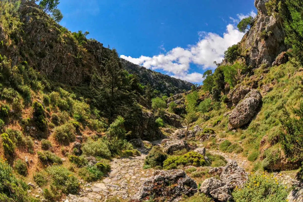
Imbros is the gorge I’d recommend to someone who isn’t sure they’re a hiker yet. It’s straightforward, well-marked, not too long, and the scenery is genuinely dramatic without requiring you to be particularly fit or experienced. The path descends from Imbros village through a narrowing gorge to Komitades, with the walls growing higher and closer until you reach the Xepitira Arch — a natural rock formation that resembles a gateway through the limestone.
There’s a taverna at each end of the route, which is always reassuring information to have. The village of Imbros at the top is the place to fuel up; Komitades at the bottom is where you end up and collect yourself before organising a lift or taxi back. It’s one-directional, so you’ll need to sort the logistics before you start.
Kourtaliotiko Gorge
4km · 1.5–2 hours · Easy–Moderate
One of Crete’s most accessible gorge walks and one that often gets overlooked in favour of the better-known trails, Kourtaliotiko runs through a deep limestone canyon between Koxaré and Asomatos, south of Rethymno. The gorge is named after the kourtaliotis — a small waterfall and pool partway through — and the trail follows a mostly flat riverbed path, shaded and cool even in summer.
The standout feature is the cave church of Agios Antonios, built directly into the cliff wall above the gorge — a small Byzantine chapel tucked into the rock face that you’d walk straight past if you didn’t know to look up. The Kourtaliotiko is a good morning walk that pairs naturally with a visit to Preveli Beach a few kilometres south, or Arkadi Monastery 30 minutes north: a solid half-day loop if you’re based in Rethymno.
Mili Gorge
5km · 2 hours · Moderate
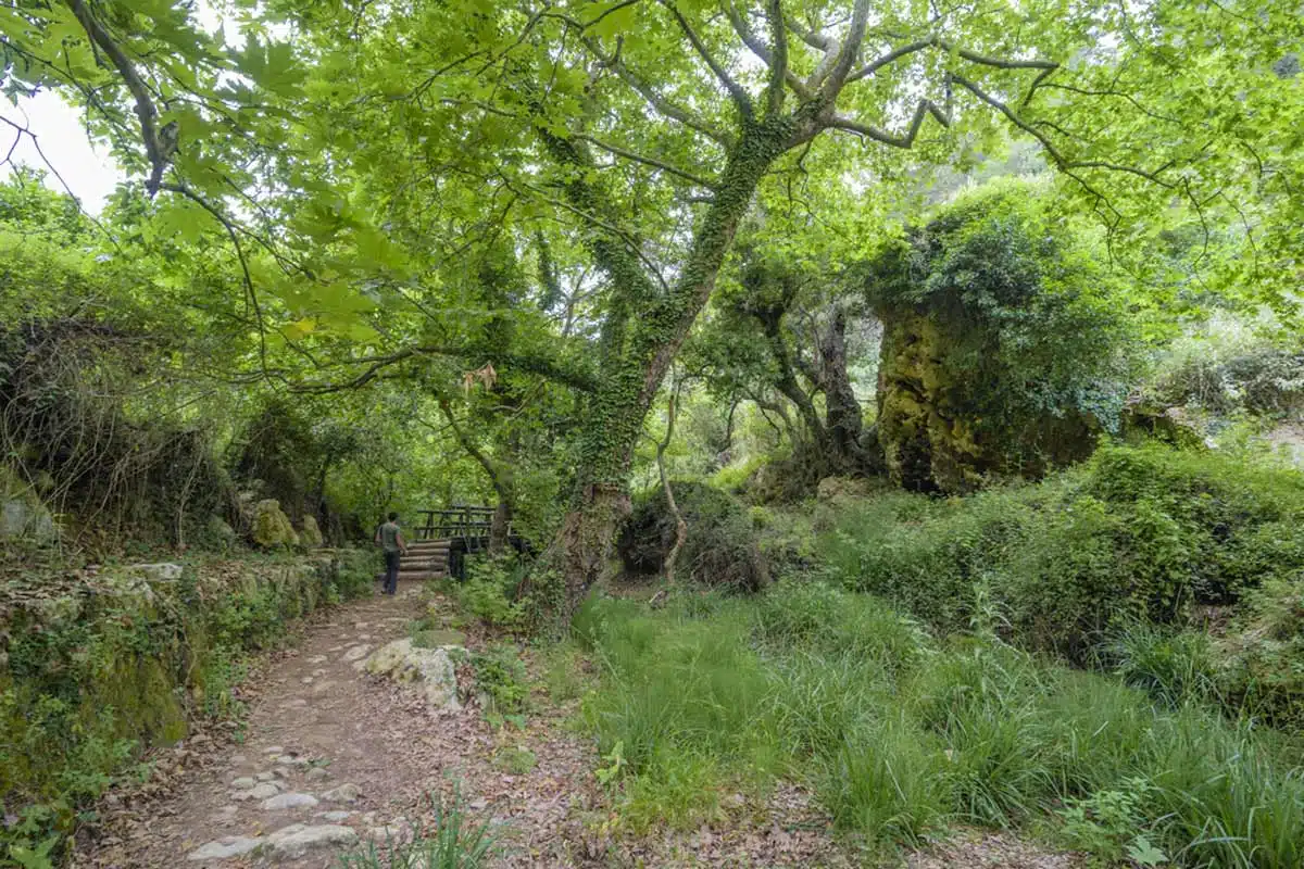
The Mili Gorge walk near Rethymno is different in character from Crete’s bigger gorge hikes — it’s lush in a way that surprises you, threaded with water and thick with vegetation that keeps things cool and shaded even in the height of summer.
The trail runs from Roussospiti to Mili, passing old ruins, working watermills and small stone churches along the way. Two cold lakes sit partway through the route — bring a swimsuit if the heat makes that sound appealing, because the water is genuinely refreshing. It’s a quieter, gentler walk than Samaria or Imbros, and all the better for it.
Zakros Gorge
3km gorge section (7km from Ano Zakros) · 1.5–2 hours · Easy–Moderate
Zakros is one of Crete’s best-kept secrets — a gorge walk in the far east of the island that ends at a Minoan palace site on the Libyan Sea at Kato Zakros. The gorge itself carves through the Sitia Geopark, with dramatic limestone walls and the kind of quiet that you only get in parts of Crete that take real effort to reach.
But what makes Zakros genuinely special is what you find at the end of it: the Minoan palace of Kato Zakros, one of the four great Minoan palace complexes on the island, excavated from the 1960s onwards and remarkably well-preserved. Walking out of the gorge directly into a Bronze Age palace site that’s been sitting at the edge of the sea for 3,500 years is an experience that’s hard to replicate elsewhere. Combine it with a swim at the small beach adjacent to the site, and you have a near-perfect afternoon in East Crete.
Sarakina Gorge
7.5km · 2 hours · Medium
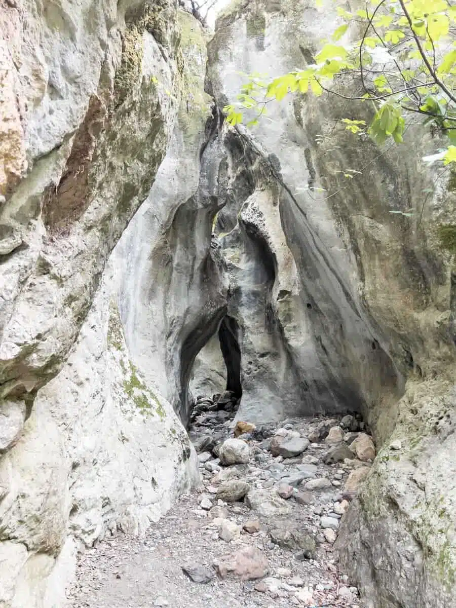
The Sarakina Gorge near Myrtos in South Crete is one of those off-piste finds that rewards the effort of getting to it. This is not a well-trodden trail — most visitors to Crete never hear of it, let alone make the journey to the Ierapetra region to walk it. But the gorge is genuinely arresting: the trail picks its way through a riverbed hemmed in by spectacular limestone boulders that have been worn and shaped over millennia into naturally-carved arches and openings through the rock.
Getting there means taking a dirt road to the riverbed entrance and then navigating past metal and wooden bridges before reaching the most dramatic sections. The scale of the boulders, with sunlight hitting the carved rock faces at odd angles, is the kind of thing that photographs badly and impresses enormously in person.
Nida Plateau and Psiloritis
8.5km · 4–5 hours · Hard
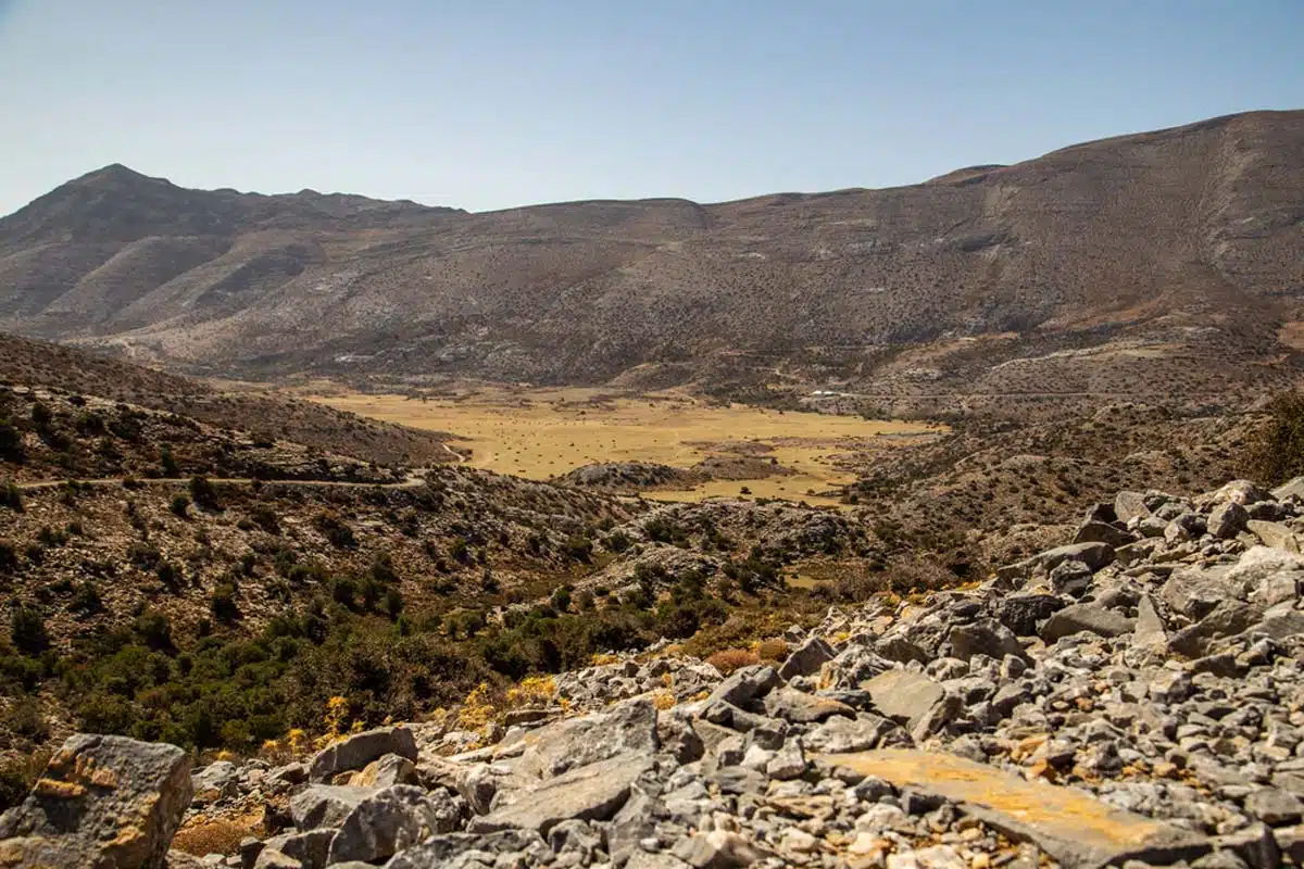
If you want to understand Crete’s scale, come up to the Nida Plateau. At 1,400 metres above sea level and sitting in the heart of the Psiloritis range — Mount Ida, the highest peak on the island — the plateau opens out into an extraordinary, almost lunar landscape that couldn’t feel further from the beaches and harbours below.
The walking here is harder than the gorge trails and demands proper preparation: there are no trees for shade, the altitude makes the sun fierce, and the terrain is rough underfoot. But the reward is an unbroken 360-degree view of the island that puts everything else into context.
The village of Anogia is the usual starting point for the ascent to Mount Ida itself. Within the plateau, the Ideon Andron — the cave where, according to mythology, Zeus spent his childhood — is a short walk from the road. The stone shepherd shelters, or mitata, scattered across the plateau are still in use; depending on the season, you may encounter cheese-making, sheep shearing or raki distillation in progress.
Cave of Agios Ioannis
4.5km · 1–2 hours · Easy
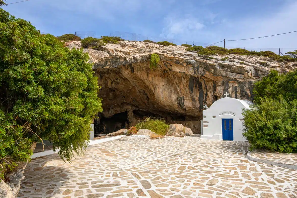
This is one of those walks that takes a bit of explaining before it makes sense, but bear with me. The trail connects the village of Agios Ioannis to the remote monastery of Koudoumas along the south coast, passing through a landscape of dry, windswept rock and cliff-face caves. It’s not dramatic in the way Samaria is dramatic — it’s quieter, stranger, more contemplative.
The payoff is the cave church of Agios Ioannis itself — an early-Byzantine church tucked into the rock face, with stalactites visible inside and the Libyan Sea visible at the end of the path. There’s a small fjord squeezed between the cliffs and the shore at the trail’s end that feels genuinely remote despite not being particularly far from the road. A good walk for those who want something off the main circuit.
Cave of Agios Ioannis trail map
Practical Tips for Hiking in Crete
A few things worth knowing before you set off. Most of the gorge trails are one-directional — you need to arrange a lift or bus back to the start, and the logistics are easier to work out before you begin than after you’ve been walking for three hours. Check this before you go for whichever trail you choose.
Samaria Gorge is the only walk on this list with a formal seasonal closure: it typically opens in May and closes by the end of October, with exact dates set annually based on safety conditions — check the official park site before you go. The other trails are generally accessible year-round, though spring (April and May) is the ideal time — wildflowers, cooler temperatures, and running water in the riverbeds. Summer is doable but hot; July and August on the busier trails can be crowded and uncomfortable.
Wear proper walking shoes rather than trainers for anything beyond the easiest walks — the riverbeds are uneven and the rock can be slippery. Carry more water than you think you’ll need. Mobile signal is patchy to non-existent in the gorges, so download your map offline before you head in.
Love This? Save and Share on Pinterest
Discover the top things to do, insider tips and hidden gems in our Greece Travel Guides.
Read the guides →