
Planning a trip to see the giant cacti of southern Arizona? From the King Canyon and Gould Mine loop and the dirt-road Bajada Loop Drive to ancient petroglyphs, sunset at Javelina Rocks and nights under an officially dark sky, these are the best things to do in Saguaro National Park, plus how to choose between East and West, where to camp and where to stay.
I’m not one to throw the word “unmissable” around lightly, but Saguaro National Park deserves it. It’s named after the towering saguaro, the largest cactus in the US, and it protects nearly 100,000 acres of Sonoran Desert on either side of Tucson, where whole hillsides bristle with the giant cacti that most people picture when they think of Arizona. There’s far more to it than prickly plants and a dry landscape, though there’s plenty of that going on too.
I visited in February as part of a Southwest road trip, staying in Tucson. I explored Saguaro West, hiking the King Canyon and Gould Mine loop through a cacti-covered canyon, and spent a couple of hours at the Arizona-Sonora Desert Museum just down the road.
Time for a quick geography lesson. The park is split into two districts, with the city in between: Saguaro West (the Tucson Mountain District) and Saguaro East (the Rincon Mountain District). If you only have time for one, go West, which has the most saguaro and is easier to explore thanks to its smaller size. Personally, I think the West also had the most stunning scenery. The East is good for a more remote backcountry experience, particularly if you’re into hiking.
This guide starts with the West, where I spent my time, then covers everything else worth doing across both districts, followed by how to choose between East and West, where to camp and my practical tips.
Want quick access to both sides of the park? I stayed at the Graduate by Hilton Tucson, close to the centre of Tucson by the University of Arizona and about 25 to 30 minutes’ drive from either district.
The best things to do in Saguaro National Park
Take in the giant saguaros of Saguaro West
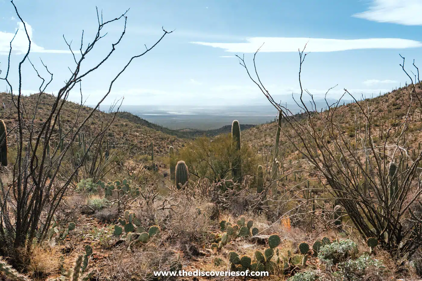
Saguaro West is the smaller, more compact half of the park, and it’s where the saguaros grow thickest: from the road and the trails, they march up every slope in their thousands, mixed in with spindly ocotillo, cholla and prickly pear. If you only have one day, this is where to spend it.
The saguaro grows naturally only in the Sonoran Desert, and it takes its time. A saguaro usually grows its first arm at around 75 years old and can live for about 200 years, and the tallest reach around 50 feet. Seeing a whole forest of them, some with a dozen arms, is a sight to behold.
Start at the Red Hills Visitor Center, at 2700 North Kinney Road. It has drinking water, restrooms, a short film about the park and rangers who can suggest trails, and you can pay your entry fee or buy a pass here. From October to May it’s open from 9am to 5pm, and from June to September from 8am to 4pm. The park is open every day except Thanksgiving and Christmas Day.
Entry costs $25 per vehicle, $20 per motorcycle or $15 per person on foot or by bike, and it’s valid for seven days in both districts. The park doesn’t accept cash anywhere, including at the fee machines, so bring a card.
Top Tip
Put the visitor centre’s street address into your map app rather than just “Saguaro National Park”, as the two districts are around 30 miles apart and it’s easy to end up at the wrong one.
Hike the King Canyon and Gould Mine loop
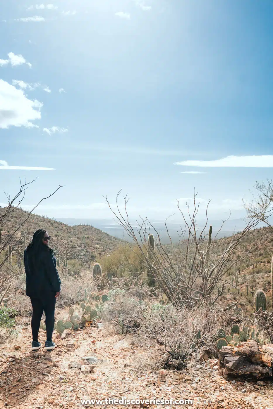
For a hike in Saguaro West, I highly recommend the King Canyon and Gould Mine loop. It’s a cool hike of about 2.5 miles (the park service says 2.4) through a cacti-covered canyon and back on a pretty loop, with a picnic spot at the halfway point. It’s nice and easy: there’s some elevation gain, about 380 feet in total, but not much.
The loop links three trails: the King Canyon Trail, the Gould Mine Trail and Sendero Esperanza. The Mam-A-Gah picnic area sits on Sendero Esperanza at roughly the halfway point, and it’s the perfect spot to refuel. Just uphill is the Gould Mine itself, where an iron grid covers the old shaft beside an old powder house that once stored dynamite. S.H. Gould opened the mine in 1906, convinced he’d found a mother lode of copper, but it produced little, and the last attempt to revive it ended in 1954.
On the way back, you can follow either the King Canyon Trail, an old road, or the dry King Canyon Wash. If you take the wash, look out for petroglyphs left by ancestral Sonoran Desert peoples several hundred years ago, and don’t touch them. Hiking the loop anticlockwise is noticeably less strenuous. Allow an hour to an hour and a half.
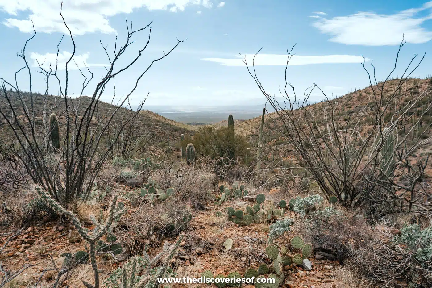
The signed King Canyon trailhead is on Kinney Road, just outside the park boundary in Tucson Mountain Park and about a third of a mile past the Desert Museum. Pay at the kiosk (cards only) if you haven’t already, and leave dogs at home, as they aren’t allowed on the trail. Bees sometimes gather in the damp King Canyon wash, so keep an eye out.
Bring water: aside from the visitor centre there aren’t places to refill, and the desert heat can kill, literally. Carry at least two litres each, and wear tonnes of sunscreen.
Top Tip
The America the Beautiful pass covers entry to Saguaro and more than 2,000 other federal recreation sites. From 2026 it costs $80 for US residents and $250 for non-residents. Buy it from Recreation.gov, store.usgs.gov or the park’s visitor centres.
Meet the desert’s wildlife at the Arizona-Sonora Desert Museum
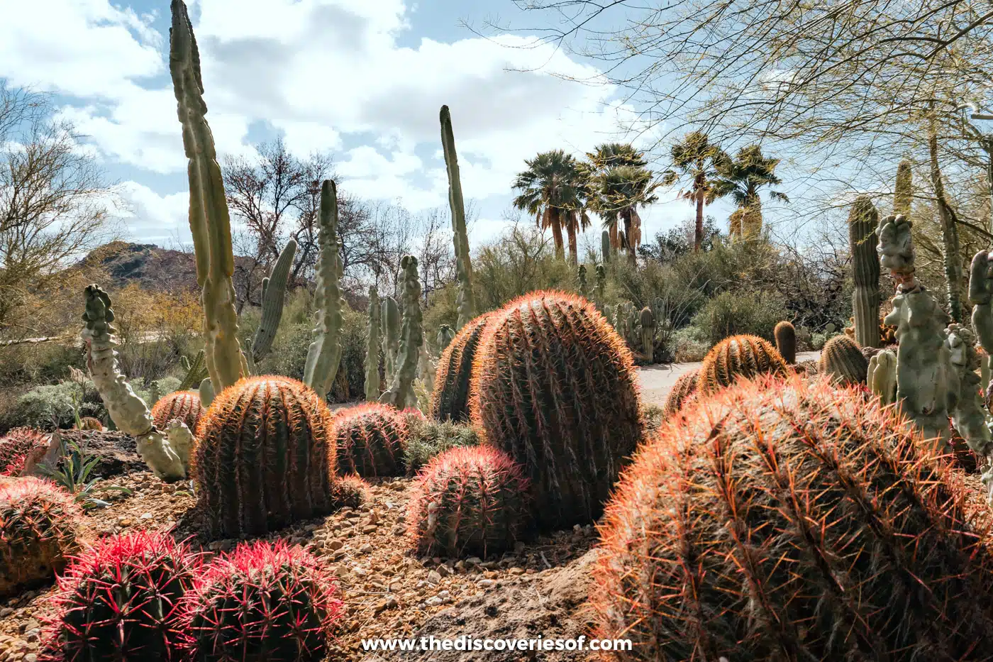
The Arizona-Sonora Desert Museum is technically something to do near Saguaro National Park rather than in it, but it sits just down the road from Saguaro West and it’s another must. It’s an outdoor museum charting the ecology of Arizona and the Sonoran Desert, one of the most vibrant deserts in the world.
Paths wind past outdoor enclosures of native animals, like javelinas and coyotes, and gardens of native plants, including a colourful cactus garden. The Desert Loop Trail is a must: it’s a relatively short trail past the enclosures, so watch for the signs about the wildlife. In all, the museum has more than 230 animal species and around 1,200 kinds of plants along about two miles of paths, plus a cave, an aquarium and an art gallery if you need to escape the heat.
It’s extensive, so plan a couple of hours, and check the programme for live animal presentations, docent tours and demonstrations. From 12 November 2026 to 29 March 2027, the Raptor Free Flight sees birds of prey fly free over the desert at 10:30am from Thursday to Monday, included in your ticket.
Entry is $29.95 for adults (13 to 64) and $24.95 for children aged 3 to 12; buy online on the museum’s website or at the gate. It’s open every day, from 8:30am to 5pm from October to May. Until 24 November 2026, Kinney Road is closed between McCain Loop and the museum entrance for water line works, but the museum stays open: follow the signed detour via McCain Loop.
Drive the Bajada Loop through the cactus forest

There’s no better way to take in the scenery of Saguaro West than on the Bajada Loop Drive, which I drove on my visit: a scenic loop of five to six miles through some of the densest stands of saguaros in the park, with mountain views all around.
From the Red Hills Visitor Center, drive 1.5 miles west on Kinney Road to Hohokam Road, where the loop begins. It’s an unpaved but graded dirt road, fine in an ordinary car, though it’s bumpy in places, so slow and steady is the rule. Part of Hohokam Road is one-way. Along the way, stop for the Valley View Overlook Trail, then turn left onto Golden Gate Road and loop back past the turn for Signal Hill. Golden Gate Road beyond the Sendero Esperanza trailhead, towards Picture Rocks Road, is now permanently closed to cars and has become a trail for hikers, cyclists and horse riders.
The loop is open from dawn to dusk and closed to vehicles overnight. Vehicles more than 8.5 feet wide, anything towing a trailer and any vehicle or combination of 40 feet or more aren’t allowed. The light is at its best late in the afternoon, so it’s a gorgeous drive towards sunset, as long as you’re out before dark.
See ancient petroglyphs at Signal Hill

Signal Hill is the best place in the park to see petroglyphs. A short trail of about a quarter of a mile, with stone steps and only about 20 feet of climbing, leads from the Signal Hill picnic area, on a spur off the Bajada Loop, to a rocky hilltop scattered with more than 200 of them.
The rock art was made by the Hohokam people, who lived in this area between around AD 450 and 1450, so the designs are roughly 550 to 1,550 years old. They aren’t paintings: the artists pecked through desert varnish, the dark natural coating that builds up on the rocks over thousands of years, to reveal the paler stone beneath. Look for spirals, animals and geometric shapes, but look with your eyes only.
Once you reach the top, you’ll want your camera out for the views over the park. The picnic area at the bottom has grills, a shelter and restrooms, so it’s a good place to stop for lunch on the loop.
Climb to the Valley View Overlook

The Valley View Overlook Trail is one of the shortest hikes in Saguaro West, and one of the most rewarding. It leaves from the one-way section of Hohokam Road on the Bajada Loop and runs about 0.4 miles each way, with only about 30 feet of climbing, up onto a small ridge south-west of Apache Peak.
From the top, the view opens out across the cactus-studded slopes to Avra Valley, with saguaros, prickly pear and ironwood trees all around. Allow 30 minutes or so for the round trip.
Learn the desert’s secrets on the Desert Discovery Trail

Think you know everything there is to know about the Sonoran Desert? The Desert Discovery Trail will soon show you otherwise. It’s a paved half-mile loop on Kinney Road, about a mile from the Red Hills Visitor Center, with signs along the way explaining how the plants and animals here survive the heat and drought.
It’s wheelchair accessible and one of the few trails in the park where dogs are allowed on a lead, and it takes only 10 to 15 minutes, so it’s a good first stop to get your bearings. It’s also a good spot for birdwatching. There’s very little shade, so fill up your water bottle at the visitor centre first.
Walk the quiet Cam-Boh Trail
For a gentle, quieter walk in Saguaro West, head to the Cam-Boh Trail on the park’s western edge, off Picture Rocks Road. It runs for about 2.7 miles over flat, sandy ground, with only around 140 feet of climbing, through cactus forest and desert wildflowers in spring.
It’s relatively easy and well marked, and it’s one of the trails in the west of the park best suited to horses, so you may share it with riders. Late afternoon is a lovely time to walk it, when the low sun lights up the saguaros, but keep an eye on the time, as the West district’s roads close to cars at dusk.
Ride the Cactus Forest Loop Drive

Just as the West has a scenic drive, so does the East. The Cactus Forest Loop Drive is a paved eight-mile loop through the rolling foothills of the Rincon Mountains, and it’s the easiest way to see the East district if you’re short on time.
The loop starts by the Rincon Mountain Visitor Center on Old Spanish Trail, and part of it is one-way, with narrow sections, tight turns and steep little hills. It’s open to vehicles from 5am to 8:30pm all year. The same vehicle limits apply as in the West (nothing wider than 8.5 feet, no trailers and nothing 40 feet or longer), and there’s no RV parking on the loop or at the visitor centre.
Pull-outs and picnic areas along the way give you access to several short trails, so you can easily fill half a day: stop at the Desert Ecology Trail, the Loma Verde trailhead and the Mica View picnic area, then finish at Javelina Rocks for sunset.
Watch the sunset at Javelina Rocks

Wondering what to do in Saguaro National Park in the evening? Watching the sunset at Javelina Rocks should be high on your list. These great boulders of Catalina gneiss, a banded metamorphic rock, sit right beside a small paved pull-out near the end of the Cactus Forest Loop Drive, so there’s no hike involved: just scramble up on the informal paths and find a comfy spot.
The grey and pink rocks glow in the evening light, with views across the saguaro forest towards the mountains. Arrive about half an hour before sunset to snag a good spot. Arizona doesn’t change its clocks, so sunset is at around 5:20 to 5:40pm in December and January, about 6:30pm in March and September, and about 7:30pm in June and July. The nearby Javelina picnic area has covered tables, grills and a vault toilet, but no water.
Spot desert birds on the Desert Ecology Trail
The Desert Ecology Trail is a paved quarter-mile walk on the northern section of the Cactus Forest Loop Drive, with exhibits about desert life and benches along the way. Say goodbye to that pesky desert sand that creeps into your boots.
It’s a good place to see how the saguaros support the wildlife around them. Look out for Gila woodpeckers and cactus wrens nesting in the cacti, roadrunners darting across the path and Harris’s hawks resting on the arms of the saguaros. Saguaros aren’t the only plants here, either: you’ll see cholla, prickly pear, agaves and palo verde trees too.
Dogs are allowed on a lead, but there’s very little shade, so walk it early or late in the day.
Walk the Loma Verde loop
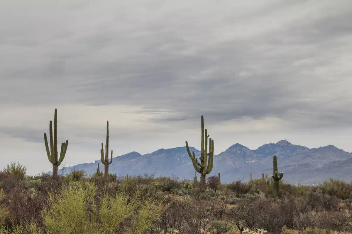
Saguaro East has some fantastic gentle hikes, and the Loma Verde loop is one of the best. The park service’s Loma Verde loop is about 3.8 miles with only about 60 feet of climbing, so you don’t need to worry about burning calves, and it starts from the Loma Verde trailhead on the Cactus Forest Loop Drive.
The trail winds through cactus forest dotted with saguaros, cholla and barrel cacti. Along the way, you’ll pass the site of the Loma Verde Mine, a small copper mine opened in 1901 with a 350-foot shaft; today, only reddish spoil heaps remain. A short spur climbs Pink Hill for views over the cactus forest towards Tanque Verde Ridge.
It’s an easy walk, but you’ll still want to avoid the harsh midday sun, so set off early.
Read Next
Picnic with a view at Mica View
If you’re spending a few days in Saguaro, make time for Mica View. The Mica View picnic area, on the Cactus Forest Loop Drive, has a shade structure over six picnic tables, plus grills and restrooms, and it’s accessible, making it a great place to pull off for lunch with views of the Santa Catalina and Rincon Mountains.
You can also walk in on the Mica View Trail, which runs about 0.7 miles each way from the Broadway trailhead to the picnic area, about 1.4 miles in total. It’s one of the few trails where dogs are allowed, and it’s a lovely walk in the soft evening light.
Look for owls on the Freeman Homestead Trail
The Freeman Homestead Trail is a mile-long loop with about 100 feet of climbing, starting from the Javelina picnic area spur at the southern end of the Cactus Forest Loop Drive. It passes the foundations of an old homestead and some impressively large saguaros before dropping into a wash where great horned owls are often seen roosting. It’s a good one to combine with sunset at Javelina Rocks.
Climb the Tanque Verde Ridge Trail

The Tanque Verde Ridge Trail is the classic big hike in Saguaro East. It starts at the Javelina picnic area and climbs steadily along the ridge into the Rincon Mountains, and the full route, about 11 miles one way with 3,900 feet of climbing to Cowhead Saddle, is best done as an overnight trip.
If you’re only visiting for the day, walk the first few miles and turn back. The views open up within the first mile, there’s a crested saguaro at around 2.5 miles and a rocky high point known as the Dome at about 3 miles. The path is rocky and steep in places, so wear proper boots, and set off early with plenty of water.
Further up, the trail reaches Juniper Basin campsite at 6.9 miles (about 3,000 feet of climbing) and Tanque Verde Peak at 8.7 miles (about 4,000 feet).
Hike to Bridal Wreath Falls
If you’re big on hiking, the trail to Bridal Wreath Falls is one of the most rewarding in Saguaro East. It starts from the Douglas Spring trailhead at the eastern end of Speedway Boulevard and climbs steadily up the Douglas Spring Trail, then takes a short side path of about 0.3 miles to the falls. The round trip is about 5 to 6 miles, with around 1,100 feet of climbing.
The reward is a seasonal waterfall in the middle of the desert, tumbling over the rocks into a small pool. It flows mainly in late winter and spring, after winter rain or snowmelt, and briefly after summer monsoon storms. Summer is dangerously hot on this exposed trail, so go in the cooler months and start early.
Go backpacking in the Rincon Mountains
If you’re feeling brave, explore the wild side of Saguaro by backpacking into the Saguaro Wilderness. The Rincon Mountains rise to more than 8,600 feet at Mica Mountain, and the trails climb from saguaro desert through oak woodland to pine forest, so you pass through several very different worlds in a single trip.
Popular multi-day routes head up the Tanque Verde Ridge to Tanque Verde Peak and Juniper Basin, to Manning Camp near the top of the range, or to Rincon Peak via Happy Valley. All camping is at six designated backcountry campsites, and you’ll need a permit: see the camping section below for the details. These are serious hikes with thousands of feet of climbing and no reliable water, so they’re best for experienced backpackers.
Cycle the park’s scenic loops
Both scenic drives double as cycling routes. In the East, you can ride the Cactus Forest Loop Drive, the 2.5-mile multi-use section of the Cactus Forest Trail and the 2.9-mile Hope Camp Trail. In the West, bikes are allowed on the Bajada Loop and the paved roads, the half-mile Belmont multi-use trail and the 2.5-mile Golden Gate multi-use trail.
E-bikes are allowed wherever ordinary bikes are. Groups are limited to 10 riders, and don’t ride against the traffic on the one-way sections of the loops.
Do
See Saguaro East on a guided e-bike tour around the park.
Go horseback riding
Horse riding has a long history in the Tucson desert, and you can ride in the park without a permit for day use. Many trails are closed to horses, though, as are the Cactus Forest Loop Drive and all the picnic areas, so check the rules before you set out. In the West, the paths around Cam-Boh are among the best suited to horses.
If you don’t have your own horse, stay at Tanque Verde Ranch, a guest ranch right next to Saguaro East with daily rides for guests, or join a guided ride in the Santa Catalina foothills north of the city.
Do
Book a guided horseback ride in Tucson at Catalina State Park.
Get to know the park’s other cacti
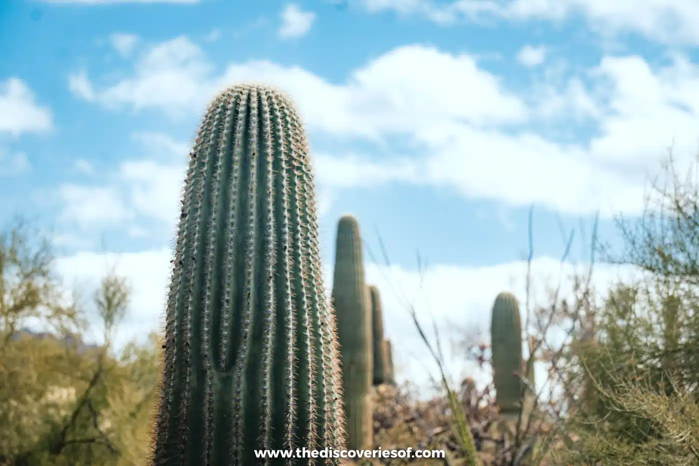
You didn’t think this park only had saguaros, did you? The saguaro is the star, and a fully grown one can weigh around 1.5 to 2.2 tonnes when it’s full of water, but it shares the desert with a whole cast of other cacti worth getting to know.
Look out for the fishhook barrel cactus, round and squat with hooked spines, the tree-like staghorn cholla and the fuzzy-looking teddy bear cholla, whose spines detach at the lightest touch (keep your distance). Prickly pear and hedgehog cacti are common too.
If you’re lucky, you might spot a crested, or cristate, saguaro, whose growing tip has fanned out into a strange, broccoli-like crest. They’re rare, at roughly one in every 10,000 saguaros, but there’s one about 2.5 miles up the Tanque Verde Ridge Trail.
See the saguaros bloom
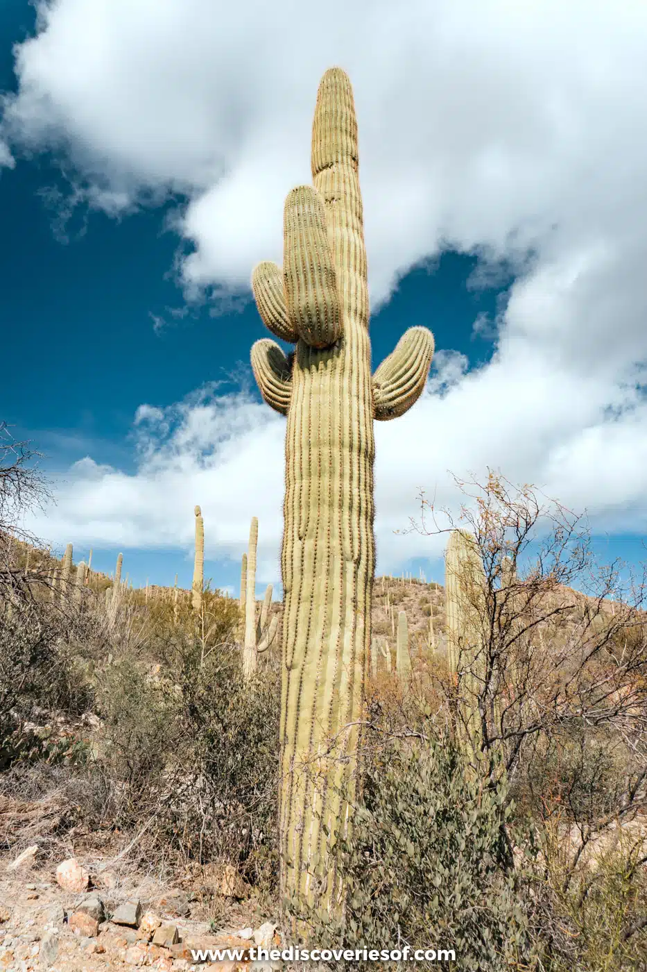
Did you know that cacti bloom? They do, and it’s a beautiful sight. Plan your trip around the flowering season if you can, but the timing varies by plant.
Spring wildflowers, like lupine, gold poppies and desert marigold, are usually at their best in mid to late March. Most of the park’s cacti and shrubs flower in April and May, with the most species in bloom around the first week of May, when hedgehog cacti put out brilliant pink flowers. The saguaros start in the last couple of weeks of April and peak from late May to the first week of June: look for creamy white flowers with yellow centres at the tips of the arms. Each flower opens at night and closes the next afternoon, so get out early in the morning.
A few cacti, including the barrel cactus and the night-blooming cereus, flower in summer instead. See my guide to the best time to visit Saguaro National Park for more on the seasons.
Look out for desert wildlife
The Sonoran Desert is far more alive than it looks. Keep your eyes peeled for roadrunners, horned lizards, jackrabbits and javelina (collared peccaries), as well as coatis and vultures. If you’re very lucky, you might spot a Gila monster, one of the world’s few venomous lizards.
The higher reaches of the Rincon Mountains in the East are a different world, home to black bears and white-tailed deer. The best time to see wildlife anywhere in the park is early in the morning or late in the afternoon, when the animals are most active.
Stargaze in an Urban Night Sky Place

Saguaro isn’t just for daytime. In November 2023, DarkSky International named it an Urban Night Sky Place, only the ninth in the world, in recognition of how well it protects its night skies despite sitting on the edge of a city.
The Cactus Forest Loop Drive in the East stays open to cars until 8:30pm, so it’s the easiest place to stargaze on your own. In the West, the roads close to vehicles at dusk, so the best way to see the stars there is on a ranger-led star party or night hike. Winter, with its long nights, is the best season for stargazing, while monsoon clouds often cover the sky in summer.
For more powerful telescopes, the Mt Lemmon SkyCenter’s SkyNights programme ($85 for adults) and Kitt Peak National Observatory are both within reach of Tucson.
Do
Book the Kitt Peak Nightly Observing Program for an evening at the telescopes.
Join a ranger programme
Rangers run guided walks, talks, night hikes and star parties in both districts all year round. They’re most frequent from January to April, and in summer only a few run each week. Schedules change, so check the park’s calendar or ask at either visitor centre when you arrive.
Explore Tucson between the two districts
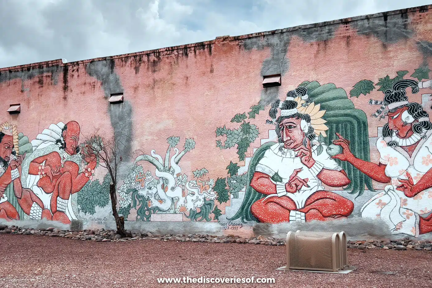
Seeing as Tucson sits between the two districts of the park, it’s worth making time for the city when you visit Saguaro National Park.
Wander historic Fourth Avenue, grab a craft beer downtown or stroll around the University of Arizona. Just make time to explore Barrio Viejo, Tucson’s oldest neighbourhood of low-rise adobe buildings and cacti-lined streets, and to end your day with dinner at Tito & Pep, a fantastic spot for contemporary Southwestern food with brilliant cocktails made with local ingredients. A short drive south of the city, Mission San Xavier del Bac is a must-visit, too.
Read Next
Saguaro East or West?
If you only have time for one district, go West. It has the most saguaro and it’s easier to explore thanks to its smaller size, and I think it had the most stunning scenery too. The East is good for a more remote backcountry experience, particularly hiking, and it’s the only place in the park where you can camp.
- Saguaro West (Tucson Mountain District): the smaller, lower district, with the densest saguaro forests, the Bajada Loop Drive, Signal Hill’s petroglyphs and the King Canyon and Gould Mine loop. Red Hills Visitor Center, 2700 North Kinney Road. It’s about 15 miles from downtown Tucson, a drive of 25 to 30 minutes west on Speedway Boulevard and over Gates Pass, then north on Kinney Road. Gates Pass isn’t suitable for RVs or trailers over 24 feet, and the roads here close to cars at dusk.
- Saguaro East (Rincon Mountain District): more than twice the size, rising from desert to pine forest in the Rincon Mountains, with the Cactus Forest Loop Drive, the longest hikes and all the backcountry campsites. Rincon Mountain Visitor Center, 3693 South Old Spanish Trail, which has maps, rangers, restrooms and water. It’s about 15 miles from downtown, 25 to 30 minutes east on Broadway Boulevard, then south for 3 miles on Freeman Road and left onto Old Spanish Trail. The visitor centre car park is being rebuilt, so expect some delays.
- Between the districts: allow 45 minutes to an hour for the 30 miles across the city. There’s no public transport to either side, so you’ll need a car.
Until 24 November 2026, the Kinney Road closure adds about 10 minutes to the Gates Pass route to Saguaro West. To avoid it, approach from the north via Interstate 10, Avra Valley Road, Sandario Road and Kinney Road.
As for how long to spend, one full day is enough for the highlights of Saguaro West, and two days lets you see both sides properly. Add more if you want to tackle the longer East hikes or camp in the mountains.
Camping near Saguaro National Park
There’s no drive-in campground anywhere in Saguaro National Park, and no vehicle or RV camping of any kind. Instead, there are six hike-in backcountry campsites in the Saguaro Wilderness, all in the Rincon Mountain District, and none in the West.
You’ll need a permit for every night, which you book on Recreation.gov as Saguaro National Park Wilderness Permits, up to two months ahead and no later than noon on the day of your trip. Sites cost $8 per night and take up to six people, with a limit of five nights in a row at any one camp. Fires are allowed only at some camps, pets aren’t allowed on the trails and you’ll need at least a gallon of water per person per day, treating anything you collect.
- Manning Camp: six sites at 7,920 feet near the historic 1905 Manning Cabin, built by former Tucson mayor Levi Manning (the cabin is closed to the public). There’s a near-permanent water source by the cabin, and it’s 7.5 miles from the Turkey Creek trailhead, which needs a high-clearance or four-wheel-drive vehicle.
- Spud Rock Spring: three sites at 7,400 feet among pines, 5.3 miles from Turkey Creek, with seasonal water. Expect snow in winter.
- Happy Valley Saddle: three sites at 6,200 feet, 4.1 miles from the Miller Creek trailhead and the base for climbing Rincon Peak. The road to the trailhead has stream crossings and can be impassable in wet weather.
- Juniper Basin: three sites at 6,000 feet, 6.9 miles up the Tanque Verde Ridge Trail; water is seasonal and often dry.
- Grass Shack: three sites at 5,200 feet under sycamores, 10 miles from the Loma Alta trailhead, with water from Chimenea Creek most of the year. No campfires.
- Douglas Spring: three sites at 4,800 feet, the lowest camp and a good choice in the colder months, 6.3 miles from the Douglas Spring trailhead past Bridal Wreath Falls. No campfires.
If you’d rather drive in, the closest campground to Saguaro West is Pima County’s Gilbert Ray Campground in Tucson Mountain Park, about 10 minutes from the Red Hills Visitor Center. It has 138 sites, many with electric hookups, plus tent-only sites, water and a dump station but no showers. It’s open from 1 September to 30 April, bookings are online only, and it stays open during the Kinney Road closure. Recent rates are from about $10 a night for tents and $35 with electricity, but check when you book.
Near Saguaro East, Colossal Cave Mountain Park in Vail has 30 first-come, first-served primitive sites at $15 a night, about 20 to 25 minutes south of the park. Up in the Santa Catalina Mountains, two Coronado National Forest campgrounds off the Catalina Highway make a cooler alternative: Molino Basin (open November to April, $20 a night, first come, first served) and General Hitchcock (open May to mid-December, from $20 a night, not suitable for trailers or RVs). Neither has drinking water. Catalina State Park in Oro Valley has 120 sites with hookups and showers. Before you go, check my camping packing list.
Tips for visiting Saguaro
- Fees and passes: entry is $25 per vehicle for seven days in both districts, and the park is card only. A $45 Saguaro Annual Pass is available to US citizens and residents.
- When to go: late autumn to spring is the most comfortable time for hiking (I visited in February). Mid-March brings wildflowers and late April to early June the saguaro blossoms, but visitor numbers peak from December to February. See my guide to the best time to visit Saguaro National Park.
- Beat the heat: summer highs top 100°F, so in the hotter months limit hiking to before 10am or after 4pm, and never cross a flooded wash during the summer monsoon (mid-June to September).
- Know the rules: dogs are allowed only on roads and a handful of paved or signed trails, drones are banned, and you can’t go off-trail below 4,500 feet.
- Pack a picnic: there are no restaurants in the park and water is only available at the visitor centres. Picnic areas include Signal Hill, Sus, Cam-Boh and Mam-A-Gah in the West and Mica View and Javelina in the East.
Where to stay near the park
There’s nowhere to stay inside the park, so base yourself in Tucson, which sits neatly between the two districts. I stayed at the Graduate by Hilton Tucson, a cool hotel in a great location at Main Gate Square by the University of Arizona, about 25 to 30 minutes from either side of the park. The rooms are relatively spacious, with nice mountain views, and the quirky decor is retro meets contemporary. There’s a gorgeous rooftop pool and a late-night rooftop bar, The Moonstone.
For luxury, The Ritz-Carlton, Dove Mountain is a desert resort in the foothills at Marana, north-west of Tucson, about 30 minutes from Saguaro West and closer to an hour from the East. For the East, Tanque Verde Ranch is an all-inclusive guest ranch right next to the park at the end of Speedway Boulevard, with daily horseback rides for guests. See my guide to where to stay in Tucson for more.
Map
Read next
- The best hikes in Saguaro National Park
- The best time to visit Saguaro National Park
- Visiting the Arizona-Sonora Desert Museum: a complete guide
- The best things to do in Tucson
- Where to stay in Tucson: the best areas and hotels
- Brilliant things to do in Arizona
- The best hikes in Sedona
- The best places to go stargazing in the US
Love this? Save and share on Pinterest

Discover the top things to do, insider tips and hidden gems in our USA Travel Guides.
Read the guides →