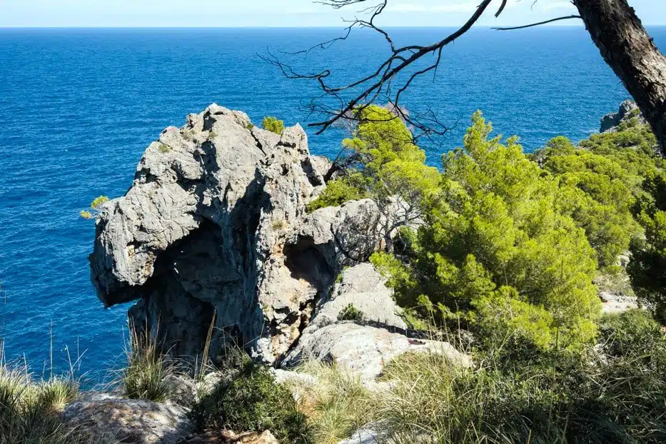

A lane climbs from the end of the beach to a lighthouse that has guided boats into Port de Sóller since 1859, and beyond it a path carries on through the pines high above the sea.
Port de Sóller sits in a round bay on Mallorca’s north-west coast, closed off by two headlands with a narrow mouth to the open sea. Cap Gros is the western one, and the lighthouse on its tip is the easiest walk from the port: half an hour up a quiet lane, with the whole bay below you and the Serra de Tramuntana rising behind it.
I was staying at Rondaia, a vineyard near Esporles, and in September I took the tram down from Sóller, wandered along the marina and walked out to the lighthouse, then kept going along the cliffs beyond it on the GR221, through pines and wild olives with the water a deep, clear blue far below.
This guide covers the walk to the lighthouse, what you’ll find at the top, the ways to carry on beyond it and when to go.
The Cap Gros walk at a glance
- Start: the Sa Torre tram stop in Port de Sóller, or anywhere on the seafront promenade.
- Distance: about 2 km each way from the port, 1.7 km of it on the lane up the headland.
- Climb: about 90 metres, on tarmac. It averages around 5%, with one short stretch nearer 12%.
- Time: 25 to 30 minutes up, a little less back down.
- Cost: free. There’s no ticket or entry fee.
- Best time: sunset, or early morning in high summer, when the lane gets hot by mid-morning.
Walking from Port de Sóller to the lighthouse
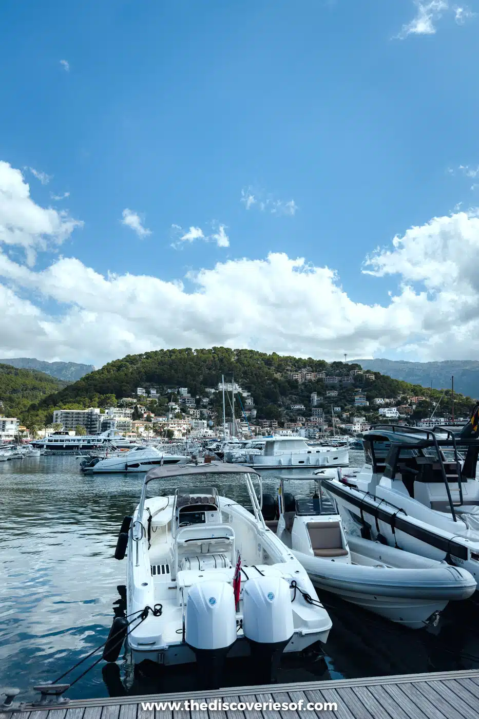
The wooden tram from Sóller runs down to the port in about 20 minutes, and its Sa Torre stop is the one the tram company suggests for the lighthouse. From there, follow the seafront round to Platja d’en Repic, the sandy beach at the southern end of the bay. You could easily spend an hour in the port before you begin: I wandered along the marina first, its pontoons crowded with day boats under the green hillside.
At the far end of the beach, the Camí del Far, the lighthouse lane, turns off and starts to climb. It’s a narrow road with a handful of hairpins, through pines and past villas, and every bend opens up more of the bay below: the round harbour, the tram line running along the front and the mountains behind the town.
The lane is shared with cars, as it’s the only road to the lighthouse, so keep to the side, especially on the bends. Parking at the top is very limited, so walking is much the easier way up.
Top Tip
The Sóller tram costs €10 each way and runs about hourly. It closes for maintenance from 23 November to 22 December 2026, when a replacement bus runs between the town and the port.
At the lighthouse
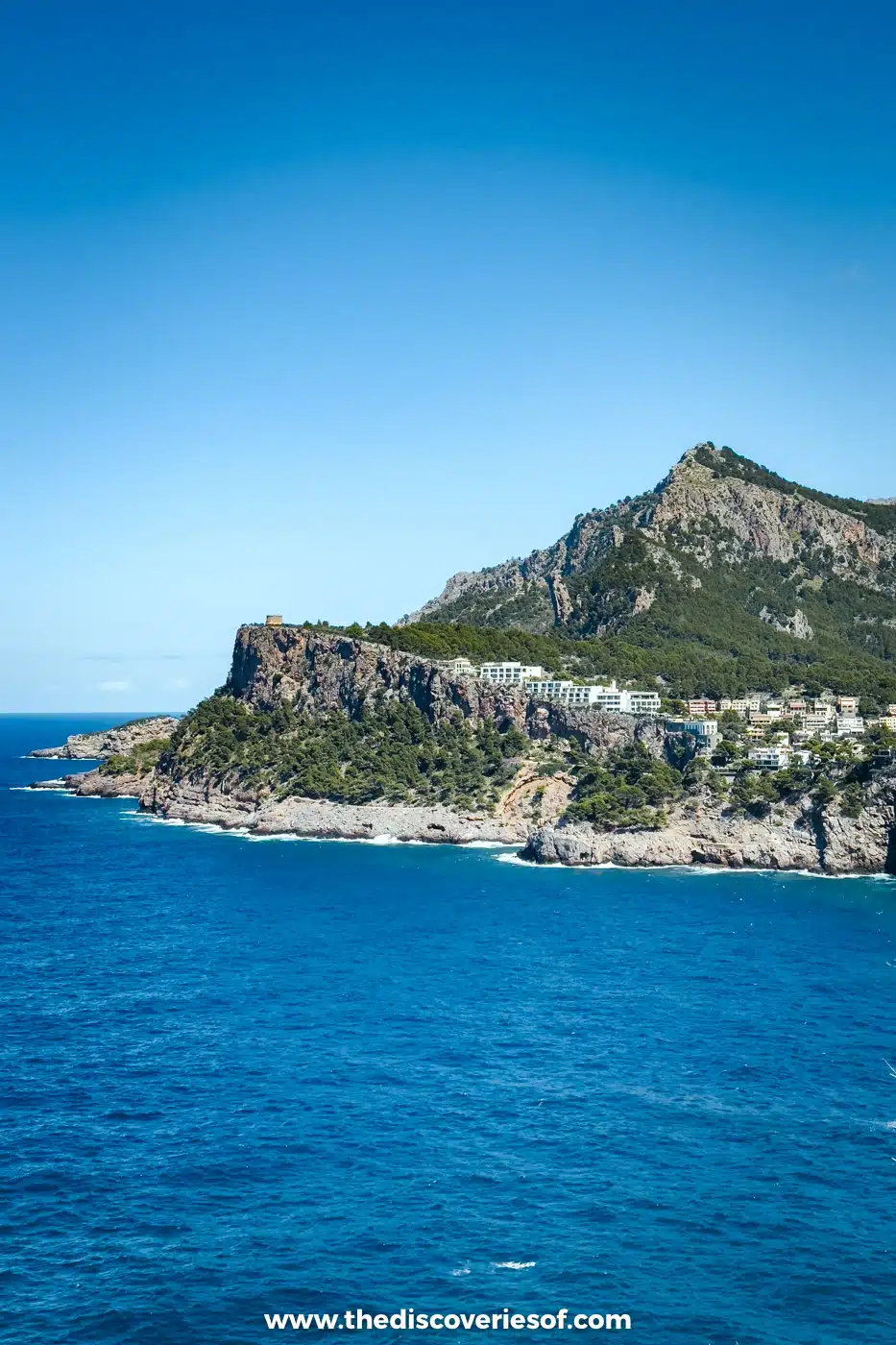
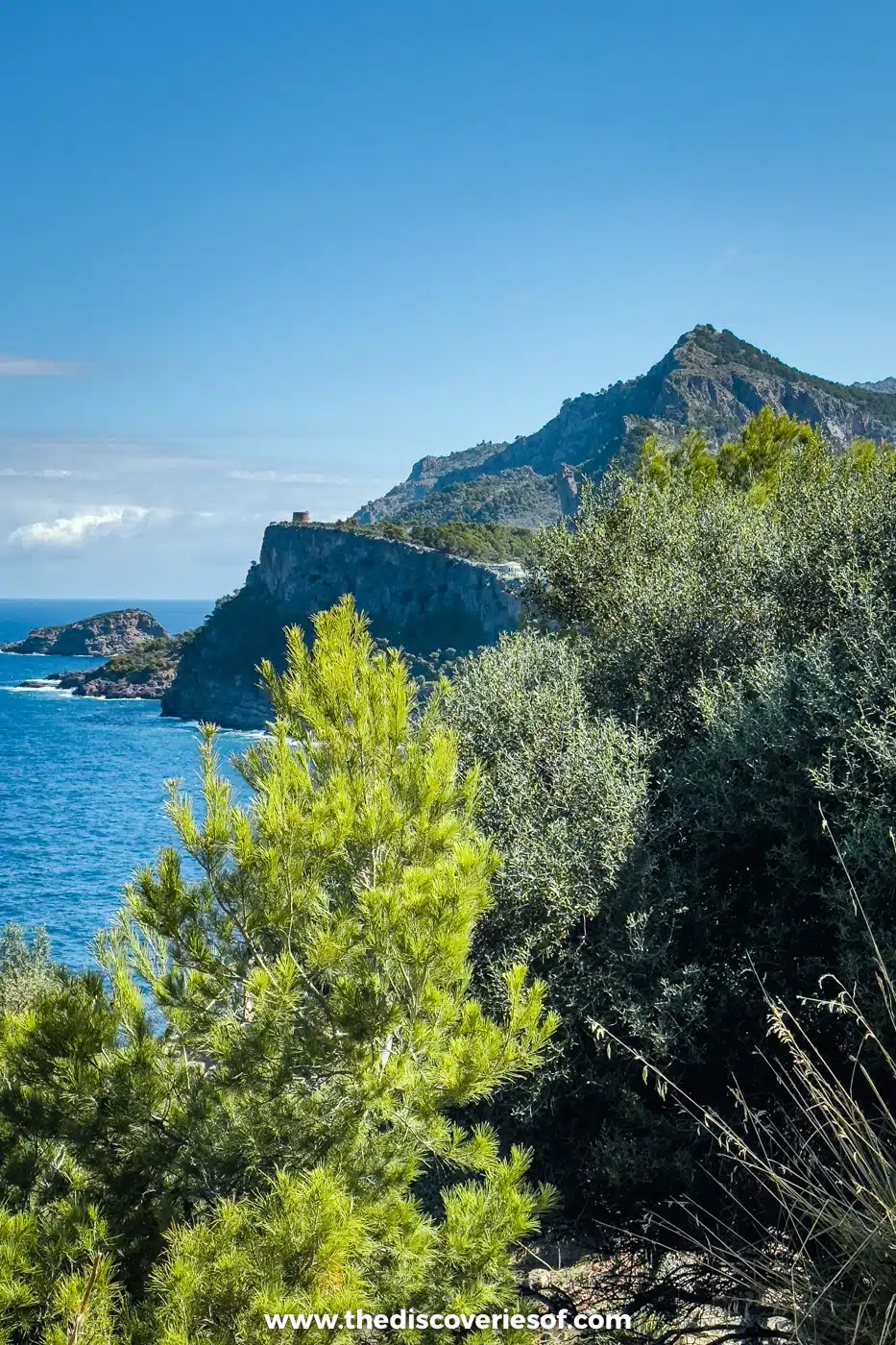
The Far de Cap Gros stands 120 metres above the sea on the tip of the headland: a white 22-metre tower beside the keepers’ red-roofed house. Sóller’s town council built the tower in 1842, but it didn’t come into use until the state took it over, and the light was first lit on 20 February 1859. It’s still a working light, flashing three times every 15 seconds and visible 19 nautical miles out to sea.
Keeping it was a hard posting. The tower was built without a proper service room, so the keepers stood their watches up in the gallery, and in the 19th century the walk down to the harbour could take them more than two and a half hours in winter.
The views are the reason to come. One viewpoint looks north over the mouth of the bay, across to the Torre Picada watchtower on the opposite cliffs, finished in 1622 to watch for the pirates who had raided the valley; a terrace on the western side faces the open sea and is the place to watch the sun go down.
Just above the lighthouse, the stone building of the Refugi de Muleta was an army telegraph station from 1912 to 1956. It’s now a refuge on the GR221, the long-distance path across the Serra de Tramuntana, with a 30-bed dormitory from about €14 a night and meals for guests, booked ahead with the refuge. If you’re only walking up for the view, don’t count on buying lunch at the top: bring water and a snack, and eat in the port.
Beyond the lighthouse on the GR221
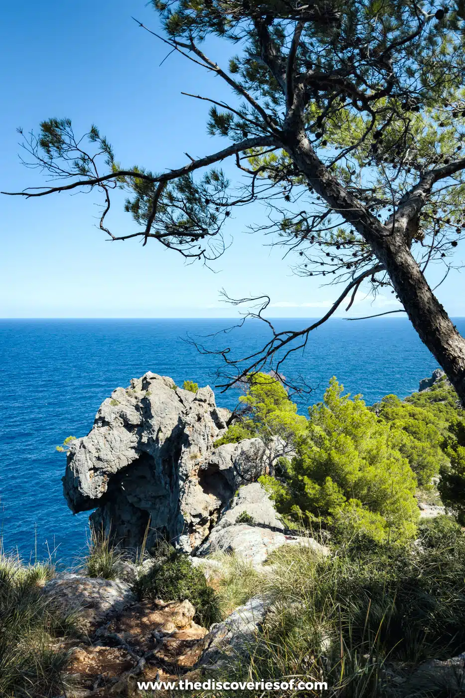
From the lighthouse, the GR221 heads south-west along the headland, and this is where the walk gets wilder. I carried on along it for a good stretch: the lane gives way to a path through pines and wild olives, with jagged limestone outcrops on the cliff edge and the sea far below.
How far you go depends on how much time you have:
- Out and back: turn round whenever you’ve had enough and return the same way. Even 20 minutes along the path is worth it for the views back along the cliffs.
- The Muleta loop, about two hours from the port: follow the GR221 up through the old Muleta farms, where a stone path drops past olive groves to a stream, then take the forest track back down to Platja d’en Repic. The groves are private land with a public path through them, so close the gates behind you.
- The long loop, about 12 km from the lighthouse: carry on past the Muleta farms and inland to the hamlet of Bens d’Avall, then back round via the Punta de Sóller. Allow three and a half hours of walking, plus the lane there and back.
- On to Deià: the GR221 continues about 10 km along the coast to Deià. Allow three to four hours, and check the bus times from Deià back to the port before you set off.
When to go
The walk is good all year, but the time of day matters more than the season. On summer afternoons the lane is hot and exposed, so go early or wait for the evening, when the light turns the mountains gold and you can watch the sun set from the lighthouse terrace. Bring a torch if you’re staying for sunset, as the walk back down will be in the dark.
Spring and autumn are the best seasons for carrying on along the GR221, when it’s cool enough to walk for longer. Winter is quiet and often clear, but check the tram dates if you’re relying on it.
Tips for the walk
- Shoes: trainers are fine for the lane, but wear proper walking shoes if you’re going beyond the lighthouse, as some old cobbled sections are uneven and slippery when wet.
- Water and shade: there’s little shade on the lane and nowhere to buy water at the top, so carry plenty.
- Traffic: in high season the lane is busy with cars and walkers, so keep children close on the bends.
- Combine it: the walk fits easily into a day in Sóller and the port. For the rest of the valley, see my guide to things to do in Sóller and Port de Sóller, and for the mountain road above it, the Serra de Tramuntana drive.
Map
Read next
- Things to do in Sóller and Port de Sóller
- The Serra de Tramuntana drive on Mallorca’s Ma-10
- Rondaia review: a vineyard stay near Esporles
- The best beaches in Spain
- Hikes and walks in Menorca
- The Spain travel guide
Love this? Save and share on Pinterest
Discover the top things to do, insider tips and hidden gems in our Spain Travel Guide.
Read the guides →