Discover the best things to do in Denver, Colorado with this in-depth guide.
I have to say, of all the US cities I’ve spent time in, Denver was the one that surprised me the most. I don’t know what I expected from it, but this quirky city, packed with cool haunts and surrounded by stunning natural landscapes more than delivered.
From hiking and biking trails to world-class museums and restaurants, it’s little wonder that the locals are fiercely proud of Denver. Now it’s time for you to get to know Colorado’s capital city – just don’t be surprised if you come away raving about it too.
Hold on tight. We’re going to explore the best things to do in Denver – complete with practical tips for planning your stay at the end.
Top 5 Things to do in Denver
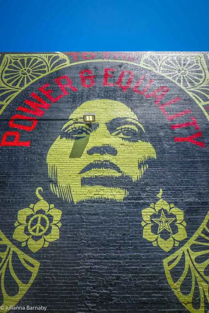
See The Street Art in RiNo
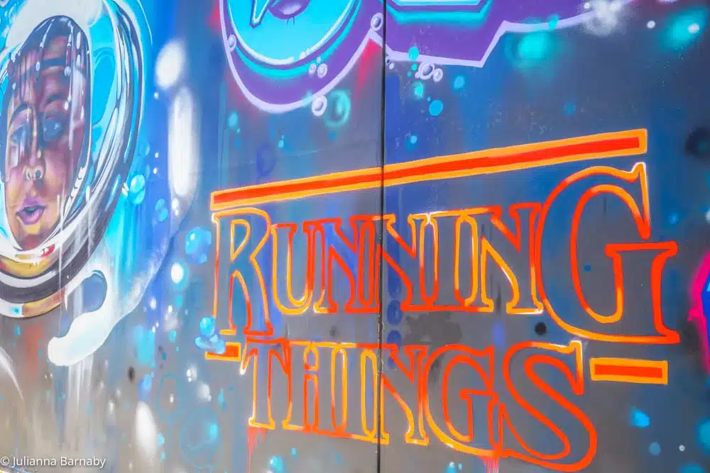
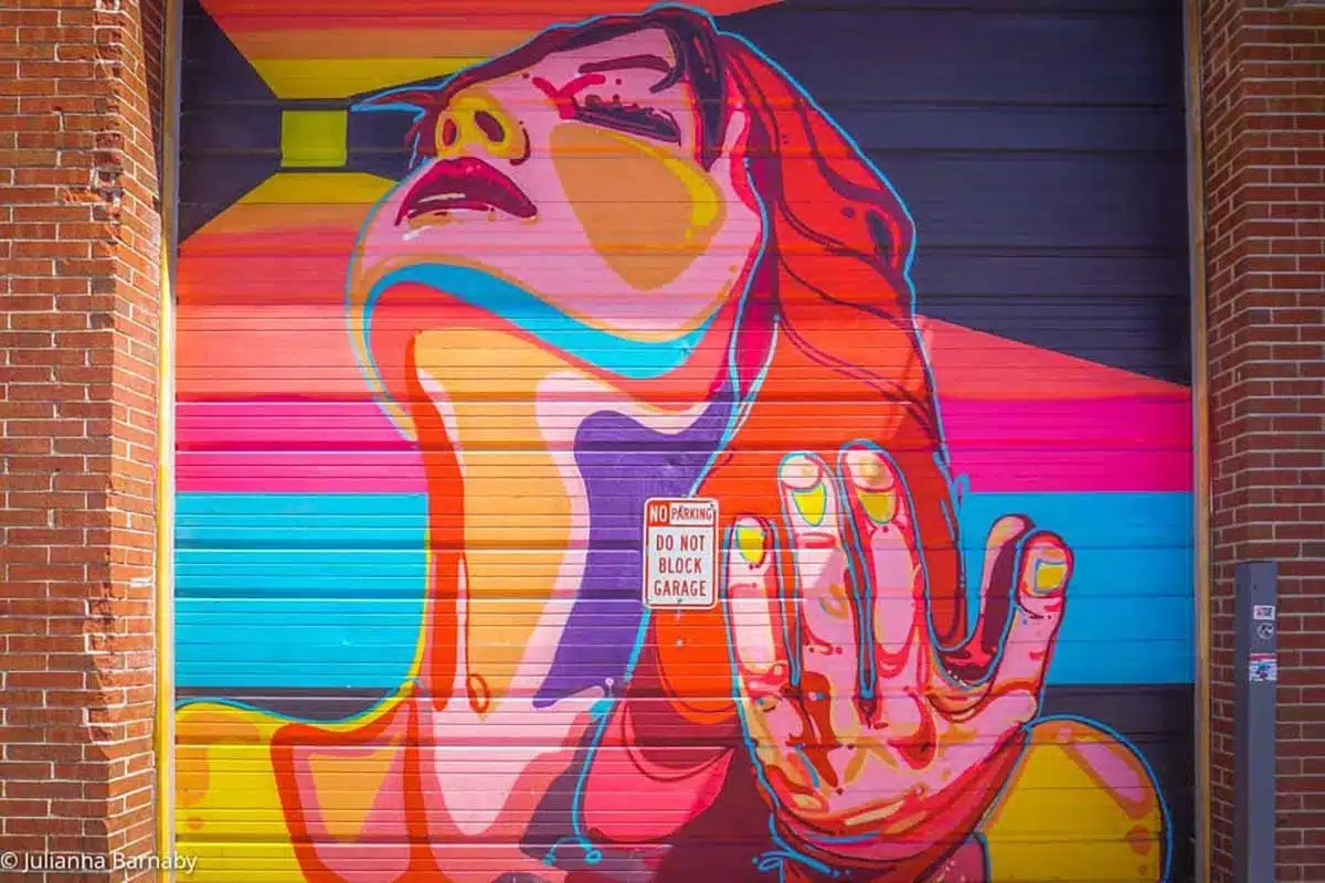
RiNo is a neighborhood in Denver that is home to some of the best street art in the city.
You can find murals, graffiti, and sculptures throughout the neighborhood. It’s a full-on explosion of colour in which there’s always something new to discover.
Once a year, it hosts a giant mural festival called CRUSH Walls. Artists fly from all over the world to bring their freshest ideas to decorate RiNo’s walls.
Time your visit right to see all of the action. Even if you don’t, the pieces stay up until the next year’s festival, ready for you to explore them at your leisure.
How to Visit: Check out my Denver Street Art Guide – Complete with a self-guided tour
Take a Visit to Red Rocks Park
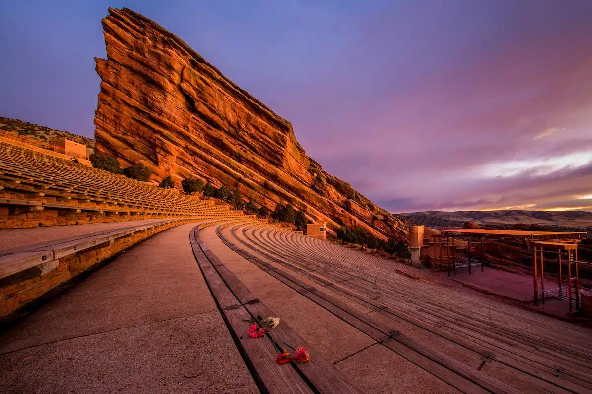
Red Rocks Park is a beautiful park located just outside of Denver that’s a popular spot for yoga, concerts and hiking. The views from the top of the rocks are absolutely stunning, so be sure to bring your camera!
Still, beautiful as the park is, it’s the Red Rocks Amphitheatre that most people come here for: a world-famous concert venue located in Red Rocks Park.
The natural amphitheatre hosts concerts and events all year round, and is a must-see for music lovers. The acoustics at Red Rocks are some of the best in the world, so you can be sure to experience a show like no other!
How to Visit: Book tickets to a concert of your choice or visit on this Red Rocks & Mount Evans Tour
Visit the Denver Zoo
Denver’s Zoo is one of the best in the US – a world-class zoo that’s a total pleasure to visit. The zoo has over 4000 animals from 500 different species.
They also have a variety of fun exhibits and activities for visitors to enjoy. Be sure to check out the Predator Ridge exhibit, which is home to lions, tigers, and other predators!
How to Visit: Book tickets online, on the door or get free admission with the Denver CityPass
Go Hiking (Or Biking) in The Rocky Mountains

You’re not going to come all the way to Denver and ignore the glorious Rocky Mountains are you? Thought not.
Let’s face it: a trip to Denver, no matter how short, would not be complete without experiencing the beauty of the Rocky Mountains. It’s only an hour and a half to Estes Park, the gateway to the Rockies – from where you can hop off to do cool hikes and trails including Bear Lake and the Glacier Gorge Trail.
Even better? Take a road trip around Colorado, kicking off in Denver and then making your way to the Rockies and a Dude Ranch like I did.
Pop into Denver Central Market
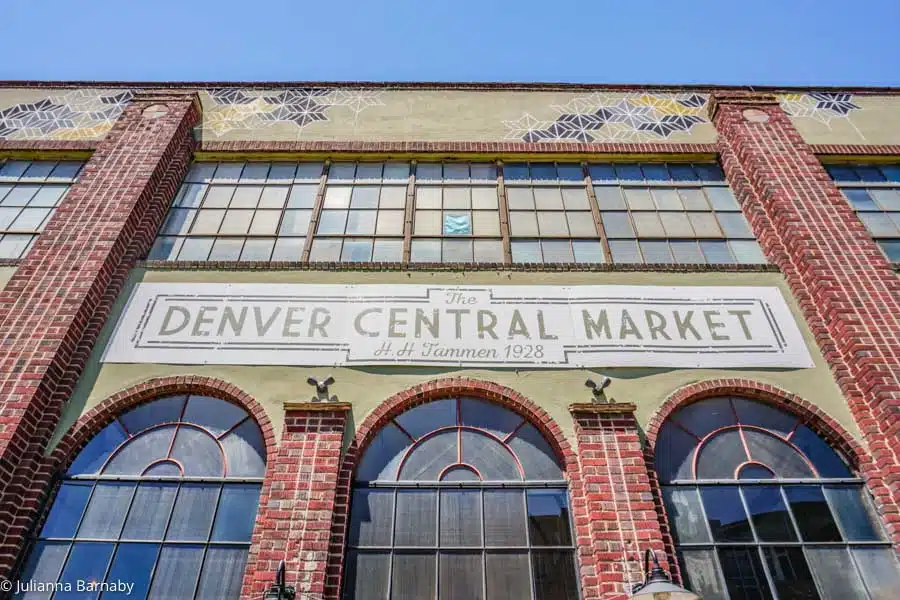
Denver’s culinary scene is booming. Jump into the deep end and eat your way around the uber-cool Denver Central Market in the RiNo district.
Packed with dozens of different food vendors as well as a few shops and bars, it’s the place to dine your way through locally-sourced Colorado food – often with an international twist.
My favourite drinks spot is Curio, who serve up some banging cocktails and a decent selection of wines and craft beers.
For food, don’t miss out on Green Seed, whose hearty salads lend a new definition to the name. They’re some of the best I’ve ever had!
Cool Things to do in Denver During the Day
Visit Denver’s Botanic Gardens
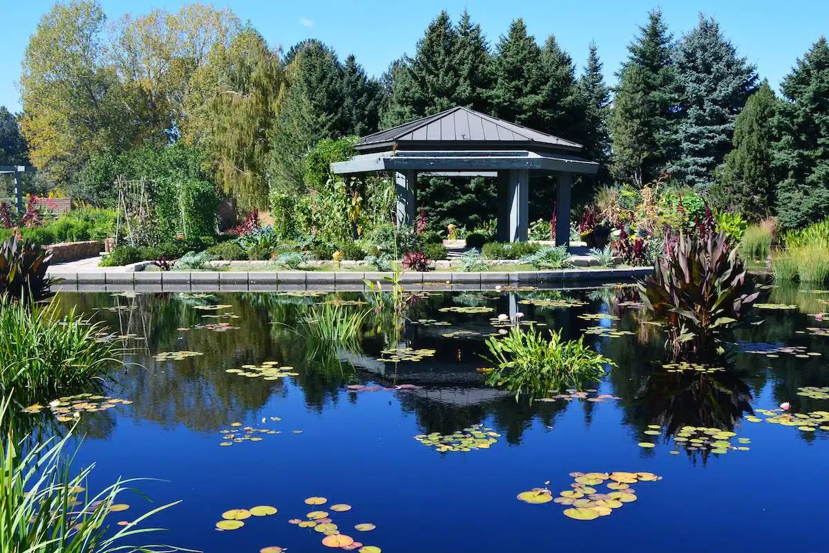
Denver’s Botanic Gardens provide a beautiful oasis of verdant calm in the middle of the city. The gardens have dozens of different gardens and exhibits to explore, as well as a selection of rare orchids from around the world.
It’s a great place to spend an afternoon relaxing and taking in all the beauty away from the crowds!
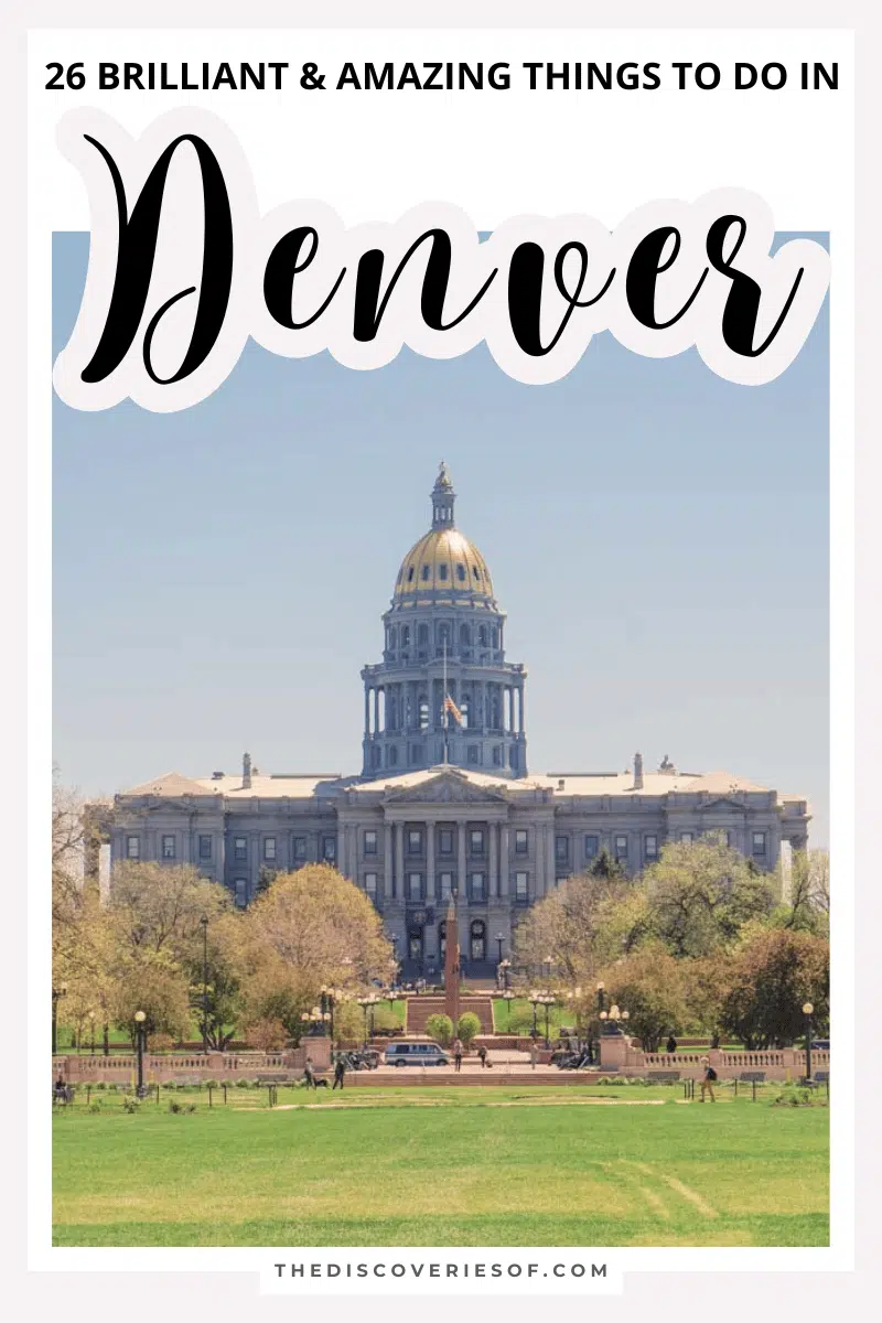
Visit The Colorado State Capitol
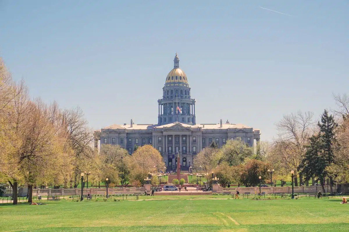
The Colorado State Capitol is one of the most iconic buildings in Denver and definitely worth a visit if you’re interested in history or architecture.
The Capitol was built in the late 1800s and is full of beautiful details. There is also a museum on-site that covers the history of Colorado.
Explore Larimer Square
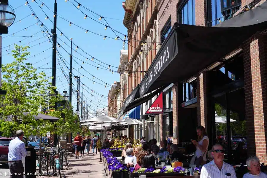
Less a square and more a wide street, Larimer Square is a historic spot in the heart of Denver that is full of trendy restaurants, bars, and shops.
This is where Denver started – and now it’s one of its coolest hangouts.
Osteria Marco serves some of the best pizzas in the city, while the secret speakeasy Green Russell is one of the coolest places to grab a cocktail in Denver – period.
Tattered Cover Book Store
The Tattered Cover Book Store is a Denver institution. It’s the largest independent bookstore in Colorado, and it’s full of new and used books, as well as magazines, comics, and more.
Historically, The Tattered Cover has been a place for writers and artists to come and hang out, so it’s the perfect place to go if you’re looking for some inspiration. They also host author readings and events throughout the year.
Visit The Denver Art Museum
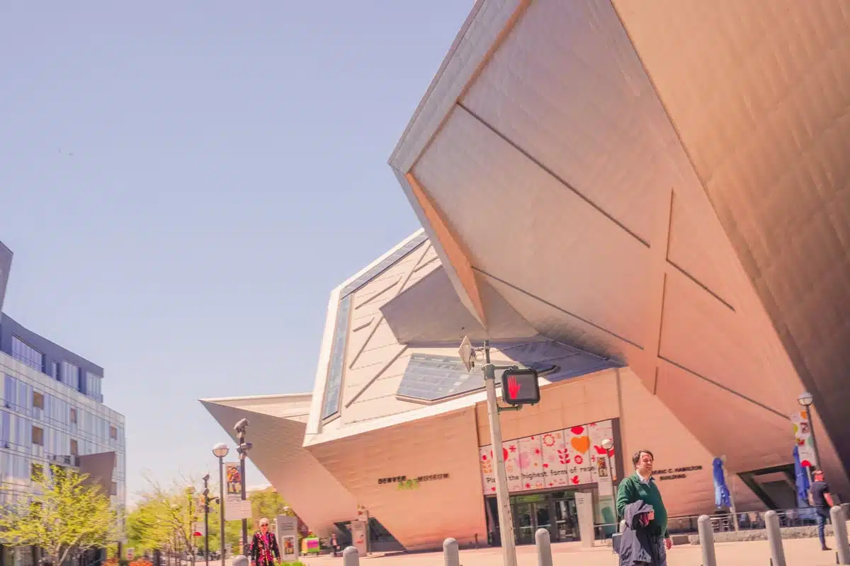
Denver is home to a number of world-class museums, which are a must-visit for any art or history lover.
The Denver Art Museum is one of the largest art museums in the United States. It is home to a variety of collections, including American Indian art, Asian art, and European modernism. The museum offers a variety of exhibits and programs for visitors to enjoy. Be sure to check out the museum’s website for information on upcoming exhibits and events.
Or The History Colorado Center
The History Colorado Center is another great museum that tells the story of Colorado’s past, from the ancient Pueblo people to the present day.
The museum has a variety of exhibits and interactive activities that are perfect for visitors of all ages. It’s also home to the Colorado History Library, which is one of the largest historical libraries in the state. Be sure to check out their website for information on upcoming exhibits and events.
Drink Your Way Around Denver’s Craft Beer Breweries
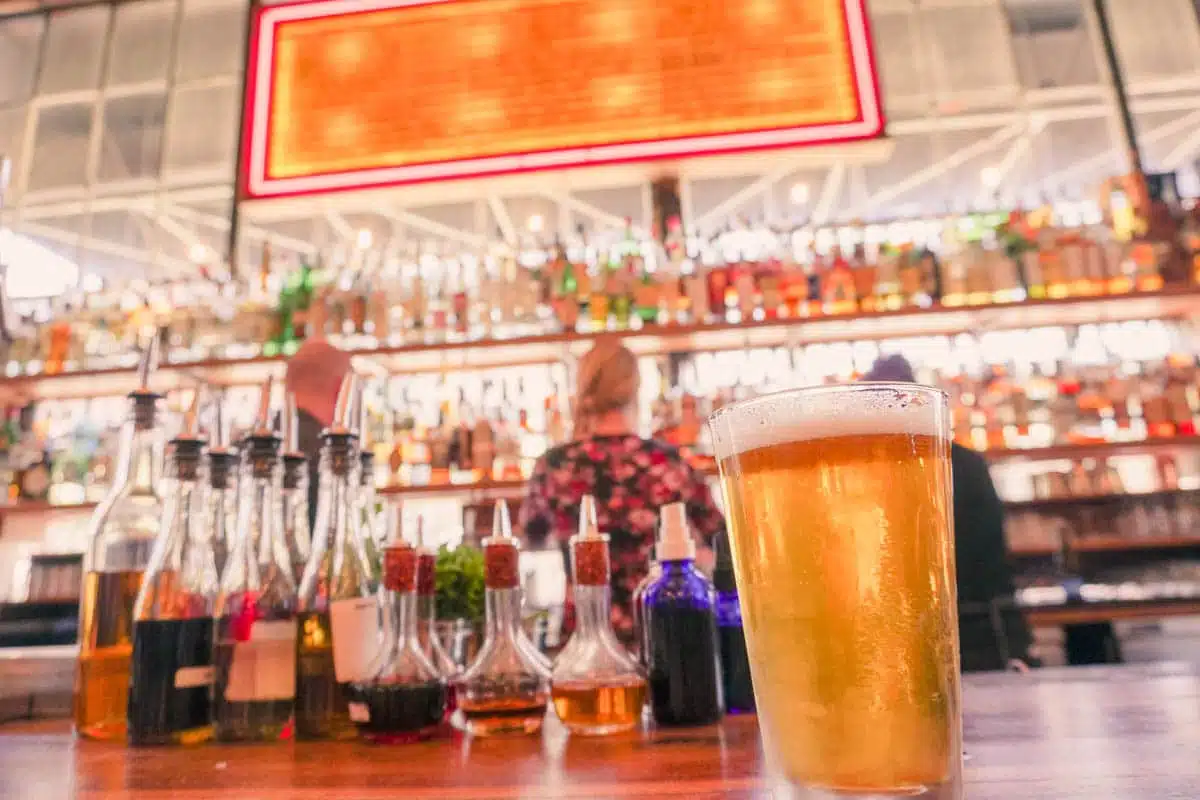
Denver is home to a number of world-class craft breweries, and beer lovers will definitely not want to miss out on them!
Some of the best breweries in Denver include Great Divide Brewing Company and Wynkoop Brewing Company. These breweries offer a variety of beer styles and flavors, so there is something for everyone.
Enjoy A Delicious Meal

Denver is home to a variety of amazing restaurants, which offer something for everyone. Whether you are in the mood for Mexican food, Italian food, or sushi, Denver has a restaurant that will satisfy your cravings.
The city also has a number of food trucks, which serve up some of the most delicious street food in the country. Be sure to check out one (or several) of Denver’s amazing restaurants during your visit!
Top picks include Blackbelly for contemporary American cuisine and Restaurant Olivia for fine dining.
Hang Out in Union Station
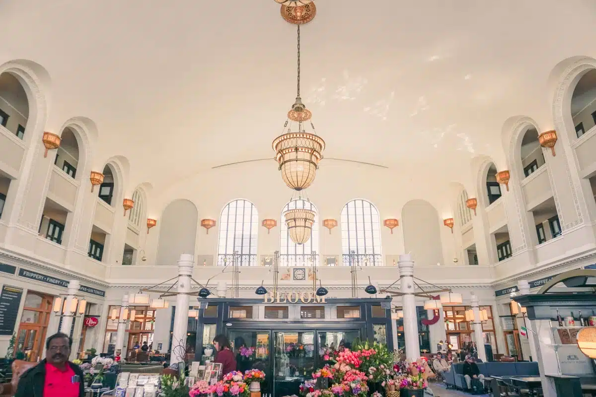
Union Station is a beautiful historic building in the heart of Denver that has been transformed into a trendy shopping and dining destination.
The station features a variety of restaurants and bars – including the much-loved Mercantile Dining & Provision – as well as several shops. It’s the perfect place to spend an afternoon or evening.
Explore the Neighborhoods
Denver is a huge city, and there’s a lot to explore beyond the tourist traps. Head to one of Denver’s neighborhoods and check out what the locals love about their neighborhood.
You’ll find everything from hipster coffee shops to hole-in-the-wall Mexican restaurants. Each neighborhood has its own style and feel.
RiNo is the best place to go for art and nightlife, for example, while LoDo is good for sports fans.
Dairy Block
If you’re looking for a place to hang out and explore, be sure to check out Dairy Block. The development is located in the heart of LoDo and is home to some of Denver’s best restaurants, bars, and shops.
The Grandoozy music festival is also located in Dairy Block. The three-day festival is a celebration of music, art, and food, and features performances by some of the biggest names in the music industry.
Have a Drink in the Lobby of the Brown Palace Hotel & Spa
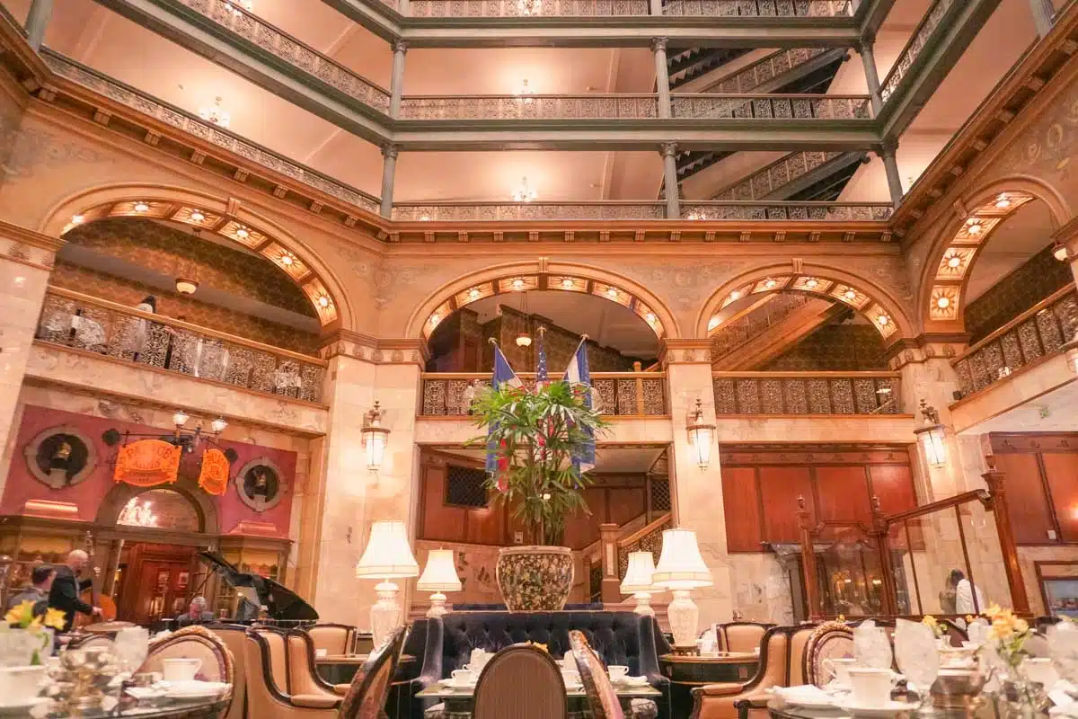
The Brown Palace Hotel & Spa is one of Denver’s most iconic buildings.
The hotel has been around since 1892 and features a beautiful lobby with marble floors and stained glass windows. It’s the perfect place to have a drink after a long day of sightseeing.
Hang Out in Washington Park
Washington Park is a beautiful park in the heart of Denver that is perfect for a relaxing afternoon stroll.
It’s huge – measuring in at over 200 acres – and features a variety of gardens, ponds, and walking trails.
Locals love it – and any tourists who venture to the park love it too, thanks to the melange of gardens, trails, and grassy areas, as well as several ponds and fountains.
Washington Park is also home to the Denver Zoo and the Museum of Nature & Science.
Denver Museum of Nature & Science
Speaking of the Denver Museum of Nature & Science – make sure you pop in for a visit too. Delve into the museum’s exhibits, which range from dinosaurs to Egyptian mummies.
Pretty much what you’d expect from a museum that covers such a wide range of fields from paleontology and human sciences.
Where else do you get the opportunity to learn about everything from the universe to human anatomy?
Catch a Game at Coors Field
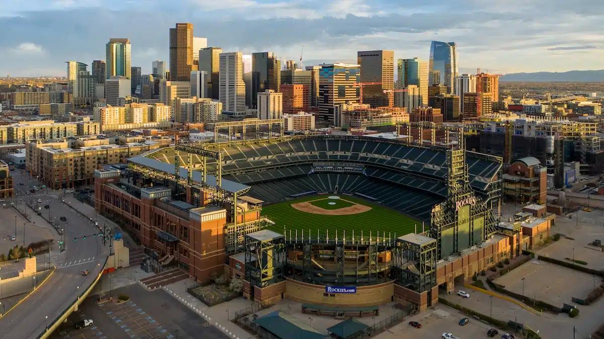
Denver is a great city for sports fans, as it is home to two professional sports teams – the Denver Broncos and the Colorado Rockies. If you’re in town when either team is playing a home game, be sure to catch a game at Coors Field.
The stadium is located in LoDo (Lower Downtown) – there’s nothing like it when the game is on and the crowd is pumped! It’s definitely worth checking out!
Molly Brown House Museum
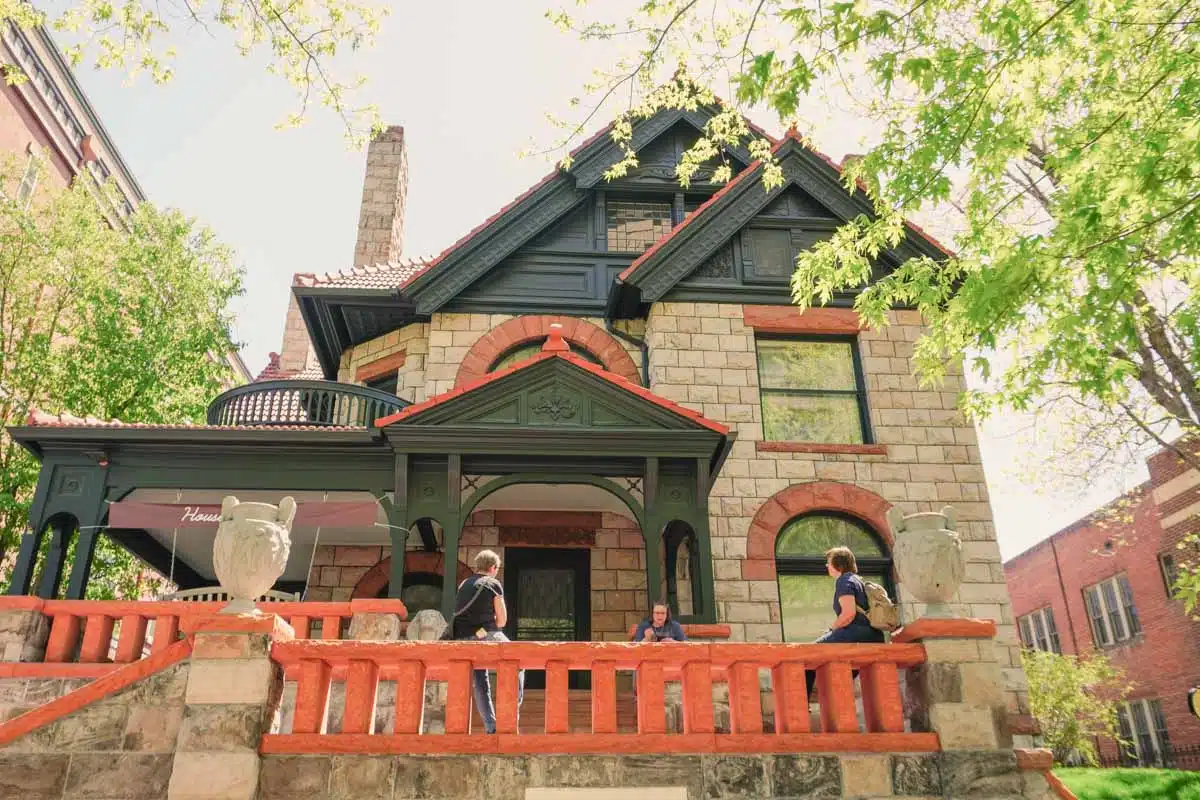
The Molly Brown House Museum is a must-visit for history lovers.
The museum is dedicated to the life of Margaret “Molly” Brown, who was a social activist and philanthropist who lived in Denver.
The museum features exhibits on Molly’s life as well as the history of the times in which she lived. It’s a fascinating look into the life of an incredible woman.
MCA Denver
If you’re looking for a little bit of culture during your visit to Denver, be sure to check out the MCA Denver.
The museum is dedicated to contemporary art and features rotating exhibits by some of the world’s most talented artists. It’s a great place to see cutting-edge pieces and get a unique perspective on modern art.
Unusual Things to do in Denver
Hang Out in Denver’s Beer Spa
Denver’s first beer spa recently opened up in the RiNo district. The spa offers a variety of different beer-themed treatments, such as a hop and malt wrap, a barley scrub, and even a beer bath!
Now, if the idea of a beer spa has you thinking about some low-quality boorish hangout that’s more pub than spa, you should think again. The spa is inspired by a traditional Czech spa but given a Japanese aesthetic – think lots of clean lines and light and you’ll be on the right track.
Take an E-Tuk Tour of the City
Denver is a great city to explore on foot, but if you want to see a little bit more of the city, consider taking an E-Tuk tour.
E-Tuks are three-wheeled vehicles that can accommodate up to six passengers. They are perfect for getting around the city and offer a fun and unique way to see Denver – particularly when headed up by some of the funniest tour guides in town. I highly recommend them.
Clyfford Still Museum
The Clyfford Still Museum is a must-visit for art lovers.
The museum is home to the world’s largest collection of works by Clyfford Still, an American painter who was a pioneer of the Abstract Expressionist movement.
Some of his most famous works are in the museum, including “Cityscape” and “1949-A-No.I”. The museum offers a variety of exhibits and programs for visitors to enjoy.
Check Out the Public Art – Including the Big Blue Bear
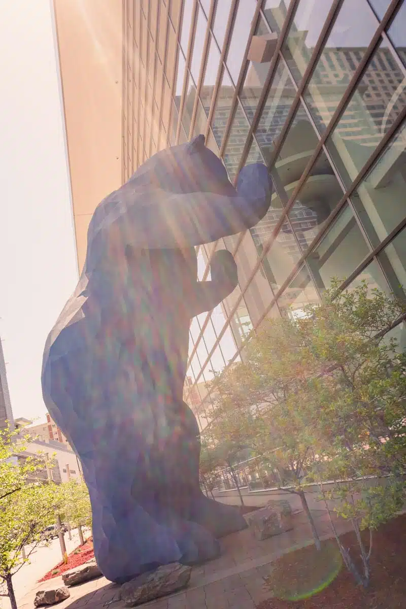
Denver is home to a number of beautiful pieces of public art, which are worth checking out during your visit.
Some of the most famous pieces of public art in Denver include “The Big Blue Bear” (which is located outside the Colorado Convention Center), “Red Pegasus” (located at 16th and Blake Streets), and “Marilyn Monroe” (located in Civic Center Park).
The Big Blue Bear is particularly interesting because it is one of the most photographed pieces of public art in the world. Be sure to stop by and snap a picture during your visit!
Meow Wolf
Want to discover something a little bit more out-of-the-box? Be sure to check out Meow Wolf. The art collective is based in Santa Fe, but they have a location in Denver too.
The exhibitions at Meow Wolf are interactive and mind-blowing – definitely not your average museum experience! Be prepared to be amazed.
So there you have it – some of the best things to do in Denver. Whether you’re a history buff, an art lover, or just looking for something fun to do, Denver has something for you – you just need to know where to find it!
Things to do in Denver: Practical Tips for Your Trip
Easy access to the Rocky Mountains
Great Breweries
Football
History
Cool Street Art
Denver is a great city to visit, and there is a lot to see and do. However, if you only have a limited amount of time, I would recommend staying for 3-4 days. This will give you enough time to explore the city and its attractions.
Where Should I Stay in Denver?
The Sheraton Denver
The Sheraton Denver – The Sheraton Denver is one of the biggest hotels in Denver.
It’s everything you’d expect from a Sheraton – high-end, comfortable and a great location downtown (plus beds so comfortable that you never want to get out of them).
Check Rates and Availability at the Sheraton Denver
Things to do in Denver: Map
Love This? Save and Share on Pinterest

Discover the top things to do, insider tips and hidden gems in our USA Travel Guides.
Read the guides →