


On a wooded hilltop where the Han and Imjin rivers meet the sea, a glass observatory looks across a strip of water barely 1.4 km wide into another country. Aegibong Peace Ecopark doesn’t need a tour, a full day or a big budget, but the view it promises comes with a catch, and it’s worth knowing what you’ll actually see before you set off.
Most people who want a glimpse of North Korea book a guided DMZ tour from Seoul, and that takes up most of a day. I visited Aegibong Peace Ecopark in October as an alternative way of seeing the border. It’s a relatively new spot, set on a former battlefield in Gimpo, about an hour and a half’s drive from the centre of the capital.
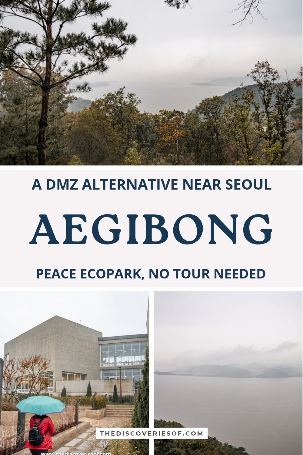
The weather didn’t play ball. It was a damp, grey day, and a thick mist hung over the water, so I couldn’t make out much on the far bank. The views were still stunning, though: pine-covered slopes tumbling down to a wide, silvery estuary, with the hills of the North fading into the cloud.
This guide covers what you can and can’t see from the observatory, how a visit compares with a DMZ tour, the history of the hill, the walk up from the exhibition hall, booking and the ID check, and how to get there.

Aegibong Peace Ecopark at a glance
- What it is: a park and observatory on Aegibong, a 154-metre hill on the South Korean bank of the Han River estuary, facing North Korea’s Gaepung county.
- Where: 289 Pyeonghwagongwon-ro, Wolgot-myeon, Gimpo, Gyeonggi province. In Naver Map or KakaoMap, look it up as 애기봉평화생태공원.
- Hours: 9.30am to 5.30pm, every day. Everyone has to be out of the area by closing time.
- Tickets: adults pay 3,000 won (under £2), teenagers (13 to 18) 2,000 won and under-13s 1,000 won; under-sixes and over-65s go free. Cards only, no cash.
- Booking: numbers are capped at about 500 people at a time, so reserve a slot online before you go.
- Bring: your passport. There’s an ID check at the gate, and no ID means no entry.
- Time needed: two to three hours on site, plus the journey from Seoul.
What you can actually see from the observatory
So, can you see North Korea from here? Yes, and it’s startlingly close. From Jogang Observatory at the top of the park, the opposite shore is about 1.4 km away across the estuary, and on a clear day the free telescopes bring its villages, paddy fields and bare hillsides in Gaepung county into sharp focus. You may even spot people working in the fields.
What you can’t see is Pyongyang. You’ll find claims online (and on plenty of tour listings) that the North Korean capital’s skyscrapers are visible from here, but Pyongyang is roughly 150 km to the north, far beyond the horizon. The view is of rural North Korea, which is arguably more striking anyway: there’s no glittering skyline, just a quiet, sparsely built landscape a stone’s throw from one of the most densely populated parts of the South.

The water between the two banks is part of the Han River Estuary Neutral Zone, set up under the 1953 armistice. Unlike the DMZ further east, there are no fences down the middle here, but no one crosses either. The estuary is also an important stop for migratory birds, and the park gives its wildlife as much space as its history.
Whether you see the far bank at all comes down to luck with the weather. Mist and haze often settle over the estuary, as they did when I visited, and on those days the telescopes show you little more than a grey wall. Clear, dry days, especially just after rain has cleared the air, give the sharpest views.
How a visit compares with a DMZ tour
Aegibong isn’t inside the Demilitarized Zone. It sits in the Civilian Control Zone just south of it, so it won’t give you the Third Infiltration Tunnel, Dora Observatory or the blue huts of the Joint Security Area at Panmunjom, which is what most DMZ tours are built around. If those are what you’re after, a guided tour is the only way in, and it’ll take most of a day; visits to the Joint Security Area in particular have often been paused, so confirm what a tour includes before you pay.
What Aegibong offers instead is freedom. You go when you like, without a group or a guide, for less than the price of a coffee, and a morning visit can have you back in the city by mid-afternoon. The North is right there across the water, and the park adds its own exhibitions and woodland trails. For anyone with only a few days in Seoul, it’s a much easier fit than a full-day tour.
The story of Hill 154
During the Korean War, this hill was known simply as Hill 154 after its height in metres. It guarded the mouth of the Han River and the western approach to Seoul, and South Korean and North Korean forces fought over it again and again.
The name Aegibong comes from a much older story. According to local legend, during the Manchu invasion of 1636, a gisaeng (a female entertainer) called Aegi climbed this hill to gaze north after the governor she loved, who had been taken captive, and asked to be buried here when she died. In 1966, President Park Chung-hee heard the tale and named the peak Aegibong, “Aegi’s peak”, in her memory.
For decades afterwards, the hill was best known for something rather less romantic. In 1971, an 18-metre steel tower was put up on the summit and strung with lights every Christmas, and the glowing “Christmas tree” was clearly visible from the North, which treated it as propaganda. The lighting was halted and revived several times as relations between the two Koreas cooled and thawed, and the tower was finally taken down in 2014 after failing a safety inspection.
The old observatory, built in 1978, went too. In its place came the Peace Ecopark, designed by the architect Seung H-Sang and opened in October 2021. The newest addition is a Starbucks inside the observatory, which opened in November 2024 and is now as much of a draw as the view, so expect a queue for it at weekends.
Walk from the exhibition hall to Jogang Observatory
A shuttle bus, included in the ticket, carries you from the ticket office up to the Peace Eco Exhibition Hall, a low building of board-marked concrete that sits neatly into the slope. Inside, displays cover the Korean War, the division of the peninsula and the wildlife of the estuary, and there’s a VR room that takes you virtually across the border to the historic sites of Kaesong. On a wet day, it’s a good place to start while you wait for the weather to lift.
From the hall, the path climbs through themed gardens and over a 112-metre suspension bridge, then zigzags up through the pines to the top of the hill. The route is steep in places and not suitable for wheelchairs, so wear comfortable shoes.

At the summit, Jogang Observatory has a large indoor viewing room with floor-to-ceiling windows and an open-air deck above it. The deck usually gives the clearest view, without reflections in the glass. Look out, too, for the Peace Bell near the top and the memorial altar where families displaced from the North come to remember the relatives they left behind.
Top Tip
Don’t photograph or film military facilities or soldiers on the site, and leave the drone at home: both are banned here, and the rules are enforced.
Booking, tickets and the ID check
Because the park sits in a restricted military area, getting in is a little more involved than buying a ticket at the gate.
- Book ahead: the park limits numbers to about 500 at a time and entry runs in timed sessions, so reserve a slot on the official Aegibong Peace Ecopark website, especially for weekends and public holidays. Turning up without a booking may work on a quiet weekday, but there’s no guarantee of a slot.
- Bring your passport: foreign visitors need their passport (or Korean residence card) for the ID check at the military checkpoint. Without it, you’ll be turned away.
- Pay by card: tickets are card only. Entry has also been free on Wednesdays, Korea’s “culture day”, so check before you pay.
- Allow time: aim to arrive by early afternoon. The shuttle, the exhibition hall and the walk to the observatory and back take longer than you’d think, and you have to be out by 5.30pm.
When to go
- For the view: choose a clear, dry day, ideally just after rain has washed the haze away. Autumn and winter tend to bring the crispest air; summer is often hazy.
- For fewer crowds: go on a weekday morning. Visitor numbers have soared since the Starbucks opened (the park welcomed its millionth visitor in June 2026), and weekends are much busier.
- Check the news: access to border areas can change at short notice for security reasons, so check the official website or call the park before you travel.
How to get to Aegibong Peace Ecopark from Seoul
The park is in the far north-west of Gimpo, and the easiest way to get there is by car or taxi: the drive from central Seoul takes 60 to 90 minutes, depending on traffic. There’s free parking by the ticket office.
By public transport, take the Gimpo Goldline light railway from Gimpo International Airport station (where it meets subway lines 5 and 9 and the airport railway) to Unyang or Gurae station. From there, Gimpo city buses 3-2 (via Unyang) and 7-2 (via Gurae) stop at the park, but they run infrequently, and some services only operate at weekends, so check the timetable in Naver Map or KakaoMap before you set off. A taxi from the end of the Goldline is quicker and costs much less than one from Seoul.
Several tour companies also run half-day and full-day trips to Aegibong from Seoul, often combined with a shopping outlet or a food experience, which take care of the transport for you. Google Maps is no use for directions in South Korea, so my South Korea travel tips explain which navigation apps and transport cards to download and buy, and my 3 days in Seoul itinerary for how to fit Aegibong into a short trip.
Map
Read next
- 32 things to do in Seoul, from a virtual royal banquet to cocktails in an old teahouse
- How to spend 3 days in Seoul, from royal palaces to a loo with a view
- 22 things to do in South Korea, from a peek into North Korea to a vigorous spa scrub
- 30 South Korea travel tips to know before you go, from cash to hidden cameras
Love this? Save and share on Pinterest

Discover the top things to do, insider tips and hidden gems in our South Korea Travel Guide.
Read the guides →