


Planning to visit Big Bend? Explore with this step-by-step two-day Big Bend National Park itinerary, with the hikes, scenic drives and practical tips you need for a weekend in the park.
Where else can you find amazing mountains, clear, starry night skies, and beautiful desert landscapes? Big Bend National Park has it all.
It’s a whopping four hours from the nearest major airport (in Midland, Texas), but it’s worth the long drive to see one of Texas‘ most beautiful destinations.
While I always recommend taking more than just two days to see the park, you can definitely have a rich experience in one weekend. I visited in March, camping in the Chisos Basin, hiking the Lost Mine Trail at sunset and crossing the Rio Grande for lunch in Mexico, and this itinerary is built around the highlights of that trip.
Read on for my suggested itinerary for a short trip to Big Bend National Park, plus everything you need to know before you go.
Planning your trip: practical tips

Arrival and transportation
The nearest commercial airport to Big Bend National Park is Midland International Air and Space Port in Midland, Texas, about 240 miles from Panther Junction, the park’s headquarters. You can also fly into El Paso, Texas, but it’s around 330 miles away, which makes for a drive of five and a half to six hours.
You absolutely need a car to properly explore Big Bend. The park is enormous, and the main sights are often an hour or more apart.
You can either drive (if you’re from Texas or New Mexico) or you can rent a car at the Midland airport. I rented with Avis, and rental cars get snapped up around spring break, so book early if you’re visiting in March. You do not need a four-wheel drive unless you plan to do some backcountry/off-road camping or tackle the rougher dirt roads. The road to Grapevine Hills, for example, needs a high-clearance vehicle.
Gas costs a bit more than average in these rural areas, and stations are few and far between. Avis had an option to pre-purchase a tank of gas (so we wouldn’t have to refill), and it ended up being a really good deal. Either way, fill up in Marathon, Alpine or Study Butte before you enter the park. Inside the park, there’s gas at Panther Junction, where the pumps take cards around the clock, and at Rio Grande Village during store hours. Storm damage has knocked out fuel in the park before, so arrive with a full tank rather than counting on it.
Cell service is patchy at best across most of the park, so download offline maps before you arrive. Flash floods regularly close roads and trails here, so check the park’s alerts and conditions page before you set off each morning.
Entrance fees
Big Bend charges $30 per private vehicle, and the pass is valid for seven days. It’s $25 for a motorcycle and $15 per person if you arrive on foot or by bike. If you’re visiting several national parks in a year, the America the Beautiful annual pass covers entry to all of them: it’s $80 for US residents and $250 for non-residents.
Visiting from outside the US? The $100-per-person surcharge for non-US residents that came in at the start of 2026 applies only at 11 of the busiest national parks, such as Yellowstone, Yosemite and the Grand Canyon. Big Bend isn’t one of them, so you pay the standard fee.
Accommodation
If you enjoy the outdoors, you can camp in the park for $16 a night.
We spent two nights in the Chisos Basin Campground, which was centrally located for a lot of the park’s most beautiful hikes. This campground has grills available for cooking, as well as restrooms. There are no showers, however. The nearest coin-operated showers and laundry are down at Rio Grande Village. The road up to the basin is steep and winding, and the park doesn’t recommend it for trailers over 20 feet or RVs over 24 feet.
Every developed campground in the park is reservation-only through recreation.gov, and from November to April, they’re full every night. Reservations open up to six months ahead, with a small number released 14 days out. There’s no first-come, first-served camping, overflow area or roadside camping, so don’t arrive without a booking. Rio Grande Village Campground and Cottonwood Campground (which closes in summer) are the other options, and there’s also an RV park with full hookups at Rio Grande Village.
If you’re not into camping, you have a few other options.
We spent one night in Chisos Mining Co. Motel in Terlingua, just outside the park’s western entrance and around an hour’s drive from the Chisos Basin. It’s a simple, no-frills motel and it’s still open, though prices have gone up a fair bit since my stay. Terlingua and Study Butte also have plenty of casitas, glamping sites and vacation rentals, which are a good backup if the park is fully booked.
For a more convenient (and more comfortable) option, the Chisos Mountains Lodge is located right next to the campground. It’s the only lodging inside the park, with motel-style rooms and a handful of stone cottages, and it books up months ahead in peak season.
The lodge has had a bumpy few years. A long-planned project to demolish and rebuild it, which would have closed the whole Chisos Basin for about two years, was cancelled in April 2026 over rising costs, so the basin is staying open for now. The lodge also closed for a while in early 2026 when the basin’s water pumps failed, and its restaurant is closed, with a food truck serving breakfast and lunch instead. Check the lodge’s website or the park’s alerts page for the latest before you book.
When to go to Big Bend National Park
To avoid the heat, plan to visit the park between the months of October and April. This way, you won’t get stuck in the extreme heat of West Texas during the summer. Even in March, our hike up the Lost Mine Trail was hot and dry.
May through August are the hottest months. On the desert floor, temperatures are usually well above 100°F by late morning, and average highs at Rio Grande Village reach 102°F to 107°F. The Chisos Mountains run 10 to 15 degrees cooler, so if you do visit in summer, hike high and early, and stay off the desert trails in the afternoon. July to September is the rainy season, when afternoon thunderstorms can bring flash floods.
Winter is generally mild and sunny, but nights can drop below freezing, which is worth knowing if you’re camping. Spring is the park’s busiest season, and Thanksgiving, the Christmas to New Year period, spring break and holiday weekends are the most crowded times of all. On busy days, the parking areas at the Lost Mine Trail and in the Chisos Basin fill up, and rangers sometimes run a one-in, one-out system.
Packing
Big Bend’s weather is very dry, and ranges from chilly in the night to scorching hot during the day. I recommend bringing a few layers that you can put on and take off easily. Otherwise, pack like you would any other camping trip, and don’t forget to bring a camera!
During the daytime, you’ll be fine with shorts and a t-shirt/tank. In the evening you’ll want sweatpants and a jacket, especially if you are planning on camping. Bring sunglasses, plenty of sunscreen and chapstick, a hat, and a water bottle.
The park recommends carrying a gallon of water per person per day, so bring a couple of big refillable jugs as well as your water bottle. Pack a headlamp too if you’re hiking at sunset or stargazing. I went back and forth between sandals and hiking boots for the Lost Mine Trail, and I was glad I chose the boots.
Food
If you stay in the Chisos Basin, you have two options for food: you can bring/buy food to cook, or you can eat at the lodge.
When I visited, we ate at the lodge restaurant, and the convenience store had everything from canned veggies to meats for cooking. The restaurant has since closed, so these days your options in the basin are the food truck outside the lodge (breakfast and lunch only) and the Chisos Basin Store, which sells groceries, snacks and drinks. There are also stores at Panther Junction, Rio Grande Village and Castolon. The snacks were perfect for me, because I get super hangry when I hike.
The nearest restaurants are outside the park in Study Butte and Terlingua, so plan to cook at camp or stock up on supplies for dinner.
Having ample water is critical, as the air and the land are quite dry and you can get dehydrated easily. Top up whenever you pass a visitor centre, store or campground, as you won’t find water on the trails.
Two days in Big Bend itinerary
Day one: hikes and starry nights

Wake up nice and early to depart Midland for Big Bend. If you leave around 8 AM, you can arrive in the park by around noon.
The most direct route heads south through Marathon to the Persimmon Gap entrance. About eight miles north of Panther Junction on that road, the Fossil Discovery Exhibit makes a good place to stretch your legs. It’s an open-air exhibit covering 130 million years of the park’s geological history, with fossils and artwork, and it’s open from dawn to dusk.
Alternatively, head via Alpine to the park’s western entrance. On the way to the park, there are a few detours you can take to see some Texas ghost towns. The one we stopped at was called Terlingua, a former mercury mining town where crumbling stone ruins and an old cemetery sit alongside a small cafe and a few locally-owned shops. You can stop here for lunch once you arrive in the Big Bend area.
Once you’ve set up your tent or checked into your room (my recommendations are in the accommodation section above), there are a variety of hikes that you can go on.
For stunning views of the Chisos Basin, I highly recommend the Lost Mine Trail. This is a moderately steep trail of 4.8 miles round trip that takes 2-3 hours on average and overlooks the amazing rock formations below. The first mile climbs to a saddle with views over the basin, and from there, the switchbacks get steeper. When the trees thin out near the top, keep going past the first viewpoint: the trail carries on along the ridge to a beautiful rock formation looking out over the west side of the park.
Watching the beautiful golden sunset over the valley was something I’ll never forget. If you’re only going to hike one trail in the park, I recommend this one.
The trailhead is at mile 5.1 on the Chisos Basin Road, and its small parking area fills up quickly on busy days. If you’re hiking for sunset, set off around three hours before the sun goes down and bring a headlamp for the walk back. For more detail, read my full guide to the Lost Mine Trail.
If your legs need a break after the drive, the Window View Trail is a much easier alternative. It’s a paved, 0.3-mile loop from the Chisos Basin with benches looking out through the Window, a V-shaped gap in the mountains, and it’s a lovely spot for sunset too.
After we completed our hike, we stopped by the Chisos Lodge to grab dinner and a draft beer from Big Bend Brewing Co (the lager was awesome). Sadly, neither is an option now: the brewery has closed, and so has the lodge restaurant. With the food truck shutting at 3 PM, pick up supplies from the Chisos Basin Store before it closes in the evening, because there is no other place to purchase food nearby.
As they say, “half the park is after dark.” Big Bend is an International Dark Sky Park, and in 2022 it became part of the Greater Big Bend International Dark Sky Reserve, which covers more than nine million acres on both sides of the border and is the largest dark sky reserve in the world. On clear nights in Big Bend, you can go stargazing and see the Milky Way with your bare eyes. The darkest skies come around the new moon.
To best see the stars, drive a little way down the road you’d take to exit the park, pull completely off at one of the paved pullouts (there are many), switch off your headlights and let your eyes adjust to the dark. Drive slowly, as there’s a lot of wildlife on the roads at night.
You can also get an app called Sky Guide which will show you the position of the Milky Way at any given time of night.
Day two: canyons and crossings

If you haven’t stayed up the entire night stargazing, wake up before dawn and head to Santa Elena Canyon for sunrise. It’s well over an hour’s drive from the Chisos Basin along the Ross Maxwell Scenic Drive, so set off early. Once there, wait at the overlook for the golden hues to appear on the canyon’s stunning cliffs.
This is one of the most beautiful places in the park to watch the sunrise. The Rio Grande has carved a 1,500-foot limestone chasm here, with Mexico on one side of the river and Texas on the other.
Afterward, if you’re feeling adventurous, you can do a short hike on the Santa Elena Canyon Trail, which runs 1.7 miles round trip into the canyon along the river. You’ll need to cross Terlingua Creek at the start, which can be dry sand, thick mud or flowing water, and the trail is impassable when the creek floods. Flash floods also close the last stretch of road to the canyon from time to time, so check the park’s alerts before you set off.
Once the sun is up, take your time driving back along the Ross Maxwell Scenic Drive. The thirty-mile road passes the Castolon Historic District, a former cavalry camp and trading post with a camper store; Tuff Canyon, a narrow gorge carved from soft volcanic ash; and the Mule Ears viewpoint, where a 3.8-mile round-trip trail leads to a desert spring. Sotol Vista looks out over the whole west side of the park, with Santa Elena Canyon in the distance. You can grab a quick breakfast from the food truck at the lodge on your way east.
For lunch, I recommend crossing the border into Boquillas, Mexico for some Mexican food and drinks. It’s perfectly legal and encouraged to cross the Rio Grande, as long as you cross at the Boquillas Crossing Port of Entry and you have your passport. The crossing is at the far east side of the park, about two hours’ drive from Santa Elena Canyon.
We took a rowboat across the river for $5 and enjoyed some burritos and margaritas on the other side of the border, avoiding the early afternoon heat on a shaded patio overlooking the Rio Grande.

A few things to know before you go. The port of entry isn’t open every day. Its schedule changes through the year, and until further notice, it’s open Friday to Monday, 9 AM to 4 PM, so plan your two days around it. You’ll need a passport book or passport card (an enhanced driver’s licence won’t work). That covers US and Canadian citizens, but visitors of other nationalities may need extra documents, so check with US Customs and Border Protection in Presidio (432-229-3349) before you go.
The rowboat is still $5 round trip, and from the riverbank it’s about half a mile to the village, which you can walk or ride by burro, horse or truck for an extra fee. There’s also a $7 entry fee on the Mexican side. US dollars are accepted, so bring small bills, and remember that you can’t bring any food back across the border, not even restaurant leftovers.
Once you’ve crossed back into the United States, you can hike around the Boquillas Canyon area. The Boquillas Canyon Trail is 1.4 miles round trip, climbing to a cliff above the river before dropping to the water’s edge at the mouth of the canyon. Nearby, the 1-mile Hot Springs Historic Trail passes an old resort and pictographs on the way to a hot spring on the riverbank, although Hot Springs Road closes after heavy rain and the spring floods when the river runs high.
In the evening, you can either return to Midland for your flight home, or you can do one more hike around the area for sunset. Either way, you should aim to drive back with some daylight left. The park’s roads at night are very dangerous, dark, and full of wildlife.
If you have more time

There are several other activities I would have loved to do if I had more time in this area.
If you’re a serious hiker, there are some day-long and multi-day hikes that are worth considering: Emory Peak is a 10-mile round trip of 6-7 hours to the highest point in the entire national park, finishing with a short scramble up exposed rock. The South Rim trail is a 7-8 hour hike of 12 to 14.5 miles, depending on your route, to the edge of the Chisos Mountains, with huge views over the desert into Mexico. Parts of the rim close during peregrine falcon nesting season.
Some highly recommended shorter hikes include the Window Trail and Grapevine Hills. The Window Trail runs 5.6 miles round trip from the Chisos Basin down Oak Creek Canyon to a narrow pour-off framing the desert below. Take care at the end, where the rock is slick and there are no railings, and save some energy for the climb back up. Grapevine Hills is a 2.2-mile round trip to Balanced Rock, a huge boulder wedged between two others, though the dirt road to the trailhead needs a high-clearance vehicle.
There are also various guided tours you can book. Outfitters in Terlingua and Lajitas run river trips through the canyons and jeep tours of the backcountry roads.
Nearby, there are also some lovely West Texas towns and landmarks to explore. If you have extra time, it’s definitely worth seeing some of the strange, scientific, and stunning things that West Texas has to offer.
Terlingua and Big Bend Ranch State Park

Terlingua deserves more than a lunch stop if you have time. Wander the ruins of the old mining town, then stay for dinner and live music at the Starlight Theatre, a former movie theatre in the ghost town that’s now a restaurant, open in the evenings. The town also hosts a famous chili cook-off, usually in early November, when the population swells with chili fans from all over.
Right next door to the national park, Big Bend Ranch State Park is Texas’ biggest state park, with stunning rock formations, steep valleys and far fewer crowds. The drive along the Camino del Río (FM 170) from Lajitas toward Presidio follows the Rio Grande through some of the most dramatic scenery in the state. There are visitor centres at both ends: Barton Warnock near Lajitas and the historic adobe Fort Leaton near Presidio.
Marfa, Fort Davis and McDonald Observatory

About two hours’ drive from the park, Marfa is a quirky little desert town that has become an art destination, thanks to the Chinati Foundation and its galleries. Many galleries and shops keep short hours early in the week, so check before you go. After dark, head east of town on US 90 to the viewing area for the mysterious Marfa Lights, and drive a little further west to see Prada Marfa, the fake designer store in the desert near Valentine.
North of Marfa, the little town of Fort Davis sits in the Davis Mountains, with a well-preserved frontier army post (Fort Davis National Historic Site) and the scenic drives of Davis Mountains State Park.

Up in the mountains beyond Fort Davis, the University of Texas’ McDonald Observatory is the perfect way to round off a dark sky trip. Its visitor centre is open Tuesday to Saturday afternoons, with guided tours and solar viewing, and its evening star parties let you look through big telescopes. Book star party passes at least three weeks ahead, as they sell out over spring break and holidays.
The bottom line
Big Bend National Park is a vast, open, beautiful expanse of mountains and desert. It’s definitely worth the long trip to get there, even if you only have a few days.
Although one weekend in the park is certainly doable, I suggest taking a few extra days if you can. Book your campsite or room as early as possible, check the alerts page before each day’s drive, and carry more water than you think you’ll need. There’s no place quite like Big Bend, and I’ll definitely be back one day to explore it even further.
Read next
- Hiking the Lost Mine Trail to Big Bend’s most stunning viewpoint
- 9 unusual places to visit in West Texas you didn’t know existed
- The ultimate Texas road trip to Prada Marfa
- The best things to do in White Sands National Park
- The ultimate USA bucket list
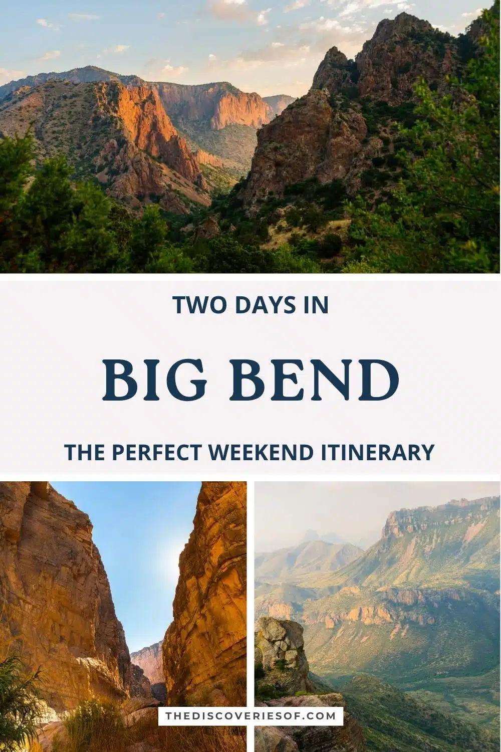
Love this? Save and share on Pinterest

Discover the top things to do, insider tips and hidden gems in our USA Travel Guides.
Read the guides →




Your tips and insights are always so useful! We are considering a trip to Big Bend, and I remembered that you had recently gone. Looking up this article was one of the first things I did (second only to finding out how long of a drive it would be)! Great writing!
Looks Incredible! I live in Texas and have yet to go!